

Key Information


.jpg)


| Kobe | |||||
|---|---|---|---|---|---|
.svg) | |||||
| Japanese name | |||||
| Kyūjitai | 神戶 | ||||
| Shinjitai | 神戸 | ||||
| |||||
Kobe (/ˈkoʊbeɪ/ KOH-bay; Japanese: 神戸, romanized: Kōbe, pronounced [koꜜː.be] ⓘ), officially Kobe City (神戸市, Kōbe-shi; [koː.beꜜ.ɕi]), is the capital city of Hyōgo Prefecture, Japan. With a population of around 1.5 million, Kobe is Japan's seventh-largest city and the third-largest port city after Tokyo and Yokohama. It is located in the Kansai region, which makes up the southern side of the main island of Honshū, on the north shore of Osaka Bay. It is part of the Keihanshin metropolitan area along with Osaka and Kyoto.[2] The Kobe city centre is located about 35 km (22 mi) west of Osaka and 70 km (43 mi) southwest of Kyoto.
The earliest written records regarding the region come from the Nihon Shoki, which describes the founding of the Ikuta Shrine by Empress Jingū in AD 201.[3][4] For most of its history, the area was never a single political entity, even during the Tokugawa period, when the port was controlled directly by the Tokugawa shogunate. Kobe did not exist in its current form until its founding in 1889. Its name comes from Kanbe (神戸; an archaic title for supporters of the city's Ikuta Shrine).[5][6] Kobe became one of Japan's designated cities in 1956.
Kobe was one of the cities to open for trade with the West following the 1853 end of the policy of seclusion and has retained its cosmopolitan character ever since with a rich architectural heritage dating back to the Meiji era. While the 1995 Great Hanshin earthquake diminished some of Kobe's prominence as a port city, it remains Japan's fourth-busiest container port.[7] Companies headquartered in Kobe include ASICS, Kawasaki Heavy Industries, and Kobe Steel, while over 100 international corporations have their Asian or Japanese headquarters in the city, including Eli Lilly and Company, Procter & Gamble, Boehringer Ingelheim, and Nestlé.[8][9] The city is the point of origin and namesake of Kobe beef, the home of Kobe University, and the site of one of Japan's most famous hot spring resorts, Arima Onsen.
History
[edit]Origins
[edit]Tools found in western Kobe demonstrate that the area was populated at least from the Jōmon period.[10]
The natural geography of the area, particularly of Wada Cape in Hyōgo-ku, led to the development of a port, which has remained the economic center of the city.[11] Some of the earliest written documents mentioning the region include the Nihon Shoki, which describes the founding of the Ikuta Shrine by Empress Jingū in AD 201.[3]
- Gallery
-

-
 Taisan-ji. The main hall is a National Treasure of Japan (built in 716).
.jpg)

Nara and Heian periods
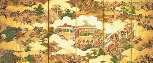
[edit]During the Nara and Heian periods, the port was known by the name Ōwada Anchorage (Ōwada-no-tomari) and was one of the ports from which imperial embassies to China were dispatched.[4][10] The city was briefly the capital of Japan in 1180, when Taira no Kiyomori moved his grandson Emperor Antoku to Fukuhara-kyō in present-day Hyōgo-ku.[10] The Emperor returned to Kyoto after about five months.[4] Shortly thereafter in 1184, the Taira fortress in Hyōgo-ku and the nearby Ikuta Shrine became the sites of the Genpei War battle of Ichi-no-Tani between the Taira and Minamoto clans. The Minamoto prevailed, forcing Taira remnants to flee to Shikoku.
- Gallery
-

-


Kamakura period
[edit]As the port grew during the Kamakura period, it became an important hub for trade with China and other countries. In the 13th century, the city came to be known by the name Hyōgo Port (兵庫津, Hyōgo-tsu).[11] During this time, Hyōgo Port, along with northern Osaka, composed the province of Settsu (most of today's Kobe belonged to Settsu except Nishi Ward and Tarumi Ward, which belonged to Harima).
- Gallery
-

-

_(BM_2008,3037.02214).jpg)

Edo period
[edit]Later, during the Edo period, the eastern parts of present-day Kobe came under the jurisdiction of the Amagasaki Domain and the western parts under that of the Akashi Domain, while the center was controlled directly by the Tokugawa shogunate.[12][13] It was not until the abolition of the han system in 1871 and the establishment of the current prefecture system that the area became politically distinct.
Meiji period
[edit]Hyōgo Port was opened to foreign trade by the Shogunal government at the same time as Osaka on January 1, 1868, just before the advent of the Boshin War and the Meiji Restoration.[14] At the time of the opening of the city for foreign trade, the area saw intense fighting resulting from the civil war in progress. Shortly after the opening of Kobe to trade, the Kobe Incident occurred, where several western soldiers sustained wounds from gunfire by troops from Bizen. The region has since been identified with the West and many foreign residences from the period remain in Kobe's Kitano area.
- Gallery
-
 Shinkaichi theatre street in Kobe (Taisho era)
 -
![Hyōgo Port in the 19th century[15]](//upload.wikimedia.org/wikipedia/commons/thumb/b/b8/Viewofkobe.PNG/250px-Viewofkobe.PNG) Hyōgo Port in the 19th century[15]
Hyōgo Port in the 19th century[15] -
 This nishiki-e (colored woodcut) shows a foreign steamboat entering Hyōgo Port shortly after its opening to the West in the late 19th century.

![Hyōgo Port in the 19th century[15]](https://en.wikipedia.org/wiki/File:Viewofkobe.PNG)

Modern era
[edit]Kobe, as it is known today, was founded on April 1, 1889, and was designated on September 1, 1956 by government ordinance. The history of the city is closely tied to that of the Ikuta Shrine, and the name "Kobe" derives from kamube (神戸; later kanbe), an archaic name for those who supported the shrine.[5][6]
During World War II, Kobe was lightly bombed in the Doolittle Raid on April 18, 1942, along with Tokyo and a few other cities. Eventually, it was bombed again with incendiary bombs by B-29 Superfortress bombers on March 16 and 17, 1945, causing the death of 8,841 residents and the destruction of 21% of Kobe's urban area. This incident inspired the well-known Studio Ghibli film Grave of the Fireflies and the book by Akiyuki Nosaka on which the film was based. It also features in the motion picture A Boy Called H.
Following continuous pressure from citizens, on March 18, 1975, the Kobe City Council passed an ordinance banning vessels carrying nuclear weapons from Kobe Port. This effectively prevented any U.S. warships from entering the port, because U.S. policy is to never disclose whether any given warship is carrying nuclear weapons. This nonproliferation policy has been termed the "Kobe formula".[16][17]
On January 17, 1995, a magnitude 6.9 earthquake occurred at 5:46 am JST near the city. About 6,434 people in the city were killed, 212,443 were made homeless, and large parts of the port facilities and other parts of the city were destroyed.[18][19] The earthquake destroyed portions of the Hanshin Expressway, an elevated freeway that dramatically toppled over. In Japan, this earthquake is known as the Great Hanshin earthquake (or the Hanshin-Awaji earthquake). To commemorate Kobe's recovery from it, the city holds an event every December called the Luminarie, where the city center is decorated with illuminated metal archways.
The Port of Kobe was Japan's busiest port and one of Asia's top ports until the Great Hanshin earthquake.[20] Kobe later dropped to fourth in Japan and, as of 2025, was the 72nd-busiest container port worldwide, as ranked by Lloyds.
- Gallery
-
 Map of the Foreign Settlement
 -
 View of Kobe after the bombing in 1945
 -
 Damage in Sannomiya after the Great Hanshin earthquake in 1995


Geography
[edit]
Wedged between the coast and the mountains, the city of Kobe is long and narrow. To the east is the city of Ashiya, while the city of Akashi lies to its west. Other adjacent cities include Takarazuka and Nishinomiya to the east and Sanda and Miki to the north.
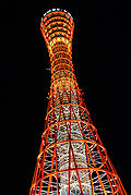
The landmark of the port area is the red steel Port Tower. A ferris wheel sits in nearby Harborland, a notable tourist promenade.[citation needed] Two artificial islands, Port Island and Rokkō Island, have been constructed to give the city room to expand.
Away from the seaside at the heart of Kobe lie the Motomachi and Sannomiya districts, as well as Kobe's Chinatown, Nankin-machi, all well-known retail areas. A multitude of train lines cross the city from east to west. The main transport hub is Sannomiya Station, with the eponymous Kobe Station located to the west and the Shinkansen Shin-Kobe Station to the north.
Mount Rokkō overlooks Kobe at an elevation of 931 m (3,054 ft). During autumn, it is famous for the rich change in colors of its forests.

Wards
[edit]Kobe has nine wards (ku):
- Nishi-ku: The westernmost area of Kobe, Nishi-ku overlooks the city of Akashi and is the site of Kobe Gakuin University. This ward has the largest population, with 247,000 residents.[21]
- Kita-ku: Kita-ku is the largest ward by area and contains the Rokko Mountain Range, including Mount Rokkō and Mount Maya. The area is well known for its rugged landscape and hiking trails. The onsen resort town of Arima also lies within Kita-ku.
- Tarumi-ku: Tarumi-ku is a mostly residential area. The second-longest suspension bridge in the world, the Akashi Kaikyō Bridge, extends from Maiko in Tarumi-ku to Awaji Island to the south. A relatively new addition to Kobe, Tarumi-ku was not a part of the city until 1946.
- Suma-ku: Suma-ku is the site of Suma beach, attracting visitors during the summer months.
- Nagata-ku: Nagata-ku is the site of Nagata Shrine, one of the three "Great Shrines" in Kobe.
- Hyōgo-ku: At various times known as Ōwada Anchorage or Hyōgo Port, this area is the historical heart of the city. Shinkaichi in Hyogo-ku was once the commercial center of Kobe, but was heavily damaged during World War II, and since, Hyogo-ku has lost much of its former prominence.
- Chūō-ku: Chūō (中央) literally means "central" and, as such, Chūō-ku is the commercial and entertainment center of Kobe. Sannomiya, Motomachi and Harborland make up the main entertainment areas in Kobe. Chūō-ku includes the city hall and Hyōgo prefectural government offices. Port Island and Kobe Airport lie in the southern part of this ward.
- Nada-ku: The site of Oji Zoo and Kobe University, Nada is known for its sake. Along with Fushimi in Kyoto, it accounts for 45% of Japan's sake production.[22]
- Higashinada-ku: The easternmost area of Kobe, Higashinada-ku borders the city of Ashiya. The man-made island of Rokko makes up the southern part of this ward.
| Wards of Kobe | ||||||
|---|---|---|---|---|---|---|
| Place Name | Map of Kobe | |||||
| Rōmaji | Kanji | Population | Land area in km2 | Pop. density
per km2 |
||
| 1 | Nishi-ku | 西区 | 240,386 | 138.01 | 1,742 |  |
| 2 | Kita-ku | 北区 | 212,211 | 240.29 | 883 | |
| 3 | Tarumi-ku | 垂水区 | 216,337 | 28.11 | 7,696 | |
| 4 | Suma-ku | 須磨区 | 158,196 | 28.93 | 5,468 | |
| 5 | Nagata-ku | 長田区 | 95,155 | 11.36 | 8,376 | |
| 6 | Hyōgo-ku | 兵庫区 | 107,307 | 14.68 | 7,310 | |
| 7 | Chūō-ku | 中央区 | 142,232 | 28.97 | 4,910 | |
| 8 | Nada-ku | 灘区 | 136,865 | 32.66 | 4,191 | |
| 9 | Higashinada-ku | 東灘区 | 214,255 | 34.02 | 6,298 | |
Cityscape
[edit]- Gallery
-
 View of MOSAIC and Meriken Park from ferry at dusk (2022)
 -
 Meriken Park (2018)
 -
 Skyline of Kobe from Kobe Bridge (2015)
 -
 View of Sannomiya from Shin-Kobe Station (2009)
 -
 Nunobiki Herb Garden (2012)
 -
 Kobe central business district (2018)
 -
 Kobe central business district at night (2016)
 -
 Downtown at night
 -
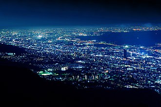 Night view from Kikuseidai
 -
 Sunset from Mt. Suwa (Suwayama) observation deck
 -
 Chūō-ku, seen by night from Mt. Suwa observation deck
 -
 Panorama of Kobe from Mt. Suwa observation deck


Climate
[edit]Kobe has a humid subtropical climate (Köppen climate classification Cfa) with hot summers and cool to cold winters. Precipitation is significantly higher in summer than in winter, though on the whole lower than most parts of Honshū, and there is no significant snowfall. The average annual temperature in Kobe is 17.0 °C (62.6 °F). The average annual rainfall is 1,277.8 mm (50.31 in) with July as the wettest month. The temperatures are highest on average in August, at around 28.6 °C (83.5 °F), and lowest in January, at around 6.2 °C (43.2 °F). The highest temperature ever recorded in Kobe was 38.8 °C (101.8 °F) on August 5, 1994; the coldest temperature ever recorded was −7.2 °C (19.0 °F) on February 27, 1981.
| Climate data for Kobe (1991−2020 normals, extremes 1896−present) | |||||||||||||
|---|---|---|---|---|---|---|---|---|---|---|---|---|---|
| Month | Jan | Feb | Mar | Apr | May | Jun | Jul | Aug | Sep | Oct | Nov | Dec | Year |
| Record high °C (°F) | 19.2 (66.6) |
20.8 (69.4) |
23.7 (74.7) |
28.5 (83.3) |
31.9 (89.4) |
36.3 (97.3) |
37.7 (99.9) |
38.8 (101.8) |
35.9 (96.6) |
31.9 (89.4) |
26.3 (79.3) |
23.7 (74.7) |
38.8 (101.8) |
| Mean daily maximum °C (°F) | 9.4 (48.9) |
10.1 (50.2) |
13.5 (56.3) |
18.9 (66.0) |
23.6 (74.5) |
26.7 (80.1) |
30.4 (86.7) |
32.2 (90.0) |
28.8 (83.8) |
23.2 (73.8) |
17.5 (63.5) |
12.0 (53.6) |
20.5 (68.9) |
| Daily mean °C (°F) | 6.2 (43.2) |
6.5 (43.7) |
9.8 (49.6) |
15.0 (59.0) |
19.8 (67.6) |
23.4 (74.1) |
27.1 (80.8) |
28.6 (83.5) |
25.4 (77.7) |
19.8 (67.6) |
14.2 (57.6) |
8.8 (47.8) |
17.0 (62.6) |
| Mean daily minimum °C (°F) | 3.1 (37.6) |
3.4 (38.1) |
6.3 (43.3) |
11.4 (52.5) |
16.5 (61.7) |
20.6 (69.1) |
24.7 (76.5) |
26.1 (79.0) |
22.6 (72.7) |
16.7 (62.1) |
10.9 (51.6) |
5.7 (42.3) |
14.0 (57.2) |
| Record low °C (°F) | −6.4 (20.5) |
−7.2 (19.0) |
−5.0 (23.0) |
−0.6 (30.9) |
3.9 (39.0) |
10.0 (50.0) |
14.5 (58.1) |
16.1 (61.0) |
10.5 (50.9) |
5.3 (41.5) |
−0.2 (31.6) |
−4.3 (24.3) |
−7.2 (19.0) |
| Average precipitation mm (inches) | 38.4 (1.51) |
55.6 (2.19) |
94.2 (3.71) |
100.6 (3.96) |
134.7 (5.30) |
176.7 (6.96) |
187.9 (7.40) |
103.4 (4.07) |
157.2 (6.19) |
118.0 (4.65) |
62.4 (2.46) |
48.7 (1.92) |
1,277.8 (50.31) |
| Average snowfall cm (inches) | 0 (0) |
0 (0) |
0 (0) |
0 (0) |
0 (0) |
0 (0) |
0 (0) |
0 (0) |
0 (0) |
0 (0) |
0 (0) |
0 (0) |
1 (0.4) |
| Average precipitation days (≥ 0.5 mm) | 6.0 | 7.1 | 10.0 | 10.1 | 10.4 | 12.1 | 10.9 | 7.4 | 10.3 | 8.8 | 6.4 | 6.8 | 106.2 |
| Average relative humidity (%) | 62 | 61 | 61 | 61 | 64 | 72 | 74 | 71 | 67 | 64 | 63 | 62 | 65 |
| Mean monthly sunshine hours | 145.8 | 142.4 | 175.8 | 194.8 | 202.6 | 164.0 | 189.4 | 229.6 | 163.9 | 169.8 | 152.2 | 153.2 | 2,083.7 |
| Source: Japan Meteorological Agency[23] | |||||||||||||
| Climate data for Kobe Airport (2006−2020 normals, extremes 2006−present) | |||||||||||||
|---|---|---|---|---|---|---|---|---|---|---|---|---|---|
| Month | Jan | Feb | Mar | Apr | May | Jun | Jul | Aug | Sep | Oct | Nov | Dec | Year |
| Record high °C (°F) | 17.2 (63.0) |
19.5 (67.1) |
22.9 (73.2) |
24.9 (76.8) |
30.2 (86.4) |
34.5 (94.1) |
36.2 (97.2) |
37.0 (98.6) |
36.2 (97.2) |
31.5 (88.7) |
25.6 (78.1) |
21.9 (71.4) |
37.0 (98.6) |
| Mean daily maximum °C (°F) | 9.3 (48.7) |
9.7 (49.5) |
12.8 (55.0) |
17.3 (63.1) |
22.2 (72.0) |
25.2 (77.4) |
28.6 (83.5) |
31.1 (88.0) |
28.1 (82.6) |
23.0 (73.4) |
17.3 (63.1) |
11.9 (53.4) |
19.7 (67.5) |
| Daily mean °C (°F) | 5.9 (42.6) |
6.3 (43.3) |
9.2 (48.6) |
13.7 (56.7) |
18.5 (65.3) |
22.2 (72.0) |
25.9 (78.6) |
27.9 (82.2) |
24.9 (76.8) |
19.7 (67.5) |
14.0 (57.2) |
8.5 (47.3) |
16.4 (61.5) |
| Mean daily minimum °C (°F) | 2.4 (36.3) |
2.6 (36.7) |
5.3 (41.5) |
9.9 (49.8) |
15.1 (59.2) |
19.8 (67.6) |
23.9 (75.0) |
25.6 (78.1) |
22.1 (71.8) |
16.7 (62.1) |
10.7 (51.3) |
5.1 (41.2) |
13.2 (55.8) |
| Record low °C (°F) | −3.6 (25.5) |
−3.4 (25.9) |
−1.5 (29.3) |
1.9 (35.4) |
7.0 (44.6) |
14.2 (57.6) |
19.4 (66.9) |
20.5 (68.9) |
14.7 (58.5) |
8.5 (47.3) |
2.7 (36.9) |
−1.4 (29.5) |
−3.6 (25.5) |
| Average precipitation mm (inches) | 33.3 (1.31) |
54.3 (2.14) |
83.2 (3.28) |
83.7 (3.30) |
117.6 (4.63) |
164.5 (6.48) |
186.9 (7.36) |
84.7 (3.33) |
135.1 (5.32) |
106.1 (4.18) |
52.8 (2.08) |
49.3 (1.94) |
1,148.4 (45.21) |
| Average precipitation days (≥ 1.0 mm) | 4.6 | 6.6 | 8.3 | 8.8 | 8.6 | 9.8 | 10.2 | 6.0 | 8.8 | 7.9 | 5.7 | 5.8 | 91.1 |
| Source: Japan Meteorological Agency[24][25] | |||||||||||||
Demographics
[edit]| Nationality | Population (2018) |
|---|---|
 South Korea South Korea |
17,175 |
 Mainland China Mainland China |
13,205 |
 Vietnam Vietnam |
5,955 |
 Taiwan Taiwan |
1,309 |
| Others | 8,974 |
| Year | Pop. | ±% |
|---|---|---|
| 1870 | 18,650 | — |
| 1880 | 48,786 | +161.6% |
| 1890 | 142,965 | +193.0% |
| 1900 | 283,839 | +98.5% |
| 1910 | 398,905 | +40.5% |
| 1920 | 746,500 | +87.1% |
| 1925 | 818,619 | +9.7% |
| 1930 | 915,234 | +11.8% |
| 1935 | 1,058,053 | +15.6% |
| 1940 | 1,134,458 | +7.2% |
| 1945 | 694,000 | −38.8% |
| 1950 | 821,062 | +18.3% |
| 1955 | 986,344 | +20.1% |
| 1960 | 1,113,977 | +12.9% |
| 1965 | 1,216,682 | +9.2% |
| 1970 | 1,288,930 | +5.9% |
| 1975 | 1,360,605 | +5.6% |
| 1980 | 1,367,390 | +0.5% |
| 1985 | 1,410,734 | +3.2% |
| 1990 | 1,477,410 | +4.7% |
| 1995 | 1,423,792 | −3.6% |
| 2000 | 1,493,398 | +4.9% |
| 2005 | 1,525,393 | +2.1% |
| 2010 | 1,544,873 | +1.3% |
| 2015 | 1,537,272 | −0.5% |
| 2020 | 1,521,241 | −1.0% |

As of September 2007, Kobe had an estimated population of 1,530,295 making up 658,876 households. This was an increase of 1,347 persons or approximately 0.1% over the previous year. The population density was approximately 2,768 persons per square kilometre, while there are about 90.2 males to every 100 females.[27] About thirteen percent of the population are between the ages of 0 and 14, sixty-seven percent are between 15 and 64, and twenty percent are over the age of 65.[28]
Approximately 44,000 registered foreign nationals live in Kobe. The four most common nationalities are Korean (22,237), Chinese (12,516), Vietnamese (1,301), and American (1,280).[28]
Economy
[edit]
The Port of Kobe is both an important port and manufacturing center within the Hanshin Industrial Region. Kobe is the busiest container port in the region, surpassing even Osaka, and the fourth-busiest in Japan.[29]
As of 2004[update], the city's total real GDP was ¥6.3 trillion, which amounts to thirty-four percent of the GDP for Hyōgo Prefecture and approximately eight percent for the whole Kansai region.[30][31] Per capita income for the year was approximately ¥2.7 million.[30] Broken down by sector, about one percent of those employed work in the primary sector (agriculture, fishing and mining), twenty-one percent work in the secondary sector (manufacturing and industry), and seventy-eight percent work in the service sector.[28]
The value of manufactured goods produced and exported from Kobe for 2004 was ¥2.5 trillion. The four largest sectors in terms of value of goods produced are small appliances, food products, transportation equipment, and communication equipment making up over fifty percent of Kobe's manufactured goods. In terms of numbers of employees, food products, small appliances, and transportation equipment make up the three largest sectors.[32]
The GDP in Kobe Metropolitan Employment Area (2.4 million people) is US$96.0 billion in 2010.[33][34]
Major companies and institutes
[edit]Japanese companies which have their headquarters in Kobe include ASICS, a shoe manufacturer; Daiei, a department store chain; Kawasaki Heavy Industries, Kawasaki Shipbuilding Co., Kinki Sharyo, Mitsubishi Motors, Mitsubishi Heavy Industries (ship manufacturer), Mitsubishi Electric, Kobe Steel, Sumitomo Rubber Industries,[35] Sysmex Corporation (medical devices manufacturer)[36] and TOA Corporation. Other companies include the confectionery manufacturers Konigs-Krone and Morozoff Ltd., Sun Television Japan and UCC Ueshima Coffee Co.
There are over 100 international corporations that have their East Asian or Japanese headquarters in Kobe. Of these, twenty-four are from China, eighteen from the United States, and nine from Switzerland.[8] Some prominent corporations include Eli Lilly and Company, Nestlé, Procter & Gamble,[37] Tempur-Pedic, Boehringer-Ingelheim, and Toys "R" Us. In 2018, April, Swift Engineering USA, an American aerospace engineering firm established their joint venture in Kobe called Swift Xi Inc.
Kobe is the site of a number of research institutes, such as the RIKEN Kobe Institute Center for developmental biology and medical imaging techniques,[38] and Center for Computational Science (R-CCS, home of the Fugaku supercomputer), the National Institute of Information and Communications Technology (NICT) Advanced ICT Research Institute,[39][40] the National Research Institute for Earth Science and Disaster Prevention,[41] and the Asian Disaster Reduction Center.[42]
International organizations include the WHO Centre for Health Development, an intergovernmental agency forming part of the World Health Organization. The Consulate-General of Panama in Kobe is located on the eighth floor of the Moriyama Building in Chūō-ku, Kobe.[43]
-
 Kawasaki Heavy Industries headquarters on Harborland
 -
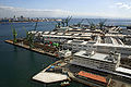 Kawasaki Shipbuilding Co. headquarters on Kobe Harbor
 -
 Procter & Gamble Asia headquarters on Rokko Island
 -
 Nestlé Japan Ltd. headquarters on Sannomiya
 -
 UCC Ueshima Coffee Co. headquarters on Port Island


Transportation
[edit]


Air
[edit]Itami Airport, in nearby Itami, serves primarily domestic flights throughout Japan, Kobe Airport, built on a reclaimed island south of Port Island, also offers mostly domestic and charter flights, while Kansai International Airport in Osaka mainly serves international flights in the area.
Rail
[edit]The JR West Sanyō Shinkansen stops at Shin-Kobe Station. Sannomiya Station is the main commuter hub in Kobe, serving as the transfer point for major intercity rail services: the JR Kobe Line connects Kobe to Osaka and Himeji, while both the Hankyū Kobe Line and the Hanshin Main Line run from Kobe to Umeda Station in Osaka. Sanyō Electric Railway trains from Himeji reach Sannomiya via the Kōbe Rapid Transit Railway. Kōbe Electric Railway runs north to Sanda and Arima Onsen.
Kobe Municipal Subway provides connections to Shin-Kobe and Sannomiya stations from Kobe's western and eastern suburbs. Additionally, Kobe New Transit runs two lines serving Kobe Airport and Rokko Island.
Ropeway
[edit]Over Mount Rokkō, the city has two funicular lines and three aerial lifts as well, namely Maya Cablecar, Rokkō Cable Line, Rokkō Arima Ropeway, Maya Ropeway, and Shin-Kobe Ropeway.
Road
[edit]Kobe is a transportation hub for a number of expressways, including the Meishin Expressway (Nagoya – Kobe) and the Hanshin Expressway (Osaka – Kobe).[44] Other expressways include the Sanyō Expressway (Kobe – Yamaguchi) and the Chūgoku Expressway (Osaka – Yamaguchi). The Kobe-Awaji-Naruto Expressway runs from Kobe to Naruto via Awaji Island and includes the Akashi Kaikyō Bridge, the second longest suspension bridge in the world.
Maritime
[edit]The Port of Kobe is one of Japan's busiest container ports and also offers ferry services to Kansai International Airport, Shikoku and Kyushu. Sub Area Activity Hanshin of the Japan Maritime Self-Defense Forces provides monitoring across Osaka Bay and Harima Sea.
Education
[edit]
The city of Kobe directly administers 169 elementary and 81 middle schools, with enrollments of approximately 80,200 and 36,000 students, respectively.[45] If the city's four private elementary schools and fourteen private middle schools are included, these figures jump to a total 82,000 elementary school students and 42,300 junior high students enrolled for the 2006 school year.[28][46][47]
Kobe also directly controls six of the city's twenty-five full-time public high schools including Fukiai High School and Rokkō Island High School. The remainder are administered by the Hyogo Prefectural Board of Education.[45][48] In addition, twenty-five high schools are run privately within the city.[49] The total enrollment for high schools in 2006 was 43,400.[28]
Kobe is home to eighteen public and private universities, including Kobe University, Kobe Institute of Computing and Konan University, and eight junior colleges. Students enrolled for 2006 reached 67,000 and 4,100, respectively.[28] Kobe is also home to 17 Japanese language schools for international students, including the international training group Lexis Japan.
International schools serve both long-term foreign residents and expatriates living in Kobe and the Kansai region. The schools offer instruction in English, German, Chinese, and Korean. There are three English-language international schools: Canadian Academy, Marist Brothers International School, and St. Michael's International School.
Culture
[edit]
Kobe is most famous for its Kobe beef (which is raised in the surrounding Hyōgo Prefecture) and Arima Onsen (hot springs). Notable buildings include the Ikuta Shrine as well as the Kobe Port Tower. Nearby mountains such as Mount Rokkō and Mount Maya overlook the city. The city is recognized as a "Design City" by UNESCO.
The city is widely associated with cosmopolitanism and fashion, encapsulated in the Japanese saying, "If you can't go to Paris, go to Kobe."[50] The biannual fashion event Kobe Fashion Week, featuring the Kobe Collection, is held in Kobe.[51] The jazz festival "Kobe Jazz Street" has been held every October at jazz clubs and hotels since 1981.[52] It also hosts both a Festival, as well as a statue of Elvis Presley, the unveiling of which was heralded by the presence of former Prime Minister of Japan Junichiro Koizumi. Kobe is well known in Japan as being a city for the affluent, as many high-end stores and mansions line its streets.
Kobe is the site of Japan's first golf course, Kobe Golf Club, established by Arthur Hesketh Groom in 1903,[53] and Japan's first mosque, Kobe Mosque, built in 1935.[54] The city hosts the Kobe Regatta & Athletic Club, founded in 1870 by Alexander Cameron Sim,[55] and a prominent foreign cemetery. A number of Western-style residences – ijinkan (異人館) – from the 19th century still stand in Kitano and elsewhere in Kobe. Museums include the Kobe City Museum and Museum of Literature.
The city headquarters the professional wrestling promotion Dragongate, established in 2004 as an offshoot of Último Dragón's original Toryumon system.[56]
The dialect spoken in Kobe is called Kobe-ben, a sub-dialect of Kansai dialect.[citation needed]
Sports
[edit]Kobe hosted the 1985 Summer Universiade as well as the 1991 Men's Asian Basketball Championship, which was the qualifier for the 1992 Summer Olympics Basketball Tournament. Kobe was one of the host cities of the 2002 FIFA World Cup, hosting matches at Noevir Stadium Kobe (then known as Wing Stadium Kobe), which was renovated to increase its capacity to 40,000 for the event. Kobe was one of the host cities for the official 2006 Women's Volleyball World Championship.
Kobe also hosted the World Darts Federation World Cup in October 2017. The event was held in the Exhibition Hall in Port Island with over 50 countries competing.
International relations
[edit]Sister cities
Kobe's sister cities are:[57]
 Barcelona, Catalonia, Spain (1993)
 Brisbane, Queensland, Australia (1985)
 Incheon, South Korea (2010)
 Genoa, Liguria, Italy (1963)
 Marseille, Provence-Alpes-Côte d'Azur, France (1961)
 Riga, Latvia (1974)
 Rio de Janeiro, Brazil (1969)
 Seattle, WA, United States (1957)
 Tianjin, China (1973)
 Aberdeen, Scotland (2022)[58]


Friendship and cooperation cities Kobe also cooperates with:[57]
- Daegu, South Korea (2010)
 Faisalabad, Punjab, Pakistan (2000)
 Kigali, Rwanda (2016)
- Philadelphia, PA, United States (1986)


A memorandum of understanding on the possible establishment of sister city relations in the future was concluded in 2019 with Ahmedabad, Gujarat, India.[59]
Sister ports The Port of Kobe's sister ports are:[57]
 Port of Rotterdam, Netherlands (1967)
- Port of Seattle, United States (1967)
- Port of Tianjin, China

Gallery
[edit]-
-

-
-

-
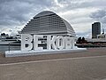 "Be Kobe" sign near Harborland
 -

-

-
 Foreigners' cemetery on the slopes of Futatabiyama
 -
 Notre Dame Kobe Wedding Hall
 -
 Arima Onsen located north of Kobe
 -
 Futatabi Park located Mount Rokkō


References
[edit]- ^ "UEA Code Tables". Center for Spatial Information Science, University of Tokyo. Archived from the original on January 9, 2019. Retrieved January 26, 2019.
- ^ Gabriele Zanatta (April 13, 2016). "Kobe". la Repubblica (in Italian). p. 48.
- ^ a b Ikuta Shrine official website; Archived April 4, 2008, at the Wayback Machine – "History of Ikuta Shrine" (Japanese)
- ^ a b c Kobe City Info; Archived June 16, 2008, at the Wayback Machine – "History". Retrieved February 2, 2007.
- ^ a b Nagasaki University; Archived May 16, 2007, at the Wayback Machine – "Ikuta Shrine". Retrieved February 3, 2007.
- ^ a b Entry for 「神戸(かんべ)」. Kōjien, fifth edition, 1998, ISBN 4-00-080111-2
- ^ American Association of Port Authorities; Archived December 21, 2008, at the Wayback Machine – "World Port Rankings 2006". Retrieved April 15, 2008.
- ^ a b "Number of foreign corporations with headquarters in Kobe passes 100." (Japanese) in Nikkei Net, retrieved from NIKKEI.net Archived July 6, 2007, at the Wayback Machine on July 3, 2007.
- ^ Hyogo-Kobe Investment Guide Archived December 8, 2006, at the Wayback Machine – "List of Foreign Enterprises and Examples". Retrieved February 8, 2007.
- ^ a b c City of Kobe Archived September 18, 2007, at the Wayback Machine – "Kobe's History" (Japanese). Retrieved October 22, 2007.
- ^ a b Hyogo International Tourism Guide Archived November 30, 2006, at the Wayback Machine – "Hyogo-tsu". Retrieved February 2, 2007.
- ^ City of Kobe Archived April 20, 2008, at the Wayback Machine – "Old Kobe" (Japanese). Retrieved February 16, 2007.
- ^ City of Ashiya Archived June 17, 2008, at the Wayback Machine – "An Outline History of Ashiya". Retrieved February 16, 2007.
- ^ John Whitney Hall; Marius B. Jansen (1988). The Cambridge History of Japan. Cambridge University Press. p. 304. ISBN 978-0-521-22356-0.
- ^ From the NYPL Digital Library Archived July 8, 2012, at archive.today
- ^ Kobe City Council – "Resolution on the Rejection of the Visit of Nuclear-Armed Warships into Kobe Port", March 18, 1975. Retrieved February 16, 2007.
- ^ Kamimura, Naoki. "Japanese Civil Society and U.S.-Japan Security Relations in the 1990s". retrieved from International Physicians for the Prevention of Nuclear War Archived May 16, 2006, at the Wayback Machine on February 2, 2007
- ^ The Great Hanshin-Awaji Earthquake Statistics and Restoration Progress (Jan. 2008). Retrieved April 14, 2008.
- ^ Great Hanshin Earthquake Restoration Archived October 14, 2014, at the Wayback Machine. Retrieved April 14, 2008.
- ^ Maruhon Business News – Port Conditions in Japan. Retrieved January 23, 2007.
- ^ City of Kobe Archived October 14, 2007, at the Wayback Machine, "Population by Ward" (Japanese). Retrieved July 25, 2007.
- ^ Kansai Window Archived June 19, 2006, at the Wayback Machine, "Japan's number one sake production". Retrieved February 6, 2007.
- ^ 気象庁 / 平年値(年・月ごとの値). Japan Meteorological Agency. Retrieved May 19, 2021.
- ^ 観測史上1~10位の値(年間を通じての値). JMA. Retrieved February 26, 2022.
- ^ 気象庁 / 平年値(年・月ごとの値). JMA. Retrieved February 26, 2022.
- ^ 神戸市統計資料 (PDF) (in Japanese). Kobe Government. Archived from the original (PDF) on April 14, 2018. Retrieved January 9, 2020.
6. 外国人数
- ^ City of Kobe Archived December 25, 2008, at the Wayback Machine – "Estimated Population of Kobe". Retrieved October 2, 2007.
- ^ a b c d e f City of Kobe Archived August 8, 2007, at the Wayback Machine – "Statistical Summary of Kobe". Retrieved July 25, 2007.
- ^ American Association of Port Authorities Archived September 27, 2007, at the Wayback Machine – "World Port Rankings 2005". Retrieved July 3, 2007.
- ^ a b Hyogo Industrial Advancement Center Archived July 4, 2007, at the Wayback Machine – "Industry Tendencies in Various Areas of Hyogo Prefecture" (Japanese). Retrieved July 3, 2007.
- ^ Cabinet Office, Government of Japan Archived July 16, 2007, at the Wayback Machine – "2004 Prefectural Economy Survey" (Japanese). Retrieved July 3, 2007.
- ^ Kobe City Report on Census of Manufacturers, 2004 Archived May 28, 2008, at the Wayback Machine (Japanese). Retrieved March 30, 2007.
- ^ Yoshitsugu Kanemoto. "Metropolitan Employment Area (MEA) Data". Center for Spatial Information Science, The University of Tokyo. Archived from the original on May 2, 2019. Retrieved June 22, 2016.
- ^ Conversion rates – Exchange rates – OECD Data
- ^ "Company Outline." Sumitomo Rubber Industries. Retrieved on January 24, 2015.
- ^ "Corporate Profile Archived 2015-01-19 at the Wayback Machine." Sysmex Corporation. Retrieved on January 21, 2015.
- ^ "P&G Locations." Procter & Gamble. Retrieved November 14, 2008.
- ^ RIKEN Center for Developmental Biology RIKEN Kobe Institute Archived April 10, 2007, at the Wayback Machine. Retrieved June 26, 2007.
- ^ National Institute of Information and Communications Technology Kobe Advanced ICT Research Center Archived July 2, 2007, at the Wayback Machine. Retrieved June 26, 2007.
- ^ "History of Advanced ICT Research Institute". National Institute of Information and Communications Technology. Archived from the original on January 20, 2018. Retrieved January 19, 2018.
- ^ National Research Institute for Earth Science and Disaster Prevention. Retrieved June 12, 2007.
- ^ Asian Disaster Reduction Center Archived July 2, 2007, at the Wayback Machine. Retrieved June 12, 2007.
- ^ "List of Consulates in Kansai Area Archived 2008-09-23 at the Wayback Machine." Creation Core Higashi Osaka. Retrieved on January 15, 2009.
- ^ Hyogo-Kobe Investment Guide Archived June 16, 2008, at the Wayback Machine – "Domestic Access". Retrieved February 15, 2007.
- ^ a b City of Kobe Archived September 27, 2007, at the Wayback Machine – "Number of municipal schools and students" (Japanese). Retrieved July 2, 2007.
- ^ Hyogo Prefectural Government – "Private elementary schools" (Japanese). Retrieved July 2, 2007.
- ^ Hyogo Prefectural Government – "Private middle schools" (Japanese). Retrieved July 2, 2007.
- ^ City of Kobe – "Municipal high school" (Japanese). Retrieved March 2, 2016.
- ^ Hyogo Prefectural Government – "Private high schools" (Japanese). Retrieved July 2, 2007.
- ^ Hassan, Sally. (April 9, 1989). "Where Japan Opened a Door To the West". The New York Times, retrieved from New York Times website on February 7, 2007.
- ^ Kobe Collection Official Website (Japanese). Retrieved February 27, 2007.
- ^ Kobe Jazz Street Archived February 10, 2007, at the Wayback Machine. Retrieved March 12, 2007.
- ^ Golf Club Atlas Archived February 18, 2007, at the Wayback Machine – "Gliding Past Fuji – C.H. Alison in Japan". Retrieved February 7, 2007.
- ^ Penn, M. "Islam in Japan", Harvard Asia Quarterly Archived February 2, 2007, at the Wayback Machine Vol. 10, No. 1, Winter 2006. Retrieved February 15, 2007.
- ^ Kobe Regatta and Athletic Club Archived March 10, 2007, at the Wayback Machine – "a distinguished history". Retrieved February 7, 2007.
- ^ Carroll, John (January 7, 2013). "Dragon Gate 101 – History and Generations". Voices of Wrestling. Retrieved December 21, 2023.
- ^ a b c "About Kobe". Global Kobe Investment. Archived from the original on July 28, 2020. Retrieved March 10, 2022.
- ^ "Hydrogen Twin Cities Award for Aberdeen and Kobe, Japan | Aberdeen City Council". November 16, 2022.
- ^ "Kobe, Ahmedabad to be sister cities". Times of India. June 27, 2019. Retrieved March 10, 2022.
Bibliography
[edit]External links
[edit]


 Media related to History of Kobe at Wikimedia Commons
- Kobe City official website (in Japanese)
- Kobe City official website
- New York Public Library Digital Gallery Archived August 7, 2007, at the Wayback Machine – late 19th-century photographs of Kobe
 Geographic data related to Kobe at OpenStreetMap
- Kobe City's channel on YouTube (in Japanese)
- . New International Encyclopedia. 1905.
- . Collier's New Encyclopedia. 1921.


| International | |
|---|---|
| National | |
| Geographic | |
| Academics | |
| Other | |

History
Prehistoric and Ancient Origins
Archaeological evidence indicates that the Kobe area, situated along the Seto Inland Sea in Hyogo Prefecture, hosted Jomon period (c. 14,000–300 BCE) hunter-gatherer settlements characterized by pit dwellings near coastal and mountainous zones, reflecting reliance on marine resources and forested environments.[6] Artifacts such as cord-marked pottery and stone tools unearthed in Hyogo suggest semi-sedentary communities adapted to the region's bounteous natural setting, with human skeletal remains from sites like those in Akashi providing direct evidence of inhabitants who utilized fishing and foraging.[6] These findings underscore early maritime orientation, as coastal locations facilitated shellfish gathering and rudimentary boating, though long-distance trade remained limited to regional exchanges of materials like obsidian.[6] The transition to the Yayoi period (c. 300 BCE–250 CE) marked a shift to wet-rice agriculture and more structured villages in the Kobe vicinity, driven by migrations of continental-origin farming populations via sea routes into the Seto Inland Sea basin.[7] Sites such as the Onaka ruins in nearby Harima (c. 100 BCE–200 CE) reveal large-scale settlements with reconstructed pit dwellings, rice paddy fields, and communal structures, indicating organized land use for cultivation and population clusters of several dozen to hundreds per village based on dwelling counts.[6] These developments, including bronze tools and ceramics, reflect technological advancements imported from the Asian mainland through Korean intermediaries, enhancing productivity in the fertile coastal plains.[6] The Kobe region's proximity to the Seto Inland Sea positioned it as an early conduit for continental influences, with Yayoi artifacts like Chinese bronze mirrors recovered from Hyogo sites evidencing indirect trade links that facilitated cultural and agricultural diffusion.[6] Mid-Yayoi maritime activity along these calm inland waters supported the spread of rice farming and metallurgy, as evidenced by navigational adaptations and resource exchanges, though empirical data from excavations prioritize local adaptation over extensive overseas commerce.[8] This foundational era laid the groundwork for sustained settlement density, transitioning from sparse Jomon foraging to Yayoi agrarian communities without indications of large-scale conflict or hierarchy in the immediate Kobe area.[6]Classical and Medieval Periods
The region of present-day Kobe emerged as a strategic coastal periphery during the Nara period (710–794 CE), characterized by early religious foundations that anchored settlement amid the rugged topography of Mount Rokko and the Seto Inland Sea. Ikuta Shrine, venerating Wakahirume-no-Mikoto as a manifestation of the sun goddess Amaterasu, originated in the early 3rd century CE, established by Empress Jingū upon her return from continental campaigns, per accounts in the Nihon Shoki. This shrine's longevity reflects the area's initial urbanization drivers, with its forested precincts serving ritual functions that drew pilgrims and fostered proto-commercial activity. Concurrently, Taisan-ji Temple was founded in 716 CE by Fujiwara no Umakai, incorporating esoteric Buddhist elements; its main hall, reconstructed in the Kamakura period yet preserving Nara-era stylistic traits, stands as Kobe's sole National Treasure, evidencing enduring architectural patronage linked to imperial and clan influences.[9][10] In the Heian period (794–1185 CE), Kobe's harbor, designated Ōwada Anchorage, facilitated outbound imperial missions to Tang China, positioning the site as a nexus for elite maritime exchange amid Japan's centralized court culture. The narrow alluvial plains hemmed by steep gradients provided inherent defensive contours, compelling samurai lineages to erect fortifications against piracy and regional rivals, thus intertwining geographic causality with militarized development. By the late Heian, Taira no Kiyomori—de facto regent through marital ties to the throne—relocated the capital to Fukuhara-kyō in November 1180 CE, exploiting the locale's proximity to Taira naval assets for consolidated control; this ephemeral shift, abandoned by February 1181 due to inadequate infrastructure and court resistance, nonetheless amplified Kobe's administrative visibility.[11][12] The Genpei War (1180–1185 CE) crystallized Kobe's medieval military salience, as clashing Minamoto and Taira forces contested its defensible shores. In March 1184 CE, Minamoto no Yoshitsune orchestrated a daring descent from Mount Hiei onto the Taira bastion at Ichi-no-Tani, a cliff-guarded enclave west of central Kobe; the assault's success, yielding over 1,000 Taira casualties, hinged on exploiting the terrain's chokepoints, precipitating the clan's westward flight and underscoring how coastal confinement amplified vulnerabilities in samurai warfare. This engagement, rooted in Heian-era power vacuums, transitioned the area into Kamakura-period (1185–1333 CE) oversight, where residual fortifications and shrines like Minatogawa—site of Kusunoki Masashige's 1336 CE loyalist stand against Ashikaga forces—perpetuated its role in defensive clan dynamics.[13][14]Edo Period Developments
During the Edo period (1603–1868), the region around modern Kobe, centered on the port of Hyōgo, functioned as a domestic trade hub under the Tokugawa shogunate's sakoku policy, enacted through edicts from 1633 to 1639 that prohibited most foreign contact and confined overseas exchange to Nagasaki.[15] Hyōgo's port activities were thus restricted to internal shipping of rice, sake, and other staples to major centers like Edo and Osaka, overseen by shogunal magistrates to enforce isolation and tax collection.[16] The Nada district in eastern Kobe adapted to these constraints by specializing in sake brewing, capitalizing on abundant local rice supplies from nearby alluvial plains and pure, soft groundwater from the Rokko Mountains, which facilitated superior fermentation. Brewing expanded from the early 1600s, with five major brewery clusters (Nada-Gogō) forming by the mid-period; shipments via sea routes to Edo grew such that, by the late 18th century, Nada accounted for approximately 80% of sake consumed in the capital, reflecting adaptive commercial resilience amid feudal edicts limiting merchant autonomy.[17][18] Domestic commerce in textiles and sake-related goods further sustained local merchants, who navigated sumptuary laws and guild regulations (za) imposed by daimyo and the shogunate to maintain social order. Urban planning emphasized stratified zoning, with merchant quarters clustered near Hyōgo port under oversight from domains like Amagasaki, prioritizing economic output for rice-stipend obligations over defensive fortifications, as the area's relative stability reduced the need for expansive castle towns.[19][20]Meiji Restoration and Industrialization
Kobe Port officially opened as a treaty port on January 1, 1868, shortly after the Meiji Restoration, facilitating foreign trade under unequal treaties and marking the end of Japan's sakoku isolation policy.[21][22] This opening prompted the establishment of a foreign settlement east of the port, where Western merchants, primarily British, American, and French, resided and conducted business, leading to the rapid construction of infrastructure including wharves, roads, and Western-style buildings to support trade activities.[23][24] The settlement's development was driven by private foreign and Japanese entrepreneurs who invested in municipal improvements, such as drainage and utilities, transforming a barren coastal area into a functional commercial hub.[25] The port quickly became a key exporter, handling the majority of Japan's rice shipments in the early years and serving as an entry point for imported cotton yarn that fueled domestic textile processing.[22] By the late 1870s, Kobe facilitated growing exports of silk textiles and other goods, with private trading companies increasingly managing shipments independently of government oversight, contributing to national export growth where silk alone accounted for significant shares by the 1890s.[26][27] This trade surge spurred industrialization, as local firms responded to market demands created by port access, with cotton textile exports from Kobe targeting China and Southeast Asia.[28] Shipbuilding emerged as a pivotal industry, with entrepreneur Shozo Kawasaki establishing a shipyard in Kobe in the 1870s for repairs before expanding into full construction; by 1896, Kawasaki Dockyard was founded, leveraging government divestitures of state facilities to build modern vessels using imported technologies.[29][30] Private initiative, rather than solely state direction, propelled this growth, as entrepreneurs like Kawasaki capitalized on the need for domestic shipping to support export volumes, which rose steadily amid broader Meiji economic policies fostering competition and technology adoption.[31] By the early 1900s, Kobe's port infrastructure, including expanded berths, handled increasing cargo, underscoring how market-driven investments amplified government-enabled opportunities for industrialization.[32]20th Century Growth and World War II
During the Taisho era (1912–1926), Kobe underwent substantial port modernization, with the completion of the comb-shaped New Piers One, Two, and Three in 1921, initiating the development of a contemporary harbor infrastructure.[33] Concurrent reclamation projects expanded the port's capacity by 2.1 million tons, positioning Kobe to handle 40% of Japan's total exports by that year.[34] These enhancements supported industrial urbanization, as the city's shipbuilding sector, including facilities operated by Mitsubishi and Kawasaki, produced key naval assets such as submarines I-19 and I-25, bolstering Japan's maritime capabilities.[35] In the early Showa period (1926–1945), Kobe's port and industries facilitated economic ties integral to imperial expansion, with 1930 exports to Central China, South China, and Southeast Asia reaching approximately 150 million yen, reflecting the city's role in resource and goods flow to occupied territories.[36] Shipyards contributed directly to military logistics, constructing vessels that enabled sustained operations across Asia, though production efficiencies were constrained by resource shortages and Allied interdiction.[30] Kobe's strategic industrial profile made it a priority target for U.S. Army Air Forces raids, culminating in incendiary bombings in March and June 1945 that devastated shipyards, warehouses, and residential districts.[37] These attacks, employing B-29 Superfortress bombers, inflicted severe infrastructure losses, including port facilities and manufacturing capacity, critically undermining Japan's wartime logistics and contributing to the collapse of its expansionist efforts by disrupting supply chains to imperial fronts.[38]Postwar Reconstruction and Economic Boom
Following Japan's surrender in 1945, Kobe, heavily damaged by Allied air raids that destroyed approximately 80% of its urban area, underwent initial reconstruction under the U.S.-led Allied Occupation (1945–1952). Reforms implemented by the Supreme Commander for the Allied Powers (SCAP) dismantled prewar monopolistic structures, including the zaibatsu conglomerates, fostering a more competitive market environment that prioritized export-oriented industrialization over centralized state planning. These changes, such as antitrust measures and labor democratization, enabled Kobe's port—Japan's principal gateway for international trade—to reopen by 1947, facilitating the influx of raw materials and the outflow of manufactured goods, which laid the groundwork for sustained recovery without excessive reliance on protectionist barriers.[39][40] In the 1950s, Kobe's economy rebounded through heavy industries, exemplified by the rapid expansion of Kobe Steel, Ltd., which resumed steel production shortly after the war and pioneered high-grade alloys for shipbuilding and machinery amid Japan's overall GDP growth averaging over 10% annually during the decade. The Korean War (1950–1953) provided a critical boost via U.S. procurement orders, injecting funds that supported Kobe's steel and engineering sectors, with the city's output contributing to national steel production rising from 4.8 million tons in 1950 to 18.7 million tons by 1960. This market-driven surge, driven by private investment and global demand rather than rigid state directives, underscored the limitations of prewar protectionism, as export incentives under the Foreign Exchange and Foreign Trade Control Law encouraged firms to compete internationally.[41] The 1960s–1980s saw Kobe's integration into Japan's export-led miracle, with its port handling over 20% of national cargo by the 1970s, fueling trade surpluses that peaked at ¥10 trillion nationally in 1987 through globalization and yen undervaluation rather than sustained import substitution. Electronics assembly in Kobe, including transistor manufacturing licensed from abroad starting in the early 1950s, complemented steel booms, though heavy industry dominated; Kawasaki Heavy Industries and related firms exported engines and ships, capitalizing on open markets while critiquing domestic protectionism that sheltered less efficient sectors. This period's growth, averaging 5–7% GDP annually for Japan into the 1970s, reflected causal efficiencies from competition and foreign technology adoption, not overplanned allocation, positioning Kobe as a key node in the archipelago's ascent to the world's second-largest economy by 1968.[41]Great Hanshin-Awaji Earthquake and Aftermath
By the early 1990s, Kobe's rapid postwar urbanization had resulted in high population density exceeding 7,000 inhabitants per square kilometer in central wards, concentrating millions in low-rise wooden residential structures built predominantly before stricter 1981 seismic codes, thereby amplifying potential collapse risks from ground shaking.[42] This density, coupled with the city's location on reclaimed coastal land overlying soft sediments, heightened susceptibility to amplified seismic waves and liquefaction, as older neighborhoods featured narrow streets impeding evacuation and dense clustering of combustible materials prone to fire spread.[43] The Great Hanshin-Awaji Earthquake struck at 5:46 a.m. JST on January 17, 1995, with a moment magnitude of 6.9, its epicenter located in the northern waters off northern Awaji Island approximately 20 kilometers southwest of Kobe's center.[44] The event involved rupture along a 40-50 kilometer segment of the Nojima Fault, a right-lateral strike-slip feature within the Rokko-Awaji fault zone, at shallow depths of 10-20 kilometers, generating peak ground accelerations over 0.8g in Kobe and JMA seismic intensity of 7 in affected urban zones.[43] Forward directivity effects from the fault's northeastward propagation intensified long-period shaking along the narrow coastal corridor, triggering immediate widespread structural failures including shear cracking in mid-rise concrete frames and total pancaking of non-ductile wooden homes due to inadequate bracing against lateral forces.[4] The quake caused 6,434 confirmed deaths, primarily from crush injuries in collapsed residences, with over 80% occurring in Kobe and surrounding Hyogo Prefecture areas within minutes of onset.[45] Economic losses totaled approximately 10 trillion yen, equivalent to about 2.5% of Japan's 1995 GDP, driven by destruction of over 100,000 buildings and disruption to the port's container facilities handling 20% of national foreign trade.[46][47]Geography
Location and Topography
Kobe lies on the southern coast of Honshu, Japan's main island, at geographic coordinates 34°41′N 135°11′E, positioned between the Rokko Mountains to the north and the waters of Osaka Bay to the south.[48] This topography confines much of the urban area to a narrow alluvial plain along the bay, with elevations averaging around 35 meters above sea level, rapidly ascending to the rugged terrain of the Rokko range, whose highest peak reaches 931 meters.[49][50] The steep gradients from mountainous hinterlands to coastal lowlands have shaped settlement patterns, concentrating development on the flatter bayfront while limiting inland expansion due to the precipitous rises.[51] The configuration provides strategic advantages for maritime activities, as Kobe's natural harbor benefits from depths ranging from 12 to 16 meters in key terminals, accommodating large container ships and facilitating trade since historical times.[52][53] These depths, combined with the sheltered position within Osaka Bay, have positioned the port as a vital node in regional logistics, though dredging and infrastructure maintain navigability amid sediment influences from surrounding rivers.[54] Underlying this setting are inherent geological risks, particularly from active fault lines such as the Nojima Fault, which traverses nearby Awaji Island and contributed to the magnitude 6.9 Great Hanshin-Awaji earthquake on January 17, 1995, causing extensive damage due to shallow rupture mechanics.[55] Paleoseismic studies indicate recurrent activity on the Nojima Fault, with evidence of multiple Holocene events, underscoring the causal vulnerability of Kobe's compressed topography to amplified seismic shaking and secondary hazards like landslides from the Rokko slopes.[56] This fault's strike-slip nature and proximity exacerbate risks in the densely built coastal zone, where soft sediments can intensify ground motion.[57]Administrative Wards
Kobe City is divided into nine administrative wards (ku), which operate as functional divisions for local governance, land-use planning, and service provision, including waste management, community welfare, and urban development. The wards are Chūō-ku, Higashinada-ku, Nada-ku, Hyōgo-ku, Nagata-ku, Suma-ku, Tarumi-ku, Kita-ku, and Nishi-ku.[58] This structure allows for tailored zoning and resource allocation to address varying densities and risks across the city's topography, from coastal plains to inland hills. Chūō-ku functions as the core business and commercial hub, housing the Port of Kobe, financial districts, and retail centers like Sannomiya, which support logistics, trade, and office-based industries central to the city's output. The port, located within this ward, historically handled about 30% of Japan's container cargo volume, bolstering export-oriented economic activities despite post-1995 recovery challenges.[59][60] In contrast, Higashinada-ku is predominantly residential, featuring low-density housing, schools, and green spaces near the Rokko range, with zoning prioritizing family-oriented development over heavy industry.[61] Wards like Nishi-ku and Tarumi-ku incorporate industrial zones for manufacturing and logistics, separated from residential clusters to reduce vulnerability to seismic and fire hazards, a direct outcome of land-use reforms following the 1995 Great Hanshin-Awaji Earthquake. That event exposed risks in mixed-use areas of Nagata-ku and Hyōgo-ku, prompting stricter ordinances that designate "gray zones" for controlled redevelopment and prohibit incompatible uses in high-risk seismic bands.[62][63] Kita-ku, encompassing mountainous terrain, focuses on low-impact residential and agricultural zoning to preserve natural buffers against urban sprawl and flooding. Population distribution reflects these roles, with denser wards like Chūō-ku and Higashinada-ku accommodating higher urban functions amid the city's overall decline to 1,490,276 residents in 2025, down from 1,530,890 in 2020.[64] This segmentation aids in targeted disaster preparedness, such as elevating industrial sites in coastal wards to counter tsunami threats while maintaining residential stability inland.[65]Climate and Natural Features
Kobe possesses a humid subtropical climate (Köppen classification Cfa), featuring four distinct seasons with hot, humid summers and cool, relatively dry winters. The average annual temperature measures 15.0°C, with monthly averages ranging from 5.8°C in January to 26.3°C in August; extremes occasionally reach below 0°C or above 35°C. Annual precipitation totals approximately 1,300–1,500 mm,| Month | Average Maximum (°C) | Mean (°C) | Minimum (°C) | Precipitation (mm) | Sunshine Hours | % Possible Sunshine |
|---|---|---|---|---|---|---|
| January | 9.4 | 6.1 | 3.3 | 40.6 | 145 | 46 |
| February | 10.0 | 6.7 | 3.3 | 55.9 | 130 | 41 |
| March | 13.3 | 10.0 | 6.1 | 94.0 | 160 | 43 |
| April | 18.9 | 15.0 | 11.7 | 99.1 | 170 | 43 |
| May | 23.3 | 20.0 | 16.7 | 134.6 | 195 | 45 |
| June | 26.7 | 23.3 | 20.6 | 175.3 | 145 | 34 |
| July | 30.6 | 27.8 | 24.4 | 190.5 | 175 | 40 |
| August | 32.2 | 29.4 | 26.1 | 104.1 | 200 | 48 |
| September | 28.9 | 25.6 | 22.8 | 154.9 | 145 | 39 |
| October | 23.3 | 20.0 | 16.7 | 119.4 | 160 | 45 |
| November | 17.8 | 14.4 | 11.1 | 61.0 | 145 | 46 |
| December | 12.2 | 8.9 | 5.6 | 50.8 | 145 | 48 |
| Year | 20.6 | 17.3 | 14.0 | 1280 | 1920 | 43 |