Respect all members: no insults, harassment, or hate speech.
Be tolerant of different viewpoints, cultures, and beliefs. If you do not agree with others, just create separate note, article or collection.
Clearly distinguish between personal opinion and fact.
Verify facts before posting, especially when writing about history, science, or statistics.
Promotional content must be published on the “Related Services and Products” page—no more than one paragraph per service. You can also create subpages under the “Related Services and Products” page and publish longer promotional text there.
Do not post materials that infringe on copyright without permission.
Always credit sources when sharing information, quotes, or media.
Be respectful of the work of others when making changes.
Discuss major edits instead of removing others' contributions without reason.
If you notice rule-breaking, notify community about it in talks.
Do not share personal data of others without their consent.
A dune is a landform composed of wind- or water-driven sand. It typically takes the form of a mound, ridge, or hill.[1] An area with dunes is called a dune system[2][3][4][5] or a dune complex.[6] A large dune complex is called a dune field,[7] while broad, flat regions covered with wind-swept sand or dunes, with little or no vegetation, are called ergs or sand seas.[8][9][10] Dunes occur in different shapes and sizes, but most kinds of dunes are longer on the stoss (upflow) side, where the sand is pushed up the dune, and have a shorter slip face in the lee side.[11] The valley or trough between dunes is called a dune slack.[12]
Dunes are most common in desert environments, where the lack of moisture hinders the growth of vegetation that would otherwise interfere with the development of dunes. However, sand deposits are not restricted to deserts, and dunes are also found along sea shores, along streams in semiarid climates, in areas of glacial outwash, and in other areas where poorly cemented sandstone bedrock disintegrates to produce an ample supply of loose sand.[13] Subaqueous dunes can form from the action of water flow (fluvial processes) on sand or gravel beds of rivers, estuaries, and the sea-bed.[14][15]
Some coastal areas have one or more sets of dunes running parallel to the shoreline directly inland from the beach. In most cases, the dunes are important in protecting the land against potential ravages by storm waves from the sea.[16] Artificial dunes are sometimes constructed to protect coastal areas.[17][18] The dynamic action of wind and water can sometimes cause dunes to drift, which can have serious consequences. For example, the town of Eucla, Western Australia, had to be relocated in the 1890s because of dune drift.[19]
The modern word "dune" came into English from French around 1790,[20] which in turn came from Middle Dutchdūne.[14]
Sand hitting sand is more likely to stick; sand hitting a more coherent surface is more likely to bounce (saltation). This exacerbating feedback loop helps sand accumulate into dunes.
A universally precise distinction does not exist between ripples, dunes, and draas,[21] which are all deposits of the same type of materials. Dunes are generally defined as greater than 7 cm tall and may have ripples, while ripples are deposits that are less than 3 cm tall.[22] A draa is a very large aeolian landform, with a length of several kilometers and a height of tens to hundreds of meters, and which may have superimposed dunes.[23]
Dunes are made of sand-sized particles, and may consist of quartz, calcium carbonate, snow, gypsum, or other materials. The upwind/upstream/upcurrent side of the dune is called the stoss side; the downflow side is called the lee side. Sand is pushed (creep) or bounces (saltation) up the stoss side, and slides down the lee side. A side of a dune that the sand has slid down is called a slip face (or slipface).
The Bagnold formula gives the speed at which particles can be transported.
Five basic dune types are recognized: crescentic, linear, star, dome, and parabolic. Dune areas may occur in three forms: simple (isolated dunes of basic type), compound (larger dunes on which smaller dunes of same type form), and complex (combinations of different types).[24]
Isolated barchan dunes on the surface of Mars. Dominant wind direction would be from left to right.
Barchan dunes are crescent-shaped mounds which are generally wider than they are long. The lee-side slipfaces are on the concave sides of the dunes. These dunes form under winds that blow consistently from one direction (unimodal
winds).[25] They form separate crescents when the sand supply is comparatively small. When the sand supply is greater, they may merge into barchanoid ridges, and then transverse dunes (see below).[26]
Some types of crescentic dunes move more quickly over desert surfaces than any other type of dune. A group of dunes moved more than 100 metres per year between 1954 and 1959 in China's Ningxia Province, and similar speeds have been recorded in the Western Desert of Egypt. The largest crescentic dunes on Earth, with mean crest-to-crest widths of more than three kilometres, are in China's Taklamakan Desert.[24]
Abundant barchan dunes may merge into barchanoid ridges, which then grade into linear (or slightly sinuous) transverse dunes, so called because they lie transverse, or across, the wind direction, with the wind blowing perpendicular to the ridge crest.[26][25]
Seif dunes are linear (or slightly sinuous) dunes with two slip faces. The dunes lie generally parallel to each other[26][25] The two slip faces make them sharp-crested. They are called seif dunes after the Arabic word for "sword". They may be more than 160 kilometres (100 miles) long, and thus easily visible in satellite images (see illustrations).
Seif dunes are associated with bidirectional winds. The long axes and ridges of these dunes extend along the resultant direction of sand movement (hence the name "longitudinal").[27] Some linear dunes merge to form Y-shaped compound dunes.[24]
Formation is debated. Ralph Bagnold, in The Physics of Blown Sand and Desert Dunes, suggested that some seif dunes form when a barchan dune moves into a bidirectional wind regime, and one arm or wing of the crescent elongates. Others suggest that seif dunes are formed by vortices in a unidirectional wind.[26] In the sheltered troughs between highly developed seif dunes, barchans may be formed, because the wind is constrained to be unidirectional by the dunes.
Rub' al Khali (Arabian Empty Quarter) sand dunes imaged by Terra (EOS AM-1). Most of these dunes are seif dunes. Their origin from barchans is suggested by the stubby remnant "hooks" seen on many of the dunes. Wind would be from left to right.
The average-direction-longitudinal model of seif dune formation
By contrast, transverse dunes form with the wind blowing perpendicular to the ridges, and have only one slipface, on the lee side. The stoss side is less steep.
Transverse dunes lie perpendicular to the wind, which moves them forwards, producing the cross-bedding shown here.
Seif dunes are common in the Sahara. They range up to 300 m (980 ft) in height and 300 km (190 mi) in length. In the southern third of the Arabian Peninsula, a vast erg, called the Rub' al Khali or Empty Quarter, contains seif dunes that stretch for almost 200 km (120 mi) and reach heights of over 300 m (980 ft).
Linear loess hills known as pahas are superficially similar. These hills appear to have been formed during the last ice age under permafrost conditions dominated by sparse tundra vegetation.
Star dunes are pyramidal sand mounds with slipfaces on three or more arms that radiate from the high center of the mound. They tend to accumulate in areas with multidirectional wind regimes.[25] Star dunes grow upward rather than laterally. They dominate the Grand Erg Oriental of the Sahara. In other deserts, they occur around the margins of the sand seas, particularly near topographic barriers. In the southeast Badain Jaran Desert of China, the star dunes are up to 500 metres tall and may be the tallest dunes on Earth.
Fixed crescentic dunes that form on the leeward margins of playas and river valleys in arid and semiarid regions in response to the direction (s) of prevailing winds, are known as lunettes, source-bordering dunes, bourrelets and clay dunes. They may be composed of clay, silt, sand, or gypsum, eroded from the basin floor or shore, transported up the concave side of the dune, and deposited on the convex side. Examples in Australia are up to 6.5 km long, 1 km wide, and up to 50 metres high. They also occur in southern and West Africa, and in parts of the western United States, especially Texas.[28]
U-shaped mounds of sand with convex noses trailed by elongated arms are parabolic dunes. These dunes are formed from blowout dunes where the erosion of vegetated sand leads to a U-shaped depression. The elongated arms are held in place by vegetation; the largest arm known on Earth reaches 12 km. Sometimes these dunes are called U-shaped, blowout, or hairpin dunes, and they are well known in coastal deserts. Unlike crescent shaped dunes, their crests point upwind. The bulk of the sand in the dune migrates forward.
In plan view, these are U-shaped or V-shaped mounds of well-sorted, very fine to medium sand with elongated arms that extend upwind behind the central part of the dune. There are slipfaces that often occur on the outer side of the nose and on the outer slopes of the arms.
These dunes often occur in semiarid areas where the precipitation is retained in the lower parts of the dune and underlying soils. The stability of the dunes was once attributed to the vegetative cover but recent research has pointed to water as the main source of parabolic dune stability. The vegetation that covers them—grasses, shrubs, and trees—help anchor the trailing arms. In inland deserts, parabolic dunes commonly originate and extend downwind from blowouts in sand sheets only partly anchored by vegetation. They can also originate from beach sands and extend inland into vegetated areas in coastal zones and on shores of large lakes.
Most parabolic dunes do not reach heights higher than a few tens of metres except at their nose, where vegetation stops or slows the advance of accumulating sand.
Simple parabolic dunes have only one set of arms that trail upwind, behind the leading nose. Compound parabolic dunes are coalesced features with several sets of trailing arms. Complex parabolic dunes include subsidiary superposed or coalesced forms, usually of barchanoid or linear shapes.
Parabolic dunes, like crescent dunes, occur in areas where very strong winds are mostly unidirectional. Although these dunes are found in areas now characterized by variable wind speeds, the effective winds associated with the growth and migration of both the parabolic and crescent dunes probably are the most consistent in wind direction.
The grain size for these well-sorted, very fine to medium sands is about 0.06 to 0.5 mm. Parabolic dunes have loose sand and steep slopes only on their outer flanks. The inner slopes are mostly well packed and anchored by vegetation, as are the corridors between individual dunes. Because all dune arms are oriented in the same direction, and, the inter-dune corridors are generally swept clear of loose sand, the corridors can usually be traversed in between the trailing arms of the dune. However to cross straight over the dune by going over the trailing arms, can be very difficult. Also, traversing the nose is very difficult as well because the nose is usually made up of loose sand without much if any vegetation.
A type of extensive parabolic dune that lacks discernible slipfaces and has mostly coarse grained sand is known as a zibar.[29] The term zibar comes from the Arabic word to describe "rolling transverse ridges ... with a hard surface".[30] The dunes are small, have low relief, and can be found in many places across the planet from Wyoming (United States) to Saudi Arabia to Australia.[31] Spacing between zibars ranges from 50 to 400 metres and they do not become more than 10 metres high.[32] The dunes form at about ninety degrees to the prevailing wind which blows away the small, fine-grained sand leaving behind the coarser grained sand to form the crest.[33]
Reversing dune showing short minor slipface atop the major stoss (upwind) face
Occurring wherever winds periodically reverse direction, reversing dunes are varieties of any of the above shapes. These dunes typically have major and minor slipfaces oriented in opposite directions. The minor slipfaces are usually temporary, as they appear after a reverse wind and are generally destroyed when the wind next blows in the dominant direction.[26]
Dune Nine in Sossusvlei, Namibia, is over 300m high.
Draas are very large-scale dune bedforms; they may be tens or a few hundreds of metres in height, kilometres wide, and hundreds of kilometres in length.[26] After a draa has reached a certain size, it generally develops superimposed dune forms.[34] They are thought to be more ancient and slower-moving than smaller dunes,[26] and to form by vertical growth of existing dunes. Draas are widespread in sand seas and are well-represented in the geological record.[34]
All these dune shapes may occur in three forms: simple (isolated dunes of basic type), compound (larger dunes on which smaller dunes of same type form), and complex (combinations of different types).[24] Simple dunes are basic forms with the minimum number of slipfaces that define the geometric type. Compound dunes are large dunes on which smaller dunes of similar type and slipface orientation are superimposed. Complex dunes are combinations of two or more dune types. A crescentic dune with a star dune superimposed on its crest is the most common complex dune. Simple dunes represent a wind regime that has not changed in intensity or direction since the formation of the dune, while compound and complex dunes suggest that the intensity and direction of the wind has changed.
The sand mass of dunes can move either windward or leeward, depending on if the wind is making contact with the dune from below or above its apogee. If wind hits from above, the sand particles move leeward; the leeward flux of sand is greater than the windward flux. Conversely, if sand hits from below, sand particles move windward. Further, if the wind is carrying sand particles when it hits the dune, the dune's sand particles will saltate more than if the wind had hit the dune without carrying sand particles.[35]
Coastal dunes covered in grasses around the mouth of the Liver Å river in DenmarkNewborough Dune Rejuvenation, Wales; video of work done by Natural Resources Wales; 2015
Coastal dunes[36] form when wet sand is deposited along the coast and dries out and is blown along the beach.[37] Dunes form where the beach is wide enough to allow for the accumulation of wind-blown sand, and where prevailing onshore winds tend to blow sand inland. The three key ingredients for coastal dune formation are a large sand supply, winds to move said sand supply, and a place for the sand supply to accumulate.[38] Obstacles—for example, vegetation, pebbles and so on—tend to slow down the wind and lead to the deposition of sand grains.[39] These small "incipient dunes" or "shadow dunes" tend to grow in the vertical direction if the obstacle slowing the wind can also grow vertically (i.e., vegetation). Coastal dunes expand laterally as a result of lateral growth of coastal plants via seed or rhizome.[40][41] Models of coastal dunes suggest that their final equilibrium height is related to the distance between the water line and where vegetation can grow.[42] Coastal dunes can be classified by where they develop, or begin to take shape. Dunes are commonly grouped into either the Primary Dune Group or the Secondary Dune Group.[36] Primary dunes gain most of their sand from the beach itself, while secondary dunes gain their sand from the primary dune. Along the Florida Panhandle, most dunes are considered to be foredunes or hummocks.[43][44] Different locations around the globe have dune formations unique to their given coastal profile.
Coastal sand dunes can provide privacy and/or habitats to support local flora and fauna. Animals such as sand snakes, lizards, and rodents can live in coastal sand dunes, along with insects of all types.[45] Often the vegetation of sand dunes is discussed without acknowledging the importance that coastal dunes have for animals. Further, some animals, such as foxes and feral pigs can use coastal dunes as hunting grounds to find food.[46] Birds are also known to utilize coastal dunes as nesting grounds. All these species find the coastal environment of the sand dune vital to their species' survival.
Over the course of time coastal dunes may be impacted by tropical cyclones or other intense storm activity, dependent on their location. Recent work has suggested that coastal dunes tend to evolve toward a high or low morphology depending on the growth rate of dunes relative to storm frequency.[47][48] During a storm event, dunes play a significant role in minimizing wave energy as it moves onshore. As a result, coastal dunes, especially those in the foredune area affected by a storm surge, will retreat or erode.[49] To counteract the damage from tropical activity on coastal dunes, short term post-storm efforts can be made by individual agencies through fencing to help with sand accumulation.[50]
How much a dune erodes during any storm surge is related to its location on the coastal shoreline and the profile of the beach during a particular season. In those areas with harsher winter weather, during the summer a beach tends to take on more of a convex appearance due to gentler waves, while the same beach in the winter may take on more of a concave appearance. As a result, coastal dunes can get eroded much more quickly in the winter than in the summer. The converse is true in areas with harsher summer weather.[51]
There are many threats to these coastal communities. Some coastal dunes, for example ones in San Francisco, have been completely altered by urbanization; reshaping the dune for human use. This puts native species at risk. Another danger, in California and places in the UK specifically, is the introduction of invasive species. Plant species, such as Carpobrotus edulis, were introduced from South Africa in an attempt to stabilize the dunes and provide horticultural benefits, but instead spread taking land away from native species. Ammophila arenaria, known as European beachgrass, has a similar story, though it has no horticulture benefits. It has great ground coverage and, as intended, stabilized the dunes but as an unintended side effect prevented native species from thriving in those dunes. One such example is the dune field at Point Reyes, California. There are now efforts to get rid of both of these invasive species.[52][53]
As a dune forms, plant succession occurs. The conditions on an embryo dune are harsh, with salt spray from the sea carried on strong winds. The dune is well drained and often dry, and composed of calcium carbonate from seashells. Rotting seaweed, brought in by storm waves adds nutrients to allow pioneer species to colonize the dune. For example, in the United Kingdom these pioneer species are often marram grass, sea wort grass and other sea grasses. These plants are well adapted to the harsh conditions of the foredune, typically having deep roots which reach the water table, root nodules that produce nitrogen compounds, and protected stoma, reducing transpiration. Also, the deep roots bind the sand together, and the dune grows into a foredune as more sand is blown over the grasses. The grasses add nitrogen to the soil, meaning other, less hardy plants can then colonize the dunes. Typically these are heather, heaths and gorses. These too are adapted to the low soil water content and have small, prickly leaves which reduce transpiration. Heather adds humus to the soil and is usually replaced by coniferous trees, which can tolerate low soil pH, caused by the accumulation and decomposition of organic matter with nitrate leaching.[54] Coniferous forests and heathland are common climax communities for sand dune systems.
Young dunes are called yellow dunes and dunes which have high humus content are called grey dunes. Leaching occurs on the dunes, washing humus into the slacks, and the slacks may be much more developed than the exposed tops of the dunes. It is usually in the slacks that more rare species are developed and there is a tendency for the dune slacks' soil to be waterlogged where only marsh plants can survive. In Europe these plants include: creeping willow, cotton grass, yellow iris, reeds, and rushes. As for vertebrates in European dunes, natterjack toads sometimes breed here.
Dune ecosystems are extremely difficult places for plants to survive. This is due to a number of pressures related to their proximity to the ocean and confinement to growth on sandy substrates. These include:
In deserts where large amounts of limestone mountains surround a closed basin, such as at White Sands National Park in south-central New Mexico, occasional storm runoff transports dissolved limestone and gypsum into a low-lying pan within the basin where the water evaporates, depositing the gypsum and forming crystals known as selenite. The crystals left behind by this process are eroded by the wind and deposited as vast white dune fields that resemble snow-covered landscapes. These types of dune are rare, and only form in closed arid basins that retain the highly soluble gypsum that would otherwise be washed into the sea.[55]
A nabkha, or coppice dune, is a small dune anchored by vegetation. They usually indicate desertification or soil erosion, and serve as nesting and burrow sites for animals.
Subaqueous (underwater) dunes form on a bed of sand or gravel under the actions of water flow. They are ubiquitous in natural channels such as rivers and estuaries, and also form in engineered canals and pipelines.[56][57][58] Dunes move downstream as the upstream slope is eroded and the sediment deposited on the downstream or lee slope in typical bedform construction.[59] In the case of subaqueous barchan dunes, sediment is lost by their extremities, known as horns.[60][61]
These dunes most often form as a continuous 'train' of dunes, showing remarkable similarity in wavelength and height. The shape of a dune gives information about its formation environment.[62] For instance, rivers produce asymmetrical ripples, with the steeper slip face facing downstream. Ripple marks preserved in sedimentary strata in the geological record can be used to determine the direction of current flow, and thus an indication of the source of the sediments.
Dunes on the bed of a channel significantly increase flow resistance, their presence and growth playing a major part in river flooding.
Cross-bedding in lithified aeolian sand dunes preserved as sandstone in Zion National Park, Utah
A lithified (consolidated) sand dune is a type of sandstone that is formed when a marine or aeolian sand dune becomes compacted and hardened. Once in this form, water passing through the rock can carry and deposit minerals, which can alter the colour of the rock. Cross-bedded layers of stacks of lithified dunes can produce the cross-hatching patterns, such as those seen in Zion National Park in the western United States.
A slang term, used in the southwest US, for consolidated and hardened sand dunes is "slickrock", a name that was introduced by pioneers of the Old West because their steel-rimmed wagon wheels could not gain traction on the rock.[63]
Sand dunes can have a negative impact on humans when they encroach on human habitats. Sand dunes move via a few different means, all of them helped along by wind. One way that dunes can move is by saltation, where sand particles skip along the ground like a bouncing ball. When these skipping particles land, they may knock into other particles and cause them to move as well, in a process known as creep. With slightly stronger winds, particles collide in mid-air, causing sheet flows. In a major dust storm, dunes may move tens of metres through such sheet flows. Also as in the case of snow, sand avalanches, falling down the slipface of the dunes—that face away from the winds—also move the dunes forward.
Sand threatens buildings and crops in Africa, the Middle East, and China. Drenching sand dunes with oil stops their migration, but this approach uses a valuable resource and is quite destructive to the dunes' animal habitats. Sand fences might also slow their movement to a crawl, but geologists are still analyzing results for the optimum fence designs.[64] Preventing sand dunes from overwhelming towns, villages, and agricultural areas has become a priority for the United Nations Environment Programme. Planting dunes with vegetation also helps to stabilise them.
Dune habitats provide niches for highly specialized plants and animals, including numerous rare species and some endangered species. Due to widespread human population expansion, dunes face destruction through land development and recreational usages, as well as alteration to prevent the encroachment of sand onto inhabited areas. Some countries, notably the United States, Australia, Canada, New Zealand, the United Kingdom, Netherlands, and Sri Lanka have developed significant programs of dune protection through the use of sand dune stabilization. In the U.K., a Biodiversity Action Plan has been developed to assess dunes loss and to prevent future dunes destruction.
Victoria Island Sand Dunes,160 km North West of Cambridge Bay, Nunavut, Canada. Approximately 600 square kilometers, the largest in Canada, third largest in North America and the largest in the Arctic. There are two lakes with direct access to the Dunes from float planes.
Dunes can likely be found in any environment where there is a substantial atmosphere, winds, and dust to be blown. Dunes are common on Mars and in the equatorial regions of Titan.
Titan's dunes include large expanses with modal lengths of about 20–30 km. The regions are not topographically confined, resembling sand seas. These dunes are interpreted to be longitudinal dunes whose crests are oriented parallel to the dominant wind direction, which generally indicates west-to-east wind flow. The sand is likely composed of hydrocarbon particles, possibly with some water ice mixed in.[78]
^Jackson, Julia A., ed. (1997). "Dune [geomorph]". Glossary of geology (Fourth ed.). Alexandria, Virginia: American Geological Institute. ISBN0-922152-34-9.
^Pavlovic, Noel B. (2005). "Dune system". Encyclopedia of Chicago. Retrieved 15 January 2021.
^"Sand dunes". Biology fieldwork. Field Studies Council. 2016. Retrieved 15 January 2021.
^"Dune systems"(PDF). Michigan Department of Environmental Quality. Archived(PDF) from the original on 20 September 2017. Retrieved 15 January 2021.
^"The dune system". Restoconlife. Parco Nazionale Arcipelago Toscano. 2010. Archived from the original on 25 March 2023. Retrieved 15 January 2021.
^Allaby, Michael, ed. (2008). "Dune slack". A dictionary of geology and earth sciences (Fourth ed.). Oxford: Oxford University Press. ISBN978-0-19-965306-5.
^Thornbury, William D. (1969). Principles of geomorphology (2d ed.). New York: Wiley. pp. 288–302. ISBN0-471-86197-9.
^Hesp, P. (1989). "A review of biological and geomorphological processes involved in the initiation and development of incipient foredunes". Proceedings of the Royal Society of Edinburgh, Section B: Biological Sciences. 96: 181–201. doi:10.1017/S0269727000010927.
^Houser, C; Hapke, C; Hamilton, S (15 August 2008). "Controls on coastal dune morphology, shoreline erosion and barrier island response to extreme storms". Geomorphology. 100 (3–4): 223–40. Bibcode:2008Geomo.100..223H. doi:10.1016/j.geomorph.2007.12.007.
^Claudino-Sales, V; Wang, P; Horwitz, MH (15 March 2008). "Factors controlling the survival of coastal dunes during multiple hurricane impacts in 2004 and 2005: Santa Rosa Barrier Island, Florida". Geomorphology. 95 (3–4): 295–315. Bibcode:2008Geomo..95..295C. doi:10.1016/j.geomorph.2007.06.004.
^Ronica, D (27 October 2008). "How sand dunes work". HowStuffWorks. Retrieved 4 December 2018.
^Hill, K. "Dune Habitats". Smithsonian Marine Station. Retrieved 4 December 2018.
^"Ripples". Archived from the original on 1 May 2018. Retrieved 11 January 2018.
^Gray, Herman; Gómez-Barris, Macarena, eds. (2010). Toward a sociology of the trace. Minneapolis, Minn: University of Minnesota Press. pp. 197–198. ISBN978-0-8166-5597-7.
^Smith, S. & Mark, S. (2006). Alice Gray, Dorothy Buell, and Naomi Svihla: "Preservationists of Ogden Dunes". The South Shore Journal, 1.
"Account Suspended". Archived from the original on 13 September 2012. Retrieved 11 June 2012.
^Smith, S. & Mark, S. (2009). "The Historical Roots of the Nature Conservancy in the Northwest Indiana/Chicagoland Region: From Science to Preservation". The South Shore Journal, 3. "Account Suspended". Archived from the original on 1 January 2016. Retrieved 22 November 2015.
^Touponce, William F. (1988). "Intellectual Background". Frank Herbert. Boston: Twayne Publishers imprint, G. K. Hall & Co. p. 119. ISBN978-0-8057-7514-3.
"Summary: Dunes, Parabolic". Desert Processes Working Group; Knowledge Sciences, Inc. Archived from the original on 21 October 2010. Retrieved 6 October 2010.
A dune is a landform composed of wind- or water-driven sand particles, typically taking the form of a mound, ridge, or hill. Dunes form when loose sediment, such as sand, is transported and deposited by aeolian (wind) or fluvial/subaqueous (water) processes, often in areas with limited vegetation to anchor the grains. An area containing multiple dunes is known as a dune system, dune complex, or dune field, while vast expanses are called ergs or sand seas.[1][2]Dunes are most commonly associated with arid desert environments, where wind shapes them into various morphologies like barchans, transverse dunes, and star dunes, but they also occur along coastlines, riverbeds, and even underwater in marine settings. Their formation depends on factors including wind speed and direction, sediment supply, grain size (typically 0.0625–2 mm for sand), and topography, with the windward (stoss) side gently sloping and the leeward (lee) side featuring a steeper slip face where avalanching occurs. Dunes migrate over time as wind erodes and redeposits sand, at rates up to 20–30 meters per year in active fields, influencing local ecosystems by trapping moisture and providing habitats for specialized flora and fauna.[3][4]Globally, dune systems cover about 20% of Earth's deserts and play key roles in coastal protection against erosion and storm surges, as well as in geological records of past climates. Human activities, such as off-road vehicle use and development, threaten many dunes, prompting conservation efforts to stabilize them with vegetation. Notable examples include the vast ergs of the Sahara Desert, the coastal dunes of the Namib Desert, and extraterrestrial dunes observed on Mars and Titan.[5][6]
Formation and Basics
Definition and Characteristics
A dune is a mound, hill, or ridge of sand deposited by wind or water currents, typically lacking vegetation or featuring only sparse cover, and formed through aeolian, fluvial, or marine processes.[7][8] These landforms arise when loose sediment accumulates in areas of sufficient sand supply and directional flow, creating organized structures that contrast with more diffuse deposits.[4]Key characteristics of dunes include their composition of primarily sand-sized grains, ranging from 0.0625 to 2 mm in diameter, which are well-sorted and often dominated by quartz due to the durability and abundance of this mineral in source areas.[9] Dunes exhibit a characteristic asymmetric profile, with a gentle windward (stoss) slope where sediment is transported upward and a steeper leeward (slip) face where sand avalanches downward at the angle of repose, typically 30° to 34° depending on grain size, rounding, and moisture content.[4] Heights vary from a few meters to over 200 meters in large dune fields, influenced by sediment availability and environmental conditions.[10]Dunes differ from other aeolian accumulations such as sand sheets, which are extensive, flat to gently undulating expanses of sand lacking the prominent, organized mounds or ridges formed by consistent flow patterns, covering a larger proportion of desert surfaces without the relief of dunes.[7] Unlike loess, which consists of finer silt particles (less than 0.0625 mm) deposited as unstratified blankets by wind in more humid or periglacial settings, dunes require coarser sand and specific aerodynamic conditions to build their structured forms.[11]Basic dune terminology includes the crest, the highest ridge along the top of the dune; the slip face, the steep leeward slope where sand slides down; the brink, the sharp upper edge separating the stoss slope from the slip face; and the stoss side, the gentler windward slope facing the prevailing flow.[12][13] These features define the dune's equilibrium shape and are essential for understanding sediment dynamics.[14]
Formation Processes
Dune formation begins with the entrainment and transport of sediment particles, primarily through aeolian processes in arid environments where wind acts as the dominant agent. In aeolian transport, sand grains are moved via three main mechanisms: saltation, where particles bounce along the surface after being lifted to heights of a few centimeters; suspension, in which finer particles are carried high into the air by turbulent winds; and creep, involving the rolling or sliding of larger grains along the bed due to impacts from saltating particles.[7] These processes require a sufficient sediment supply of loose, well-sorted sand, typically with grain sizes between 0.0625 and 2 mm, and wind speeds exceeding the threshold velocity for entrainment, which ranges from approximately 4 to 6 m/s at 10 cm above the surface for quartz sand under dry conditions.[15] Topography plays a crucial role in initiation by creating zones of flow acceleration or deceleration that concentrate shear stress on the bed, facilitating the initial dislodgement of grains.[16]The development of dunes progresses through stages of instability growth, starting from small-scale ripples on the order of centimeters in wavelength to larger dunes meters in scale. This evolution is driven by hydrodynamic instabilities at the sand-air interface, notably the Kelvin-Helmholtz instability, where shear between the airflow and the granular bed generates vortices that amplify small perturbations into coherent bedforms.[17] Ripples form first as the bed responds to the spacing of saltating grains, and their coalescence leads to dune-scale features through positive feedback in sediment flux divergence. Environmental factors such as aridity, which limits moisture that binds particles, and vegetation scarcity, which reduces surface roughness and anchoring, are essential for sustaining these processes by maintaining a bare, erodible substrate.[8] Additionally, fetch length—the unobstructed distance over which wind can interact with the sediment surface—influences formation rates by allowing transport to build up to equilibrium, with longer fetches promoting larger initial bedforms.[18]For non-aeolian dunes, subaqueous formation occurs in aquatic environments where currents and waves drive sediment movement analogous to wind in air. Bedload transport dominates, with particles rolling or saltating under the influence of unidirectional currents in rivers or bidirectional oscillatory flows from waves in coastal and shelf settings, leading to dune development when flow velocities exceed the critical threshold for motion.[19] Wave-current interactions can enhance or suppress dune growth by altering bed shear stress, with combined flows often producing steeper lee faces and faster initiation in shallow waters. Sediment supply from upstream or adjacent sources, along with topographic features like channel bends that focus flow, initiates subaqueous dunes through similar instability mechanisms, evolving from small bedforms to stable dunes under sustained hydrodynamic forcing. Aridity indirectly affects subaqueous systems in coastal zones by influencing riverine sediment delivery, while vegetation in marginal areas can stabilize nascent forms, though scarcity in high-energy settings favors formation.
Aeolian Dunes
Dune Shapes and Morphology
Aeolian dunes exhibit a variety of shapes determined primarily by the prevailing wind regime, sediment supply, and grain characteristics, with morphologies ranging from simple isolated forms to complex compound structures. These shapes reflect adaptations to wind directionality and flux, where unidirectional winds favor crescentic or linear forms, while multidirectional regimes produce more complex pyramidal or irregular patterns. Classification systems emphasize external geometry, such as plan view, profile, and cross-section, to identify dune types and their environmental controls.[20]Barchan dunes are crescent-shaped or arcuate isolated mounds, featuring a gentle windward slope and a steep leeward slip face, with elongated horns extending downwind from the crest. They form in areas of low sediment availability under predominantly unidirectional or bimodal wind regimes, where sand is transported across a firm, non-erodible surface. The horns typically diverge and can extend 2 to 3 times the length of the dune body in asymmetric cases, contributing to a planform width that exceeds the along-wind length. Aspect ratios (height to length) for barchans generally range from 0.1 to 0.15, increasing slightly with dune size due to aerodynamic scaling.[21][22][23]Transverse dunes appear as long, linear ridges oriented perpendicular to the dominant wind direction, often merging into sinuous or linguoid patterns with multiple slip faces. These forms develop under unidirectional winds with abundant sand supply, allowing continuous accretion along the crest and lateral extension. Unlike isolated barchans, transverse dunes lack distinct horns and exhibit lower aspect ratios, typically below 0.1, emphasizing their broad, ridge-like profile over height.[24][25]Longitudinal or seif dunes are elongated ridges aligned parallel to the prevailing wind, forming in bidirectional wind regimes where opposing flows reinforce the central crest. They feature sharp, sinuous crests up to several kilometers long and heights reaching tens of meters, with slip faces on alternating sides; aspect ratios are low, often less than 0.05, reflecting their streamlined shape against wind flow. These dunes are common in sand seas with moderate to high sediment flux.[26][24]Star dunes are complex, pyramidal structures with three or more radiating arms emanating from a central summit, arising in multidirectional wind regimes with winds from at least three directions separated by less than 120 degrees. The arms, which can extend hundreds of meters, propagate individually under favorable winds while the core remains stable; morphological features include steep slip faces on multiple orientations and aspect ratios varying from 0.1 to 0.2 depending on arm development. Dome dunes, in contrast, are low, circular mounds without pronounced slip faces or arms, forming as transitional features under variable winds with moderate sand cover, exhibiting the lowest aspect ratios (around 0.05–0.1) and a hemispheric profile.[27][28][29]Parabolic dunes display a U- or V-shaped planform with trailing arms anchored by vegetation, oriented upwind under unidirectional regimes but stabilized by sparse plant cover that traps sediment. The arms, often 1–2 km long, extend upwind and converge toward the open end, with aspect ratios similar to barchans (0.1–0.15) but elongated forms due to fixation. Reversing dunes are transient, lens- or sigmoidal-shaped features that form and reform under winds that reverse direction seasonally, lacking persistent slip faces and showing variable aspect ratios below 0.1 as they adjust to shifting flows.[30][24]Draa represent large-scale compound dunes, often 100–300 m high and kilometers in extent, serving as platforms for smaller superimposed dunes of various types; they form under chronic multidirectional winds in high-sediment environments, with morphologies including sinuous ridges or irregular mounds and aspect ratios as low as 0.01–0.05 due to their massive scale. Morphological features across dune types, such as arm lengths and aspect ratios, scale with grain size and wind strength, where finer sands and stronger winds promote steeper profiles.[29][24]Dune shapes evolve in response to changes in sand supply and wind patterns; for instance, under increasing sediment flux in unidirectional regimes, isolated barchans may coalesce and elongate into transverse ridges as accretion outpaces isolated migration. Such transitions highlight how morphology adapts to environmental shifts, with barchans representing starved-bed conditions and transverse forms indicating saturated flux.[31][29]
Internal Structure and Complexity
The internal structure of aeolian dunes is primarily characterized by cross-stratification, resulting from the migration of slip faces as dunes advance under wind action. This stratification consists of foreset beds that dip downwind at angles typically between 20° and 34°, reflecting the angle of repose of dry sand and the depositional processes on the lee side.[32][12] These foreset beds form through avalanching of sand grains, creating inclined layers that record the direction and variability of past winds, with coarser grains often concentrated at the base of each set due to grain size sorting during transport and deposition.[33] Identification of this bedding is commonly achieved through outcrop exposures or non-invasive geophysical methods, providing insights into the dune's evolutionary history without surface disturbance.[33]Aeolian dunes exhibit varying degrees of complexity in their internal architecture, ranging from simple to compound forms. Simple dunes feature a single set of cross-strata without significant superposition, whereas compound dunes involve draas—large-scale bedforms 10 to hundreds of meters high—upon which smaller dunes are superimposed, creating hierarchical layering.[28][34] These superposition patterns, visible as stacked cross-set boundaries, preserve records of wind regime changes over time, with truncations and reactivation surfaces indicating erosional episodes between depositional phases.[35]The complexity of dune internal structures is influenced by environmental factors such as variability in sand supply and wind seasonality. Abundant and consistent sand supply promotes the development of taller, more superimposed compound forms, while intermittent supply leads to simpler architectures with pronounced bounding surfaces.[36] Seasonal wind patterns, including periods of calm that allow vegetation establishment, contribute to complex superpositions by stabilizing portions of the dune and altering sediment accumulation, resulting in heterogeneous layering with vegetated interdune zones.[37][38]Measurement of dune internal structures relies on a combination of direct and indirect techniques to reveal dip angles, bedding geometries, and sedimentological variations. Trenching provides direct access to cross-sections, allowing detailed logging of layers and confirmation of grain size sorting, where finer materials are often found in upper foresets due to selective wind transport.[33] Geophysical surveys, particularly ground-penetrating radar (GPR), offer high-resolution imaging of subsurface features up to tens of meters deep, delineating foreset dips and superposition without excavation, and are sensitive to grain size contrasts that enhance reflectivity in radar profiles.[39][40] These methods collectively enable quantitative analysis of structural complexity, supporting models of dune stability and long-term evolution.[32]
Migration and Dynamics
Aeolian dunes advance downwind through a primary mechanism involving the accumulation of sediment on the leeward slip face, where oversteepening leads to avalanching when the angle exceeds the repose limit of approximately 32–34 degrees, depositing material that propagates the dune's crest forward.[41] This process maintains the dune's asymmetric profile and enables net migration, with rates generally ranging from 1 to 50 meters per year, influenced by prevailing wind strength and sediment supply.[42] For instance, crescentic barchan dunes typically migrate faster than linear longitudinal forms due to their streamlined shape and exposure to unidirectional winds, often exceeding 10 meters per year in active desert settings.[43]Wind-dune interactions drive these dynamics via gross bedform-normal transport, where the dune's migration rate scales with the excess shear stress beyond the fluid threshold for entrainment, maximizing sedimentflux perpendicular to the bedform orientation.[44] Surface ripples, forming at wavelengths of 5–20 cm, create a feedback loop with airflow by modulating near-surface shear and enhancing saltation trajectories, which in turn sustain larger-scale dune movement.[45] These interactions ensure that dunes align to optimize transportefficiency under variable wind regimes.Several factors control dune dynamics beyond wind forcing. Vegetation cover stabilizes surfaces by increasing roughness and binding sand with roots, substantially reducing migration rates—often by 50% or more in partially vegetated zones—and can halt movement entirely when coverage exceeds 15–30%.[46] Human interventions, such as sand-trapping fences, alter local wind flow by diverting streamlines and promoting deposition, which can redirect or slow dune advance by trapping up to 70% of incoming sediment in their lee.[47]Migration is quantified using ground-based GPS tracking for high-precision surveys and satellite imagery for large-scale monitoring, revealing annual shifts such as approximately 20 meters per year for barchan dunes in the Sahara Desert.[48] These methods, including real-time kinematic GPS, allow detection of centimeter-scale changes over years, confirming variability tied to dune morphology and environmental controls.[49]
Coastal Dunes
Coastal dunes form through the interaction of onshore winds transporting sand deposited by waves on the beach, creating elongated ridges parallel to the shoreline. Wave action delivers sediment to the backshore, where prevailing onshore winds, often prevailing from the sea, carry it inland, leading to the accumulation of sand into foredunes—the primary dune ridge closest to the beach—and backshore ridges further landward.[18] This process is most effective in areas with ample sand supply, moderate wind speeds, and minimal obstruction, resulting in dynamic features that can reach heights of several meters and lengths extending hundreds of meters along the coast.[50]Ecological succession in coastal dunes begins with pioneer species that colonize unstable, nutrient-poor sands, progressing through distinct stages that stabilize and enrich the environment. Embryonic dunes, the initial low mounds near the strandline, are sparsely vegetated by salt-tolerant grasses such as American beachgrass (Ammophila breviligulata) in North America or marram grass (Ammophila arenaria) in Europe, which trap windblown sand to initiate growth.[51] As dunes mature into yellow dunes or foredunes, denser marram grass cover develops, binding sand and allowing organic matter to accumulate; this stage supports increased biodiversity before transitioning to grey dunes inland, where shrublands and eventually forests establish on more stable, humus-rich soils with reduced sand mobility.[52] This succession fosters a gradient from open beach to climax vegetation, enhancing dune resilience against erosion.[53]Key to this stabilization are floral adaptations in pioneer species like Ammophila arenaria, which features extensive rhizomatous root systems extending up to 2 meters deep to access freshwater below saline surface layers, coupled with high tolerance to salt spray and periodic burial by sand.[54] These traits enable the grass to bind sand effectively through dense tillers and root mats, promoting vertical growth in response to burial and preventing deflation, thereby facilitating dune building at rates that outpace erosion in suitable conditions.[55]The dynamics of coastal dunes involve alternating periods of accretion and erosion influenced by marine and atmospheric forces, with onshore winds driving sand advance during calm weather while storms cause rapid setback through wave overwash and aeolian deflation. Accretion typically occurs at rates of 1-5 m per year under steady winds, but foredunes can advance up to 10-15 m per year in high-sediment environments with strong vegetation trapping.[51] Erosion during intense storms may remove 5-20 m of dune face in a single event, redistributing sand offshore, yet recovery follows with renewed onshore transport, maintaining long-term equilibrium shaped by tidal and wave interactions.[56]
Specialized Aeolian Types
Specialized aeolian dunes encompass niche forms distinguished by their sediment composition or formation in specific microenvironments, such as sulfate-rich deposits or vegetation-trapped accumulations in arid and semi-arid regions. These dunes deviate from typical quartz-sand structures due to unique material properties or biological influences that alter wind-sediment interactions. Gypsum dunes, nabkha dunes, zibars, and falling dunes represent key examples, each adapted to evaporative basins, vegetated patches, coarse substrates, or cliff edges, respectively. Their formation highlights how local geochemistry and biota can produce morphologically and dynamically distinct aeolian landforms.Gypsum dunes form in closed evaporative basins where sulfate minerals precipitate from groundwater or ancient lake waters, creating low-density, white sediments that contrast with darker quartz sands. At White Sands National Park in New Mexico, the world's largest gypsum dune field spans about 710 km², originating from deflation of late-Pleistocene sediments of pluvial Lake Otero, with gypsum sourced from Permian bedrock via groundwater dissolution and evaporation. These dunes exhibit parabolic and transverse morphologies, with slip faces forming at a lower angle of repose of approximately 30° due to the mineral's lower density (specific gravity ~2.3) compared to quartz sand (~2.65), which facilitates steeper avalanching in typical dunes. Migration rates reach up to 6 m per year, driven by prevailing southwest winds, faster than many sand dunes because of the reduced intergranular cohesion and lighter grains. The sulfated composition results from chemical precipitation in hypersaline conditions rather than mechanical weathering alone, leading to unique optical properties like high albedo that influence local microclimates.Nabkha dunes, also known as coppice dunes, develop as windblown sand accumulates around isolated shrubs or perennial vegetation in semi-arid zones, forming vegetated mounds that stabilize otherwise mobile sediments. Common in regions like the southwestern United States and Middle East, these dunes trap saltating sand particles through biogenic baffling, with typical host plants including tamarisk (Tamarix spp.) and mesquite (Prosopis spp.) that create aerodynamic shelters. Heights range from 1 to 5 m, with basal diameters often 5–20 m, depending on plant density and wind regime; for instance, mature tamarisk nabkhas can reach 3–5 m in height in the Colorado Desert. Formation relies on biogenic trapping, where root systems and foliage intercept up to 80% of airborne sediment, promoting vertical growth until the mound elevates the plant above deflation levels, though over time, shrub die-off can lead to reactivation or collapse. These structures enhance soil fertility by concentrating nutrients and organic matter, playing a critical role in desert ecosystem resilience.Other specialized variants include zibar dunes, which form on gravelly or coarse-sand plains as low-amplitude, transverse ridges with gentle slopes (5–15°), composed of granules and pebbles (0.5–2 mm) that resist saltation and instead roll under wind shear. Typically 2–4 m high and spaced 50–200 m apart, zibars occur in areas like the Algodones Dunes of California, where mixed sediment sizes create stable, vegetated or deflation-armored surfaces that transition into finer-sand dunes downwind. Falling dunes, meanwhile, prograde over cliff edges or mesa escarpments as wind transports sand from elevated sources, piling it against or beyond the drop-off in irregular, avalanche-prone heaps. These accumulations, often 5–10 m thick, form in locales like the American Southwest's badlands, where topographic barriers amplify deposition, resulting in unstable forms that cascade until reaching a temporary angle of repose. Both types underscore how substrate heterogeneity or relief influences aeolian sorting and stabilization, distinct from unrestricted dune fields.
Non-Aeolian Dunes
Subaqueous Dunes
Subaqueous dunes form through the action of water currents that induce bedload transport, where sediment grains roll, slide, or saltate along the bed surface, analogous to aeolian processes but modified by the greater density of water, which lowers the threshold for initiation of motion and influences bedform stability. This transport mechanism is prevalent in fluvial, estuarine, and marine settings, where unidirectional or oscillatory flows exceed critical shear stresses for sediment entrainment. Unlike wind-driven dunes, the denser fluid medium results in bedforms that are generally more subdued and responsive to flow reversals.[57][58]These dunes typically exhibit smaller scales than their aeolian counterparts, with heights ranging from 0.1 to 10 m and wavelengths of tens to hundreds of meters, often displaying bidirectional or sinuous crestlines due to reversing currents that produce sand waves. The morphological transition from smaller ripples to larger dunes occurs at flow velocities of approximately 0.5–1 m/s, where increased shear stress amplifies bedform growth and spacing. In deeper waters, forms can scale up, with some sediment waves reaching wavelengths of 1–6 km.[59][60]Subaqueous dunes occupy diverse environments, including fluvial channels like the Mississippi River, where they develop under steady river currents with heights up to several meters and contribute to flow resistance. In tidal settings, such as the North Sea's Wadden Sea inlets, they form under semidiurnal tidal flows, exhibiting barchanoid shapes influenced by lateral grain size variations and depths of 5–20 m. Submarine examples occur on continental slopes and abyssal plains, driven by bottom currents or density flows, with elongated waves spanning hundreds of kilometers in low-energy deep-sea basins.[61][62][63]Their dynamics involve migration rates of 0.1–10 m per year, determined by the imbalance between erosion on the stoss side and deposition on the lee side, with rates varying based on flow strength and sediment supply. In tidal environments, migration is modulated by semidiurnal cycles, leading to net displacement aligned with residual currents, while in deeper submarine settings, episodic turbidity currents can accelerate movement over short bursts. These rates underscore the role of subaqueous dunes in long-term sediment redistribution across aquatic landscapes.[64][65]
Lithified Dunes
Lithified dunes, known as eolianites, result from diagenetic processes that transform unconsolidated aeolian sands into solid rock through cementation by minerals such as calcite, silica, or gypsum, primarily introduced via percolating groundwater. This cementation binds sand grains while often preserving original depositional features like cross-bedding, which records ancient dune morphologies and wind patterns. In carbonate-rich environments, calcite is the dominant cement, forming in the vadose zone above the water table, whereas silica or gypsum may predominate in more arid or evaporative settings.[66]The lithification process unfolds in stages, beginning with early vadose cementation where descending meteoric water precipitates minerals at grain contacts, creating meniscus and pendulous cements that stabilize the sediment shortly after deposition. Over thousands of years, repeated episodes of dissolution and reprecipitation lead to progressive induration, with factors like regional aridity minimizing bioturbation and chemical alteration to preserve delicate internal structures such as wind-rippled laminations. In settings with fluctuating water tables, selective cementation can enhance porosity contrasts, but overall, the process converts mobile dunes into durable rock units resistant to erosion.[67][68]These rocks hold significant geological value as proxies for paleoclimates, encapsulating evidence of ancient desert environments through their composition and stratigraphy; for instance, the Jurassic Navajo Sandstone in the southwestern United States represents vast eolian erg systems from a time of widespread aridity, with its cross-bedded outcrops allowing reconstruction of prevailing paleowind directions. Studies of such eolianites provide insights into atmospheric circulation and sediment transport in prehistoric deserts, aiding broader reconstructions of continental paleogeography.[69][70]Modern analogs for incipient lithification occur in the Namib Desert, where carbonate-cemented dune deposits demonstrate early stages of stabilization in interdune areas influenced by ephemeral groundwater, mirroring the initial diagenetic phases observed in ancient eolianites.[71]
Environmental and Human Interactions
Role in Desertification
Aeolian dunes play a significant role in desertification processes, where the reactivation and expansion of dunes exacerbate land degradation in arid and semi-arid regions. Desertification occurs when vegetation cover is diminished, allowing wind to mobilize sand and soil particles, leading to dune formation and migration that buries productive land. This process is primarily driven by human activities such as overgrazing and deforestation, which remove stabilizing vegetation, combined with natural factors like prolonged drought that reduce soil moisture and increase wind erosion. For instance, in northeastern Nigeria, dune area expansion has been observed at a rate of about 15 km² per year due to these mechanisms, resulting in substantial soil loss and landscape alteration.[72]The consequences of dune-driven desertification are profound, including the burial of farmland, which diminishes agricultural productivity and threatens food security for millions. Reduced biodiversity follows as habitats are fragmented and species adapted to vegetated areas decline, while intensified dust storms degrade air quality and contribute to respiratory health issues. Globally, aeolian processes in deserts like the Sahara emit hundreds of megatons of dust annually—estimates range from 130 to 760 Mt per year—transporting fine particles over long distances and affecting distant ecosystems and climate patterns. These dust emissions not only accelerate local desertification by stripping topsoil but also influence global atmospheric dynamics.[73]Climate change amplifies dune reactivation through warmer temperatures that heighten evaporation rates and prolong droughts, thereby enhancing wind-driven sediment transport in drylands. Projections indicate that under high-emission scenarios, global drylands could expand by approximately 10% (or 5.8 million km²) by 2100, leading to increased dune mobilization and advance rates in vulnerable areas. This expansion is expected to intensify desertification feedback loops, where mobilized dunes further reduce vegetation cover and perpetuate aridity. Dune migration, typically occurring at rates of several meters to tens of meters per year depending on wind regimes, would accelerate under these conditions, compounding land degradation across semi-arid zones.[74]A historical example of dune-related desertification is the Dust Bowl in the 1930s United States Great Plains, where severe drought combined with poor land management practices like excessive plowing led to widespread wind erosion and dune formation. This event transformed fertile prairies into barren landscapes, displacing thousands and highlighting how human-induced vegetation loss can trigger rapid aeolian desertification on a continental scale.[75]
Conservation and Management
Dune stabilization techniques primarily involve vegetation planting and physical barriers to trap sediment and reduce wind-driven migration. Marram grass (Ammophila arenaria), a hardy rhizomatous species tolerant of saline and nutrient-poor conditions, is widely planted to anchor dunes by binding sand with its extensive root systems, promoting accretion and preventing erosion.[76] Sand fencing, typically constructed from wooden or synthetic slats with 50% porosity, disrupts wind flow and captures airborne sand, initiating dune toe formation and growth; these structures have demonstrated effectiveness in coastal restoration, with optimal designs reducing local sand transport rates by up to 30-50% depending on configuration and wind direction.[77][78] Shrubs such as Ammophila breviligulata (American beachgrass) serve similar roles inland, enhancing long-term stability when combined with initial fencing.[76]Protected areas play a crucial role in dune conservation by safeguarding ecosystems and biodiversity hotspots. In the United States, Great Sand Dunes National Park and Preserve, established in 1932, includes a main dunefield of approximately 30 square miles of active dunes within a total area of about 233 square miles, managed by the National Park Service to protect rare species like the southwestern willow flycatcher while allowing natural processes to continue.[79][80] UNESCO World Heritage sites, such as the Namib Sand Sea in Namibia, cover over three million hectares of fog-influenced dunes supporting unique flora and fauna, including endemic lichens and insects adapted to hyper-arid conditions, emphasizing global biodiversity preservation.[81] These designations enforce restrictions on development and resource extraction, fostering habitat connectivity across dune systems.Management challenges include balancing tourism pressures with erosion control, as visitor foot traffic can compact sand and accelerate degradation in high-use areas. Modern tools like Geographic Information Systems (GIS) integrate satellite and ground data for mapping dune morphology and human impacts, enabling predictive modeling of erosion risks.[82] Unmanned aerial vehicles (drones) provide high-resolution monitoring of sediment dynamics, with studies showing their utility in detecting centimeter-scale changes over large areas, post-2020 advancements in photogrammetry enhancing accuracy for real-time assessments.[83]Policy initiatives exemplify large-scale management efforts. China's Three-North Shelter Forest Program, known as the Great Green Wall, launched in 1978, aims to combat Gobi Desert expansion through afforestation across 13 provinces, having planted over 100 billion trees on approximately 30 million hectares by 2023 to stabilize shifting sands and restore degraded lands. By 2024, an additional 4.45 million hectares of trees were planted as part of ongoing efforts.[84][85][86]
Examples and Distributions
Continental Examples
Africa hosts some of the world's most extensive dune systems, including the longitudinal dunes of the Namib Desert and the vast barchan fields of the Sahara. The Namib Sand Sea, a UNESCO World Heritage Site within Namibia's Namib-Naukluft National Park, exemplifies longitudinal dunes formed by ancient and active sand accumulation, covering approximately 30,777 km² along the South Atlantic coast with dunes reaching heights of up to 300 meters.[81] These dunes, transported by rivers, ocean currents, and winds over thousands of kilometers, create dynamic landscapes influenced by fog as the primary moisture source, supporting unique endemic species in microhabitats.[81] Extending northward into Angola and southward into South Africa, the Namib's dune cordon spans over 1,200 km in length, representing one of the oldest and driest coastal deserts on Earth.[87]The Sahara Desert, the largest hot desert globally, covers about 9 million km² across North Africa and features expansive "seas" of barchan dunes in regions like the Grand Erg Oriental and Occidental.[88] These crescent-shaped barchans, formed by unidirectional winds, dominate ergs (sand sea areas) that constitute roughly 25% of the Sahara's surface, with individual dunes migrating at rates of 10-20 meters per year.[89] Trade winds drive the formation of these complex dune fields, interspersed with gravel plains and rocky plateaus, creating a hyperarid environment where annual rainfall is less than 25 mm in core areas.[89]In Asia, the Gobi Desert in Mongolia and northern China showcases complex draa formations—large-scale dune compounds—amid its predominantly gravelly terrain.[90] These draas, often barchanoid in structure, coalesce into akle patterns in the northwest, reaching heights of tens of meters and extending across arid basins influenced by cold winter winds and sparse vegetation.[90] The Thar Desert, straddling India and Pakistan, is characterized by parabolic dunes stabilized by vegetation, covering about 200,000 km² in a semi-arid zone.[91] These U-shaped dunes, with trailing arms fixed by grasses and shrubs, form due to bidirectional winds and human-induced stabilization, contrasting with active transverse forms in less vegetated sectors.[92]Europe's dune examples are more localized and often inland or coastal, with the Lüneburger Heath in northern Germany featuring parabolic dunes amid heathlands. These vegetated, U-shaped dunes, remnants of medieval sand drift, span heath areas influenced by historical deforestation and now protected within the Lüneburger Heath Nature Park, covering approximately 1,078 km². Formed by prevailing westerly winds, they integrate with acidic soils and heather blooms, exemplifying stabilized aeolian features in a temperate climate.North America's continental dunes include the star-shaped formations in Colorado's Great Sand Dunes National Park and Preserve, where multi-ridged dunes rise up to 225 meters due to variable winds from surrounding mountains.[93] The 78 km² dunefield, comprising reversing and star dunes, contains about 5 billion cubic meters of sand derived from the Sangre de Cristo Mountains.[93] In New Mexico, White Sands National Park protects the world's largest gypsum dunefield, spanning 275 square miles with dunes of 98% pure white gypsum sand that do not heat excessively under the sun.[94] These rare, fine-grained dunes, formed from evaporated lake deposits, migrate slowly and support specialized ecosystems adapted to the bright, reflective environment.[94]South America's Atacama Desert along Chile's coast features transverse dunes in its hyperarid coastal zones, where ridges perpendicular to trade winds accumulate sand from Andean sources.[95] These dunes, including compound forms over 150 meters high, dominate proximal fields near salt flats, with migration driven by consistent southerly winds in one of Earth's driest regions, receiving less than 1 mm of rain annually in some spots.[95] In Oceania, Australia's Simpson Desert exemplifies longitudinal dune fields, with parallel linear dunes up to 200 km long and 30-40 meters high, covering over 100,000 km² in the arid interior.[96] These seif dunes, oriented along prevailing winds, form vast networks stabilized in places by spinifex grass, representing a key example of unidirectional wind-dominated aeolian landscapes.[96]
Highest and Notable Dune Systems
Dune 7 in the Namib Desert of Namibia stands as one of the tallest known sand dunes, reaching a height of approximately 383 meters above its base, formed by persistent coastal winds transporting sediment inland.[97] This star dune exemplifies extreme aeolian accumulation in a hyper-arid environment, where minimal vegetation and strong unidirectional winds allow for such vertical growth.[98]In the Atacama Desert of Chile, dune systems near volcanic features like Cerro Aracar exhibit notable elevations, with estimates suggesting heights around 400 meters in some complexes, driven by the region's extreme aridity and episodic wind regimes that prevent stabilization.[99]Erg Chebbi in Morocco represents a prominent barchan chain system spanning about 50 kilometers in length, characterized by interconnected crescentic dunes that migrate and evolve under variable winds, forming a dynamic erg of roughly 18 by 9 kilometers with peaks exceeding 150 meters.[100] These dunes include reversing barchanoid forms and complex star dunes, highlighting multi-directional wind influences in the Sahara's southeastern margin.[101]The Kelso Dunes in California's Mojave National Preserve are renowned for their reversing morphology, where dune crests shift direction within a 9-12 meter zone due to fluctuating wind patterns, reaching heights over 180 meters across a 116 square kilometer field.[102] This phenomenon, observed through long-term monitoring, underscores the dunes' adaptability to seasonal wind reversals in a semi-arid inland setting.[103]Among the world's largest sand seas, the Rub' al-Khali in Saudi Arabia covers approximately 560,000 square kilometers, featuring expansive star dunes that attain heights up to 250 meters, shaped by multi-directional winds across its vast gravel-interspersed expanse.[13] These pyramidal forms dominate the erg's interior, illustrating large-scale sediment trapping in one of Earth's most extensive aeolian landscapes.[104]Unique vegetated complexes in Israel's Negev Desert stabilize linear dunes through sparse but effective plant cover, including species like Artemisia monosperma and Haloxylon articulatum, which anchor sands and form associations that mitigate migration in this marginal arid zone.[105] Similarly, the Indiana Dunes National Park along Lake Michigan hosts actively migratory coastal dunes, advancing inland at rates influenced by lake-effect winds and sediment supply, with ongoing movement documented through geological surveys.[106]
Extraterrestrial Dunes
Extraterrestrial dunes, or aeolian bedforms on other celestial bodies, provide insights into planetary atmospheres, surface processes, and geological histories distinct from Earth's. On Mars, barchan and transverse dunes are prominent in impact craters such as Gale Crater, where the Curiosity rover has documented the Bagnold Dunes field featuring barchanoid forms 10–20 meters high with wavelengths of 200–400 meters.[107] These dunes migrate slowly at rates of approximately 1–5 cm per Earth year, influenced by the thin atmosphere and seasonal carbon dioxide ice avalanches that temporarily pin and slow their movement during winter.[108] Recent Perseverance rover observations in Jezero Crater confirm similar active barchan dunes up to 100 meters high, highlighting ongoing wind-driven sediment transport despite the low atmospheric pressure.[109]Saturn's moon Titan hosts vast fields of longitudinal dunes composed of organic particles, spanning hundreds of kilometers in the equatorial regions and reaching heights of 50–150 meters, as mapped by Cassini spacecraft radar data.[110] These dunes, aligned with bidirectional winds influenced by methane rainfall and seasonal cycles, migrate at estimated rates of 1–10 cm per Earth year, based on comparisons of Cassini synthetic aperture radar images over the mission's duration.[111] The dunes' composition, likely tholins derived from atmospheric photochemistry, and their slow movement reflect Titan's dense nitrogen-methane atmosphere and low gravity, enabling stable, linear forms unlike Earth's more variable transverse dunes.Dune-like features have also been identified on other bodies through remote sensing. On Venus, Magellan mission radar detected two small dune fields: the Aglaonice field, covering about 1,290 km² with dunes 0.5–5 km long in an ejecta channel, and the larger Meshkenet field, spanning 17,120 km² in a northern valley, both suggesting wind erosion under the planet's thick CO₂ atmosphere.[112] Jupiter's moon Io exhibits sinuous, dune-like ridges of sulfur dioxide frost, potentially up to several meters high, formed not purely by wind but through aeolian transport driven by volcanic lava-frost interactions that generate high-speed vapor jets lofting grains.[113] On Pluto, New Horizons imagery revealed transverse dunes in Sputnik Planitia, composed of methane ice grains 200–300 micrometers in size, with heights of 2–5 meters and wavelengths around 400 meters, sculpted by winds of 3–10 m/s in the thin nitrogen atmosphere.[114]Comparisons across these bodies underscore the role of environmental factors in dune morphology; for instance, Mars' surface gravity, at 38% of Earth's, permits dunes up to twice as tall relative to their base wavelength compared to terrestrial equivalents, as lower gravitational forces reduce the threshold for instability in growing bedforms.[115] These extraterrestrial dunes imply dynamic past and present climates, such as Mars' shift from stronger winds during ice ages to current subdued regimes, and Titan's seasonal methane cycles, offering analogs for interpreting ancient Earth-like processes under alien conditions.[109]


 Rub' al Khali (Arabian Empty Quarter) sand dunes imaged by Terra (EOS AM-1). Most of these dunes are seif dunes. Their origin from barchans is suggested by the stubby remnant "hooks" seen on many of the dunes. Wind would be from left to right.
 Large linear seif dunes in the Great Sand Sea in southwest Egypt, seen from the International Space Station. The distance between each dune is 1.5–2.5 km.
 The average-direction-longitudinal model of seif dune formation
 By contrast, transverse dunes form with the wind blowing perpendicular to the ridges, and have only one slipface, on the lee side. The stoss side is less steep.
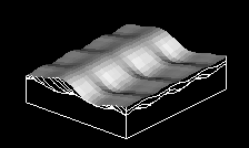 Transverse dunes lie perpendicular to the wind, which moves them forwards, producing the cross-bedding shown here.
_sand_dunes_imaged_by_Terra_(EOS_AM-1).jpg)


.jpg)


-002.JPG)
.jpg)


.jpg)


.jpg)


.jpg)


.jpg)
.jpg)

.jpg)


.jpg)