

Community hub
Recent from talks
Contribute something
Nothing was collected or created yet.
Fall River, Massachusetts
View on Wikipedia

Key Information


_(3535957840).jpg)


.jpg)
Fall River is a city in Bristol County, Massachusetts, United States. Fall River's population was 94,000 at the 2020 United States census,[5] making it the tenth-largest city in the state, and the second-largest municipality in the county behind New Bedford. It abuts the Rhode Island state line with Tiverton, Rhode Island, to its south.
Located along the eastern shore of Mount Hope Bay at the mouth of the Taunton River, the city gained recognition during the 19th century as a leading textile manufacturing center in the United States. While the textile industry has long since moved on, its impact on the city's culture and landscape is still prominent. Fall River's official motto is "We'll Try", dating back to the aftermath of the Great Fire of 1843. Nicknamed The Scholarship City after Irving Fradkin founded Dollars for Scholars there in 1958, mayor Jasiel Correia introduced the "Make It Here" slogan as part of a citywide rebranding effort in 2017.[6]
Fall River is known for the Lizzie Borden case, the Fall River cult murders, Portuguese culture, its numerous 19th-century textile mills and Battleship Cove, home of the world's largest collection of World War II naval vessels (including the battleship USS Massachusetts). Fall River has its city hall located over an interstate highway.
History
[edit]Colonial period to 1800s
[edit]
At the time of the establishment of the Plymouth Colony in 1620, the area that would one day become Troy City was inhabited by the Pocasset Wampanoag tribe, affiliated with the Pokanoket Confederacy headquartered at Mount Hope in what is now Bristol, Rhode Island. The "falling" river that the city's name refers to is the Quequechan River (pronounced "quick-a-shan" by locals) a 2.5 mi (4.0 km) river which flows through the city before draining into the bay. Quequechan is a Wampanoag word believed to mean "falling river" or "leaping/falling waters." During the 1960s, Interstate 195 was constructed through the city along the length of the Quequechan River. The portion west of Plymouth Avenue was routed underground through a series of box culverts, while much of the eastern section "mill pond" was filled in for the highway embankment.
In 1653, Freetown was settled at Assonet Bay by members of the Massachusetts Bay Colony as part of Freeman's Purchase, which included the northern part of what is now Fall River. In 1683, Freetown was incorporated as a town within the colony. The southern part of what is now Fall River was incorporated as the town of Tiverton as part of the Massachusetts Bay Colony in 1694, a few years after the merger with Plymouth Colony. In 1746, in the settlement of a colonial boundary dispute between Rhode Island and Massachusetts, Tiverton was annexed to Rhode Island, along with Little Compton and what is now Newport County, Rhode Island. The boundary was then placed approximately at what is now Columbia Street.
In 1703, Benjamin Church, a hero of King Philip's War established a saw mill, grist mill, and a fulling mill on the Quequechan River. In 1714, Church sold his land, along with the water rights to Richard Borden of Tiverton and his brother Joseph. This transaction would prove to be extremely valuable 100 years later, helping to establish the Borden family as the leaders in the development of Fall River's textile industry.
During the 18th century, the area consisted mostly of small farms and relatively few inhabitants. In 1778, the Battle of Freetown, was fought here during the American Revolutionary War (1775–1783) after British raids badly damaged Bristol and Warren. The militia of Fall River, at that time known as Freetown, put up a stronger defense against a British force.
In 1803, Fall River was separated from Freetown and officially incorporated as its own town. A year later, Fall River changed its name to "Troy." The name "Troy" was used for 30 years and was officially changed back to Fall River on February 12, 1834. During this period, Fall River was governed by a three-member Board of Selectmen, until it became a City in 1854.
In 1835, The Fall River Female Anti Slavery Society was formed (one of the many anti-slavery societies in New England) to promote abolition and to allow a women's space to conduct social activism. There was an initial group, which was wary of allowing free black full membership, so a second group (this one) was formed in response by Elizabeth Buffum Chace and her sisters, who were committed to allowing free black women membership.[7] Sarah G. Buffman, a delegate from the group, was sent to the Anti-Slavery Convention of American Women in Philadelphia in 1838. Buffman signed all three of the statements that the convention's delegates agreed on.[8]
In July 1843, the first great fire in Fall River's history destroyed much of the town center, including the Atheneum, which housed the Skeleton in Armor which had been discovered in a sand bank in 1832 near what is now the corner of Hartwell and Fifth Street.
During this time, the southern part of what is now Fall River (south of Columbia Street) remained part of Tiverton, Rhode Island. In 1856, the town of Tiverton, Rhode Island voted to split off its industrial northern section as Fall River, Rhode Island. In 1861, after decades of dispute, the United States Supreme Court moved the state boundary to what is now State Avenue, unifying both Fall Rivers as a city in Massachusetts (among other changes; see History of Massachusetts § Rhode Island eastern border).
Industrial development and prosperity
[edit]
19th century
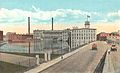
[edit]The early establishment of the textile industry in Fall River grew out of the developments made in nearby Rhode Island, beginning with Samuel Slater at Pawtucket, Rhode Island in 1793. In 1811, Col. Joseph Durfee, the Revolutionary War veteran and hero of the Battle of Freetown in 1778, built the Globe Manufactory, a spinning mill at the outlet of Cook Pond on Dwelly St. near what is now Globe Four Corners in the city's South End. (It was part of Tiverton, Rhode Island at the time.) While Durfee's mill itself was not particularly successful, its establishment marked the beginning of Fall River's time as a mill city.
The real development of Fall River's industry, however, would occur along the falling river from which it was named, about a mile north of Durfee's first mill. The Quequechan River, with its eight falls, combined to make Fall River the best tidewater privilege in southern New England. It was perfect for industrialization—big enough for profit and expansion, yet small enough to be developed by local capital without interference from Boston.[9]
The Fall River Manufactory was established by David Anthony and others in 1813. That same year, the Troy Cotton & Woolen Manufactory was founded by a group of investors led by Oliver Chace of Swansea. Chace had worked as a carpenter for Samuel Slater in his early years. The Troy Mill opened in 1814 at the upper end of the falls.
In 1821, Colonel Richard Borden (along with Maj. Bradford Durfee) established the Fall River Iron Works at the lower part of the Quequechan River. Durfee was a shipwright, and Borden was the owner of a grist mill. After an uncertain start, in which some early investors pulled out, the Fall River Iron Works was incorporated in 1825. The Iron Works began producing nails, bar stock, and other items, such as bands for casks in the nearby New Bedford whaling industry. They soon gained a reputation for producing nails of high quality, and business flourished. In 1827, Col. Borden began regular steamship service to Providence, Rhode Island.[10]
The American Print Works was established in 1835 by Holder Borden, uncle of Col. Richard Borden. With the leadership of the Borden family, the American Print Works (later known as the American Printing Company) became the largest and most important textile company in the city, employing thousands at its peak in the early 20th century. Richard Borden also constructed the Metacomet Mill in 1847, which today is the oldest remaining textile mill in the city; it is located on Anawan Street.
By 1845, the Quequechan's power had been all but maximized. The Massasoit Steam Mill was established in 1846, above the dam near the end of Pleasant Street. However, it would be another decade or so when improvements in the steam engine by George Corliss would enable the construction of the first large steam-powered mill in the city, the Union Mills in 1859.
The advantage of being able to import bales of cotton and coal to fuel the steam engines to Fall River's deep water harbor (and ship them out from the same) made Fall River the city of choice for a series of cotton mill magnates. The first railroad line serving Fall River, The Fall River Branch Railroad, was incorporated in 1844 and opened in 1845. In 1847, the first regular steamboat service to New York City began. The Fall River Line, as it came to be known, operated until 1937, and for many years was the preferred way to travel between Boston and Manhattan. The Old Colony Railroad and Fall River Railroad merged in 1854, forming the Old Colony and Fall River Railroad.
In 1854, Fall River was officially incorporated as a city; it had a population of about 12,000.[11] Its first mayor was James Buffington.
Fall River profited well from the American Civil War and was in a fine position to take advantage of the prosperity that followed. By 1868, it had surpassed Lowell as the leading textile city in America with over 500,000 spindles.
Expansion and growth
[edit]
In 1871 and 1872, a "most dramatic expansion" of the city occurred: 15 new corporations were founded, building 22 new mills throughout the city, while some of the older mills expanded. The city's population increased by 20,000 people during these two years, while overall mill capacity doubled to more than 1,000,000 spindles.
By 1876, the city had one-sixth of all New England cotton capacity and one-half of all print cloth production. The Spindle City, as it became known, was second in the world to only Manchester, England in terms of output.
To house the thousands of new workers—mostly Irish and French Canadian immigrants during these years—over 12,000 units of company housing were built. Unlike the well-spaced boardinghouses and tidy cottages of Rhode Island, worker housing in Fall River consisted of thousands of wood-framed, multi-family tenements, usually three-floor "triple-deckers" with up to six apartments. Many more privately owned tenements supplemented the company housing.[12]
During the 19th century, Fall River became famous for the granite rock on which much of the city is built. Several granite quarries operated during this time, the largest of which was the Beattie Granite Quarry, near what is now the corner of North Quarry and Locust Streets.[13] Many of the mills in the city were built from this stone, and it was highly regarded as a building material for many public buildings and private homes alike. The Chateau-sur-Mer mansion in Newport, Rhode Island was constructed from Fall River granite, known for its greyish-pink color.
While most of the mills "above the hill" were constructed from native Fall River granite, nearly all of their counterparts along the Taunton River and Mount Hope Bay were made of red brick due to the high costs and impracticality associated with transporting the rock through the city and down the hill. (One notable exception is the Sagamore Mills on North Main Street, which were constructed from similar rock quarried in Freetown and brought to the site by rail).
20th century
[edit]

Fall River rode a wave of economic prosperity well into the early 20th century. During this time, the city boasted a bustling downtown with several upscale hotels and theaters. As the city continuously expanded during the late 19th century, additional infrastructure such as parks, schools, streetcar lines, a public water supply, and sewerage system were constructed to meet the needs of its growing population.
From 1896 to 1912, Fall River was the headquarters of the E. P. Charlton & Company, a chain of five and ten cent stores. Founded at Fall River in 1890 by Seymour H. Knox and Earle Perry Charlton as the Knox & Charlton Five and Ten Cent Store, E.P. Charlton operated fifty-eight stores in the United States and Canada by the time of its merger with several other retailers to form the F. W. Woolworth Company in 1912.
In 1920, the population of Fall River peaked at 120,485.[14]
-
 North Main Street, c. 1910
 -
 First Cotton Mill, built in 1811
 -
 Printing Works, c. 1920
 -
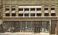 The Charlton Block, 1908


The cotton mills of Fall River had built their business largely on one product: print cloth. Around 1910, the city's largest employer, the American Printing Company (APC), employed 6,000 people and was the largest company printer of cloth in the world. Dozens of other city mills solely produced cloth to be printed at the APC.
World War I had provided a general increase in demand for textiles, and many of the mills of New England benefited during this time. The post-war economy quickly slowed, however, and production quickly outpaced demand. The Northern mills faced serious competition from their Southern counterparts due to lower labor and transportation costs, as well as the South's large investment in new machinery and other equipment. In 1923, Fall River faced the first wave of mill closures. Several of the mills merged, allowing them to remain in business into the late 1920s.
The worst fire in Fall River's history occurred on the evening of February 2, 1928.[15] It began when workers were dismantling the recently vacated Pocasset Mill. During the night, the fire spread quickly and wiped out a large portion of downtown. City Hall was spared, but was badly damaged. Today, many of the structures near the corner of North Main and Bedford Street date from the early 1930s, as they were rebuilt soon after the fire.
By the 1930s and the Great Depression, many of the mills were out of business and the city was bankrupt. The once mighty American Printing Company finally closed for good in 1934. In 1937, their huge plant waterfront on Water Street was acquired by the Firestone Tire & Rubber Company and soon employed 2,600 people. A handful managed to survive through World War II and into the 1950s. In October 1941, just a few weeks before the attack on Pearl Harbor, another large fire broke out in the main building of the printworks. The fire was a major setback to the U.S. war effort; 30,000 pounds (14,000 kilograms) of raw rubber worth $15 million was lost in the inferno.[16]
With the demise of the textile industry, many of the city's mills were occupied by smaller companies, some in the garment industry, traditionally based in the New York City area but attracted to New England by the lure of cheap factory space and an eager workforce in need of jobs.[17] The garment industry survived in the city well into the 1990s, by which point it had fallen victim to globalization and foreign competition.[18]
Modern era
[edit]
In the 1960s, the city's landscape was drastically transformed with the construction of the Braga Bridge and Interstate 195, which cut directly through the heart of the city. In the wake of the highway building boom, the city lost many of its longtime landmarks. The Quequechan River was filled in and re-routed for much of its length. The historic falls were diverted into underground culverts. A series of elevated steel viaducts was constructed to allow access the new bridge. Many historic buildings were demolished, including the Old City Hall, the Troy Mills, the Second Granite Block (built after the 1928 fire), as well as other 19th-century brick-and-mortar buildings near Old City Hall.
Constructed directly over Interstate 195 in the place of it predecessor, the new city hall (known as Government Center) was opened in 1976 after years of construction delays and quality control problems. Built in the Brutalist style popular in the 1960s and 1970s, the new city hall drew complaints from city workers and residents almost immediately.[citation needed]
In 1970, Valle's Steak House opened one of its landmark restaurants on William S. Canning Boulevard in the city's South End. The steak house was popular with Fall River residents, but economic challenges caused the chain to close all of its restaurants in the 1980s.[19]
Also during the 1970s, several modern apartment high-rise towers were built throughout the city, many part of the Fall River Housing Authority. There were two built near Milliken Boulevard, two on Pleasant Street in Flint Village, another on South Main Street, and in the north end off Robeson Street. Today, these high-rises mostly house the elderly.
In 1978, the city opened the new B.M.C. Durfee High School in the North End, replacing the historic Rock Street building that had become overcrowded and outdated for use as a high school. The "new" Durfee is one of the largest high schools in Massachusetts.
Since approximately 1980, there has been a considerable amount of new development in the North End of the city. A significant number of new single- and multi-family housing developments have been constructed, particularly along North Main Street.
In 2017, Fall River was ranked the 51st most dangerous city in the United States. It was also the third most dangerous city in Massachusetts and fourth most dangerous city in New England.[20]
On January 20, 2019, a cannabis dispensary opened in Fall River, becoming only the sixth dispensary in Massachusetts and the first in Southeastern Massachusetts to open to anyone 21 years or older.[21]
On the night of July 13–14, 2025, a fire at a Fall River assisted living facility claimed the lives of ten people and injured thirty others, prompting a call for stricter oversight of assisted living facilities throughout the Commonwealth.
Geography
[edit]
According to the U.S. Census Bureau, the city has a total area of 40.2 square miles (104.2 km2), of which 33.1 square miles (85.8 km2) is land and 7.1 square miles (18.4 km2), or 17.68%, is water.[22]
Water power from the Quequechan River and natural granite helped form and shape Fall River into the city it is today. The Quequechan River once flowed through downtown unrestricted, providing water power for the mills and, in the last 1⁄2 mile (0.8 km) of its length, down a series of eight steep waterfalls falling 128 feet (39 m) into the Taunton River at the head of the deep Mount Hope Bay. Fall River and surrounding areas are located in the northeastern coastal forests, which make up the temperate broadleaf and mixed forest biome.
Fall River was the only city on the East Coast of the United States to have had an exposed waterfall in part of its downtown area; it flowed less than 1⁄2 mile (0.8 km) into a sheltered harbor at the edge of downtown. Fall River has two large lakes (originally one lake) and a large portion of protected woodlands on the eastern part of the city, which is higher in elevation, with the Quequechan River draining out of the ponds and flowing 2.5 miles (4.0 km) through the heart of the city, emptying out an estimated 26 million US gallons (98×106 L) per day into the deep Mount Hope Bay/Taunton River estuary in the western part of the city.
The city lies on the eastern border of Mount Hope Bay, which begins at the mouth of the Taunton River starting south from the Charles M. Braga Jr. Memorial Bridge. The greater portion of the city is built on hillsides rising quite abruptly from the water's edge to a height of more than 200 feet (60 m). From the summits of these hills, the terrain extends back in a comparatively level table-land, on which a large section of the city now stands.
Two miles (3 km) eastward from the shore lies a chain of deep and narrow ponds, eight miles (13 km) long, with an average width of three-quarters of a mile, and covering an area of 3,500 acres (14 km2). These ponds are supplied by springs and brooks, draining a watershed of 20,000 acres (81 km2). The northern pond is the North Watuppa Pond, the city's main reservoir. The southern pond is the South Watuppa Pond. The narrow strip of land where the two ponds meet is known as The Narrows. East of the North Watuppa Pond is the Watuppa Reservation, which includes several thousand acres of forest-land for water supply protection that extends north into the Freetown-Fall River State Forest, and east to the Copicut Reservoir. Copicut Pond is located on the border of Dartmouth in North Dartmouth's Hixville section that borders Fall River. Copicut Hill, the highest point in Fall River, is located between North Watuppa Pond and the Copicut Reservoir. The hill has a summit elevation of greater than 404 feet (123 m) above sea level.[23]
The Quequechan River breaks out of its bed in the west part of the South Watuppa Pond, just west of The Narrows, and flows through the city (partially underground in conduits) where it falls to a channel leading to what is now Fall River Heritage State Park at Battleship Cove on the Taunton River. The Quequechan River originally flowed unconfined over an almost level course for more than a mile. In the last half-mile (800 m) of its progress it rushes down the hillside in a narrow, precipitous, rocky channel, creating the falls for which Fall River is named. In this distance the total fall is about 132 feet (40 m). and the volume of water 122 cubic feet (3.5 m3) per second.


Originally an attractive feature of the landscape, the Quequechan has seldom been visible since it was covered over by cotton mills and the Bay Colony Railroad line in the 19th century. As the Quequechan became an underground feature of the industrial landscape, it also became a sewer. In the 20th century the mills were abandoned and some of them burned, exposing the falls once more. Because of highway construction in the 1960s, the waterfalls were buried under I-195, which crosses the Taunton River at Battleship Cove. Plans exist to "daylight" the falls, restore or re-create them, and build a green belt with a bicycle path along the Quequechan River.
In the south end, Cook Pond, also formerly known as Laurel Lake, is located east of the Taunton River and west of the South Watuppa Pond. The area between the modern day Cook and South Watuppa Ponds, east of the Taunton River and north of Tiverton, Rhode Island, was once referred to as "Pocasset Swamp" during King Philip's War in 1675–1676.
Fall River is a part of the South Coast region of Massachusetts.
Neighborhoods
[edit]The city is divided into two by I-195, which runs directly through downtown and underneath Fall River City Hall. The two sections of the city contain a number of distinct neighborhoods.
Northern Neighborhoods ("The North End"; North of I-195, extending to the city's northern border with Freetown, Massachusetts, and western border with Dartmouth, Massachusetts)
- Waterfront/Battleship Cove (east of Route 79 to the edge of the Taunton River/Mount Hope Bay)
- The Highlands
- Lower Highlands (Bedford St, up High St to Prospect St)
- Upper Highlands (Prospect St along President Ave, up to Wilson Rd)
- Fall River Industrial Park ("Airport Road", area north of Wilson Rd bounded to the west by Route 24 and to the east by Riggenbach Rd)
- Fall River/Freetown State Forest
Southern Neighborhoods ("The South End"; South of I-195, extending to the city's southern border with Tiverton, Rhode Island)
- Flint Village ("The Flint")South and east of Bedford and Quarry Sts, respectively)
- Globe Village (Cook Pond, Broadway)
- Townsend Hill (South Main and Bay St Neighborhoods bordering Tiverton, R.I.)
- Maplewood
Parks
[edit]Fall River has 23 municipal parks and playgrounds, including three designed by landscape architect Frederick Law Olmsted.[24][25] Fall River's more notable parks include:
- Kennedy Park (Olmsted, 1868): South Main Street, 54 acres, four tennis courts, three baseball fields, two basketball courts, softball field, skating pond, playground[24]
- North Park (Olmsted, 1901): President Avenue, 25 acres, two baseball fields, two basketball courts, playground, skating pond, skate park[24]
- Ruggles Park (Olmsted, 1903): Locust Street, 9 acres, basketball court, playground, softball field[24]
- Bicentennial Park: Davol Street, 2 acres, boat ramp[24]
- Lafayette Park: Eastern Avenue, 11 acres, baseball field, basketball court, playground, swimming pool, tennis court, skate park[24]
- Quequechan River Rail Trail: 2.5 mile Bike path from Britland Park and Rodman Street to Westport Line on Route 6[26]
The city is also home to several Massachusetts state parks, including Fall River Heritage State Park and Freetown-Fall River State Forest.
Demographics
[edit]| Year | Pop. | ±% |
|---|---|---|
| 1810 | 1,296 | — |
| 1820 | 1,594 | +23.0% |
| 1830 | 4,158 | +160.9% |
| 1840 | 6,738 | +62.0% |
| 1850 | 11,524 | +71.0% |
| 1860 | 14,026 | +21.7% |
| 1870 | 26,766 | +90.8% |
| 1880 | 48,961 | +82.9% |
| 1890 | 74,398 | +52.0% |
| 1900 | 104,863 | +40.9% |
| 1910 | 119,295 | +13.8% |
| 1920 | 120,485 | +1.0% |
| 1930 | 115,274 | −4.3% |
| 1940 | 115,428 | +0.1% |
| 1950 | 111,963 | −3.0% |
| 1960 | 99,942 | −10.7% |
| 1970 | 96,898 | −3.0% |
| 1980 | 92,574 | −4.5% |
| 1990 | 92,703 | +0.1% |
| 2000 | 91,938 | −0.8% |
| 2010 | 88,857 | −3.4% |
| 2020 | 94,000 | +5.8% |
| 2024* | 94,689 | +0.7% |
| * = population estimate. Source: United States census records and Population Estimates Program data.[27][28][29][30][31][32][33][34][35][36][37][38] Source: U.S. Decennial Census[39] | ||

2020 census
[edit]| Race / Ethnicity (NH = Non-Hispanic) | Pop 2000[40] | Pop 2010[41] | Pop 2020[42] | % 2000 | % 2010 | % 2020 |
|---|---|---|---|---|---|---|
| White alone (NH) | 82,274 | 74,107 | 66,746 | 89.49% | 83.40% | 71.01% |
| Black or African American alone (NH) | 2,097 | 3,016 | 4,643 | 2.28% | 3.39% | 4.94% |
| Native American or Alaska Native alone (NH) | 147 | 163 | 185 | 0.16% | 0.18% | 0.20% |
| Asian alone (NH) | 1,980 | 2,249 | 2,475 | 2.15% | 2.53% | 2.63% |
| Pacific Islander alone (NH) | 16 | 10 | 17 | 0.02% | 0.01% | 0.02% |
| Some Other Race alone (NH) | 323 | 787 | 1,370 | 0.35% | 0.89% | 1.46% |
| Mixed Race or Multi-Racial (NH) | 2,061 | 1,963 | 5,982 | 2.24% | 2.21% | 6.36% |
| Hispanic or Latino (any race) | 3,040 | 6,562 | 12,582 | 3.31% | 7.38% | 13.39% |
| Total | 91,938 | 88,857 | 94,000 | 100.00% | 100.00% | 100.00% |
According to the U.S. Census of 2020, the population of Fall River is 94,000. The largest racial groups within the city were 87.2% (83.4% Non-Hispanic) White, 3.5% African American, 2.5% Asian and 0.2% Native American and 7.4% Hispanic or Latino. 49% of residents are Luso American or have origins somewhere in the former Portuguese Empire. 37% of the population described themselves as being of Portuguese ancestry. The next largest groups by ancestry are French (12.4%) the original immigrants to largely populate Fall River until the Portuguese started immigrating to the area, Irish (8.9%), Cape Verdean (8.1%), English (6.0%), French Canadian (5.9%), Puerto Rican (4.5%), and Italian (3.6%).[43]
Fall River and its surrounding communities form much of the Massachusetts portion of the Providence metropolitan area, which has an estimated population of 1,622,520.
In percentage terms, Fall River has the largest Portuguese American population in the United States. The exact percentage of the population they make up is disputed; a 2005 study by the University of Massachusetts Dartmouth estimated that 49.6% of city residents are Portuguese American,[44] while other sources estimate that 43.9% are.[45]
The city has 38,759 households and 23,558 families. The population density was 2,963.7 inhabitants per square mile (1,144.3/km2). There were 41,857 housing units at an average density of 1,349.3 per square mile (521.0/km2). Of the 38,759 households, 29.9% had children under the age of 18 living with them, 40.3% were married couples living together, 16.5% had a female householder with no husband present, and 39.2% were non-families. 34.2% of all households were made up of individuals, and 14.2% had someone living alone who was 65 years of age or older. The average household size was 2.32 and the average family size was 3.00.
In terms of age, the population was spread out, with 24.1% under the age of 18, 9.2% from 18 to 24, 29.8% from 25 to 44, 20.0% from 45 to 64, and 16.9% who were 65 years of age or older. The median age was 36 years. For every 100 females, there were 87.7 males. For every 100 females age 18 and over, there were 82.9 males.
The median household income was $29,014, and the median family income was $37,671. Males had a median income of $31,330 versus $22,883 for females. The per capita income for the city was $16,118. About 14.0% of families and 17.1% of the population were below the poverty line, including 25.4% of those under age 18 and 17.4% of those age 65 or over.[43]
Income
[edit]Fall River is ranked 344th out of Massachusetts' 350 municipalities in terms of per capita income.[46][47][48]
| Rank | ZIP Code (ZCTA) | Per capita income |
Median household income |
Median family income |
Population | Number of households |
|---|---|---|---|---|---|---|
| Massachusetts | $35,763 | $66,866 | $84,900 | 6,605,058 | 2,530,147 | |
| Bristol County | $28,837 | $55,298 | $72,018 | 549,870 | 210,037 | |
| United States | $28,155 | $53,046 | $64,719 | 311,536,594 | 115,610,216 | |
| 1 | 02720 | $25,090 | $41,910 | $56,091 | 30,811 | 13,079 |
| Fall River | $21,257 | $33,211 | $42,962 | 88,811 | 38,258 | |
| 2 | 02721 | $19,321 | $30,180 | $38,133 | 26,141 | 10,943 |
| 3 | 02723 | $18,980 | $28,120 | $34,835 | 14,298 | 6,442 |
| 4 | 02724 | $18,827 | $27,390 | $39,246 | 16,769 | 7,561 |
Culture
[edit]

Fall River retains a vibrant mix of cultures that date back to its time as an immigration hub. While the distinct ethnic neighborhoods formed in the late 19th and early 20th centuries have changed over the years, the legacy of immigrants who came to work in the mills can be found in the various parishes and restaurants throughout the city. This heritage is commemorated by the 19 flags which make up the "Banners of Allegiance" at Gromada Plaza.[49] Erected in 1979 across from City Hall (and restored in 2019), this landmark commemorates the diverse nationalities of Fall River's residents.[49]
The city is host to several ethnic festivals throughout the year. The largest, the Great Feast of the Holy Ghost, occurs each August at Kennedy Park and attracts "more than 100,000 visitors."[50] The feast is held over a total of four days and includes parades, music, food, and a crowning ceremony and procession featuring local dignitaries and guests from Portugal, Brazil, and the Azores.[51][50]
Each summer, the city uses its waterfront at Heritage State Park and Battleship Cove for a Fourth of July fireworks display. For many years, the waterfront also hosted the annual Fall River Celebrates America Festival, sponsored by the Fall River Chamber of Commerce. The event was suspended in 2010 due to lack of financial support stemming from the Great Recession. While the Chamber of Commerce hoped to hold the event again in 2011, it has not been held since.[52]
Performing arts
[edit]A number of community organizations have made concerted efforts to promote the arts in the city, using vacant mill space for studios and performance centers. The Narrows Center for the Arts, located on Anawan Street, has been played by a number of national and international acts since its opening in 2001, including Rosanne Cash, Los Lobos, Blue Öyster Cult, Dr. John, The Avett Brothers, Richie Havens, Lake Street Dive and Susan Tedeschi.[53] A proposal is in place to revitalize the downtown area by the creation of an Arts District. Along with the art centers being established throughout the city, Fall River has numerous Portuguese/Community Bands throughout the city that perform throughout the year.
Visual arts
[edit]In 2020, artists and Fall River natives Harry Gould Harvey IV and Brittni Ann Harvey opened the Fall River Museum of Contemporary Art (Fall River MoCA) in the first floor of a former mill on Bedford Street.[54] The museum aims to "create culturally relevant programming that is in dialog with the global contemporary art world."[55]
Religion
[edit]


Fall River remains a predominantly Roman Catholic city due to the French Canadians who first populated the city, and is the seat of the Roman Catholic Diocese of Fall River. St. Mary's Cathedral was formed in the 1850s by Irish immigrants; Edgar DaCunha has served as bishop since 2014. Santo Christo Parish on Columbia Street is known as the Mother Church of the Portuguese parishes in the diocese. The Church was established in 1892 to serve the local Portuguese community, Many of whom came from the Azorean island of São Miguel. Other notable Catholic churches include St. Anne's Church, Good Shepherd Church (formerly Saint Patrick's), and the former Notre Dame de Lourdes in the Flint neighborhood, which was destroyed in a large fire on May 10, 1982. At the time of the city's peak population in 1920, there were over two dozen Catholic parishes existing throughout the city, with each ethnic enclave having its own parish. In recent years, the diocese has merged several parishes in the city, closing some and renaming the united congregations, bringing the total number of parishes in the diocese to ten as of 2021.[56] St. Louis the King Church closed in 2000.[57]
Historically, the Highlands neighborhood was predominantly Protestant, with several churches in the area of North Main and Rock Streets, notably including the Central Congregational Church and the First Congregational Church, known for hosting many New England luminaries before its demise in a fire in the 1980s.
German Jewish settlers arrived in Fall River beginning in the 1860s and continuing into the 1870s.[58] The 1880s and 1890s saw the arrival of Russian Jewish immigrants.[58] At the start of the 20th century, Fall River was home to three synagogues.[58] The Jewish community historically worked in peddling, retail, and clothing stores.[58] Temple Beth-El was founded in 1924 on High Street.[58] In 1970 there were three congregations serving 4,000 Jews in Fall River; by 2008 that number had declined to less than 1,000.[58]
Various other ethno-religious groups also live in the city. Recent arrivals from Cambodia and India maintain temples in the city, such as Wat Udomsaharatanaram and BAPS Shri Swaminarayanwasi.
Government
[edit]City government and services
[edit]

.jpg)

The city is led by the mayor-council form of government. There is a mayor and nine at-large city councillors, elected in odd-years to two year terms. The mayor, along with their appointed city administrator, lead and manage the city's day-to-day operations. The majority of the city's municipal offices are located at Government Center.
The city's police department is consolidated into a large central police station. There are six fire stations located around the city. The Fire Headquarters is located on Commerce Drive, across from the former Fall River Municipal Airport.
There are four post offices in the city. The central, located adjacent to Government Center, is modeled after the James Farley Post Office in New York City. The central branch was named after the late Sgt. Robert Barrett in May 2011, a Fall River native who died in Afghanistan in 2010. Additional branches are located in the Flint, the South End, and the Highlands.
The city is home to several state and county-level courthouses. The murder trial of former New England Patriots tight end Aaron Hernandez in 2015 was held at the district courthouse on South Main Street.[59]
State and federal representation
[edit]Fall River is represented by three separate Massachusetts House of Representatives districts; only one, the 7th Bristol, is wholly within city limits. As of 2021, the city is represented by Democrats Carole Fiola (6th Bristol), Alan Silvia (7th Bristol), and Paul A. Schmid III (8th Bristol). The city is entirely within the First Bristol and Plymouth district, represented by State Senator Michael Rodrigues (D-Fall River). The First Bristol and Plymouth also includes the towns of Freetown, Lakeville, Rochester, Somerset and Swansea.[60][61]
Fall River's state highways are patrolled by the Third Barracks of Troop D of the Massachusetts State Police, based out of Dartmouth.
On the national level, the city is divided between two congressional districts. Massachusetts' 4th congressional district, represented by Democrat Jake Auchincloss, contains most of the city, while Massachusetts' 9th congressional district, represented by Democrat Bill Keating, contains a part of the northeastern portion of the city.
Fall River's voting history has, until recently, largely mirrored that of Massachusetts as a whole. Before 1928, Fall River was a Republican-leaning city. Beginning in 1928, Fall River became a strongly Democratic city, owing to the large Portuguese Catholic population in the city. Fall River even voted Democratic in the Republican landslide election wins in 1952 and 1956. However, in 2024, Donald Trump became the first Republican since Calvin Coolidge to win Fall River, narrowly winning the city by 50%-48%; Kamala Harris easily carried the state as a whole. This marked a dramatic reversal of the city's typical voting pattern; Democrats such as Barack Obama usually obtained over 70% of the city's votes before Trump's entrance into politics. Fall River's unique demographics, including an overwhelmingly large Catholic population and blue-collar labor force, have been cited as potential factors. Another major reason cited was the declining influence of labor unions, which has resulted in Democrats losing sway over an otherwise heavily socially conservative population.[62]
| Voter registration and party enrollment as of October 26, 2024[63] | |||||
|---|---|---|---|---|---|
| Party | Number of voters | Percentage | |||
| Democratic | 16,798 | 26.87% | |||
| Republican | 4,920 | 7.87% | |||
| Unaffiliated | 39,989 | 63.96% | |||
| Libertarian | 320 | 0.51% | |||
| Total | 62,521 | 100% | |||
| Year | Republican | Democratic | Third parties |
|---|---|---|---|
| 2024 | 49.9% 15,230 | 48.2% 14,726 | 1.9% 593 |
| 2020 | 43.0% 13,571 | 55.3% 17,459 | 1.7% 535 |
| 2016 | 36.2% 10,850 | 58.2% 17,467 | 4.8% 1,444 |
| 2012 | 24.8% 7,390 | 73.5% 21,878 | 1.4% 427 |
| 2008 | 25.4% 7,933 | 72.4% 22,591 | 2.2% 678 |
| 2004 | 23.3% 7,369 | 75.6% 23,859 | 1.1% 332 |
| 2000 | 19.4% 5,621 | 76.0% 22,051 | 4.6% 1,343 |
| 1996 | 14.3% 4,290 | 76.2% 22,805 | 9.5% 2,831 |
| 1992 | 17.5% 5,456 | 59.8% 18,652 | 22.8% 7,102 |
| 1988 | 29.2% 8,394 | 70.1% 20,184 | 0.8% 216 |
| 1984 | 35.5% 11,463 | 64.2% 20,722 | 0.3% 109 |
| 1980 | 29.6% 9,958 | 58.5% 19,644 | 11.9% 4,001 |
| 1976 | 27.1% 10,065 | 70.5% 26,126 | 2.4% 886 |
| 1972 | 36.4% 14,088 | 63.0% 24,379 | 0.6% 216 |
| 1968 | 18.0% 7,449 | 78.8% 32,516 | 3.2% 1,324 |
| 1964 | 11.2% 5,096 | 88.6% 40,502 | 0.2% 101 |
| 1960 | 20.4% 10,055 | 79.4% 39,036 | 0.2% 100 |
| 1956 | 48.1% 24,575 | 51.8% 26,469 | 0.1% 83 |
| 1952 | 41.5% 22,791 | 58.3% 32,060 | 0.2% 133 |
| 1948 | 26.3% 13,915 | 72.4% 38,347 | 1.3% 668 |
| 1944 | 30.6% 13,835 | 69.2% 31,249 | 0.2% 104 |
| 1940 | 29.1% 13,766 | 70.5% 33,355 | 0.4% 201 |
| 1936 | 26.2% 11,181 | 67.6% 28,813 | 6.2% 2,646 |
| 1932 | 35.0% 12,493 | 63.4% 22,642 | 1.7% 596 |
| 1928 | 34.8% 13,012 | 64.1% 23,965 | 1.1% 401 |
| 1924 | 56.6% 17,190 | 32.7% 9,935 | 10.7% 3,232 |
| 1920 | 64.4% 15,943 | 33.0% 8,166 | 2.6% 655 |
| 1916 | 48.1% 6,619 | 50.1% 6,894 | 1.8% 253 |
| 1912 | 31.5% 4,047 | 39.8% 5,125 | 28.7% 3,688 |
| 1908 | 51.7% 6,207 | 41.5% 4,985 | 6.8% 820 |
| 1904 | 49.5% 5,691 | 46.8% 5,382 | 3.7% 426 |
| 1900 | 57.6% 6,516 | 39.6% 4,481 | 2.8% 320 |
| 1896 | 65.7% 6,925 | 31.9% 3,366 | 2.4% 251 |
| 1892 | 51.3% 4,812 | 47.5% 4,451 | 1.2% 109 |
| 1888 | 50.6% 4,125 | 48.4% 3,952 | 1.0% 81 |
| 1884 | 54.5% 3,204 | 38.2% 2,244 | 7.3% 428 |
| 1880 | 57.6% 3,325 | 39.8% 2,299 | 2.6% 149 |
| 1876 | 60.2% 2,533 | 39.8% 1,672 | 0.0% 0 |
| 1872 | 71.5% 2,100 | 28.5% 839 | 0.0% 0 |
| 1868 | 72.3% 1,814 | 27.7% 694 | 0.0% 0 |
| 1864[65] | 80.5% 1,504 | 19.5% 364 | 0.0% 0 |
Education
[edit]
.jpg)

Public schools
[edit]Fall River Public Schools operates all public schools in the city. Fall River has one public high school, B.M.C. Durfee High School. Durfee alum include Chris Herren, former NBA player for the Denver Nuggets and the Boston Celtics, former Supreme Court Justice James M. McGuire, and Humberto Sousa Medeiros, a Cardinal of the Roman Catholic Church and former Archbishop of Boston.
The city is also home to Diman Regional Vocational Technical High School, which serves Fall River and the towns of Somerset, Swansea, and Westport. Chef Emeril Lagasse is a Diman Graduate. The school dates back to the Durfee Textile School, which branched out to include Diman. (The college, founded to promote the city's textile sciences, is now a part of University of Massachusetts Dartmouth.)
Private schools
[edit]In addition to public schools, there are several private and parochial schools in the city, including six Catholic schools, two private schools, a Christian academy (East Gate Christian Academy). Atlantis Charter School, a Pre-K through 8 charter school with a marine science-themed curriculum, was founded in 1995.[66] The city was also home to Bishop Connolly High School, a Catholic high school named for Bishop James Louis Connolly, fourth Bishop of the Diocese of Fall River, however, it closed its doors in May 2023. Bishop Feehan was located in Fall River from 1961 to 1972.[67]
Espirito Santo School opened on September 19, 1910, and was the first Portuguese grammar school to open in the United States. As of 2011, the majority of its students were ethnic Portuguese, and 70% of the students were bilingual.[68]
Higher education
[edit]University of Massachusetts Dartmouth has two branches in the city: the Professional and Continuing Education Center, located at 139 South Main Street, and the Advanced Technical & Manufacturing Center at the Narrows, on the former site of the Kerr Mills. Bristol Community College, founded in 1965, is a two-year college offering associate degrees as well transfer programs to four-year institutions. Eastern Nazarene College offers Adult Studies/LEAD classes in Fall River as well. It has GED programs and a recording studio.[69]
Sister cities
[edit]Fall River is twinned with:
 Ponta Delgada, The Azores – Portugal
Library
[edit]
Fall River established its public library in 1860.[70][71] As of fiscal year 2022, the city of Fall River spends 0.53% ($1,861,112) of its budget on its public library—roughly $20 per person.[72]
The main location of the Fall River Public Library is located at 104 North Main Street, within the Downtown Fall River Historic District. It opened in 1899, and was designed by architect Ralph Adams Cram in the Renaissance Revival style. It is constructed from native Fall River granite. The building underwent an extensive renovation during the late 1990s and early 2000s.
The public library system also includes two branches; the South End Branch, located at 58 Arch Street, and the East End Branch, located at 1386 Pleasant Street.[73]
The Fall River Historical Society also maintains the Charlton Library of Fall River History.[74]
Transportation
[edit]
Fall River has historically been a transportation hub for the South Coast and Mount Hope Bay areas due to its location along the Taunton River. In addition to the Fall River Line, Slade's Ferry ran from Fall River to Somerset beginning in the 17th century. In 1875, Slade's Ferry Bridge was opened, connecting the two cities by trolley (and late by car). A two-tiered steel swing-span bridge, Slade's Ferry Bridge extended over 1,100 feet (340 m) from Remington Avenue in Fall River to the intersection of Wilbur Avenue, Riverside Avenue and Brayton Avenue in Somerset. The bridge was in use until 1970, when it was closed and subsequently demolished. The path of the bridge is now roughly marked by twin sets of power lines crossing the river.
In 1903, the state authorized construction of a second bridge, the Brightman Street Bridge, a four lane, 922-foot (281 m) long drawbridge ending at its namesake street; the bridge opened in 1908. Closed in 2011 and inaccessible to pedestrians and vehicles, the old span is still partially standing. By the 1980s, structural issues with the Brightman Street Bridge resulted in frequent closures for repair, straining local traffic and forcing motorists to take long detours. By 1983, plans were being made to build a new bridge 1,500 feet (460 m) north of the original, which would directly link with Route 138 in Somerset. Plans were put on hold in 1989 due to Coast Guard concerns. Construction of the new span began in the late 1990s and continued until late 2011. The new bridge, the Veterans Memorial Bridge, was formally dedicated on September 11, 2011.
Construction on the Charles M. Braga Jr. Memorial Bridge began in 1959, and the bridge opened to traffic in the spring of 1966. The six-lane cantilever truss highway bridge spans 1.2 miles (1.9 km) and was constructed in tandem with Interstate 195. The bridge is named for Charles M. Braga Jr., who died during the attack on Pearl Harbor while aboard the U.S.S. Pennsylvania.[75]
Road
[edit]I-195 is the main east–west artery through the city for motorists. The highway enters Fall River from Somerset via the Charles M. Braga Jr. Memorial Bridge, continuing through the center of the city to The Narrows and eastwards into Westport. I-195 connects Fall River to New Bedford and Cape Cod to the east and Providence to the west. The highway roughly parallels both the Bay Colony/New Bedford Cape Cod Railroad as well the original path of the Quequechan River. In 1999, a cement ceiling tile fell from the roof of the tunnel beneath Government Center, landing on several cars and causing minor injuries.[76]
In addition to I-195, Fall River is served by six other routes, being Route 6, MA 138, MA 79, MA 81, MA 177, and MA 24.
 Route 6 - This route enters the city from Somerset via an overlap with MA 138 crossing the Taunton River on the Veterans Memorial Bridge. After crossing the river, it intersects with MA 79 (West Fall River Expressway) and parallels the highway for a few blocks. At President Avenue. it turns east, splitting from MA 138 and following the avenue until it reaches a circle with Eastern Avenue and Exit 5 of MA 24. It then turns southwards onto Eastern Avenue, which it follows until US 6 reaches Maritime Street, where it turns back east, paralleling I-195 in the Narrows until it reaches Westport.
 MA 24 (Fall River Expressway) - This highway enters Fall River from Tiverton. (as RI 24) A few exits are contained in the city, including one for MA 81, a brief overlap with I-195, and an interchange with MA 79. It stays in the eastern edge of the city, following the Watuppa Ponds. The highway continues northwards to Freetown, Taunton, and eventually to I-93/MA 128 and Boston.
 MA 79 (Western Fall River Expressway) - This road starts at the intersection with I-195 and MA 138 on the western waterfront nearby Battleship Cove. It continues northwards through the western edge of the city by the river, intersecting with US 6 and then goes up to MA 24 in the northern end of the city, continuing its overlap with the highway until Freetown. Large sections of this highway have been torn down in recent years and have been replaced with avenues and at-grade intersections, including a large portion which closed in 2023.
 MA 81 - This route enters the city from Tiverton (RI 81) as well, intersecting with MA 24 not long past the state border. It follows Rhode Island Ave. and Plymouth Ave. until the road intersects with I-195 in downtown Fall River, in which it ends.
 MA 138 - This road enters the city as well from Tiverton, following S. Main St. and then Broadway until approaching I-195. It then overlaps with MA 79 before exiting and crossing with US 6 across the Taunton River into Somerset.
 MA 177 - This road passes 300 feet through the city in the very southeastern edge, coming from Tiverton (RI 177) and quickly entering Westport, continuing to MA 88 and Route 6 in Dartmouth.
Rail
[edit]
Fall River station is served by the Fall River/New Bedford Line of the MBTA Commuter Rail system.[77]
Bus
[edit]Along with New Bedford, Fall River shares ownership of the Southeastern Regional Transit Authority (SRTA), a bus network that services both cities, as well as Acushnet, Dartmouth, Fairhaven, Freetown, Mattapoisett, Somerset, Swansea, and Westport.[78] The twelve fixed-route bus lines that service Fall River depart from the Louis D. Pettine Transportation Center, which opened in 2013.[79] Service to Providence, Tiverton, and Newport, Rhode Island is offered by the Rhode Island Public Transit Authority (RIPTA).[80]
Intercity bus service to Boston and Hyannis is provided by Peter Pan, with connections available to the company's larger network via transfers.[81]
Air
[edit]Fall River Municipal Airport, opened in 1951, served as a general aviation airport for small planes and commuter flights to the Cape and Islands for several decades. By the 1960s, the airport had fallen into a state of relative disrepair. it was closed on February 18, 1996, after the Federal Aviation Administration deemed it unsafe due to its proximity to the city's large landfill. Limited commercial service to the Cape and Islands, as well as general aviation, is available from New Bedford Regional Airport in nearby New Bedford, Massachusetts. Domestic and international commercial air service is available from T.F. Green Airport, located 13 miles west in Warwick, Rhode Island, and at Logan International Airport, located 45 miles north in Boston.
Water
[edit]The Fall River Line Pier, located directly beneath the Braga Bridge, is a major port for commercial fishing[82] and cargo shipping, handling imports from and to Cape Verde, the Azores, Brazil, Haiti, and the Dominican Republic.[83] A water taxi service began in 2024, connecting the pier to several points throughout the city's waterfront.[84] The port has also served as port-of-call for cruise ships,[85] and formerly served as the terminus for a passenger ferry line connecting to the Rhode Island communities of Newport and Block Island,[86] though the service was cancelled in 2020.[87] The pier also offers connections to freight rail via the Massachusetts Coastal Railroad.
Soccer
[edit]Fall River has a rich soccer history. The game was first introduced to the city in the 1880s by immigrants from Lancashire and Glasgow who worked in the local textile industry. In later decades, the arrival of immigrants from Portugal helped to sustain the game's popularity. Between 1888 and 1892, teams from Fall River won the American Cup for five straight years. One of these teams, the Fall River Rovers, also won the 1917 National Challenge Cup. The star and captain of the team was local-born Thomas Swords, who in 1916 captained the United States in their first official international.
During the 1920s and early 1930s, the Fall River F.C. of Sam Mark were one of the most successful soccer clubs in the United States and were American soccer champions on seven occasions. A subsequent Fall River F.C., were champions in 1932.
The 'Marksmen' won the National Challenge Cup four times. Among their most notable players were Billy Gonsalves and Bert Patenaude, who were both raised in Fall River. Both played for the United States at the first ever soccer World Cup in 1930. Patenaude is also credited with scoring the first ever hat-trick in World Cup history. He scored all three goals in the United States' 3–0 victory over Paraguay.
During the 1940s, Ponta Delgada S.C. became one of the most successful amateur teams in the United States. In 1947 the team was selected to represent the United States at the North American soccer championship. In 1950, two of their local born players, Ed Souza and John Souza, played at the World Cup, helping the United States defeat England 1–0.[88]
On January 18, 2011, Andrew Sousa was drafted by New England Revolution, becoming the first ever Fall River native to play in Major League Soccer.
In 2019, Fall River Football Club and Fall River Marksmen FC returned to the field after a long hiatus. Both clubs participated in the 1st annual Taça de Fall River, a Home & Away match series, with Fall River Football Club becoming the eventual winners.
Points of interest
[edit]
- Battleship Cove, the world's largest historic naval ship exhibit, featuring the USS Massachusetts
- Lincoln Park Carousel,[89] restored 1920 carousel, located at Battleship Cove
- Fall River Heritage State Park, the focal point of Fall River's waterfront
- The Marine Museum at Fall River
- Freetown-Fall River State Forest
- Kennedy Park, North Park and Ruggles Park, designed by Frederick Law Olmsted
- Lizzie Borden Bed and Breakfast Museum
- Maplecroft, home of Lizzie Borden from 1894 to her death in 1927[90]
- Oak Grove Cemetery
- Barnard's Folly, a group of historic triple decker tenement houses located on North Main Street[91]
- Granite Mills, two historic cotton textile mills located on Bedford Street[91]
Notable people
[edit]
- Chick Albion (1890–), soccer player
- Mariano S. Bishop (1906–1953), labor and union leader involved with the Textile Workers Union of America[92]
- Lizzie Borden (1860–1927), tried and acquitted of the 1892 murder of father and step-mother and public speaking teacher in Fall River; is buried with them and the rest of their immediate family in Oak Grove Cemetery
- Nathaniel B. Borden (1801–1865), businessman and politician
- Colonel Richard Borden (1795–1874), mill owner and industrialist
- Dave Brinnel, musician, television producer, radio personality
- David Glendenning Cogan (1908–1993), ophthalmologist
- Jasiel Correia (born 1991), former mayor; arrested twice on charges related to fraud and extortion while in office
- Morton Dean, television and radio anchor, news correspondent and author
- Diesel, born Mark Denis Lizotte, American-born Australian singer-songwriter and musician[93]
- E. J. Dionne, journalist, political commentator
- Robert Dollard, first Attorney General of South Dakota[94]
- Greg Gagne, Major League Baseball shortstop, World Series Champion with the Minnesota Twins in 1987 and 1991
- Kristen Gilbert, serial killer nurse who murdered four patients
- Brandon Gomes, former Major League Baseball player and current Los Angeles Dodgers general manager
- Leslie Gourse, jazz writer, born here in 1939[95]
- Hank the Angry Drunken Dwarf (Henry Joseph Nasiff Jr.), entertainer
- Chris Herren, professional basketball player (Denver Nuggets & Boston Celtics)
- Louie Howe, political advisor to President Franklin D. Roosevelt
- Thomas J. Hudner, Jr., Naval aviator and Medal of Honor recipient
- Sam Hyde, comedian
- Napoleon A. L'Herault, lawyer and Minnesota state senators
- Emeril Lagasse, celebrity chef
- Tom Lawlor, professional mixed martial artist
- Marc Megna, American and Canadian football player
- Ernest Moniz, 13th U.S. Secretary of Energy
- John Moriarty, pianist, vocal coach, diction and repertoire professor, New England Conservatory of Music
- Bert Patenaude, professional soccer player, scored the first hat-trick in a World Cup match
- Irving Picard, attorney in the Madoff scandal
- Joe Raposo, songwriter for Sesame Street
- Kimberly Clark Saenz, convicted serial killer and former nurse
- Chris Santos, celebrity chef
- Ronald A. Sarasin, politician
- Winston Sharples, composer known for his work at RKO Radio Pictures and Paramount cartoons
- Reginald Heber Smith (1889–1966), lawyer, known for his book Justice and the Poor
- Andrew Sousa, professional soccer player
- George Stephanopoulos, Good Morning America co-host, born in Fall River[96]
- Tecia Torres, professional mixed martial artist
- Susan H. Wixon (1839–1912), freethought writer, editor, feminist, educator
- Mel Yoken, academic and professor. French Legion of Honor recipient.
See also
[edit]References
[edit]- ^ Appears to have first been coined in Thayer Lincoln, Jonathan (1909). The City of the Dinner-Pail. Cambridge, Mass.: The Riverside Press; Houghton Mifflin Company.
- Coburn, Frederick William (1920). History of Lowell and Its People. Vol. I. Lewis Publishing Company. p. 345.
For Fall River's rapid rise...the labor union movement has been much more vigorous in 'the City of the Dinner Pail' and at New Bedford than it ever has been in Lowell
- "The Dinner Pail". American Heritage. Vol. XLVII, no. 2. April 1996.
Fall River has been called the City of the Dinner Pail. Although I haven't seen a dinner nail [sic] in many years, I remember it well. It was made of galvanized tin, had three nesting compartments, and a bail handle.
- Coburn, Frederick William (1920). History of Lowell and Its People. Vol. I. Lewis Publishing Company. p. 345.
- ^ Chapter 2-1, Current City Charter Archived September 14, 2015, at the Wayback Machine, rev. 1995 under ordinance 1995-42.
- "The Municipal Register for 1857, Containing the City Charter, with Rules and Orders of the City Council, and the Ordinances of the City of Fall River". Fall River (Mass.): J.S. Potter. February 8, 2018 – via Google Books.
- ^ "Video: Paul Coogan takes over as mayor of Fall River". The Herald News, Fall River, MA. The Herald News.
- ^ "2020 U.S. Gazetteer Files". United States Census Bureau. Retrieved May 21, 2022.
- ^ "U.S. Census Bureau QuickFacts: United States". U.S. Census Bureau. Retrieved September 16, 2021.
- ^ "A Rallying Cry for the Dream Chasers, A Mantra for the Hard Workers: Fall River Case Study". Figmints Digital Creative Marketing. February 17, 2017. Retrieved October 23, 2017.
- ^ Stevens, Elizabeth C. Elizabeth Buffum Chace and Lillie Chace Wyman: A Century of Abolitionist, Suffragist, and Workers' Rights Activism. United States: McFarland Publishing, 2003.
- ^ Ira V. Brown, ""Am I Not a Woman and a Sister?" The Anti Slavery Convention of American Women, 1837-1839", Pennsylvania State University
- ^ The Run of the Mill, Dunwell, Steve, 1978
- ^ "The Fall River Iron Works Prospered After Shaky Start", Fall River Herald News, October 17, 1989 Archived December 27, 2005, at the Wayback Machine
- ^ "Illustrated History of Fall River, 1903" (PDF).
- ^ The Run of the Mill, Dunwell, Steve, 1978, p.105-110
- ^ 2003 "Local Rock Vital in City's Construction", Herald News, February 26, 2003
- ^ U.S. Census. 1940 Population Reports. p. 32
- ^ Sailsinc.org Picture of the Worst Fire in Fall River's History
- ^ "Keeley Library, B.M.C. Durfee High School - Full-text Online Books & Articles". sailsinc.org.
- ^ "MHC Survey, 1982" (PDF).
- ^ History of Fall River's Garment Industry Archived June 27, 2008, at the Wayback Machine
- ^ "Valle's Steak House, opened in 1970 and demolished in 1984" (August 6, 2012) The Herald News (Fall River, Mass.)[1]
- ^ Schiller, Andrew (January 2, 2021). "NeighborhoodScout's Most Dangerous Cities - 2021". Neighborhoodscout.com. Archived from the original on March 8, 2017. Retrieved January 2, 2021.
- ^ "The Northeast Alternatives Story". Northeast Alternatives. Archived from the original on May 31, 2019. Retrieved May 31, 2019.
- ^ "Geographic Identifiers: 2010 Demographic Profile Data (G001): Fall River city, Massachusetts". U.S. Census Bureau, American Factfinder. Retrieved February 5, 2013.
- ^ U.S. Geological Survey Fall River, MA 7.5 by 15-minute quadrangle, 1985.
- ^ a b c d e f "Fall River has 23 parks and playgrounds for recreational fun". Fall River Herald News. May 15, 2011. Retrieved February 15, 2020.
- ^ Dion, Marc Munroe (May 15, 2011). "OLMSTED FACTS: Frederick Law Olmsted famed for parks nationwide". Fall River Herald News. Retrieved February 15, 2020.
- ^ "Fall River". South Coast Bikeway. Archived from the original on August 1, 2021. Retrieved August 1, 2021.
- ^ "Total Population (P1), 2010 Census Summary File 1". American FactFinder, All County Subdivisions within Massachusetts. United States Census Bureau. 2010.
- ^ "Massachusetts by Place and County Subdivision - GCT-T1. Population Estimates". United States Census Bureau. Retrieved July 12, 2011.
- ^ "1990 Census of Population, General Population Characteristics: Massachusetts" (PDF). US Census Bureau. December 1990. Table 76: General Characteristics of Persons, Households, and Families: 1990. 1990 CP-1-23. Retrieved July 12, 2011.
- ^ "1980 Census of the Population, Number of Inhabitants: Massachusetts" (PDF). US Census Bureau. December 1981. Table 4. Populations of County Subdivisions: 1960 to 1980. PC80-1-A23. Retrieved July 12, 2011.
- ^ "1950 Census of Population" (PDF). Bureau of the Census. 1952. Section 6, Pages 21-10 and 21-11, Massachusetts Table 6. Population of Counties by Minor Civil Divisions: 1930 to 1950. Retrieved July 12, 2011.
- ^ "1920 Census of Population" (PDF). Bureau of the Census. Number of Inhabitants, by Counties and Minor Civil Divisions. Pages 21-5 through 21-7. Massachusetts Table 2. Population of Counties by Minor Civil Divisions: 1920, 1910, and 1920. Retrieved July 12, 2011.
- ^ "1890 Census of the Population" (PDF). Department of the Interior, Census Office. Pages 179 through 182. Massachusetts Table 5. Population of States and Territories by Minor Civil Divisions: 1880 and 1890. Retrieved July 12, 2011.
- ^ "1870 Census of the Population" (PDF). Department of the Interior, Census Office. 1872. Pages 217 through 220. Table IX. Population of Minor Civil Divisions, &c. Massachusetts. Retrieved July 12, 2011.
- ^ "1860 Census" (PDF). Department of the Interior, Census Office. 1864. Pages 220 through 226. State of Massachusetts Table No. 3. Populations of Cities, Towns, &c. Retrieved July 12, 2011.
- ^ "1850 Census" (PDF). Department of the Interior, Census Office. 1854. Pages 338 through 393. Populations of Cities, Towns, &c. Retrieved July 12, 2011.
- ^ "1950 Census of Population" (PDF). Bureau of the Census. 1952. Section 6, pp. 21-7 – 21-09, Massachusetts Table 4. Population of Urban Places of 10,000 or more from Earliest Census to 1920. Retrieved July 12, 2011.
- ^ "City and Town Population Totals: 2020-2022". United States Census Bureau. Retrieved November 10, 2023.
- ^ "Census of Population and Housing". Census.gov. Retrieved June 4, 2015.
- ^ "P004 Hispanic or Latino, and Not Hispanic or Latino by Race – 2000: DEC Summary File 1 – Fall River city, Massachusetts". United States Census Bureau.
- ^ "P2 Hispanic or Latino, and Not Hispanic or Latino by Race – 2010: DEC Redistricting Data (PL 94-171) – Fall River city, Massachusetts". United States Census Bureau.
- ^ "P2 Hispanic or Latino, and Not Hispanic or Latino by Race – 2020: DEC Redistricting Data (PL 94-171) – Fall River city, Massachusetts". United States Census Bureau.
- ^ a b General Demographic Characteristics for Fall River Archived April 10, 2008, at the Wayback Machine
- ^ University of Massachusetts Dartmouth p. 8 Archived April 10, 2008, at the Wayback Machine
- ^ "Ancestry Search – Genealogy by City". epodunk.com. Archived from the original on July 16, 2014. Retrieved February 25, 2008.
- ^ "Selected Economic Characteristics 2009–2013 American Community Survey 5-Year Estimates". U.S. Census Bureau. Retrieved January 12, 2015.
- ^ "ACS Demographic and Housing Estimates 2009–2013 American Community Survey 5-Year Estimates". U.S. Census Bureau. Retrieved January 12, 2015.
- ^ "Households and Families 2009–2013 American Community Survey 5-Year Estimates". U.S. Census Bureau. Retrieved January 12, 2015.
- ^ a b c Jasinski, Peter (September 27, 2019). "Flags vanish from downtown Fall River, but for a good reason". Fall River Herald News. Archived from the original on August 10, 2020. Retrieved September 14, 2020.
Intended as a way to represent the city's diverse population and the nations they hailed from, the flags honored a variety of countries including Lebanon, Greece and Brazil.
- ^ a b da Silva, Lurdes (July 29, 2024). "Fall River's Great Feast of the Holy Ghost: Your guide to parades, music, food and more". O Jornal. South Coast Today. Retrieved August 2, 2024.
On Thursday, Aug. 22, at 7 p.m., a special illumination ceremony will turn on thousands of bulbs, lighting up the giant crown in Kennedy Park, representing the Holy Spirit, and other decorations on the feast grounds.
- ^ "O Jornal". The Herald News, Fall River, MA.
- ^ "Fall River Celebrates America canceled".
- ^ narrowsadmin (October 5, 2011). "Live Music - Fall River, MA Waterfront". www.narrowscenter.org. Retrieved August 10, 2021.
- ^ Murphy, Linda. "Fall River's new contemporary art museum, FR MoCA, opens Friday". The Herald News. Retrieved August 10, 2021.
- ^ "About Us — FR MoCA". frmoca.org. Retrieved August 10, 2021.[permanent dead link]
- ^ "List of Parishes". Fall River Diocese. Archived from the original on August 10, 2021. Retrieved August 10, 2021.
- ^ Stewardson, Jack (May 23, 2000). "Another Fall River church will close". South Coast Today. Retrieved June 26, 2020.
- ^ a b c d e f "Encyclopedia Judaica: Fall River, Massachusetts". Jewish Virtual Library. American-Israeli Cooperative Enterprise. Retrieved July 18, 2018.
- ^ Linton, David (January 9, 2015). "News organizations flock to Aaron Hernandez murder trial". The Sun Chronicle. Retrieved August 10, 2021.
- ^ "Massachusetts Senatorial Districts". Sec.state.ma.us. Retrieved April 9, 2020.
- ^ Commonwealth of Massachusetts, Elections Division. "State Senate elections: 1st Bristol and Plymouth district". Sec.state.ma.us. Retrieved April 9, 2020.
- ^ Medeiros, Dan. "Red tide: Fall River flipped Republican for first time in a century. How did Trump do it?". Herald News. Retrieved January 29, 2025.
- ^ "Enrollment Count: Registered Voters and Party Enrollment as of October 26, 2024" (PDF). sec.state.ma.us. Retrieved January 29, 2025.
- ^ Galvin, William. "Public Document 43". electionstats.state.ma.us.
- ^ "10 Nov 1864, 2 - The Berkshire County Eagle at Newspapers.com". Newspapers.com. 1864. p. 2. Archived from the original on July 21, 2021. Retrieved July 21, 2021.
- ^ "About Us". Atlantis Charter School. Retrieved August 10, 2021.
- ^ "Bishop Feehan High School :: History". www.bishopfeehan.com. Archived from the original on August 10, 2021. Retrieved August 10, 2021.
- ^ "History of Espirito Santo School Archived 2011-12-22 at the Wayback Machine." Espirito Santo School. Retrieved on August 21, 2012.
- ^ "ENC's Adult and Graduate Studies Program expands into satellite locations around the state". Nazarene Communications Network. December 18, 2008. Archived from the original on December 23, 2008. Retrieved January 14, 2009.
- ^ C.B. Tillinghast. The free public libraries of Massachusetts. 1st Report of the Free Public Library Commission of Massachusetts. Boston: Wright & Potter, 1891.
- ^ Fall River Public Library Archived September 26, 2010, at the Wayback Machine. Retrieved November 11, 2010
- ^ City of Fall River. 2021. FY 2022 Budget. Retrieved from https://www.fallriverma.org/wp-content/uploads/2021/05/FY-22-Budget_5-7-21.pdf Archived August 10, 2021, at the Wayback Machine
- ^ "Fall River Public Library Branches". fallriverlibrary.org. Archived from the original on February 15, 2015. Retrieved September 5, 2014.
- ^ "Fall River Historical Society – North American Reciprocal Museum (NARM) Association®". Retrieved July 7, 2022.
- ^ Dion, Marc Munroe. "The name on the Braga Bridge is about more than steel and asphalt". The Herald News, Fall River, MA. Retrieved August 10, 2021.
- ^ writers, Ric Oliveira and Mary Jo Curtis, Standard-Times staff. "Overpass crumbles". New Bedford Standard-Times. Retrieved September 9, 2023.
{{cite web}}: CS1 maint: multiple names: authors list (link) - ^ Medeiros, Dan (March 24, 2025). "South Coast Rail is finally running after 34 years. Commuters to Boston ready for Day One". The Herald News, Fall River MA.
- ^ "SRTA – Southeastern Regional Transit Authority". www.srtabus.com. Retrieved August 10, 2021.
- ^ Holtzman, Michael. "Officials on hand for dedication of SRTA's new transportation center". The Herald News, Fall River, MA. Retrieved August 10, 2021.
- ^ "24L | Newport/Fall River/Providence". RIPTA. May 22, 2020. Retrieved August 10, 2021.
- ^ "Peter Pan Bus Lines | Better. Quicker. Safer". Peter Pan Bus Lines. Retrieved August 10, 2021.
- ^ "Commercial Fishing". Fall River Line Pier. Retrieved January 6, 2020.
- ^ "Shipping". Fall River Line Pier. Retrieved January 6, 2020.
- ^ Allegra Zamore (May 27, 2024). "Fall River water taxi begins service at city's waterfront". NBC. Retrieved June 4, 2024.
- ^ "Cruise". Fall River Line Pier. Retrieved January 6, 2020.
- ^ "Fall River Hi-Speed Schedule". Block Island Ferry. Archived from the original on July 24, 2020. Retrieved July 23, 2020.
- ^ Winokoor, Charles. "Why the Fall River to Block Island ferry run is canceled for the second season in a row". The Herald News. Retrieved August 10, 2021.
- ^ Soccer in a Football World - The Story of America's Forgotten Game (2006) : David Wangerin amazon.com
- ^ Battleshipcove.org Archived May 9, 2008, at the Wayback Machine
- ^ Allard, Deborah. "Lizzie Borden's Maplecroft estate is up for sale again".
- ^ a b Giza, Patricia (1984). A Guide Book to Fall River's National Register Properties. Fall River, Massachusetts: The City.
- ^ "Letter: A salute to Mariano S. Bishop, Fall River's noted labor leader". Wicked Local. September 8, 2015. Retrieved January 28, 2025.
- ^ "Mark Lizotte aka Johnny Diesel | Australian Music Database".
- ^ Executive Committee (April 14, 1900). Souvenir Program, Association of Mass. Minute Men of '61: Celebration of the Thirty-Ninth Anniversary. Boston, MA: Geo. W. Nason. p. 70.
- ^ "Leslie Gourse, 65, Biographer of Jazz Artists". The New York Times. January 5, 2005.
- ^ Archived at Ghostarchive and the Wayback Machine: "Lawmaker reacts to Trump's State of the Union address". YouTube. January 31, 2018.
External links
[edit]- Fall River official website
- Preservation Society of Fall River
- Beers, D.G. 1872 Atlas of Essex County Map of Massachusetts Plate 5. Click on the map for a very large image. Also see detailed map of 1872 Essex County Plate 7.
- Fall River History, Old Newspaper Articles, Genealogy
Municipalities and communities of Bristol County, Massachusetts, United States | ||
|---|---|---|
| Cities | 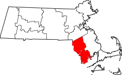 | |
| Towns | ||
| CDPs | ||
| Other villages | ||
| Ghost town | ||
Boston (capital) | |
| Topics | |
| Society | |
| Regions | |
| Counties | |
| Cities |
|
| Topics | |||||||
|---|---|---|---|---|---|---|---|
| States | |||||||
| Major cities | |||||||
| State capitals | |||||||
| Transportation |
| ||||||
| International | |
|---|---|
| National | |
| Geographic | |
| Other | |
Fall River, Massachusetts
View on GrokipediaFall River is a city in Bristol County, southeastern Massachusetts, United States, located on the Taunton River estuary approximately 10 miles (16 km) from the Rhode Island border. As of the 2020 United States Census, its population was 94,000, reflecting a decline from a peak of 120,485 in 1920 amid the collapse of its dominant textile industry.[1] Once a preeminent hub of cotton textile manufacturing in the 19th and early 20th centuries, powered by the waterfalls of the Quequechan River, Fall River attracted waves of immigrant labor, particularly from Portugal, contributing to its cultural fabric and rapid urbanization.[2] The sector's downturn after World War II, driven by southern competition and technological shifts, precipitated economic stagnation, high poverty rates around 21%, and a pivot toward health care, retail trade, and residual manufacturing as primary employers.[3] Today, the city draws tourism from preserved industrial relics, Battleship Cove—the world's largest collection of preserved World War II naval vessels including the USS Massachusetts—and the Lizzie Borden House, scene of the 1892 double axe murders of Andrew and Abby Borden, for which their daughter Lizzie was tried and acquitted amid enduring public fascination and unresolved questions of culpability.[4][5][6]
History
Early settlement and colonial era
The territory now known as Fall River was inhabited prior to European contact by the Pocasset band of the Wampanoag tribe, who utilized the region's rivers and coastal resources for subsistence.[7] Plymouth Colony authorities initiated land acquisitions in the mid-17th century through negotiated purchases from native sachems, including a 1659 transaction by Wamsutta (son of Massasoit) as part of the broader Freeman's Purchase encompassing northern areas later divided into townships.[8] Additional tracts were secured by the colony between 1679 and 1680, formalizing English claims amid tensions over expanding colonial boundaries.[8] King Philip's War (1675–1676), led by Wampanoag sachem Metacom from his base near Mount Hope, erupted in adjacent Swansea on June 20, 1675, following disputes over native sovereignty and colonial encroachments; the conflict devastated local Wampanoag populations, with estimates of 40–50% tribal mortality from combat, disease, and displacement.[9] Raids and skirmishes halted nascent English homesteading in the Fall River vicinity, as Plymouth forces prioritized defense, destroying native villages and infrastructure along the Taunton River watershed.[10] The war's resolution in August 1676, with Metacom's death, eliminated organized native resistance in the region, enabling Plymouth to redistribute confiscated lands to colonial militiamen.[9] Postwar resettlement proceeded cautiously under Plymouth Colony governance, with English families establishing farms on cleared native lands by the late 1670s.[10] In 1683, portions of the territory were organized into the new town of Freetown, reflecting Plymouth's administrative consolidation of frontier areas for agricultural use.[11] Captain Benjamin Church, a key Plymouth ranger during the war, acquired significant holdings and constructed a sawmill, gristmill, and fulling mill along the Quequechan River circa 1690, harnessing its falls for early proto-industrial activity amid predominantly subsistence farming.[2] Population remained sparse through the 18th century, with Freetown's residents—numbering around 500 by 1765—focused on livestock, timber, and coastal trade, while the Fall River precinct endured as a peripheral, flood-prone hamlet until separation in 1803.[2] Colonial records indicate minimal infrastructure, with governance centered on militia musters and town meetings enforcing Puritan norms amid ongoing native land disputes resolved via provincial courts.[11]Textile industry rise and 19th-century boom
The textile industry in Fall River originated with the construction of the first cotton mill in 1811 by Colonel Joseph Durfee at the northeast corner of South Main and Globe Streets in what was then Globe Village.[12] Powered by water from a small adjacent pond, the mill initially featured fewer than 1,000 spindles and basic equipment like Arkwright spinning frames, operating as a stock company with 100 shares but achieving limited commercial success before transitioning to print works by 1829.[12] This modest beginning laid the foundation for industrial development, drawing on influences from nearby Rhode Island textile ventures and leveraging the Quequechan River's water resources.[13] Subsequent establishments accelerated growth, including the Troy Cotton and Woolen Manufactory and Fall River Manufactory in 1813, each equipped with approximately 1,500 to 2,000 spindles and also reliant on river water power.[12] By the 1820s and 1830s, additional firms like the Pocasset Manufacturing Company (organized 1822, Bridge Mill built 1827 with 1,000 spindles) emerged, supported by local iron works established in 1821 for machinery production.[13] The introduction of power looms by 1817 in the Fall River Manufactory marked early mechanization, while population rose from 1,594 in 1820 to 6,738 by 1840, reflecting initial economic pull from milling.[12] The mid-19th-century boom transformed Fall River into a textile powerhouse, driven by post-Civil War expansion and innovations in scale. Between 1845 and 1875, the number of cotton mills reached 42, operating 1,268,000 spindles—double those in rival Lowell—and spindles quadrupled from 1855 levels.[13] Limited water power prompted a shift to steam, which by 1870 accounted for 25% of horsepower (26,763 HP), enabling larger facilities like the Pocasset's expansive 1847 mill (219 by 75 feet, five stories).[13] In 1865, 15 mills employed 2,654 workers (15% of population); by 1875, 38 mills had 11,514 operatives (over 25% of 45,340 residents) and 1,269,048 spindles, with output valued at $20,228,000 from $20,484,000 capital.[14] This surge positioned Fall River as the United States' premier cotton textile producer by the late 19th century, with spindles exceeding 2 million by 1889 and population climbing to 104,863 by 1900, fueled by immigrant labor and rail/steamboat infrastructure linking to markets.[12] The concentration on print cloth specialization and efficient large-scale operations, rather than diversified products, capitalized on cotton's availability and mechanized efficiency, though vulnerability to market fluctuations loomed.[13]Peak expansion and social changes (late 19th to early 20th century)
Fall River's textile industry reached its apex between 1890 and 1920, with the number of operating cotton mills surpassing 100 by 1910, making the city the preeminent center for print cloth production in the United States.[15] These mills, powered increasingly by steam engines after the mid-19th century, spun vast quantities of cotton yarn and wove fabrics, with total spindle capacity exceeding several million by the early 1900s.[13] Employment in the sector peaked at around 30,000 workers in 1910, comprising a significant portion of the local economy and driving infrastructure expansions such as new mill complexes and rail connections.[15] Population surged accordingly, from 48,961 in 1880 to 104,863 in 1900 and 119,295 in 1910, per U.S. Census figures, as the city annexed adjacent areas and developed densely packed tenement housing to accommodate the workforce.[16] This growth relied heavily on immigrant labor, with waves of French Canadians arriving in the 1880s and 1890s to operate looms and spindles, followed by large numbers of Portuguese migrants from the Azores and mainland Portugal starting in the late 19th century.[17] [18] By 1900, immigrants and their children dominated the mill labor force, altering the city's ethnic composition from predominantly Yankee Protestant to overwhelmingly Catholic and foreign-born, with Portuguese becoming the largest group by the 1910s.[18] These newcomers established cultural institutions, including Portuguese-language newspapers and parishes like St. Anne's Church, reflecting community cohesion amid rapid urbanization that strained housing and sanitation.[18] Social transformations included widespread child labor and grueling work environments, where 23 percent of children aged 10 to 15 held mill jobs in 1900, often in humid, dust-filled rooms with long hours and minimal safety measures.[19] Labor tensions escalated due to stagnant wages and mechanization pressures, sparking frequent strikes; for instance, intense agitation in the 1910s and the 1922 walkout involved tens of thousands demanding better pay and conditions, though southern competition began eroding northern advantages.[20] [21] These events underscored the causal link between low-cost immigrant labor and industrial output, but also highlighted exploitative practices that fueled union organizing and eventual regulatory reforms.[20]Industrial decline and economic challenges (1920s–1970s)
The textile industry in Fall River faced initial post-World War I profitability in the early 1920s, but decline accelerated due to overproduction, obsolete machinery, and intensifying competition from southern mills with lower labor costs, newer facilities, and non-union workforces.[13][22] By the mid-1920s, New England cotton textile operations, including those in Fall River, began downsizing as capital migrated southward to exploit cheaper wages—often half those in the North—and reduced energy expenses.[23] High humidity requirements for cotton processing, combined with aging infrastructure ill-suited for modernization, compounded operational inefficiencies in the region's mills.[22] Catastrophic events exacerbated vulnerabilities: the Great Fire of February 2–3, 1928, razed 36 downtown buildings, inflicting approximately $10 million in damages (equivalent to over $170 million in 2023 dollars) and disrupting supply chains tied to the textile sector.[24] Labor unrest peaked with the 1934 national textile strike, where Fall River workers joined over 400,000 nationwide in demanding wage increases, shorter hours, and an end to production speedups; local actions included 10,000 strikers confining 300 strikebreakers in a mill, leading to prolonged shutdowns and weakened employer finances.[25] The Great Depression triggered a collapse in print cloth prices, initiating a 15-year downturn that shuttered 73 mills and eliminated three-quarters of the city's industrial jobs by the late 1930s.[26] By 1940, only 17 textile firms operated in Fall River, down from over 100 at the 1920 peak, as employment in the sector contracted by about 70 percent during the Depression era.[26] World War II spurred a brief resurgence through government contracts, temporarily stabilizing output, but postwar imports and sustained southern advantages resumed erosion.[13] Manufacturing employment plummeted 55 percent citywide between 1948 and 1960, with further mill closures like Narragansett Mills in 1955 symbolizing irreversible contraction; by the 1960s, many facilities stood abandoned or repurposed amid rising imports and outsourcing pressures.[27][15] Economic challenges manifested in demographic shifts and hardship: population fell from 120,485 in 1920 to 99,478 in 1960 and 96,898 in 1970, driven by job losses that fueled out-migration and entrenched poverty.[1] Union insistence on wage parity, while protecting northern workers short-term, accelerated capital flight to low-wage southern states, where non-union environments and state incentives lured relocations without equivalent labor costs.[27] A partial pivot to garment and needle trades absorbed some displaced workers by the 1940s, employing thousands in lower-skill sewing operations, but this could not offset the scale of textile losses or restore pre-1920s prosperity.[26] Persistent high unemployment and urban decay underscored the causal role of uncompetitive labor markets and failure to diversify beyond mills.[28]Post-industrial stagnation and recent revitalization attempts
Following the sharp industrial contraction of the 1920s through 1970s, Fall River entered a phase of entrenched economic stagnation marked by persistent high unemployment, population outmigration, and underutilized infrastructure. The city's unemployment rate, averaging 9.37% over the long term, spiked to 18.7% in January 1991 amid the early 1990s recession, reflecting limited diversification beyond legacy manufacturing and vulnerability to broader economic downturns.[29][30] This period saw sluggish income growth compared to peer older industrial cities, with local wages lagging as the regional economy shifted toward knowledge-based sectors that Fall River struggled to capture.[31] Vacant mills and brownfield sites symbolized the decay, contributing to elevated poverty rates and neighborhood disinvestment, as the loss of textile jobs—once employing tens of thousands—left a causal void in employment without commensurate replacement industries.[32] Revitalization efforts intensified in the 2010s and 2020s, emphasizing infrastructure reconfiguration, housing incentives, and targeted district development to leverage waterfront assets and proximity to Boston. The Transformative Development Initiative (TDI), launched in 2019 by MassDevelopment, designated Fall River's central business district as a growth hub, providing financing and technical support to foster advanced manufacturing, healthcare, and tourism sectors.[33][34] Key infrastructure projects included the Route 79-Davol Street corridor redesign, converting a highway into an urban boulevard to yield 19 acres of developable land and 9 acres of open space, aimed at spurring mixed-use development.[35] State-funded housing initiatives, such as $15 million in grants for a 52-unit mixed-use building in 2025 and $2.5 million in tax credits for downtown market-rate apartments, sought to address housing shortages and attract residents, though critics argue for balancing market-rate and affordable units to avoid exacerbating socioeconomic divides.[36][37] Waterfront and neighborhood programs further supported renewal, with projects like the Northfield Point redevelopment and City Pier brownfield remediation—awarded Environmental Business Council honors in 2025 for environmental cleanup—aiming to create jobs and recreational space.[38] Community-driven efforts, including the Flint Neighborhood Revitalization and Love Your Block grants, empowered local groups to tackle blight through gardens, art installations, and alley activations.[39][40] American Rescue Plan Act allocations since 2021 bolstered economic development, funding infrastructure to stimulate tourism and job creation.[41] These initiatives correlated with unemployment falling to 4.9% in September 2024, signaling modest recovery, though structural challenges like low median household income around $52,700 persist.[42][3]Geography
Physical features and layout
Fall River lies along the northeastern shore of Mount Hope Bay in southeastern Massachusetts, where the Taunton River empties into the bay.[43] The city spans a total area of 40.2 square miles, comprising 33.1 square miles of land and 7.1 square miles of water, which accounts for 17.7% of the total area per U.S. Census Bureau measurements. Its terrain rises steeply from the coastal waterfront to hilly uplands, with the city often referred to as the "City of Hills" due to elevations reaching up to 354 feet above sea level.[44] The Quequechan River, an Algonquian term meaning "falling water," originates from South Watuppa Pond and traverses the city center before joining the Taunton River, dropping approximately 130 feet over its final half-mile course through a series of eight falls.[45][46] These falls, harnessed historically for water power, define much of the downtown topography. South Watuppa Pond, the third-largest natural body of water in Massachusetts, occupies the northwestern portion of the city and serves as a key reservoir.[47] The urban layout aligns with the natural contours of the Quequechan River valley and adjacent hills, featuring compact waterfront districts with industrial remnants along the riverbanks and residential areas extending up steep slopes, which influence transportation and development patterns. This topography contributes to a varied street grid, with many roads winding or ascending sharply to accommodate the elevation changes.[48]Neighborhoods and urban development
Fall River's neighborhoods reflect its industrial past and ethnic diversity, with distinct areas formed around mills, immigrant communities, and topography. The Highlands, an elevated district, features Victorian-era homes and is among the city's more affluent residential zones. Corky Row, a historic enclave settled by Portuguese immigrants in the late 19th century, centers around tight-knit streets near downtown and maintains cultural ties through events and architecture. Flint Village, east of downtown, developed as worker housing for nearby mills, characterized by dense triple-decker buildings and ongoing revitalization efforts. Other recognized areas include Father Kelly, Maplewood, and Sandy Beach, each with neighborhood associations advocating for local improvements.[49][50] The city is served by the ZIP codes 02720, 02721, 02722 (a PO Box code), 02723, and 02724.[51] The city's urban development stems from a 19th-century grid layout accommodating textile factories along the Quequechan River, resulting in a compact, hilly form with over 1,000 mill structures, many now vacant or adaptively reused. Post-industrial decline led to blight, prompting urban renewal initiatives; the 2018 Downtown Urban Renewal Plan targets the central business district, emphasizing Main Street as a unified spine for mixed-use development, pedestrian enhancements, and design guidelines to control building aesthetics and public spaces. Complementing this, the Fall River Waterfront Urban Renewal Plan, also from 2018, addresses three industrial waterfront parcels for potential residential, commercial, and tourism projects without specifying immediate builds, guided by the Redevelopment Authority.[52][53][54] The Planning Division within the Department of Engineering & Planning oversees zoning and boards, supporting the 2009-2030 Master Plan's goals for sustainable growth amid challenges like aging infrastructure and economic stagnation. Neighborhoods such as Lower Highlands and Historic Downtown, which peaked in the early 20th century before mid-century decline, now see targeted preservation and infill to leverage historic assets. Since the 1980s, northern suburbs have added modern housing, contrasting central density.[55][56][57]Climate and environmental factors
Fall River lies within a humid continental climate zone (Köppen Dfa/Dfb), moderated by its coastal position on Mount Hope Bay, resulting in milder winters and cooler summers compared to inland areas of Massachusetts. Average annual precipitation totals approximately 48 inches, with rainfall distributed fairly evenly throughout the year, though autumn and spring see higher frequencies of heavy events. Snowfall averages 34 inches annually, primarily from December to March.[58][59] Summer highs in July average 80°F, with lows around 64°F, while winter daily highs from December to February rarely exceed 47°F, and lows often drop to 20°F or below during cold snaps influenced by nor'easter storms. The growing season spans about 180–200 days, supporting agriculture in surrounding areas but limited by occasional frost pockets in the city's hilly terrain. Proximity to the Atlantic Ocean reduces temperature extremes, with marine layers contributing to higher humidity levels averaging 70–80% year-round.[59][60] Environmental factors stem largely from the city's 19th-century textile boom, which discharged effluents into the Quequechan River, degrading it into an urban waterway burdened by non-point source pollution from legacy industrial sites and urban runoff. Sediments in local rivers and Mount Hope Bay contain persistent contaminants from historical direct discharges, including heavy metals and organics, though remediation efforts under state oversight have targeted brownfields. Combined sewer overflows remain a challenge, exacerbating water quality issues during storms, as the aging infrastructure—over a century old—mixes sewage with stormwater.[61][62] Bristol County, encompassing Fall River, ranks among the top 10% of U.S. counties for air pollution, linked to industrial legacies and regional transport, with ozone exceedances noted in summer periods as recently as the early 2000s. Flood risk is moderate due to the city's low-lying coastal geography and riverine features; approximately 9% of properties face inundation threats over the next 30 years from riverine flooding, storm surges, and rising sea levels, prompting FEMA-designated zones and local conservation measures under the Massachusetts Wetlands Protection Act.[63][64][65]Demographics
Population growth and trends
Fall River's population expanded dramatically during the 19th century, fueled by immigration and the textile industry's rise, reaching 104,863 by 1900 according to U.S. decennial census figures.[1] This growth continued into the early 20th century, peaking at 120,485 in 1920 amid the height of industrial activity.[1] Thereafter, the city experienced a prolonged decline, with the population falling to 115,274 by 1930 and further to 111,759 in 1950, reflecting the onset of deindustrialization and outmigration.[1][66] The downward trend persisted through the late 20th century, bottoming out at 88,857 in the 2010 census, a decrease of approximately 3.4% from the 91,938 recorded in 2000.[67][68] However, the 2020 census showed a reversal, with the population rising to 94,000, an increase of 5.8% over the decade, indicating stabilization or modest recovery possibly linked to regional economic shifts and housing availability.[67] U.S. Census Bureau estimates place the population at 94,689 as of July 1, 2024, reflecting continued slight growth of about 0.7% since the 2020 base of 93,983.[69]| Decennial Census Year | Population |
|---|---|
| 1900 | 104,863 |
| 1910 | 119,295 |
| 1920 | 120,485 |
| 1930 | 115,274 |
| 1940 | 115,428 |
| 1950 | 111,759 |
| 2000 | 91,938 |
| 2010 | 88,857 |
| 2020 | 94,000 |
Ethnic composition and immigration patterns
Fall River's ethnic composition reflects waves of immigration tied to its textile industry expansion. English-descended settlers dominated early, but Irish immigrants arrived en masse in the 1840s and 1850s, drawn by mill jobs amid Ireland's potato famine. By the 1850s, the labor force included substantial Irish elements alongside English workers. French-Canadians from Quebec formed the next major influx starting in the 1860s, recruited aggressively by mill owners facing labor shortages; this "fever" of migration peaked in the 1870s–1890s, with about 40,000 French descendants in Fall River by 1900.[17] Portuguese immigrants, mainly Azoreans, followed from the late 19th century, initially via New England whaling ports and then directly for textile employment; two primary waves occurred before 1920, with additional surges post-World War II and after the 1957 Capelinhos volcano eruption on Faial island, which displaced thousands and prompted U.S. resettlement aid.[70][71] These groups established distinct neighborhoods, churches, and mutual aid societies, with Portuguese Catholics building prominent institutions like St. Anne's Church. Smaller contingents included Poles, Lithuanians, and Jews in the early 20th century, while Cape Verdeans arrived via maritime trades. The 2020 U.S. Census recorded Fall River's population at 93,864, with non-Hispanic Whites at 69.5%, Hispanics or Latinos (of any race) at 13.2%, non-Hispanic Blacks or African Americans at 5.5%, and multiracial individuals at 7.7%.[3][72] American Community Survey data shows Portuguese ancestry reported by 34.5% of residents, Irish by 14.3%, and French (excluding Basque) by about 8%, though self-reported ancestries often overlap and exceed 100% total due to multiple identifications.[73] Local estimates place Portuguese-claiming residents higher, at around 46%, reflecting cultural persistence.[74] Foreign-born residents comprise approximately 20% of the population, with 51% from Europe (largely Portugal), 32% from Latin America (including Brazil, where Portuguese is spoken), and smaller shares from Africa and Asia per recent ACS estimates.[75][76] Recent immigration has included Brazilians and other Portuguese-speakers, sustaining ethnic enclaves amid broader assimilation of earlier groups like French-Canadians, many of whom intermarried and shifted to English-dominant identities. Cape Verdean communities, though under 1% by ancestry, maintain visibility through historical nautical links and cultural organizations.[73]Income, poverty, and socioeconomic indicators
The median household income in Fall River was $53,933 in 2023 dollars, based on the 2019–2023 American Community Survey (ACS), significantly below the Massachusetts state median of approximately $96,505 and the national median of $75,149. Per capita income stood at $31,047 over the same period, reflecting limited earning potential amid a labor market dominated by lower-wage service and manufacturing roles. These figures indicate a household income distribution skewed toward the lower end, with only about 17.7% of adults aged 25 and older holding a bachelor's degree or higher in recent ACS data, compared to 45.3% statewide.[77] Poverty affects roughly 20.9% of Fall River residents, higher than the state rate of 9.4% and national rate of 11.5%, with elevated rates among families and children contributing to intergenerational economic strain.[78] Unemployment averaged around 6.1% in late 2024, exceeding the national figure of 4.1% and reflecting structural mismatches in a post-industrial economy with fewer high-skill opportunities.[29]| Indicator | Fall River | Massachusetts | United States |
|---|---|---|---|
| Median Household Income (2023 dollars) | $53,933 | $96,505 | $75,149 |
| Per Capita Income (2023 dollars) | $31,047 | $49,475 | $41,261 |
| Poverty Rate (%) | 20.9 | 9.4 | 11.5 |
| Unemployment Rate (late 2024, %) | 6.1 | 3.0 | 4.1 |
| Bachelor's Degree or Higher (age 25+, %) | 17.7 | 45.3 | 34.3 |
| Homeownership Rate (%) | 36.3 | 62.9 | 65.7 |
Economy
Current major sectors and employment
As of 2023, Fall River's workforce comprised approximately 43,000 employed residents, marking a modest 0.651% increase from 42,700 in 2022, amid an overall employment rate of 91.9% for the working-age population.[3][79] The city's unemployment rate was 6.1% in early 2025, elevated relative to the Massachusetts state average of around 3.5-4% during the same period, and above the national average, reflecting persistent structural challenges in transitioning from historical industries.[29][81] Labor force estimates for the city hovered near 41,000-43,000, with median annual earnings of $51,618 for men and $38,004 for women.[3][82] The dominant sector is health care and social assistance, employing 7,842 individuals in 2023, driven by institutions like the Southcoast Health System, which operates major hospitals and clinics serving the region.[3] Retail trade follows with 5,289 workers, supported by distribution centers such as Amazon's fulfillment operations and traditional outlets like Walmart.[3] Construction ranks third at 4,815 employees, fueled by ongoing urban revitalization projects and infrastructure maintenance, though this sector exhibits cyclical volatility tied to local investment.[3] Education, public administration, and limited manufacturing—particularly in food processing (e.g., Blount Fine Foods and Gold Medal Bakery) and medical devices—also contribute, with the latter leveraging proximity to Boston's biotech cluster but employing far fewer than service-oriented fields.[83][84] These sectors underscore a service-heavy economy, with health care providing relative stability amid deindustrialization's legacy, while retail and construction reflect dependence on consumer spending and public funding. Top employers include Southcoast Health, Bristol Community College, and logistics firms, though no comprehensive official list exists; private data aggregators highlight smaller-scale manufacturing firms like Anodyne Medical Services alongside national chains.[83][84] Overall employment growth remains subdued, constrained by skill mismatches and geographic factors limiting commuting to higher-wage areas like Providence or Boston.[3]Historical legacy's ongoing impact
The textile industry's dominance in Fall River, peaking with over 100 mills and tens of thousands of workers by the 1920s, established a manufacturing-centric economy that shaped workforce skills, infrastructure, and urban layout but collapsed due to southern competition offering lower labor and energy costs.[85][23] This decline accelerated post-World War II, with the city losing 55% of manufacturing jobs between 1948 and 1960, leading to unemployment spikes reaching 20% by 1949 and persistent socioeconomic challenges including high poverty and low educational attainment.[27][22] The legacy manifests in abandoned mill complexes, many designated as brownfields contaminated by industrial pollutants, which deter investment and require costly remediation funded partly by state programs to enable redevelopment into housing or commercial uses.[86][87] Such sites, like the former Kerr Mills, symbolize the shift from production hubs to obstacles for economic revitalization, though successful cleanups have supported projects promising billions in broader economic benefits through property value increases and job creation in non-manufacturing sectors.[86] Efforts to leverage historical assets for tourism, including mill tours and related sites, provide modest revenue but fail to offset the wage gap from lost high-employment textile jobs, which once supported multiplier effects generating additional local employment.[88] The entrenched deindustrialization has rooted Fall River among Massachusetts' struggling small cities, with ongoing recovery hindered by a workforce legacy mismatched for modern service and tech economies.[89][90]Challenges including deindustrialization causes
Fall River's economy faced profound challenges from deindustrialization, particularly the collapse of its dominant textile sector, which peaked around 1925 before a swift downturn. The city's over 100 cotton mills, once employing tens of thousands, closed en masse due to structural economic disadvantages. Higher labor costs in unionized New England mills, coupled with outdated machinery and higher energy expenses, made competition untenable against newer southern facilities built after World War I.[13] [23] Southern states attracted textile operations through lower wages—often half those in Massachusetts—non-union environments, right-to-work legislation, and subsidies that reduced operational costs. Overproduction in the 1920s exacerbated the issue, as northern mills liquidated assets rather than modernize amid falling demand and price wars. The 1922 New England textile strike further weakened the industry by disrupting production and highlighting labor-management tensions.[28] [23] The Great Depression accelerated closures, shrinking textile employment by 70% in the 1930s as mills idled amid national economic contraction. Post-World War II, between 1948 and 1960, Fall River lost 55% of its manufacturing base, driven by surging imports from abroad that undercut domestic prices and flooded markets.[26] [27] These factors yielded lasting socioeconomic fallout, including chronic double-digit unemployment, elevated poverty, and low educational attainment that hindered workforce adaptation to service-oriented economies. Deindustrialization fostered an informal economy reliant on unregulated activities like gambling, while infrastructure decay—exemplified by underfunded utilities—compounded fiscal strains from a diminished tax base.[27] [90]Recent developments and policy effects
In recent years, Fall River has benefited from federal American Rescue Plan Act (ARPA) funding totaling $69.6 million, allocated toward economic recovery, infrastructure upgrades, and public health measures, contributing to a reported $20 million city surplus in fiscal year 2025.[91][41] These investments have supported initiatives like business grants and neighborhood revitalization, including the Transformative Development Initiative, which targets economic growth in key districts through state-backed financing.[92][93] Housing development has accelerated, with state tax credits enabling projects such as the Cordeiro Group's $2.5 million award for 52 downtown apartments in 2025, amid broader efforts to address scarcity.[94] Median single-family home prices doubled from $228,000 in 2016 to $450,000 by June 2025, reflecting demand pressures but also straining affordability for local working-class residents, as market-rate incentives have outpaced affordable unit mandates.[95][96] City council resolutions in 2025 pushed for developer requirements to include affordable units in new builds, though implementation remains debated.[97] National policies have introduced headwinds; proposed tariffs have pressured local manufacturers, with representatives noting risks to supply chains, though firms like Merrow Manufacturing reported growth in apparel production as of October 2025.[98] Restrictive immigration measures have disrupted labor in manufacturing and hospitality sectors, reducing workforce availability despite overall population stability around 93,700 in 2023.[99] Local strategies, including $50,000 grants for South Main Street business activation in June 2025 and emphasis on advanced manufacturing, healthcare, and tourism, aim to counter deindustrialization legacies, bolstered by South Coast Rail's completion enhancing waterfront redevelopment.[100][34][101] Median household income rose modestly to approximately $55,000 by 2023, signaling incremental recovery but persistent socioeconomic challenges.[3]Government and Politics
Municipal structure and administration
Fall River employs a mayor-council form of government, as established by its city charter adopted on November 7, 2017.[102] The executive branch is led by a mayor elected at-large by city voters to a two-year term, with elections held in odd-numbered years.[103] The mayor serves as the chief executive officer, responsible for enforcing the city charter, ordinances, and official acts; appointing and removing department heads subject to council confirmation where required; preparing the annual budget; and overseeing the administration of city services.[103] [104] A city administrator, appointed by the mayor, manages the day-to-day operations of city departments and the Government Center, directing initiatives, policies, and administrative functions to support the mayor's directives.[105] Key departments under executive oversight include finance, law, public works, and community development, coordinated through the mayor's office to handle municipal affairs such as fiscal management, legal compliance, and service delivery.[106] The legislative branch consists of a city council comprising nine members elected at-large to staggered two-year terms, also in odd-numbered years, exercising powers over ordinances, taxation, borrowing, and appropriations.[107] The council approves the mayor's budget and appointments in certain cases but lacks direct control over administrative operations.[108] A separate elected school committee governs the public school system, operating independently from the mayor and council on educational policy and budgeting.[109] Municipal elections occur annually in November of odd years, with non-partisan races determined by plurality vote.[110] The structure emphasizes separation of powers, with the mayor holding veto authority over council ordinances, subject to override by a two-thirds vote.[103] This framework aligns with Massachusetts' prevailing model for cities, promoting accountability through direct election of both executive and legislative officials.[110]State and federal representation
Fall River is represented in the United States Congress by the state's two senators, Elizabeth Warren (Democrat, serving since 2013) and Edward J. Markey (Democrat, serving since 2013), both elected statewide.[111][112] In the House of Representatives, the city lies entirely within Massachusetts's 9th congressional district, represented by William R. Keating (Democrat), who has held the seat since 2013 and was reelected in November 2024.[113][114] At the state level, Fall River falls within the Massachusetts Senate's 1st Bristol and Plymouth district, represented by Michael J. Rodrigues (Democrat), who has served since 2011 and was reelected in 2024 with 97.6% of the vote in an uncontested race.[115][116] The city's wards are covered by multiple districts in the Massachusetts House of Representatives, primarily the 6th Bristol district (represented by Carole A. Fiola, Democrat, since 2013) and the 7th Bristol district (represented by Alan Silvia, Democrat, since 2023).[117][118] These districts encompass various precincts across Fall River's wards, with Fiola's district including parts of Wards 1–4 and Freetown, while Silvia's covers portions of Wards 5–9.[119]Fiscal policies, corruption, and governance controversies
Fall River has faced notable governance controversies, most prominently involving former Mayor Jasiel F. Correia II, who served from 2015 to 2019 and was convicted in May 2021 on 21 federal counts including nine of wire fraud, four of filing false tax returns, four of extortion conspiracy, and related offenses.[120][121] Correia defrauded investors of over $500,000 through misrepresentations about his mobile app, SnoOwl, and orchestrated a pay-to-play scheme extorting at least $75,000 from marijuana vendors seeking city business licenses.[122] He was sentenced in September 2021 to six years in federal prison, ordered to pay $878,000 in restitution, and began serving time in April 2022 after his appeal was denied in November 2022; as of August 2025, he was transferred to a halfway house with less than a year remaining.[123][124] His former chief of staff was also sentenced in March 2022 for making false statements to federal investigators in the case.[125] These events highlighted vulnerabilities in municipal oversight, with observers noting a local tolerance for political misconduct amid the city's economic struggles.[126] Fiscal policies in Fall River follow Massachusetts municipal standards, with the mayor submitting an annual operating budget to the city council for approval, emphasizing balanced operations, reserve maintenance, and debt management as outlined in city financial procedures.[127] The FY2026 proposed municipal budget totaled $516,896,586, reflecting ongoing efforts to address infrastructure and services post-deindustrialization.[128] However, controversies have arisen over budget execution, including a 2021 potential shortfall tied to miscalculations of pandemic-related lost revenue and ARPA fund allocations, where state school aid was omitted from projections.[129] In June 2025, the city council rejected the FY2026 $500 million spending plan—7% higher than FY2025—citing inadequate financial management and transparency concerns, sending it back to Mayor Paul Coogan for revisions.[130][131] Additional fiscal strains include debates over a reported $20 million surplus in early 2025, interpreted by critics as evidence of over-taxation rather than prudent management, alongside persistent challenges in funding repairs for aging fire stations and school staffing amid budget constraints.[132][133][134] These issues underscore tensions between spending priorities and fiscal sustainability in a city with historical underinvestment in reserves and infrastructure.Public Safety and Crime
Crime statistics and trends
In 2024, Fall River recorded 2,082 Part A crimes, a 0.86% decrease from 2,100 in 2023.[135] Violent crimes totaled 598, reflecting a 24.4% decline from 791 in 2023, with aggravated assaults dropping sharply to 447 from 660.[135] Murders numbered 3, down from 4, while rapes rose to 57 from 46 and robberies increased to 91 from 81.[135] Property crimes reached 1,484, up 13.37% from 1,309 in 2023, driven by higher larceny (1,072 vs. 918) and burglary (230 vs. 203), though motor vehicle thefts edged down to 167 from 173.[135] The prior year saw broader reductions: total Part A crimes fell 23.13% from 2,732 in 2022, violent crimes decreased 11.12% to 791, and property crimes dropped 28.94% to 1,309, including a 65.12% plunge in burglaries from 582.[136] These figures align with Massachusetts statewide trends, where Part One crimes declined 4.4% in 2024 compared to 2023.[137]| Year | Total Part A Crimes | Violent Crimes | Property Crimes |
|---|---|---|---|
| 2022 | 2,732 | 890 | 1,842 |
| 2023 | 2,100 | 791 | 1,309 |
| 2024 | 2,082 | 598 | 1,484 |
Law enforcement and policing strategies
The Fall River Police Department (FRPD) operates as a nationally accredited agency, holding certifications from both the Commission on Accreditation for Law Enforcement Agencies (CALEA) and the Massachusetts Police Accreditation Commission (MPAC), with its sixth successful re-accreditation achieved on June 18, 2025.[140][141] Its core mission emphasizes crime reduction and quality-of-life enhancement through citizen partnerships, guiding strategies that blend proactive enforcement with community engagement.[142] Under Chief Kelly Furtado, appointed in recent years, FRPD has prioritized community policing to foster trust beyond crisis responses, addressing quality-of-life issues such as neighborhood nuisances and non-emergency complaints to prevent escalation into serious crime.[143] This approach includes officer-led interventions in persistent problems, like resolving disruptive "party houses," and participation in positive events such as community Halloween gatherings attended by over 2,000 residents to bolster morale and mental health amid operational stresses.[143] To combat understaffing—operating at 152 officers against a target of 183 as of mid-2025, with 16 patrol vacancies—FRPD has secured federal COPS hiring grants totaling $2.375 million in 2023 and $1.6 million in state Municipal Public Safety Staffing Program funds expedited in August 2025, enabling recruitment of 40 new officers by January 2026 through lateral transfers and academy classes.[144][143] Flexible "plug and play" personnel shifts across units mitigate burnout, while rigorous vetting ensures high-caliber hires.[143] The Special Operations Division deploys six specialized units—Street Crimes, Housing, School Resource Officers, Environmental Police, Motor Vehicle, and Harbor Patrol—for targeted enforcement, including aggressive foot patrols, intelligence gathering, and gang violence prevention in high-risk areas.[145] These units recover firearms, conduct saturation patrols, and integrate with federal programs like Shannon Community Safety Initiative grants for gang prevention, alongside state efforts such as the Commonwealth Project Safe Neighborhoods for narcotics and illegal gun reductions.[145][146][147] Youth-focused strategies include the Teen Police Academy, a free two-week summer program for high school students offering modified training, fitness, and career insights to build police-youth relationships and deter delinquency through education and mentorship.[148] Complementing this, the Street Smart Youth Initiative emphasizes intervention over suppression for violence prevention, supporting a continuum of services without reliance on arrests or patrols alone.[149] Additional capabilities encompass a Gang Task Force, K-9 unit, bike patrols, and crisis negotiations to address diverse threats.[150] Overall, these measures aim to reduce crime fear via visible presence, education, and collaborative enforcement.[145]Factors influencing safety and community impacts
Fall River's elevated crime rates are significantly influenced by persistent economic challenges, including high poverty levels stemming from deindustrialization, which have fostered unemployment and underemployment rates exceeding state averages, correlating with increased property and violent offenses.[151] Neighborhood conditions, such as deteriorating housing stock and visible disorder, further exacerbate vulnerability to burglary and vandalism, as poorly maintained areas signal low guardianship and attract opportunistic crime.[152] Substance abuse, particularly opioids and related narcotics, drives a substantial portion of criminal activity, with drug-related incidents intertwined with theft, assaults, and overdoses that strain emergency services and perpetuate cycles of addiction-fueled desperation.[153] Gang presence amplifies these issues, as organized groups engage in retaliatory violence, firearms trafficking, and distribution networks, with approximately 19% of identified members under age 25 contributing to youth recruitment and intergenerational transmission of criminal behavior.[154][155] These factors yield profound community repercussions, including an estimated $17 million annual cost from violent crime alone in 2025, equating to roughly $169 per resident in tangible losses from victimization, policing, and judicial processes.[156] Perceptions of insecurity deter investment and tourism, eroding social cohesion and prompting resident exodus to lower-crime areas, while youth exposure to gang dynamics hinders educational attainment and long-term economic mobility.[157] Despite recent declines in overall crime—such as a 60% drop in total incidents over 17 years through targeted interventions like gang task forces—these underlying drivers sustain a violent crime rate twice the national average, underscoring the need for addressing root socioeconomic and familial disruptions over symptomatic policing alone.[158][159][160]Education
Public school system performance
The Fall River Public Schools district, serving over 8,700 students across 18 schools, exhibits proficiency rates on the Massachusetts Comprehensive Assessment System (MCAS) that lag significantly behind state averages. In 2025, 19% of students in grades 3-8 met or exceeded expectations in English language arts (ELA), compared to 42% statewide, while mathematics proficiency was 18% against 41% for the state.[161] Science proficiency for grades 5-8 was also 18%, versus 42% statewide.[161] At the high school level, grade 10 results showed 32% proficient in ELA (state: 51%), 17% in mathematics (45%), and 18% in science (46%).[161] These figures represent minimal change from 2024, with ELA in grades 3-8 holding steady at around 20%, mathematics dipping slightly from 19%, and science unchanged at 18%; grade 10 ELA saw a marginal 1 percentage point increase.[161] The district's accountability progress toward state targets was rated moderate at 40% in 2025, down from 45% the prior year.[162] Graduation rates further underscore underperformance, averaging 75% for the four-year cohort district-wide, below the state average of approximately 89%.[163] At B.M.C. Durfee High School, the district's largest, the rate was 66.4% for the 2023-2024 cohort.[164] Low graduation rates contributed to the Massachusetts Department of Elementary and Secondary Education classifying the district as requiring assistance or intervention in 2025.[162]| Subject | Grades 3-8/5-8 Proficiency (Fall River 2025) | State Average | Grade 10 Proficiency (Fall River 2025) | State Average |
|---|---|---|---|---|
| ELA | 19% | 42% | 32% | 51% |
| Math | 18% | 41% | 17% | 45% |
| Science | 18% | 42% | 18% | 46% |
Private and parochial schools
Fall River's private and parochial schools are predominantly Catholic institutions under the Roman Catholic Diocese of Fall River, serving elementary and middle grades amid a decline in enrollment and operations at higher levels.[165] These schools emphasize faith-based education integrated with academic curricula, often drawing from the city's longstanding Portuguese-American Catholic community.[166] The closure of Bishop Connolly High School, the primary Catholic secondary option, at the end of the 2022-2023 academic year due to financial shortfalls marked a significant reduction in private high school availability, leaving students to seek options in neighboring communities or public systems.[167] [168] Espirito Santo Parochial School, established over a century ago to educate Portuguese immigrant children, operates from pre-kindergarten through eighth grade, focusing on Catholic values alongside core academics in a nurturing environment.[169] St. Michael's School provides Catholic instruction from age 3 pre-school through eighth grade, prioritizing spiritual formation and academic readiness with programs tailored to early childhood development.[170] Holy Name School serves pre-kindergarten through eighth grade students, with an enrollment of 177 as of the 2025-2026 school year and annual tuition around $3,825, emphasizing preparation for high school transition.[171] [172] Holy Trinity School delivers a Christ-centered curriculum for elementary and middle grades in a safe setting, aligning education with diocesan standards for moral and intellectual growth.[173] Smaller or specialized private options include the Fall River Deaconess Home School, a limited-enrollment program with approximately 27 students serving older grades in a home-based or alternative format.[174] The Antioch School operates as a private alternative, though detailed enrollment and programmatic data remain sparse in public records.[175] Overall, these institutions represent a modest private sector, with total private school enrollment in Fall River standing at around 1,346 students across multiple schools as of recent pre-closure assessments, amid broader trends of consolidation in diocesan education.[176]Higher education institutions
Bristol Community College, a public community college chartered in 1965, maintains its flagship campus in Fall River at 777 Elsbree Street, spanning 105 acres with 11 buildings, including a 700-seat theater and an on-site pond.[177][178] The institution serves as the primary provider of higher education in the city, offering over 119 associate degrees, certificates, and workforce training programs in fields such as nursing, business, STEM, and offshore wind technology.[179] Enrollment across the multi-campus system reached approximately 6,256 students as of recent data, with a student-faculty ratio of 18:1 and open enrollment policies aligned with Massachusetts' access-focused higher education framework.[180][181] The Fall River campus, which originated as the college's initial location in a shared space before expanding, supports both credit-bearing academic pathways and non-credit professional development courses tailored to local industries like manufacturing and healthcare.[177] Recent initiatives, including tuition-free attendance for eligible Massachusetts residents regardless of age or income, have driven enrollment growth, with a reported 19% increase attributed to expanded accessibility.[182][183] Transfer agreements with nearby four-year institutions, such as the University of Massachusetts Dartmouth, facilitate pathways to bachelor's degrees for graduates.[181] Vocational post-secondary options in Fall River include Rob Roy Academy, a for-profit institution at 260 South Main Street specializing in cosmetology, barbering, esthetics, and manicuring, with an enrollment of about 98 students focused on trade certifications.[184] No four-year universities are physically located within city limits, though proximity to regional state universities supports commuter access.[185]Culture and Society
Ethnic heritage and community influences
Fall River's ethnic composition reflects waves of immigration tied to its 19th-century textile boom, which drew laborers from Ireland during the Great Famine and French-Canadians from Quebec for mill employment. By 1900, French-Canadians formed about 40% of the population, totaling roughly 40,000 individuals in a city of approximately 100,000. [17] Irish arrivals established early Catholic parishes, influencing neighborhood development and labor organizing. [186] Portuguese immigration, mainly from the Azores, accelerated post-World War II and peaked in the late 1960s and 1970s, differing from prior groups by sustaining high retention rates in the city due to chain migration and economic niches in fishing and textiles. [18] As of recent census-derived data, Portuguese ancestry predominates, claimed by 36% of residents, followed by French at 12.4%. [73] This heritage manifests in dense Azorean-descended enclaves, with 46% of the population reporting Portuguese roots per local analyses. [74] Community influences are evident in religious and cultural institutions, particularly Portuguese-led Holy Ghost festivals honoring Queen Saint Isabel's devotion through communal soups, parades, and auctions. The annual Great Feast of the Holy Ghost at Kennedy Park, ongoing for over 40 years, reinforces social bonds and Azorean identity via music, traditional foods like mala de carne, and crown bestowal rituals. [187] [188] Churches such as Espirito Santo anchor these traditions, hosting feasts that blend faith with ethnic solidarity. [189] French-Canadian legacies persist in institutions like St. Anne's Shrine, a pilgrimage site tied to early 20th-century mill worker piety. [17] These elements foster resilient subcultures amid economic shifts, though out-migration of earlier cohorts diluted Irish and French-Canadian prominence relative to Portuguese continuity. [190]Arts, performing, and visual culture
The Narrows Center for the Arts, founded in 1995 and located on the Fall River waterfront adjacent to Battleship Cove, functions as a nonprofit venue dedicated to live music performances, visual art exhibitions, and community events, hosting genres from rock and folk to classical concerts in a converted 19th-century textile mill.[191] Its gallery space features rotating exhibits of local and regional contemporary works, emphasizing industrial heritage influences in visual media.[192] The Fall River Symphony Orchestra, a community ensemble active since the early 20th century with its 100th season commencing in November 2024, comprises musicians aged 15 to 85, including professionals, educators, and amateurs, and performs classical repertoire alongside popular arrangements at venues such as local churches and theaters.[193] Concerts, including holiday programs and seasonal events like Sunset Sounds in June 2025, aim to foster local musical participation and accessibility.[194] Visual arts in Fall River center on public murals and contemporary galleries, driven by initiatives like the Fall River Arts & Culture Coalition, which commissions works depicting community themes such as family and industrial history, including a 2024 mural on the Pearl Street parking garage honoring parental roles.[195] The Viva Fall River 2022 project, organized by Beyond Walls, produced multiple large-scale murals in downtown areas through international artist collaborations, revitalizing blank walls with culturally rooted designs.[196] Youth programs, such as the YEAH! Corps, engage local teens aged 14-18 in creating public art, contributing over a dozen murals since 2023 that address neighborhood identity.[197] The Fall River Museum of Contemporary Art (FR MoCA) exhibits experimental installations and sculptures by emerging artists, such as the 2024 "Post Scarcity Sculpture" featuring works by Alex Tum, Karyn Nakamura, Serena Chang, and Hanna Umin, exploring futuristic and material-scarce themes.[198] These efforts reflect Fall River's post-industrial adaptation, where arts leverage mill-era architecture for creative reuse amid economic constraints.[199]Religion and social institutions
Fall River's religious landscape is dominated by Roman Catholicism, reflecting waves of Irish, French-Canadian, and Portuguese immigration during the city's 19th-century industrial boom. The Roman Catholic Diocese of Fall River, established in 1904, encompasses the city and reports a total Catholic population of 251,916 across its jurisdiction as of recent vital statistics.[200] Within Fall River, Portuguese parishes such as Santo Christo, founded in 1892 to serve Portuguese-speaking Catholics, highlight the ethnic dimension of this dominance; it remains the only parish worldwide bearing that name.[201] Other notable Portuguese-influenced churches include Espirito Santo, established in 1904, which hosts annual Holy Ghost feasts—a tradition blending religious observance with community celebration rooted in Portuguese Azorean customs.[189] The diocese originally comprised 44 parishes serving 130,000 Catholics but has since consolidated to 69 parishes amid declining attendance, priest shortages, and demographic shifts, including parish closures in nearby areas as of 2025.[202][203] Non-Catholic denominations, including Baptist, Episcopal, Lutheran, Methodist, Presbyterian, and historic Primitive Methodist congregations, maintain a presence but constitute a minority.[204] Independent ethnic Catholic churches, such as Polish ones, also emerged to serve specific immigrant groups.[205] Social institutions in Fall River include faith-based and secular organizations addressing community needs. Catholic Charities of the Diocese of Fall River operates food pantries, emergency shelters, immigration assistance, disability services, and mental health support, serving individuals regardless of faith.[206] The Family Service Association, a nonprofit, delivers clinical counseling, elder care, and child services to bolster family stability.[207] Secular entities like United Way of Greater Fall River fundraise and coordinate initiatives for education, health, and financial stability, while Community Connections provides employment training, day supports, and housing for people with disabilities.[208][209] These groups respond to persistent challenges like poverty and housing insecurity in a city with a historically blue-collar population.[210]
Sports and recreational traditions
Fall River's sports traditions are prominently tied to soccer, which took root in the late 19th century amid the city's textile mills and influx of immigrant laborers from soccer-playing regions like Scotland, England, and Portugal. Organized soccer in Massachusetts originated in Fall River, with early clubs forming as early as 1883 in mill villages, predating widespread adoption in larger cities like Boston.[211] The Fall River Rovers achieved early national success, capturing the American Cup in 1888 and 1889, and later the National Challenge Cup in 1917, reflecting the sport's appeal to working-class communities.[212] The Fall River Marksmen, founded in 1922 by purchasing and renaming Fall River United, emerged as one of the most dominant American soccer clubs of the interwar era, securing six American Soccer League championships and the 1924 National Challenge Cup, which positioned them as national champions.[213] Their success stemmed from recruiting skilled immigrant players and leveraging local mill worker support, though the club folded in 1931 amid economic pressures from the Great Depression.[212] An amateur iteration of the Marksmen persists today, marking its centennial in 2022 and maintaining ties to the city's Portuguese heritage through community events and youth programs.[213] Baseball also featured in Fall River's minor league history, with teams like the Fall River Indians competing in the New England League from 1893 to 1910 and briefly from 1946 to 1949 as a Chicago White Sox affiliate.[214] Hall of Fame second baseman Nap Lajoie played for the Indians in 1896, batting .365 and contributing to their first-place finish that season.[214] The franchise struggled post-World War II, posting a 94-loss record in 1946 before disbanding, emblematic of declining minor league viability in smaller industrial cities.[215] Recreational traditions emphasize outdoor pursuits linked to the city's rivers and ponds, including fishing and boating on the Taunton River and South Watuppa Pond, as well as hiking and biking along the Quequechan River Rail Trail, a converted industrial corridor spanning several miles.[216] These activities draw on Fall River's geography, with annual events like community sailing regattas and trail-based fitness programs fostering local engagement, though they lack the organized competitive legacy of soccer and baseball.[216] Youth sports, particularly soccer and baseball through high school and club leagues, continue to channel these historical influences, producing notable local athletes such as those highlighted in regional rankings for achievements in football, basketball, and hockey.[217]Infrastructure and Transportation
Road and highway networks
Fall River's road network centers on Interstate 195, a major east-west corridor that passes through the city, facilitating travel between Providence, Rhode Island, and southeastern Massachusetts destinations including New Bedford and Cape Cod. The highway includes multiple interchanges within city limits, such as those connecting to Route 24 to the north and Route 18, a spur providing direct access to downtown areas. Ongoing rehabilitation of the I-195 to Route 18 interchange involves replacing viaducts, piers, and ramps to enhance safety and mobility, with construction addressing structural deficiencies identified in inspections.[218] Massachusetts Route 24, designated as the Fall River Expressway or AMVETS Highway, serves as the primary north-south link, terminating at its junction with I-195 after extending 40.91 miles from the Rhode Island state line to the Boston metropolitan area via connections to Interstate 93. This freeway provides essential connectivity for commuter and freight traffic, with exits in Fall River directing to local arterials like Brayton Avenue (Route 81) and the Charles M. Braga Jr. Memorial Bridge over the Taunton River. Recent traffic counts and project data indicate high volumes, underscoring its role in regional logistics.[219] Route 79 originates in Fall River at I-195, extending northward along the Taunton Riverfront as Davol Street before transitioning to highway form; a $228 million reconstruction project by MassDOT is reconfiguring the corridor by demolishing the former four-lane elevated expressway, which had severed waterfront access since its construction, and rerouting traffic to at-grade boulevards with improved multimodal features. The initiative, aimed at reconnecting neighborhoods to the river and enhancing regional links to I-495 and I-95, advanced ahead of schedule, achieving substantial completion by fall 2025 through phased lane shifts and paving. Local streets, maintained by the city's Department of Public Works, include routine repairs for potholes and reclamation projects on arterials like North Main Street, supporting urban mobility amid industrial heritage constraints.[220][221][222]