
Community hub
Recent from talks
Contribute something
Nothing was collected or created yet.
Epirus
View on Wikipedia
Epirus (/ɪˈpaɪrəs/) is a geographical and historical region in southeastern Europe, now shared between Greece and Albania. Classical Epirus roughly lay between the Pindus Mountains in the east and the Ionian Sea in the west, and between the Acroceraunian Mountains in the north and the Ambracian Gulf in the south.[1] It is currently divided between the region of Epirus in northwestern Greece and the counties of Gjirokastër and Vlorë in southern Albania. The largest city and seat of the Greek administrative region of Epirus is Ioannina.
Key Information

A rugged and mountainous region, in classical antiquity Epirus was the north-west area of ancient Greece.[1] It was inhabited by the Greek tribes of the Chaonians, Molossians, and Thesprotians. It was home to the sanctuary of Dodona, the oldest oracle in ancient Greece, and the second most prestigious after Delphi. Unified into a single state in 370 BC by the Aeacidae dynasty, Epirus achieved fame during the reign of Pyrrhus of Epirus who fought the Roman Republic in a series of campaigns. Epirus subsequently became part of the Roman Republic along with the rest of Greece in 146 BC, which was followed by the Roman Empire and Eastern Roman Empire.
Following the sack of Constantinople by the Fourth Crusade (1204), Epirus became the center of the Despotate of Epirus, one of the successor states to the Byzantine Empire. In the 14th century, Epirus was brought under the rule of the restored Byzantine Empire, before being briefly conquered by the Serbian Empire. The region was then divided amongst a number of despotates and political entities, including the Despotate of Epirus, the Despotate of Arta, the Zenebishi family, and the Republic of Venice, before being conquered by the Ottoman Empire in the 15th century. Epirus became part of the semi-independent Pashalik governed by the Ottoman Albanian ruler Ali Pasha in the early 19th century, but the Sublime Porte re-asserted its control in 1821. Following the Balkan Wars and World War I, southern Epirus became part of Greece, while northern Epirus became part of Albania.
Name and etymology
[edit]
The name Epirus is the Latin name of the region, derived from the Ancient Greek: Ἤπειρος, romanized: Ḗpeiros (Doric Greek: Ἄπειρος, romanized: Ápeiros), meaning "mainland" or terra firma.[2][3] It is thought to come from an Indo-European root *apero- 'coast',[4] and was applied by the Ancient Greeks to the territory opposite Corfu and the Ionian islands.[5][6] The name first appears in the work of Hecataeus of Miletus in the 6th century BC and is one of the few Greek names from the view of an external observer with a maritime-geographical perspective. Although a foreign name, it later came to be adopted by the inhabitants of the area,[7] and it was struck on the coinage of the unified Epirote commonwealth: "ΑΠΕΙΡΩΤΑΝ" (Ancient Greek: Ἀπειρωτᾶν, romanized: Āpeirōtân, Attic Greek: Ἠπειρωτῶν, romanized: Ēpeirōtôn, i.e. "of the Epirotes", see adjacent image).
In the Middle Ages, the term was used by the Despotate of Epirus, one of the Greek successor states of the Byzantine Empire following the dismemberment of the latter in 1204. By the Late Middle Ages, during the period of Humanism and the European Renaissance, the term was used as a synonym for Albania.[8] During the Ottoman period the term was not used. Since the development of the modern Greek nationalism from the early 19th century onwards, the part of Lower Albania – the southern half of Ottoman Albania – that fell within the definition of ancient Epirus, has been called by the newly revived name by Greeks ever since.[9] In Greece the name is used by the administrative region of Epirus. The Albanian name Epiri, which is derived from the ancient name, is used for the ancient region and not for an administrative one. Similarly, the Aromanian name Epiru is derived from the ancient one.
Boundaries and definitions
[edit]
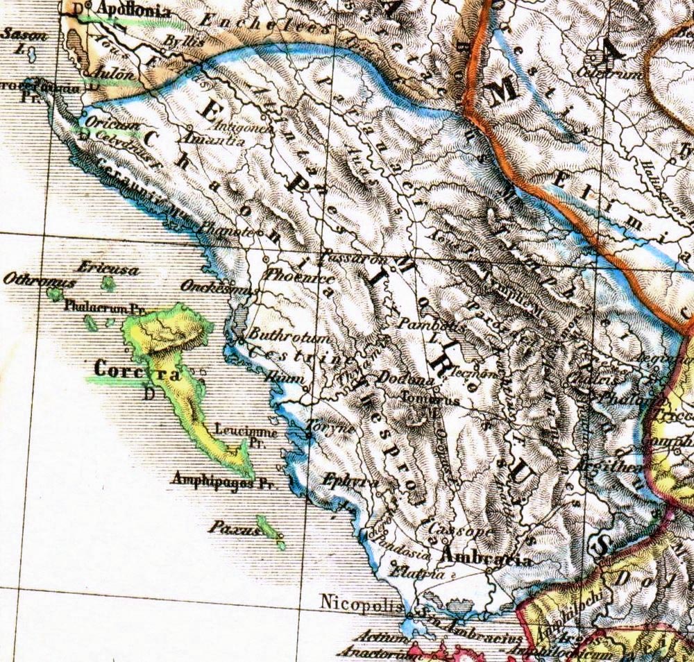
Historically, the geographical area of Epirus proper is defined within the lines drawn from Cape Gjuhëz of the Ceraunian Mountains in the north-west, to Mount Qelqëz in the north-east, to Mount Gavrovo in the south-east, to the mouth of the Ambracian Gulf in the south-west.[10][11] The northern boundary of ancient Epirus is alternatively given as the Vjosa river.[12] Epirus's eastern boundary is defined by the Pindus Mountains, that form the spine of mainland Greece and separate Epirus from Macedonia and Thessaly.[13] To the west, Epirus faces the Ionian Sea. The island of Corfu is situated off the Epirote coast but is not regarded as part of Epirus.
The definition of Epirus has changed over time, such that modern administrative boundaries do not correspond to the boundaries of ancient Epirus. The region of Epirus in Greece only comprises a fraction of classical Epirus and does not include its easternmost portions, which lie in Thessaly. In Albania, where the concept of Epirus is never used in an official context, classical Epirus comprises parts of the counties of Gjirokastër and Vlorë.
History
[edit]Early history
[edit]
In the Neolithic period Epirus was populated by seafarers along the coast and by shepherds and hunters from the southwestern Balkans who brought with them the Greek language. These people buried their leaders in large mounds containing shaft graves. Similar burial chambers were subsequently used by the Mycenaean civilization, suggesting that the founders of Mycenae may have come from Epirus and central Albania. Epirus itself remained culturally backward during this time, but Mycenaean remains have been found at two religious shrines of great antiquity in the region: the Oracle of the Dead on the Acheron River, familiar to the heroes of Homer's Odyssey, and the Oracle of Zeus at Dodona, to whom Achilles prayed in the Iliad.[13]
In the Middle Bronze Age, Epirus was inhabited by the same nomadic Hellenic tribes that went on to settle in the rest of Greece.[14] Aristotle considered the region around Dodona to have been part of Hellas and the region where the Hellenes originated.[15][16]
According to Bulgarian linguist Vladimir I. Georgiev, Epirus was part of the Proto-Greek linguistic area during the Late Neolithic period.[17] By the early 1st millennium BC, all fourteen Epirote tribes including the Chaonians in northwestern Epirus, the Molossians in the centre and the Thesprotians in the south, were speakers of a strong west Greek dialect.[13][1][18]
Epirus in the Classical and Hellenistic periods
[edit]

Geographically on the edge of the Greek world, Epirus remained for the most part outside the limelight of Greek history until relatively late, much like the neighbouring Greek regions of Macedonia, Aetolia, and Acarnania, with which Epirus had political, cultural, linguistic and economic connections.[19] Unlike most other Greeks of this time, who lived in or around city-states, the inhabitants of Epirus lived in small villages and their way of life was foreign to that of the poleis of southern Greece.[13][20] Their region lay on the periphery of the Greek world[13] and was far from peaceful; for many centuries, it remained a frontier area contested with the Illyrian peoples to the north. However, Epirus had a far greater religious significance than might have been expected given its geographical remoteness, due to the presence of the shrine and oracle at Dodona – regarded as second only to the more famous oracle at Delphi.
The Epirotes, speakers of a Northwest Greek dialect, different from the Doric of the Greek colonies on the Ionian islands, and bearers of mostly Greek names, as evidenced by epigraphy, seem to have been regarded with some disdain by some classical writers. The 5th-century BC Athenian historian Thucydides describes them as "barbarians" in his History of the Peloponnesian War,[21] as does Strabo in his Geography,[22] although the latter clearly distinguishes them from the neighboring Illyrians.[23] Other writers, such as Herodotus,[24] Dionysius of Halicarnassus,[25] Pausanias,[26] and Eutropius,[27] describe them as Greeks. Similarly, Epirote tribes/states are included in the Argive and Epidaurian lists of the Greek Thearodokoi (hosts of sacred envoys).[28] Plutarch mentions an interesting element of Epirote folklore regarding Achilles: In his biography of King Pyrrhus, he claims that Achilles "had a divine status in Epirus and in the local dialect he was called Aspetos" (meaning unspeakable, unspeakably great, in Homeric Greek).[29][30]
.jpg)
Beginning in 370 BC, the Molossian Aeacidae dynasty built a centralized state in Epirus and began expanding their power at the expense of rival tribes.[13] The Aeacids allied themselves with the increasingly powerful kingdom of Macedon, in part against the common threat of Illyrian raids,[31] and in 359 BC the Molossian princess Olympias, niece of Arybbas of Epirus, married King Philip II of Macedon.[13] She was to become the mother of Alexander the Great.
On the death of Arybbas, Alexander of Epirus succeeded to the throne and the title King of Epirus in 334 BC. He invaded Italy, but was killed in battle by a Lucanian in the Battle of Pandosia against several Italic tribes 331 BC.[13][32] Aeacides of Epirus, who succeeded Alexander, espoused the cause of Olympias against Cassander, but was dethroned in 313 BC. The struggle between Macedonia and Epirus involved the Illyrian Taulantii, when the Illyrian king Glaukias offered asylum to Aeacides' son, Pyrrhus, after his father was expelled from his kingdom among the Molossians.[33] In 306 BC Glaukias invaded Epirus and established Pyrrhus on the Epirote throne, where he ruled with Illyrian help until he attended the wedding of one of his adoptive brothers (son of Glaukias) in 302 BC. In Pyrrhus' absence Molossians replaced him with Neoptolemus, another member of the Aeacides. Pyrrhus managed to murder Neoptolemus and eventually regained the throne.[34] As king of Epirus, Pyrrhus strengthened his links with the Illyrian tribes by marriage alliances.[33][35] For six years Pyrrhus fought against the Romans and Carthaginians in southern Italy and Sicily. The high cost of his victories against the Romans gave Epirus a new, but brief, importance, as well as a lasting contribution to the Greek language with the concept of a "Pyrrhic victory". Pyrrhus nonetheless brought great prosperity to Epirus, building the great theater of Dodona and a new suburb at Ambracia (now modern Arta), which he made his capital.[13]
The Aeacid dynasty ended in 232 BC, but Epirus remained a substantial power, unified under the auspices of the Epirote League as a federal state with its own parliament, or synedrion.[13] However, it was faced with the growing threat of the expansionist Roman Republic, which fought a series of wars against Macedon. The League steered an uneasy neutral course in the first two Macedonian Wars but split in the Third Macedonian War (171–168 BC), with the Molossians siding with the Macedonians and the Chaonians and Thesprotians siding with Rome.[13] The outcome was disastrous for Epirus; Molossia fell to Rome in 167 BC and 150,000 of its inhabitants were enslaved and deported; the central part of Epirus never regained its former prosperity.[13][36]
Roman and Byzantine rule
[edit]Epirus as a Roman province
[edit]Following his victory over Cleopatra and Mark Antony at Actium, Emperor Augustus commemorated the triumph by founding a Roman colony at Nicopolis ('City of Victory') in 29 BC.[36] The region of Epirus was placed under the senatorial province of Achaea in 27 BC, with the exception of its northernmost part, which remained part of the province of Macedonia.[37] Under Emperor Trajan, sometime between 103 and 114 AD, Epirus became a separate province, under a procurator Augusti. The new province extended from the Gulf of Aulon (Vlorë) and the Acroceraunian Mountains in the north to the lower course of the Acheloos River in the south, and included the northern Ionian Islands of Corfu, Lefkada, Ithaca, Cephallonia, and Zakynthos.[37]
Late Antiquity
[edit]
Sometime during the provincial reorganization by Diocletian (r. 284–305), the western portion of the province of Macedonia along the Adriatic coast was split off into a new province, called "New Epirus" (Latin: Epirus Nova) which roughly corresponded to southern Illyria proper, historically inhabited by Illyrian tribes. Epirus proper thereafter became known as "Old Epirus" (Latin: Epirus Vetus, Ancient Greek: Παλαιὰ Ἤπειρος).[38][39]
The two Epirote provinces became part of the Diocese of Moesia, until it was divided in ca. 369 into the dioceses of Macedonia and Dacia, when they became part of the former.[40] In the 4th century, Epirus was still a stronghold of paganism, and was aided by Emperor Julian (r. 361–363) and his praetorian prefect Claudius Mamertinus through reduction in taxes and the rebuilding of the provincial capital, Nicopolis.[41] According to Jordanes, in 380 the Visigoths raided the area.[41] With the division of the Empire on the death of Theodosius I in 395, Epirus became part of the Eastern Roman or Byzantine Empire.[41] In 395–397, the Visigoths under Alaric plundered Greece. They remained in Epirus for a few years, until 401, and again in 406–407, during Alaric's alliance with the Western Roman generalissimo Stilicho in order to wrest the Eastern Illyricum from the Eastern Empire.[41]

The Synecdemus of Hierocles, composed in ca. 527/8 AD but probably reflecting the situation in the first half of the 5th century, reports 11 cities for Old Epirus (Ancient Greek: Παλαιὰ Ἤπειρος, Latin: Epirus Vetus): the capital Nicopolis, Dodona, Euroea, Hadrianopolis, Appon, Phoenice, Anchiasmos, Buthrotum, Photike, Corfu Island, and Ithaca Island.[42] New Epirus, with capital at Dyrrhachium, comprised 9 cities.[41] From 467 on, the Ionian Islands and the coasts of Epirus became subject to raids by the Vandals, who had taken over the North African provinces and established their own kingdom centred on Carthage. The Vandals notably seized Nicopolis in 474 as a bargaining chip in their negotiations with Emperor Zeno, and plundered Zakynthos, killing many of its inhabitants and ferrying off others into slavery.[43] Epirus Nova became a battleground in the rebellions of the Ostrogoths after 479.[43] In 517, a raid of the Getae or Antae reached Greece, including Epirus Vetus.[43] The claim of Procopius of Caesarea in his Secret History, that under Justinian I (r. 527–565) the entirety of the Balkan provinces was raided by barbarians every year, is considered rhetorical hyperbole by modern scholars; only a single Slavic raid to the environs of Dyrrhachium, in 548/9, has been documented.[43] Procopius further reports that in 551, in an attempt to interdict the Byzantines' lines of communication with Italy during the Gothic War, the Ostrogoth king Totila sent his fleet to raid the shores of Epirus.[44] In response to these raids, and to repair the damage done by two destructive earthquakes in 522, Justinian initiated a wide-ranging programme of reconstruction and re-fortification: Hadrianopolis was rebuilt, albeit in reduced extent, and renamed Justinianopolis, while Euroea was moved further inland (traditionally identified with the founding of Ioannina), while Procopius claims that no less than 36 smaller fortresses in Epirus Vetus—most of them not identifiable today—were either rebuilt or built anew.[44]
Epirus from the Slavic invasions until 1204
[edit]In the late 6th century Epirus proper fell under the control of the Avars and their Slavic allies. This is placed by the Chronicle of Monemvasia in the year 587, and is further corroborated by evidence that several sees were abandoned by their bishops by 591. Thus in c. 590 the bishop, clergy and people of Euroea fled their city, carrying with them the relics of their patron saint, St. Donatus, to Cassiope in Corfu.[45]
Of the various Slavic tribes, only the Baiounitai, first attested c. 615, are known by name, giving their name to their region of settlement: "Vagenetia".[45] Based on the density of the Slavic toponyms in Epirus, the Slavs must have settled in the region, although the extent of this settlement is unclear.[46] Slavic toponyms occur mainly in the mountainous areas of the interior and the coasts of the Gulf of Corinth, indicative of the fact that this was the avenue used by most of the Slavs who crossed the Gulf into the Peloponnese. With the exception of some few toponyms on Corfu, the Ionian Islands seem to not have been affected by Slavic settlement. The linguistic analysis of the toponyms reveals that they date mostly to the early wave of Slavic settlement at the turn of the 6th/7th centuries. Due to scarcity of textual evidence, it is unclear how much the area was affected by the second wave of Slavic migration, which began in the middle of the 8th century due to Bulgar pressure in the northern Balkans.[47] Slavic toponyms are nearly lacking in the mountains of Labëria (on the Kurvelesh plateau), in the Ionian coast where today Lab Albanian villages neighbour with the Greek-speaking ones, therefore it can be assumed that the expansion of the Slavs had not reached this region.[48] A number of Slavic toponyms in Epirus proper were acquired by Albanian in the earliest phase of contacts between the two languages (Early Middle Ages), reflecting some of the more archaic phonetic features of Slavic as well as early Albanian phonology.[49][50]
As in eastern Greece, the restoration of Byzantine rule seems to have proceeded from the islands, chiefly Cephallonia, which was certainly under firm Imperial control in c. 702, when Philippicus Bardanes was banished there. The gradual restoration of Imperial rule is evidenced further from the participation of local bishops in councils in Constantinople: whereas only the bishop of Dyrrhachium participated in the Ecumenical Councils of 680/1 and 692, a century later the bishops of Dyrrhachium, Nicopolis, Corfu, Cephallonia, and Zakynthos are attested in the Second Council of Nicaea in 787.[51] In about the middle of the 8th century, the Theme of Cephallenia was established, but at least initially it was more oriented towards restoring Byzantine control over the Ionian and Adriatic seas, combating Saracen piracy, and securing communications with the remaining Byzantine possessions in Italy, rather than any systematic effort at subduing the Epirote mainland.[51] Nevertheless, following the onset of the Muslim conquest of Sicily in 827, the Ionian became particularly exposed to Arab raids.[52]

The 9th century saw great progress in the restoration of Imperial control in the mainland, as evidenced by the participation of the bishops of Ioannina, Naupaktos, Hadrianopolis, and Vagenetia (evidently by now organized as a Sklavinia under imperial rule) in the Ecumenical Councils of 869/70 and 879/80.[52] The Byzantine recovery resulted in an influx of Greeks from southern Italy and Asia Minor into the Greek interior, while remaining Slavs were Christianized and Hellenized.[53] The eventual success of the Hellenization campaign also suggests a continuity of the original Greek population, and that the Slavs had settled among many Greeks, in contrast to areas further north, in what is now Bulgaria and the former Yugoslavia, as those areas could not be Hellenized when they were recovered by the Byzantines in the early 11th century.[53] Following the great naval victory of admiral Nasar in 880, and the beginning of the Byzantine offensive against the Arabs in southern Italy in the 880s, the security situation improved and the Theme of Nicopolis was established, most likely after 886.[52][54] As the ancient capital of Epirus had been laid waste by the Slavs, the capital of the new theme became Naupaktos further south. The extent of the new province is unclear, but probably matched the extent of the Metropolis of Naupaktos, established at about the same time, encompassing the sees of Vonditsa, Aetos, Acheloos, Rogoi, Ioannina, Hadrianopolis, Photike, and Buthrotum. Vagenetia notably no longer appears as a bishopric. As the authors of the Tabula Imperii Byzantini comment, it appears that "the Byzantine administration had brought the strongly Slavic-settled areas in the mainland somewhat under its control, and a certain Re-Hellenization had set in".[55] Further north, the region around Dyrrhachium existed as the homonymous theme possibly as early as the 9th century.[56]
During the early 10th century, the themes of Cephallenia and Nicopolis appear mostly as bases for expeditions against southern Italy and Sicily, while Mardaites from both themes are listed in the large but unsuccessful expedition of 949 against the Emirate of Crete.[57] In c. 930, the Theme of Nicopolis was raided by the Bulgarians, who even occupied some parts until driven out or subjugated by the Byzantines years later.[57] Only the extreme north of Epirus seems to have remained consistently under Bulgarian rule in the period, but under Tsar Samuel, who moved the centre of Bulgarian power south and west to Ohrid, probably all of Epirus down to the Ambracian Gulf came under Bulgarian rule.[58] This is evidenced from the fact that the territories that were under Bulgarian rule formed part of the autocephalous Archbishopric of Ohrid after the Byzantine conquest of Bulgaria by Emperor Basil II in 1018: thus in Epirus the sees of Chimara, Hadrianopolis, Bela, Buthrotum, Ioannina, Kozyle, and Rogoi passed under the jurisdiction of Ohrid, while the Metropolitan of Naupaktos retained only the sees of Bonditza, Aetos, and Acheloos.[58] Basil II also established new, smaller themes in the region: Koloneia, and Dryinopolis (Hadrianopolis).[58]
The region joined the uprising of Petar Delyan in 1040, and suffered in the First Norman invasion of the Balkans: Dyrrhachium was occupied by the Normans in 1081–1084, Arta was unsuccessfully besieged, and Ioannina was captured by Robert Guiscard.[59] An Aromanian presence in Epirus is first mentioned in the late 11th century, while Jewish communities are attested throughout the medieval period in Arta and Ioannina.[60]
Despotate of Epirus
[edit]
When Constantinople fell to the Fourth Crusade in 1204, the partitio Romaniae assigned Epirus to Venice, but the Venetians were largely unable to effectively establish their authority, except over Dyrrhachium (the "Duchy of Durazzo"). The Greek noble Michael Komnenos Doukas, who had married the daughter of a local magnate, took advantage of this, and within a few years consolidated his control over most of Epirus, first as a Venetian vassal and eventually as an independent ruler. By the time of his death in 1214/5, Michael had established a strong state, the Despotate of Epirus, with the former theme of Nicopolis at its core and Arta as its capital.[61][62] Epirus, and the city of Ioannina in particular, became a haven for Greek refugees from the Latin Empire of Constantinople for the next half century.[62]
The Despotate of Epirus ruled over Epirus and western Greece as far south as Naupaktos and the Gulf of Corinth, much of Albania (including Dyrrhachium), Thessaly, and the western portion of Macedonia, extending its rule briefly over central Macedonia and most of Thrace following the aggressive expansionism of Theodore Komnenos Doukas, who established the Empire of Thessalonica in 1224.[63][64] During this time, the definition of Epirus came to encompass the entire coastal region from the Ambracian Gulf to Dyrrhachium, and the hinterland to the west up to the highest peaks of the Pindus mountain range. Some of the most important cities in Epirus, such as Gjirokastër (Argyrokastron), were founded during this period.[65] The oldest reference to Albanians in the area of Epirus proper is from a Venetian document dating to 1210, which states that "the continent facing the island of Corfu is inhabited by Albanians".[66]
14th century and Ottoman conquest
[edit]In 1337, Epirus was once again brought under the rule of the restored Byzantine Empire.[64] In 1348, taking advantage of the civil war between the Byzantine emperors John V Palaiologos and John VI Kantakouzenos, the Serbian king Stefan Uroš IV Dušan conquered Epirus, with a number of Albanian mercenaries assisting him.[67] The Byzantine authorities in Constantinople soon re-established a measure of control by making the Despotate of Epirus a vassal state, but Albanian clans proceeded to invade and seize most of the region. Under Pjetër Losha, the Albanian Malakasi and Mazaraki tribes defeated Nikephoros II Orsini at the Battle of Achelous in 1359, which won Pjetër Losha the rule of Arta; Losha then founded the Despotate of Arta (1358–1416) with the help of the Mazaraki and Malakasi clans.[68]

Although Albanian clans gained control of most of the region by 1366/7, their continued division into rival clans meant that they could not establish a single central authority.[69] Ioannina became a center of Greek resistance to the Albanian clans. The Greeks of Ioannina offered power to three foreign rulers during this time, beginning with Thomas II Preljubović (1367–1384), whose rule was marked by hostilities in the region, as Ioannina came under constant siege by the Mazaraki and Malakasi clans under Losha. These tribes would besiege Ioannina a second time in 1374–1375.[70][71][72] A truce was signed when Pjetër's son Gjin was betrothed to Thomas's daughter Irina, but she would soon die in the 1375 plague and hostilities would recommence.[73] Preljubović attempted to pacify the Albanians of Epirus; however, under Gjin Bua Shpata, the Albanians defeated him.[74]
The reign of Esau de' Buondelmonti (1385–1411) in Ioannina followed, and with an army that consisted of the Albanian tribes of the Mazaraki and Malakasi, he marched against the Principality of Gjirokastër. He was defeated and captured by Albanian nobleman Gjon Zenebishi, and ransomed for 10,000 gold pieces on the intervention of the Venetian governor of Corfu.[75] At the time the Zenebishi clan controlled the area around Gjirokastër (1386–1411), while only the city of Ioannina remained under Greek control.[76]
Carlo I Tocco (1411–1429) then assumed control of Ioannina, commencing heavy conflicts with Jakob and Muriq Shpata, the Albanian leaders of the Despotate of Arta. The Shpata were originally defeated by Carlo's brother Leonardo II Tocco at Mazoma near ancient Nicopolis, but Carlo's son Torno was in turn defeated by the Albanians.[77][78] After the Tocchi succeeded in capturing Rhiniasa, Leonardo tried to take Rogoi and Carlo attempted to take Arta, but Jakob and Muriq succeeded in defending their capital for the time being. Carlo withdrew to Ioannina, but soon after was able to lure Jakob to an ambush near Vobliana: Jakob was captured and immediately executed (1 October 1416).[77][78] Carlo had effectively ended the rule of the Albanian clans in southernmost Epirus.[79]
Nevertheless, internal dissension eased the Ottoman conquest, which began with the capture of Ioannina in 1430 and continued with Arta in 1449, Angelokastro in 1460, Riniasa Castle and its environs (in what is now Preveza) in 1463,[80] and finally Vonitsa in 1479. With the exception of several coastal Venetian possessions, this was also the end of Latin rule in mainland Greece.
Ottoman rule
[edit]The Ottomans ruled Epirus for almost 500 years. Their rule in Epirus proved particularly damaging; the region was subjected to deforestation and excessive cultivation, which damaged the soil and drove many Epirotes to emigrate so as to escape the region's pervasive poverty.[13] Nonetheless, the Ottomans did not enjoy total control of Epirus. The Himara and Zagori regions managed to successfully resist Ottoman rule and maintained a degree of independence throughout this period. The Ottomans expelled the Venetians from almost the whole area in the late 15th century.
Between the 16th and 19th centuries, the city of Ioannina attained great prosperity and became a major center of the modern Greek Enlightenment.[81][82][83][84] Numerous schools were founded, such as the Balaneios, Maroutsaia, Kaplaneios, and Zosimaia, teaching subjects such as literature, philosophy, mathematics and physical sciences. In the 18th century, as the power of the Ottoman Empire declined, the area of Epirus became part of a de facto independent state, the Pashalik of Yanina, under the rule of Ali Pasha of Tepelena, a Muslim Albanian brigand who rose to become the provincial governor of Ioannina in 1788.[13] At the height of his power, he and his sons controlled all southern and central Albania; most of mainland Greece, including Epirus, Thessaly, West Macedonia, western Central Macedonia, Continental Greece (excluding Attica), and the Peloponnese; and parts of southwestern North Macedonia around Ohrid and Manastir. Ali Pasha's campaign to subjugate the confederation of the settlements of Souli met with fierce resistance by the Souliot warriors of the mountainous area. After numerous failed attempts to defeat the Souliotes, his troops succeeded in conquering the area in 1803. On the other hand, Ali, who used Greek as official language, witnessed an increase of Greek cultural activity with the establishment of several educational institutions.[85]
When the Greek War of Independence broke out, the inhabitants of Epirus contributed greatly. Two of the founding members of the Filiki Eteria (the secret society of the Greek revolutionaries), Nikolaos Skoufas and Athanasios Tsakalov, came from the Arta area and the city of Ioannina, respectively. Greece's first constitutional prime minister (1844–1847), Ioannis Kolettis, was a native of the village of Syrrako in Epirus and was a former personal physician to Ali Pasha. Ali Pasha tried to use the war as an opportunity to make himself a fully independent ruler, but was assassinated by Ottoman agents in 1822. When Greece became independent in 1830, however, Epirus remained under Ottoman rule. In 1854, during the Crimean War, a major local rebellion broke out. Although the newly found Greek state tried tacitly to support it, the rebellion was suppressed by Ottoman forces after a few months.[86] Another failed rebellion by local Greeks broke out in 1878. During this period, the Ecumenical Patriarchate of Constantinople managed to shut down the few Albanian schools, considering teaching in Albanian a factor that would diminish its influence and lead to the creation of separate Albanian church, while publications in Albanian were banned by the Ottoman Empire.[87][88] In the late 19th century, the Kingdom of Italy opened various schools in the regions of Ioannina and Preveza in order to influence the local population. These schools began to attract students from the Greek language schools, but were ultimately closed after intervention and harassment by the Ecumenical Patriarchate of Constantinople.[89] Throughout, the late period of Ottoman rule (from the 18th century) Greek and Aromanian population of the region suffered from Albanians raiders, that sporadically continued after Ali Pasha's death, until 1912–1913.[90]
20th-century Epirus
[edit]While the Treaty of Berlin (1878) awarded large parts of Epirus to Greece, opposition by the Ottomans and the League of Prizren resulted in only the region of Arta being ceded to Greece in 1881.[91] It was only following the First Balkan War of 1912–1913 and the Treaty of London that the rest of southern Epirus, including Ioannina, was incorporated into Greece.[92] Greece had also seized northern Epirus during the Balkan Wars, but the Treaty of Bucharest, which concluded the Second Balkan War, assigned Northern Epirus to Albania.[93]
This outcome was unpopular among local Greeks, as a substantial Greek population existed on the Albanian side of the border.[94] Among Greeks, northern Epirus was henceforth regarded as terra irredenta.[95] Local Greeks in northern Epirus revolted, declared their independence and proclaimed the Autonomous Republic of Northern Epirus in February 1914.[96] After fierce guerrilla fighting, they managed to gain full autonomy under the terms of the Protocol of Corfu, signed by Albanian and Northern Epirote representatives and approved by the Great Powers. The signing of the Protocol ensured that the region would have its own administration, recognized the rights of the local Greeks and provided self-government under nominal Albanian sovereignty.[97] The Republic, however, was short-lived, as when World War I broke out, Albania collapsed, and northern Epirus was alternately controlled by Greece, Italy and France at various intervals.[95][98]
Although the Paris Peace Conference of 1919 awarded Northern Epirus to Greece, developments such as the Greek defeat in the Greco-Turkish War and, crucially, Italian lobbying in favor of Albania meant that Greece would not keep Northern Epirus. In 1924, the area was again ceded to Albania.[99]
In 1939, Italy occupied Albania, and in 1940 invaded Greece. The Italians were driven back into Albania, however, and Greek forces again took control of northern Epirus. The conflict marked the first tactical victory of the Allies in World War II. Benito Mussolini himself supervised the spring counter-offensive of his divisions in spring 1941, only to be repulsed again by the poorly equipped, but determined, Greeks. Nazi Germany then intervened in April 1941 to avert an Italian defeat. The German military performed rapid military maneuvers through Yugoslavia and forced the encircled Greek forces of the Epirus front to surrender.
The whole of Epirus was then placed under Italian occupation until 1943, when the Germans took over following the Italian surrender to the Allies. Due to the extensive activity of the anti-Nazi Greek resistance (mainly under EDES), the Germans carried out large scaled anti-partisan sweeps, making wide use of Nazi-collaborationist bands of Cham Albanians, who committed numerous atrocities against the civilian population.[100] They fought fiercely against the Greek partisans of the EDES, the latter being ordered by the Allied command to push them out of Greece into Albania. The violent clashes and the reprisals that followed by the Greek guerillas resulted in the expulsion to Albania of almost the entire Cham population.[100]
With the liberation of Greece and the start of the first round of the Greek Civil War at the end of 1944, the highlands of Epirus became a major theater of guerrilla warfare between the leftist Greek People's Liberation Army (ELAS) and the right-wing National Republican Greek League (EDES). In subsequent years (1945–1949), the mountains of Epirus also became the scene of some of the fiercest fighting of the second and bloodier round of the Greek Civil War. The final episode of the war took place on Mount Grammos in 1949, ending with the defeat of the Communists. Peace returned to the region in 1949, although because of official Albanian active involvement in the civil war on the side of the communists, the formal state of war between Greece and Albania remained in effect until 1987. Another reason for the continuation of the state of war until 1987 was that during the entire period of Communist rule in Albania, the Greek population of Northern Epirus experienced forced Albanisation.[101] Although a Greek minority was recognized by the Hoxha regime, this recognition only applied to an "official minority zone" consisting of 99 villages, leaving out important areas of Greek settlement, such as Himara.[95] People outside the official minority zone received no education in the Greek language, which was prohibited in public.[95] The Hoxha regime also diluted the ethnic demographics of the region by relocating Greeks living there and settling in their stead Albanians from other parts of the country.[95] Relations began to improve in the 1980s with Greece's abandonment of any territorial claims over Northern Epirus and the lifting of the official state of war between the two countries.[95]
Geography and ecology
[edit]

Epirus is a predominantly rugged and mountainous region. It is largely made up of the Pindus Mountains, a series of parallel limestone ridges that are a continuation of the Dinaric Alps.[13][102] The Pindus mountains form the spine of mainland Greece and separate Epirus from Macedonia and Thessaly to the east. The ridges of the Pindus are parallel to the sea and generally so steep that the valleys between them are mostly suitable for pasture rather than large-scale agriculture.[13] Altitude increases as one moves east, away from the coast, reaching a maximum of 2,637 m at Mount Smolikas, the highest point in Epirus. Other important ranges include Tymfi (2,496 m at Mount Gamila), Lygkos (2,249 m), to the west and east of Smolikas respectively, Gramos (2,523 m) in the northeast, Tzoumerka (2,356 m) in the southeast, Tomaros (1,976 m) in the southwest, Mitsikeli near Ioannina (1,810 m), Mourgana (1,806 m), and Nemercke/Aeoropos (2,485 m) on the border between Greece and Albania, and the Ceraunian Mountains (2,000 m) near Himara in Albania. Most of Epirus lies on the windward side of the Pindus, and the prevailing winds from the Ionian Sea make the region the rainiest in mainland Greece.[13]
Significant lowlands are to be found only near the coast, in the southwest near Arta and Preveza, in the Acheron plain between Paramythia and Fanari, between Igoumenitsa and Sagiada, and also near Saranda. The Zagori area is a scenic upland plateau surrounded by mountain on all sides.
The main river flowing through Epirus is the Vjosë, which flows in a northwesterly direction from the Pindus mountains in Greece to its mouth north of the Bay of Vlorë in Albania. Other important rivers include the Acheron river, famous for its religious significance in ancient Greece and site of the Necromanteion, the Arachthos river, crossed by the historic Bridge of Arta, the Louros, the Thyamis or Kalamas, and the Voidomatis, a tributary of the Vjosë flowing through the Vikos Gorge. The Vikos Gorge, one of the deepest in the world, forms the centerpiece of the Vikos–Aoös National Park, known for its scenic beauty. The only significant lake in Epirus is Lake Pamvotis, on whose shores lies the city of Ioannina, the region's largest and traditionally most important city.
The climate of Epirus is Mediterranean along the coast and Alpine in the interior. Epirus is heavily forested, mainly by coniferous species. The fauna in Epirus is especially rich and features species such as bears, wolves, foxes, deer, and lynxes.
Economy
[edit]
A rugged topography, poor soils, and fragmented landholdings have kept agricultural production low and have resulted in a low population density.[13] Animal husbandry is the main industry and corn the chief crop.[13] Oranges and olives are grown in the western lowlands, while tobacco is grown around Ioannina.[13] Epirus has few natural resources and industries, and the population has been depleted by migration.[13] The population is centered around Ioannina, which has the largest number of industrial establishments.[13]
Transportation
[edit]Epirus has historically been a remote and isolated region due to its location between the Pindus mountains and the sea. In antiquity, the Roman Via Egnatia passed through Epirus Nova, which linked Byzantium and Thessalonica to Dyrrachium on the Adriatic Sea. The modern Egnatia Odos, the A2 motorway, which links Ioannina to the Greek province of Macedonia and terminating at Igoumenitsa, is the only highway through the Pindus mountains and has served to greatly reduce the region's isolation from the east, while the Ionia Odos highway, connecting Epirus with Western Greece, helped reducing the region's isolation from the south. Also, the Aktio-Preveza Undersea Tunnel connects the southernmost tip of Epirus, near Preveza, with Aetolia-Acarnania in western Greece. Ferry services from Igoumenitsa to the Ionian islands and Italy exist. The only airport in Epirus is the Ioannina National Airport, while the Aktion National Airport is located just south of Preveza in Aetolia-Acarnania. There are no railroads in Epirus.
Gallery
[edit]-
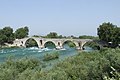 The Bridge of Arta
 -
 The village of Aetomilitsa on Mount Gramos, in the Pindus mountains
 -
 The Vikos river, Vikos–Aoös National Park
 -
 Aerial view of the castle of Ali Pasha of Yanina, Sarandë municipality
 -
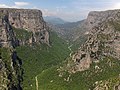 The Vikos Gorge
 -

-
 The high altitude Lake Drakolimni (Dragon Lake), on Mount Gamila in the Pindus mountains
 -
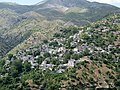
 Hill formations in Horë-Vranisht.
 -
 A canyon of the Acheron river
 -
 The village of Sirako
 -
 The city of Sarandë
 -
 The walls of ancient Nicopolis
 -
 The Hellenistic theater of Dodona
 -
 The village of Konispol
 -
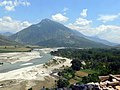
 Sheep under the shade of a tree near Konitsa
 -
 The city of Përmet
 -
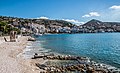
 The bay of Parga
 -
 Waters of Ksamil
 -
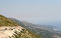 The region of Himara seen from the Llogara pass
 -
-
 Main street of Libohovë
 -
 Section of the A2 motorway, near Igoumenitsa
 -

-
 Preveza seen from the air
 -
 View of the Butrint Lake


See also
[edit]References
[edit]Citations
[edit]- ^ a b c Hammond 2012, "Epirus", p. 527.
- ^ Liddell & Scott 1940, ἤπειρ-ος.
- ^ Filos 2018, p. 215, footnote #1.
- ^ Babiniotis 1998
- ^ David Sacks; Lisa R. Brody; Oswyn Murray (2005). Encyclopedia of the Ancient Greek World. Facts on File Library of World History. Facts on File. p. 85. ISBN 0816057222.
... in a region of northwest Greece called Epirus.
- ^ Winnifrith 2002, p. 22.
- ^ Douzougli, Angelika; Papadopoulos, John (2010). "Liatovouni: a Molossian cemetery and settlement in Epirus". Jahrbuch des Deutschen Archäologischen Instituts. 125: 1.
- ^ Demiraj, Bardhyl (2012). "La Maledizione dell'Epirota (1483)". Res Albanicae. I (1). Palermo: 133–149. pp. 132–133.
- ^ Skoulidas, Elias G. (2011). "Identities, Locality and Otherness in Epirus during the Late Ottoman period". Identities in the Greek world (from 1204 to the present day). European Society of Modern Greek Studies. pp. 1–3.
- ^ Suha 2021, p. 19
- ^ Greenwalt 2011, p. 280
- ^ Wilkes 1995, p. 92 "Appian's description of the Illyrian territories records a southern boundary with Chaonia and Thesprotia, where ancient Epirus began south of the river Aous (Vijosë)." (Map)
- ^ a b c d e f g h i j k l m n o p q r s t u v "Epirus". Encyclopædia Britannica. Encyclopædia Britannica, Inc. Retrieved 16 November 2013.
- ^ Borza 1992, pp. 62, 78, 98.
- ^ Hammond 1986, p. 77: "The original home of the Hellenes was 'Hellas', the area round Dodona in Epirus, according to Aristotle. In the Iliad it was the home of Achilles' Hellenes."
- ^ Aristotle. Meteorologica, 1.14 Archived 29 June 2011 at the Wayback Machine: "Rather we must take the cause of all these changes to be that, just as winter occurs in the seasons of the year, so in determined periods there comes a great winter of a great year and with it excess of rain. But this excess does not always occur in the same place. The deluge in the time of Deucalion, for instance, took place chiefly in the Greek world and in it especially about ancient Hellas, the country about Dodona and the Achelous, a river which has often changed its course. Here the Selli dwelt and those who were formerly called Graeci and now Hellenes."
- ^ Georgiev 1981, p. 192: "Late Neolithic Period: in northwestern Greece the Proto-Greek language had already been formed: this is the original home of the Greeks."
- ^ Hammond 1998; Wilkes 1995, p. 104; Hammond 1994, pp. 430, 434; Hammond 1982, p. 284.
- ^ Hammond 1967.
- ^ Thucydides. The History of the Peloponnesian War, 1.8 Archived 5 August 2011 at the Wayback Machine.
- ^ Strabo. Geography, 7.7.1.
- ^ Strabo. Geography, 7.11
- ^ Herodotus. Histories, 6.127.
- ^ Dionysius of Halicarnassus. Roman Antiquities, 20.10 (19.11).
- ^ Pausanias. Description of Greece, 1.11.7–1.12.2.
- ^ Eutropius. Abridgment of Roman History (Historiae Romanae Breviarium), 2.11.13.
- ^ Davies 2002, pp. 234–258.
- ^ Cameron 2004, p. 141: "As for Aspestos, Achilles was honored in Epirus under that name, and the patronymic [Ἀ]σπετίδης is found in a fragmentary poem found on papyrus."
- ^ cf. Athenian secretary: Aspetos, son of Demostratos from Kytheros c. 340 BC.
- ^ Anson 2010, p. 5.
- ^ Livy (1926), 8.24.8–14
- ^ a b Zimi 2006, p. 377.
- ^ Greenwalt 2011, p. 296.
- ^ Greenwalt 2011, pp. 296–297.
- ^ a b Hammond, N. G. L. (1999). "Epirus". In Hornblower, Simon; Spawforth, Antony (eds.). Oxford Classical Dictionary (PDF) (3rd ed.). New York: Oxford University Press. pp. 546–547. ISBN 978-0-19-522408-5.
- ^ a b Soustal & Koder 1981, p. 47.
- ^ Shpuza 2014, p. 59.
- ^ Shpuza 2022, p. 553.
- ^ Soustal & Koder 1981, pp. 47–48.
- ^ a b c d e Soustal & Koder 1981, p. 48.
- ^ Soustal & Koder 1981, pp. 48–49.
- ^ a b c d Soustal & Koder 1981, p. 49.
- ^ a b Soustal & Koder 1981, p. 50.
- ^ a b Soustal & Koder 1981, p. 51.
- ^ Osswald 2007, p. 128.
- ^ Soustal & Koder 1981, pp. 51–52.
- ^ Desnickaja 1973, p. 48.
- ^ Ylli 1997, p. 317.
- ^ Ylli 2000, pp. 103, 106, 136, 174, 175, 183, 197, 267, 269.
- ^ a b Soustal & Koder 1981, p. 52.
- ^ a b c Soustal & Koder 1981, p. 53.
- ^ a b Fine 1991, p. 64.
- ^ Kazhdan 1991, p. 1485.
- ^ Soustal & Koder 1981, pp. 53–54.
- ^ Kazhdan 1991, p. 668.
- ^ a b Soustal & Koder 1981, p. 54.
- ^ a b c Soustal & Koder 1981, p. 55.
- ^ Soustal & Koder 1981, pp. 55–56.
- ^ Osswald 2007, p. 129.
- ^ Soustal & Koder 1981, pp. 59–61.
- ^ a b Osswald 2007, p. 132.
- ^ Nicol 1984, "Introduction", pp. 4–5.
- ^ a b Osswald 2007, p. 133.
- ^ Giakoumis 2002, p. 176.
- ^ Giakoumis 2002, p. 176: "Are we obliged to see in this a possible earlier Albanian immigration in the Epeirote lands, as Kostas Komis did in the case of the etymology of the toponym 'Preveza'? I believe that the use of hypothetical immigrations as a basis to interpret sources that indicate the presence of Albanians in the Epeirote lands prior to the thirteenth-fourteenth century is somewhat arbitrary."
- ^ Osswald 2007, p. 135.
- ^ Epeirotica 2.220; cf. 222 f
- ^ Fine 1994, pp. 348–351.
- ^ Sansaridou-Hendrickx 2017, p. 294.
- ^ Nicol 1984, pp. 142–145.
- ^ M. V. Sakellariou (1997). Epirus, 4000 years of Greek history and civilization. Ekdotikē Athēnōn. ISBN 978-960-213-371-2.
For the Albanian tribes of the Mazarakaioi and the Malakasioi, led by Peter Losha the despot of Arta,
- ^ Nicol 1984, pp. 142–145; Fine 1994, pp. 351–352; Sansaridou-Hendrickx 2017, p. 294.
- ^ Hammond, 1976 & ps"The Albanians and in particular the Mazarakii of the Kalamas valley held firm against him. In 1385 he was assassinated by some of his own bodyguards" (Epeirotica 2.230), p. 59.
- ^ Hutchinson, Richard Wyatt (1956). The Lord of Patras (PDF). A.G. Kalokairinos. p. 343.
- ^ Osswald 2007, p. 134.
- ^ a b PLP, 26521. Σπάτας Γιαγούπης.
- ^ a b Nicol 1984, p. 186.
- ^ Osswald 2007, p. 136.
- ^ Karabelas 2015, pp. 972–975.
- ^ Sakellariou 1997, p. 268.
- ^ Fleming 1999, pp. 63–66.
- ^ The Era of Enlightenment (Late 7th century–1821). Εθνικό Kέντρο Bιβλίου, p. 13.
- ^ Υπουργείο Εσωτερικών, Αποκέντρωσης και Ηλεκρονικής Διακυβέρνησης Περιφέρεια Ηπείρου: "Στη δεκαετία του 1790 ο νεοελληνικός διαφωτισμός έφθασε στο κορύφωμά του. Φορέας του πνεύματος στα Ιωάννινα είναι ο Αθανάσιος Ψαλίδας."
- ^ Fleming 1999, p. 64.
- ^ Reid 2000.
- ^ Jelavich & Jelavich 1977, p. 226.
- ^ Ramet 1998, p. 205.
- ^ Blumi 2002, p. 57.
- ^ Hammond 1976, p. 41: "Throughout this period bands of Albanians raiders pillaged and destroyed the villages of the Vlachs and the Greeks in Epirus, northern Pindus, the lakeland of Prespa and Ochrid, and parts of western Macedonia. One Albanian leader, 'Ali the Lion', emulated the achievements of 'John the Sword' and 'Peter the Pockmark' when he established himself as Ali Pasha, independent ruler of Ioannina. He and his Albanian soldiers, recruited mainly from his homeland in the Kurvelesh and the Drin valley of North Epirus, controlled the whole of Epirus and carried their raids far into western Macedonia and Thessaly. As we have seen, they destroyed the Vlach settlements in the lakeland and weakened those farther south. After the assassination of Ali Pasha in 1822 sporadic raids by bands of Albanians were a feature of life in northern Greece until the liberation of 1912–13".
- ^ Gawrych 2006, pp. 68–69.
- ^ Clogg 2002, p. 105: "In February 1913 the Greek Army seized Ioannina, the capital of Epirus. The Turks recognized the gains of the Balkan allies by the Treaty of London, in May 1913."
- ^ Clogg 2002, p. 105 "The Second Balkan War had short duration and the Bulgarians were soon dragged to the table of negotiations. By the Treaty of Bucharest (August 1913) Bulgaria was forced to accept a little favourable regulation of the borders, even if she kept a way to the Aegean, in Degeagatch (modern Alexandroupolis). The sovereignty of Greece over Crete was now recognised, but her ambition to annex Northern Epirus with its large Greek population was stopped by the annexation of the area to an independent Albania".
- ^ Pettifer 2001, p. 4.
- ^ a b c d e f Konidaris 2013, pp. 64–92.
- ^ Winnifrith 2002, p. 130.
- ^ Triadafilopoulos 2000, p. 152.
- ^ Tucker & Roberts 2005, p. 77.
- ^ Miller 1966, pp. 543–544.
- ^ a b Konidaris 2013, p. 67.
- ^ Pettifer 2001, p. 7.
- ^ Bahr, Johnston & Bloomfield 1997, p. 389.
General and cited sources
[edit]- Anson, Edward M. (2010). "Why Study Ancient Macedonia and What This Companion is About". In Roisman, Joseph; Worthington, Ian (eds.). A Companion to Ancient Macedonia. Oxford, Chichester, & Malden: Wiley-Blackwell. pp. 3–20. ISBN 978-1-4051-7936-2.
- Antoniadis, Vyron (2016). Tabula Imperii Romani : J 34 - Athens : Epirus. Athens: Academy of Athens. ISBN 978-960-404-308-8.
- Babiniotis, Georgios (1998). Lexiko tis Neas Ellinikis Glossas. Athens, Greece: Kentro Lexikologias. ISBN 960-86190-0-9.
- Bahr, Lauren S.; Johnston, Bernard; Bloomfield, Louise A. (1997). Collier's Encyclopedia. Vol. 11. New York, NY: Collier.
- Blumi, Isa (2002). "The Role of Education in the Albanian Identity and its Myths". In Schwandner-Sievers, Stephanie; Fischer, Bernd Jürgen (eds.). Albanian Identities: Myth and History. Bloomington, IN: Indiana University Press. pp. 49–59. ISBN 0-253-21570-6.
- Borza, Eugene N. (1992). In the Shadow of Olympus: The Emergence of Macedon (Revised ed.). Princeton, NJ: Princeton University Press. ISBN 0-691-00880-9.
- Bowden, William (2003). Epirus Vetus: The Archaeology of a Late Antique Province. London: Gerald Duckworth & Co. Limited. ISBN 0-7156-3116-0.
- Cameron, Alan (2004). Greek Mythography in the Roman World. New York and Oxford: Oxford University Press. ISBN 0-19-517121-7.
- Clogg, Richard (2002) [1992]. A Concise History of Greece (2nd ed.). Cambridge and New York: Cambridge University Press. ISBN 978-0-52-100479-4.
- Davies, J. K. (2002). "13. A Wholly Non-Aristotelian Universe: The Molossians as Ethnos, State, and Monarchy". In Brock, Roger; Hodkinson, Stephen (eds.). Alternatives to Athens: Varieties of Political Organization and Community in Ancient Greece. Oxford: Oxford University Press. pp. 234–258. ISBN 0-19-925810-4.
- Desnickaja, A. V. (1973). "Language Interferences and Historical Dialectology". Linguistics. 11 (113): 41–52. doi:10.1515/ling.1973.11.113.41. S2CID 144569294.
- Fleming, Katherine Elizabeth (1999). The Muslim Bonaparte: Diplomacy and Orientalism in Ali Pasha's Greece. Princeton, NJ: Princeton University Press. ISBN 0-691-00194-4.
- Filos, Panagiotis (2018). "The Dialectal Variety of Epirus". In Giannakis, Georgios; Crespo, Emilio; Filos, Panagiotis (eds.). Studies in Ancient Greek Dialects: From Central Greece to the Black Sea. Berlin and Boston: Walter de Gruyter. pp. 215–248. ISBN 9783110532135.
- Fine, John V. A. Jr. (1991) [1983]. The Early Medieval Balkans: A Critical Survey from the Sixth to the Late Twelfth Century. Ann Arbor: University of Michigan Press. ISBN 0-472-08149-7.
- Fine, John V. A. Jr. (1994) [1987]. The Late Medieval Balkans: A Critical Survey from the Late Twelfth Century to the Ottoman Conquest. Ann Arbor, Michigan: University of Michigan Press. ISBN 978-0-472-10079-8. OCLC 749133662.
- Gawrych, George Walter (2006). The Crescent and the Eagle: Ottoman Rule, Islam and the Albanians, 1874–1913. New York and London: I.B. Tauris. ISBN 1-84511-287-3.
- Georgiev, Vladimir Ivanov (1981). Introduction to the History of the Indo-European Languages. Sofia: Bulgarian Academy of Sciences. ISBN 9789535172611.
- Giakoumis, Kosta (2002). "Fourteenth-century Albanian migration and the 'relative autochthony' of the Albanians in Epeiros. The case of Gjirokastër". Byzantine and Modern Greek Studies. 27: 171–183. doi:10.1179/byz.2003.27.1.171.
- Greenwalt, William S. (2011). "Macedonia, Illyria and Epirus". In Roisman, Joseph; Worthington, Ian (eds.). A Companion to Ancient Macedonia. John Wiley & Sons. pp. 279–305. ISBN 978-1-4443-5163-7.
- Hammond, Nicholas Geoffrey Lemprière (1967). Epirus: The Geography, the Ancient Remains, the History and the Topography of Epirus and Adjacent Areas. Oxford: The Clarendon Press.
- Hammond, Nicholas Geoffrey Lemprière (1976). Migrations and Invasions in Greece and Adjacent Areas. Park Ridge, NJ: Noyes Press. ISBN 0-8155-5047-2.
- Hammond, Nicholas Geoffrey Lemprière (1982). "ILLYRIS, EPIRUS AND MACEDONIA". In Boardman, John; Hammond, N. G. L. (eds.). The Cambridge Ancient History, Volume III, Part 3: The Expansion of the Greek World, Eighth to Sixth Centuries B.C. Cambridge: Cambridge University Press. pp. 261–285. ISBN 978-0-5212-3447-4.
- Hammond, Nicholas Geoffrey Lemprière (1986). A History of Greece to 322 B.C. Oxford: Clarendon Press. ISBN 0-19-873096-9.
- Hammond, Nicholas Geoffrey Lemprière (1994). "ILLYRIANS AND NORTH-WEST GREEKS". In Lewis, David M.; Boardman, John; Hornblower, Simon; Ostwald, M. (eds.). The Cambridge Ancient History, Volume VI: The Fourth Century B.C. Cambridge: Cambridge University Press. pp. 422–443. ISBN 978-0-5212-3348-4.
- Hammond, Nicholas Geoffrey Lemprière (1998). Philip of Macedon. London: Duckworth. ISBN 0-7156-2829-1.
- Hammond, NGL (2012) [1949]. Hornblower, Simon; Spawforth, Antony; Eidinow, Esther (eds.). The Oxford Classical Dictionary (4th ed.). Oxford: Oxford University Press. ISBN 978-0-19-954556-8.
- Jelavich, Charles; Jelavich, Barbara (1977). The Establishment of the Balkan National States, 1804–1920: A History of East Central Europe. Vol. VIII. Seattle, WA: University of Washington Press. ISBN 0-295-96413-8.
- Karabelas, Nikos D. (2015). The Ottoman Conquest of Preveza and its First Castle. XVIth Turkish Congress of History, organised by the Turkish Historical Society, in Ankara, 20–24 September 2010. Kongreye Sunulan Bildiriler, Volume 4, Part 2, Osmanli Tarihi. Ankara: Türk Tarih Kurumu. pp. 967–998. ISBN 978-975-16-2982-1.
- Katona, A. L. (2000). "Proto-Greeks and the Kurgan Theory" (PDF). The Journal of Indo-European Studies. Archived (PDF) from the original on 26 January 2021. Retrieved 22 January 2021.
- Kazhdan, Alexander, ed. (1991). The Oxford Dictionary of Byzantium. Oxford and New York: Oxford University Press. ISBN 0-19-504652-8.
- Konidaris, Gerasimos (2013). "Examining Policy Responses to Immigration in the Light of Interstate Relations and Foreign Policy Objectives: Greece and Albania". In King, Russell; Mai, Nicola; Schwandner-Sievers, Stephanie (eds.). The New Albanian Migration. Portland, OR: Sussex Academic Press. pp. 64–92. ISBN 9781837641932.
- Liddell, Henry George; Scott, Robert (1940). A Greek-English Lexicon. Oxford: Clarendon Press.
- McHenry, Robert (2003). The New Encyclopædia Britannica (15th ed.). Chicago, IL: Encyclopædia Britannica, Inc. ISBN 978-0-85229-961-6.
- Miller, William (1966). The Ottoman Empire and Its Successors, 1801–1927. New York and London: Frank Cass. ISBN 978-0-7146-1974-3.
- Nicol, Donald MacGillivray (1984). The Despotate of Epiros, 1267–1479: A Contribution to the History of Greece. Cambridge: Cambridge University Press. ISBN 978-0-521-26190-6.
- Osswald, Brendan (2007). "The Ethnic Composition of Medieval Epirus". In Ellis, Steven G.; Klusáková, Lud'a (eds.). Imagining Frontiers, Contesting Identities. Pisa: Edizioni Plus – Pisa University Press. pp. 125–154. ISBN 978-88-8492-466-7.
- Pettifer, James (2001). The Greek Minority in Albania – In the Aftermath of Communism. Camberley, Surrey: Conflict Studies Research Centre, Royal Military Academy Sandhurst. ISBN 1-903584-35-3. Archived from the original (PDF) on 21 May 2010.
- Trapp, Erich; Beyer, Hans-Veit; Walther, Rainer; Sturm-Schnabl, Katja; Kislinger, Ewald; Leontiadis, Ioannis; Kaplaneres, Sokrates (1976–1996). Prosopographisches Lexikon der Palaiologenzeit (in German). Vienna: Verlag der Österreichischen Akademie der Wissenschaften. ISBN 3-7001-3003-1.
- Ramet, Sabrina P. (1998). Nihil Obstat: Religion, Politics, and Social Change in East-Central Europe and Russia. Durham, NC: Duke University Press. ISBN 0-8223-2070-3.
- Reid, James J. (2000). Crisis of the Ottoman Empire: Prelude to Collapse 1839–1878. Stuttgart: Franz Steiner Verlag. ISBN 3-515-07687-5.
- Ruches, Pyrrhus J. (1965). Albania's Captives. Chicago, IL: Argonaut Incorporated, Publishers.
- Sakellariou, M. V. (1997). Epirus, 4000 Years of Greek History and Civilization. Athens, Greece: Ekdotikē Athēnōn. ISBN 960-213-371-6.
- Sansaridou-Hendrickx, Thekla (2017). "The Albanians in the Chronicle(s) of Ioannina: An Anthropological Approach". Acta Patristica et Byzantina. 21 (2): 287–306. doi:10.1080/10226486.2010.11879131. S2CID 163742869.
- Soteriades, Georgios (1918). An Ethnological Map Illustrating Hellenism in the Balkan Peninsula and Asia Minor. London: Edward Stanford.
- Soustal, Peter; Koder, Johannes (1981). Tabula Imperii Byzantini, Band 3: Nikopolis und Kephallēnia (in German). Vienna: Verlag der Österreichischen Akademie der Wissenschaften. ISBN 978-3-7001-0399-8.
- Shpuza, Saimir (2014). "Le monoptère carré d'Orikos (Albanie)". Revue archéologique. 1: 57–69. doi:10.3917/arch.141.0057.
- Shpuza, Saimir (2022). "D'un limên à une polis. Orikos aux périodes archaïque et classique". In Brancato, Rodolfo (ed.). Schemata: la città oltre la forma: per una nuova definizione dei paesaggi urbani e delle loro funzioni: urbanizzazione e società nel Mediterraneo pre-classico: età arcaica. Edizioni Quasar. ISBN 9788854912755.
- Suha, Mikko (2021). Late Classical – Hellenistic Fortifications in Epirus: Fourth to Second Century BC (Thesis). Unigrafia, University of Helsinki. ISBN 978-951-51-7673-8.
- Tandy, David W. (2001). Prehistory and History: Ethnicity, Class and Political Economy. Montréal, Québec, Canada: Black Rose Books Limited. ISBN 1-55164-188-7.
- Triadafilopoulos, Triadafilos (November 2000). "Power politics and nationalist discourse in the struggle for 'Northern Epirus': 1919-1921". Journal of Southern Europe and the Balkans. 2 (2): 149–162. doi:10.1080/713683343. ISSN 1461-3190. S2CID 140687333. Retrieved 17 June 2023.
- Tucker, Spencer; Roberts, Priscilla Mary (2005). World War I: Encyclopedia. Santa Barbara, CA: ABC-CLIO Incorporated. ISBN 1-85109-420-2.
- Wilkes, John J. (1995). The Illyrians. Oxford: Blackwell Publishers Limited. ISBN 0-631-19807-5.
- Winnifrith, Tom (2002). Badlands, Borderlands: A History of Northern Epirus/Southern Albania. London: Duckworth. ISBN 0-7156-3201-9.
Zimi, Eleni (2006). "Illyrians". In Wilson, Nigel (ed.). Encyclopedia of Ancient Greece. Routledge. pp. 376–377. ISBN 9781136787997.
- Ylli, Xhelal (1997). Das slawische Lehngut im Albanischen: Lehnworter. Peter Lang International Academic Publishers. hdl:20.500.12657/26220. ISBN 9783954790746.
- Ylli, Xhelal (2000). Das slawische Lehngut im Albanischen: Ortsnamen. Peter Lang International Academic Publishers. hdl:20.500.12657/26167. ISBN 9783954790432.
External links
[edit]- Didrachm of the Epirote League
- Epirus Info Guide
- Panepirotic Federation of America Archived 11 June 2008 at the Wayback Machine
- Panepirotic Federation of Greece
- Panepirotic Society of Cairo
- Folk music in Epirus by musicologist Christopher C. King
| International | |
|---|---|
| National | |
| Geographic | |
| Other | |
Epirus
View on GrokipediaEtymology and Nomenclature
Ancient Origins of the Name
The name Epirus derives from the Ancient Greek term ἤπειρος (ḗpeiros), meaning "mainland" or "continent," a designation that highlighted the region's continental expanse in contrast to the nearby Ionian islands such as Corcyra. This etymology reflects the geographical reality of Epirus as the solid land opposite insular territories, with the term's root emphasizing terra firma over maritime domains.[7][8] The earliest attested use of Epirus as a specific toponym occurs in the geographical writings of Hecataeus of Miletus, circa 550–476 BC, who applied it to the northwestern Greek mainland from an Ionian perspective, distinguishing it from more familiar southern regions. Prior to Hecataeus, Homeric epics (composed around the 8th century BC) employed ḗpeiros in a broader sense to denote continental land north of the Ambracian Gulf, including allusions to sacred sites like the Dodona oracle within the future Epirus territory, though without the precise regional label.[7] In the Doric Greek dialects prevalent among Epirote tribes such as the Molossians, the name manifested as ἄπειρος (ápeiros), potentially connoting "boundless" or "infinite land," evocative of the area's vast, mountainous interior that defied easy boundaries. This linguistic variation underscores the indigenous Greek character of the nomenclature, consistent with the tribal alliances and oracle cults documented from the Archaic period onward.[9]Modern Designations and Regional Variants
The historical region of Epirus is today divided between Greece and Albania, with distinct modern administrative designations reflecting national boundaries established after the Balkan Wars and World War I. In Greece, the southern and core portions form the official Epirus Region (Greek: Περιφέρεια Ηπείρου), a first-level administrative unit created under the 1987 Kallikratis reform, comprising the regional units of Arta, Ioannina, Preveza, and Thesprotia. This region spans 9,160 square kilometers and recorded a population of 319,992 in the 2021 census, with Ioannina serving as the capital and largest city.[10][11][12] The northern portion, lying within southern Albania, lacks an official designation as "Epirus" in Albanian governance and is instead administered as parts of the counties (qarqe) of Vlorë, Gjirokastër, and to a lesser extent Korçë, covering areas historically associated with Greek-speaking communities in regions like Dropull, Konitsa equivalents, and Sarandë. Greek sources and the diaspora commonly term this area Northern Epirus (Greek: Βόρεια Ήπειρος), a nomenclature originating from irredentist aspirations during the 1913–1914 period, including the short-lived Autonomous Republic of Northern Epirus, and tied to the presence of an indigenous Greek minority estimated at tens of thousands, though official Albanian census figures report lower numbers around 24,000 due to disputed self-identification criteria.[13][14][12] These designations underscore persistent cross-border ethnic ties and territorial sensitivities, with "Northern Epirus" invoked in Greek political discourse to highlight cultural continuity and minority rights concerns, such as property disputes and linguistic education, amid Albania's integration of the territory post-1920 without acknowledging historical Greek claims. Albanian authorities maintain the area's full sovereignty as southern prefectures, prioritizing national unity over regional historical labels.[13][14]Geography and Environment
Physical Features and Topography
Epirus exhibits a predominantly rugged and mountainous topography, dominated by the Pindus range, which extends northward into Albania and forms parallel limestone ridges separating the region from central Greece.[15] The interior is characterized by steep peaks, deep valleys, and karst formations, with limited arable plains confined mostly to coastal areas and around inland lakes like Pamvotida near Ioannina.[15] This terrain contributes to Epirus's isolation historically, fostering unique ecological niches amid frequent seismic activity due to its position on the Hellenic Arc.[16] The Pindus Mountains reach their highest elevations in Epirus, with Mount Smolikas standing at 2,637 meters as the region's apex and Greece's second-highest peak.[17] Nearby summits include Gamila at 2,497 meters within the Tymfi massif, supporting glacial lakes such as Drakolimni at high altitudes.[18] These ranges, peaking just before the Albanian border, create a barrier that influences local microclimates and drainage patterns, directing rivers westward to the Ionian Sea.[19] Prominent geomorphic features include the Vikos Gorge in the Vikos-Aoös National Park, stretching approximately 20 kilometers with depths reaching 900-1,000 meters and widths narrowing to mere meters, yielding one of the world's highest depth-to-width ratios.[20] The gorge, carved by the Voidomatis River—a tributary of the Aoös—exemplifies fluvial erosion in limestone bedrock, flanked by vertical cliffs and endemic flora.[21] Major rivers dissect the topography, including the Aoös (Vjosa), which spans about 260-272 kilometers and partially delineates the Greece-Albania border before entering the Adriatic.[22] The Acheron, roughly 52 kilometers long, flows through dramatic canyons in Thesprotia, emerging from karst springs and historically linked to mythological underworld associations due to its dark gorges.[23] The Kalamas, another key waterway, traverses eastern Epirus for over 100 kilometers, supporting wetlands and emptying into the Ionian near the ancient site of Gitanae.[24] These fluvial systems, fed by alpine snowmelt and rainfall, sustain the region's hydrology amid its predominantly calcareous soils.[25]
Climate, Ecology, and Biodiversity
Epirus features a diverse climate shaped by its rugged topography, transitioning from Mediterranean conditions along the Ionian coast to continental and alpine influences in the Pindus Mountains. Coastal plains experience mild winters with minimum temperatures rarely below 5°C and hot, dry summers, while inland valleys and highlands endure colder winters averaging 0°C with snowfall from December to April and sunnier, warmer summers.[26][27] Annual precipitation exceeds 1,200 mm in many areas, ranking among Greece's highest, with peaks in November (up to 218 mm) and minimal rainfall in July; the region's windward position relative to the Pindus range amplifies orographic rainfall from Ionian Sea moisture.[28][29][30] The ecology of Epirus encompasses mixed deciduous and coniferous forests, deep river gorges, glacial lakes, and coastal wetlands, with the Pindus Mountains serving as a barrier fostering habitat isolation and endemism. Key ecosystems include oak woodlands, black pine stands, riparian forests along rivers like the Aoös and Acheron, and eutrophic lakes such as Pamvotis, which is Europe's second-oldest at 7 million years. Protected areas, designated under Natura 2000, cover significant portions, including the Vikos-Aoös National Park (recognized for its geological and biological uniqueness) and the Northern Pindos National Park, where rivers support endemic fish like the Pindus trout (Salmo peristericus). Sacred groves, historically managed under communal rules, demonstrate socio-ecological resilience, recovering forest cover during low-disturbance periods.[31][32][33] Biodiversity hotspots abound, particularly in gorges and highlands, hosting over 1,300 vascular plant taxa in the Kalamas basin alone, with endemic species like Jankaea heldreichii in mixed forests. Tzoumerka National Park records more than 700 plant species, including 79 rare or endemic (20 Greek, 59 Balkan-wide), alongside 145 bird species, 21 reptiles, 10 amphibians, and mammals such as brown bears (Ursus arctos), wolves (Canis lupus), and otters (Lutra lutra). Lake Pamvotis supports 200 birds, 24 reptiles, 7 endemic fish, and 49 aquatic invertebrates, while fungal and lichen diversity thrives in sacred groves, exceeding that of managed forests in some surveys. These areas sustain 229 bird and 68 mammal species across the broader Pindus ecoregion, underscoring Epirus's role in Balkan conservation amid threats from grazing and climate shifts.[31][34][33]Boundaries: Historical and Contemporary Definitions
In antiquity, Epirus was geographically defined as the region extending from the Ambracian Gulf (modern Gulf of Arta) in the south to the Acroceraunian Mountains (near modern Llogara Pass in Albania) in the north, with the Pindus Mountains forming the eastern boundary and the Ionian Sea the western limit. This delineation, described by the geographer Strabo in the 1st century BCE, encompassed territories inhabited primarily by Greek-speaking Epirote tribes, including the Thesprotians in the south, Molossians in the central highlands, and Chaonians in the north. The core area, often centered on the Molossian kingdom, covered roughly the modern Greek prefectures of Ioannina, Thesprotia, and Preveza, plus adjacent southern Albanian territories up to the Aoös River valley, though fluid tribal alliances and conquests periodically expanded influence eastward into Macedonia and southward into Aetolia.[35] During the Hellenistic period, under kings like Pyrrhus (r. 297–272 BCE), Epirus briefly expanded to include Corcyra (Corfu) and parts of Illyria, but Roman conquest in 167 BCE fragmented the region, incorporating it into provinces like Epirus Vetus (southern) and Epirus Nova (northern).[36] In the medieval era, the Despotate of Epirus (1205–1479 CE) redefined boundaries around key centers like Arta and Ioannina, stretching from the Ionian coast to the Pindus and occasionally northward to Valona (Vlorë), though Ottoman conquest by 1430 progressively eroded these limits, administering the area as the Sanjak of Ioannina within the Rumelia Eyalet.[37] Contemporary definitions reflect the 1913 Balkan Wars partition along the modern Greece-Albania border, dividing Epirus into the Greek administrative Region of Epirus (Περιφέρεια Ηπείρου, est. 1987) and informal "Northern Epirus" in Albania.[38] The Greek portion includes four regional units—Arta (1,569 km²), Ioannina (4,978 km²), Preveza (1,050 km²), and Thesprotia (1,515 km²)—totaling 9,112 km², bounded by Albania (north), Western Macedonia and Thessaly (east), West Greece (south), and the Ionian Sea (west).[39] Northern Epirus, a non-administrative historical term, denotes southern Albanian areas contiguous with Greece, primarily Gjirokastër and Sarandë counties (roughly 2,500–3,000 km² south of Vlorë), noted for its ethnic Greek minority but integrated into Albania since 1913 protocols.[40] These modern lines prioritize national borders over historical or ethnic continuity, with no unified Epirote administration today.Ancient History
Prehistoric Settlements and Early Inhabitants
Evidence of human occupation in Epirus dates to the Middle Paleolithic period, with open-air sites like Kokkinopilos yielding stratified bifacial tools, Levallois cores, and flakes dated between 250,000 and 150,000 years ago through luminescence and other radiometric methods.[41] Rock shelters such as Asprochaliko and caves including Kastritsa provide further testimony, with Asprochaliko's sequence spanning Middle Paleolithic layers from approximately 200,000 to 35,000 BC and extending into the Upper Paleolithic, characterized by Mousterian and Aurignacian industries associated with nomadic hunter-gatherers exploiting local fauna.[42] [43] Sites like Agia, an open-air Middle Paleolithic locality, indicate specialized activities such as animal kill and butchering, reflecting adaptive strategies in the rugged northwestern Greek landscape.[44] Mesolithic evidence appears in coastal zones, suggesting continued low-density foraging populations bridging the Pleistocene-Holocene transition.[45] Neolithic settlement in Epirus remains sparsely documented, particularly in central areas like the Ioannina basin, but recent discoveries such as the extended settlement at Episkopi reveal middle Neolithic occupation around 5500-4500 BC, with obsidian artifacts sourced from Melos indicating maritime contacts and integration into broader Balkan-Anatolian networks.[46] [47] Coastal and adjacent Albanian sites show denser early Neolithic presence from circa 6500 BC, featuring impressed ware pottery and domesticated species, pointing to seafarers and pastoralists diffusing farming practices from the eastern Adriatic and Thessaly.[48] These communities practiced mixed agropastoral economies, with tumulus burials emerging by late Neolithic suggesting emerging social hierarchies among early inhabitants, likely indigenous Balkan groups adopting sedentism.[7] The Bronze Age marks increased settlement density and cultural complexity, with the Petromagoula-Doliana group in Ioannina exemplifying the Neolithic-to-Early Bronze Age transition around 3000 BC through handmade pottery, stone tools, and fortified habitations reflecting local continuity amid metallurgical adoption.[49] [50] Middle and Late Bronze Age sites feature tumuli with grave goods, indicating warrior elites and pastoral mobility in upland areas.[48] Mycenaean influences appear peripherally in the Late Bronze Age (circa 1600-1100 BC), evidenced by imported pottery, chamber tombs, and acropolis fortifications at Ephyra, denoting trade and cultural exchange with mainland Greek centers rather than direct colonization, among populations ancestral to later Epirote groups.[51] [52] These early inhabitants, transitioning from foraging to agro-pastoral societies, laid foundations for the region's enduring settlement patterns in a topographically challenging environment.[53]Classical Greek Tribes and the Molossian Kingdom
In classical antiquity, the region of Epirus was primarily inhabited by three major Greek tribes: the Chaonians in the northwest, the Molossians in the central area, and the Thesprotians in the southwest.[54] These tribes shared linguistic and cultural affinities with other Greek peoples, speaking dialects of ancient Greek, including northwest Doric forms evidenced by inscriptions found in the region.[7] Archaeological findings, such as Greek-style theaters and Dorian Greek transcripts, further support their integration into the Hellenic cultural sphere from at least the 4th century BC onward.[55] The Molossians, centered around the area of modern Ioannina, emerged as the most politically organized among these tribes, forming the core of what became known as the Molossian Kingdom.[54] Traditionally, their ruling dynasty, the Aeacidae, traced descent from Neoptolemus (Pyrrhus), son of Achilles, linking them mythologically to the Trojan War heroes and reinforcing their Greek identity through heroic genealogies recorded in ancient sources like Homer and later historians.[7] By the late 5th century BC, Molossian kings such as Tharyps had adopted Greek customs, including symposia and equestrian training, as noted by Thucydides, indicating cultural alignment with southern Greek city-states.[54] Centralization of power under the Molossians intensified around 370 BC with the Aeacidae dynasty establishing a more unified state, incorporating elements of monarchy with tribal assemblies.[7] The kingdom's religious focal point was the Oracle of Dodona, dedicated to Zeus and reputedly the oldest in Greece, dating back to the 2nd millennium BC with continuous use through classical times; priests interpreted divine will from the rustling oak leaves and bronze vessels.[56] Dodona's sanctuary, located in Molossian territory, served as a pan-Hellenic site, attracting consultations from across Greece, as evidenced by inscribed lead tablets from the 5th-3rd centuries BC recording queries in Greek.[3] The Molossian Kingdom maintained alliances with Macedonian rulers, such as the marriage of Olympias, a Molossian princess, to Philip II in 357 BC, which strengthened ties and facilitated cultural exchange.[7] Economically, the region relied on pastoralism, with Molossian horse-breeding renowned enough to supply cavalry to Greek forces, reflecting adaptation to the rugged Pindus Mountains terrain.[54] While less urbanized than southern Greece, Epirus featured fortified settlements and participated in Greek religious festivals, underscoring tribal participation in broader Hellenic networks despite peripheral geography.[56]Key Figures and Events: Pyrrhus and Hellenistic Expansion
Pyrrhus (c. 319–272 BCE), a member of the Aeacid dynasty of the Molossians, ascended to the throne of Epirus in 306 BCE at the age of approximately 13, following the deposition of his father Aeacides amid the instability of the Wars of the Diadochi.[57] Deposed by Macedonian forces under Cassander in 302 BCE, he spent years in exile, fighting as a mercenary in the service of various Hellenistic rulers, including participation in the Battle of Ipsus in 301 BCE on the side of Demetrius I Poliorcetes.[58] Restored to power in Epirus in 297 BCE through alliances and internal maneuvering, Pyrrhus consolidated his rule by reorganizing the kingdom's tribal structure into a more centralized monarchy, fostering urban development in cities like Ambracia and Passaron, and building a professional army equipped with Macedonian-style phalanxes and war elephants acquired from the East.[59] In 288 BCE, Pyrrhus pursued Hellenistic expansion eastward by allying with Lysimachus of Thrace to invade Macedonia, deposing Demetrius Poliorcetes and briefly claiming the Macedonian throne alongside his ally, which extended Epirote influence over Thessaly and parts of central Greece for several years.[59] This campaign marked the zenith of Epirus as a Hellenistic power, with Pyrrhus emulating Alexander the Great—his claimed ancestor—through aggressive diplomacy and military innovation, including the integration of diverse troop types such as Thessalian cavalry and Tarentine light infantry. However, internal betrayals and Lysimachus's ambitions forced his withdrawal to Epirus by 284 BCE, limiting the durability of these gains.[60] Pyrrhus's westward ambitions ignited in 280 BCE when the Italian Greek city of Tarentum appealed for aid against Roman expansion; he crossed to Italy with an army of about 25,000 infantry, 3,000 cavalry, and 20 Indian elephants, achieving tactical victories at Heraclea (280 BCE) and Asculum (279 BCE) through the decisive shock of his elephants and phalanx against Roman legions, though at disproportionate costs exceeding 15,000 casualties in the latter battle. These "Pyrrhic victories"—a term derived from his own reported lament over irreplaceable losses—halted Roman advances temporarily but failed to secure lasting alliances among southern Italian Greeks. Diverted to Sicily in 278 BCE at the request of Greek cities, Pyrrhus campaigned against Carthaginian forces, liberating Syracuse and much of the island's Greek territories by 276 BCE, only to face logistical strains and Syracusan ingratitude that compelled his return to Italy.[59] A decisive defeat at the Battle of Beneventum in 275 BCE against Roman consul Manius Curius Dentatus shattered Pyrrhus's Italian enterprise, prompting his retreat to Epirus with fewer than half his original forces and minimal reinforcements. Undeterred, he invaded Macedonia again in 274 BCE, ousting Antigonus II Gonatas and reclaiming Thessaly, before pushing into the Peloponnese in 272 BCE to challenge Macedonian garrisons in cities like Sparta and Corinth, aiming to forge a pan-Hellenistic league under Epirote hegemony.[59] His death in 272 BCE—struck by a tile thrown by an Argive woman during nocturnal street fighting in Argos—abruptly ended these efforts, leaving Epirus vulnerable to internal strife and eventual Roman intervention. Pyrrhus's relentless campaigns, while transient in territorial gains, elevated Epirus's profile in the Hellenistic world, introducing eastern military tactics, promoting Greek cultural patronage, and briefly positioning the kingdom as a contender among the Diadochi successor states.[59]Medieval and Early Modern History
Byzantine Rule and Slavic Invasions
Epirus remained under Byzantine imperial administration following the permanent division of the Roman Empire in 395 AD, forming part of the provinces of Epirus Vetus and Epirus Nova within the praetorian prefecture of Illyricum.[61] Under Emperor Justinian I (r. 527–565), the region saw fortification efforts and administrative stability, though Balkan territories faced ongoing threats from external migrations.[5] The Slavic invasions commenced in the late 6th century, with Sclaveni tribes raiding across the Danube frontier around 577–582 AD, often in alliance with the Avars, leading to temporary losses of Byzantine control in parts of the Balkans including western Greece.[62] In Epirus, these incursions disrupted coastal and lowland areas, but the rugged mountainous terrain limited deep Slavic penetration and permanent settlements compared to Thessaly or the Peloponnese.[36] Archaeological and toponymic evidence indicates sporadic Slavic presence, with some groups assimilated or displaced by subsequent Byzantine reconquests, preserving a predominantly Greek-speaking population core.[63] Byzantine responses included military campaigns by Emperor Heraclius (r. 610–641), who repelled Avar-Slavic forces from Thrace and initiated Balkan recovery, followed by Constans II's (r. 641–668) expeditions that reasserted control over Illyricum by the 660s.[64] Administrative reorganization under the theme system integrated Epirus into defensive structures, with the Theme of Nicopolis emerging in the 7th–8th centuries to counter residual threats, headquartered near ancient Nikopolis and encompassing Acarnania and southern Epirus.[65] This period marked a shift toward militarized provincial governance, fostering gradual re-Hellenization and economic recovery amid ongoing low-level Slavic activity until the 9th century.[66]Despotate of Epirus: Formation and Conflicts
The Despotate of Epirus emerged in the aftermath of the Fourth Crusade's sack of Constantinople in 1204, when Michael Angelos Komnenos Doukas, an illegitimate son of the sebastokrator John Angelos Komnenos, seized control of the region by 1205.[67] Michael adopted the title of despot and established his capital at Arta, securing a territory stretching from Arta to Naupaktos, bolstered by the natural defenses of the Pindus Mountains.[67] In 1205, he clashed with Latin forces at the Battle of Koundoura, where defeat cost him influence in the Peloponnese but allowed consolidation in Epirus.[67] Michael pursued expansion against Latin holdings, signing a commercial agreement with Venetian Doge Pietro Ziani in 1210 that he later disregarded to launch offensives.[67] He allied with the Bulgarian noble Dobromir Strez in 1210 against the Latin Kingdom of Thessalonica but suffered significant losses in the campaign.[67] By June 1212, Michael captured Larissa and Salona, extending Epirote reach toward the Aegean Sea; further gains included Dyrrhachium (modern Durrës) in 1213 and Corfu in 1214.[67] His murder in late 1215 led to succession by his half-brother Theodore Komnenos Doukas, who intensified aggressive policies.[67] Theodore escalated conflicts with the Latin Empire, capturing Emperor Peter II of Courtenay in 1217 during an attempted Latin incursion into Epirus.[68] In 1224, he seized Thessalonica from Latin control, prompting Archbishop Demetrios Chomatianos to crown him emperor in 1227, temporarily elevating the state to the Empire of Thessalonica.[68] This expansion provoked Bulgarian Tsar Ivan Asen II, leading to Theodore's invasion of Bulgaria and decisive defeat at the Battle of Klokotnitsa on March 9, 1230, where he was captured and the Epirote army shattered.[68] Theodore remained imprisoned for seven years and was later blinded following a conspiracy; his brother Manuel assumed control of Thessalonica under Bulgarian suzerainty.[68] Freed in 1237, Theodore deposed Manuel and installed his son John as co-emperor, but Bulgarian influence waned after Ivan Asen's death in 1241.[68] Nicaean Emperor John III Vatatzes exploited the weakness, marching on Thessalonica in 1242 and compelling John to renounce imperial claims, reducing Epirus to a subordinate despotate within the Nicaean sphere.[68] These conflicts highlighted the Despotate's precarious position amid rival successor states and external powers, setting the stage for further fragmentation.[67]Ethnic Migrations: Vlachs, Slavs, and Albanian Influx
The Slavic migrations into Epirus occurred primarily during the late 6th to 9th centuries, as part of broader invasions into Byzantine territories, with documented raids in 548, 587, and 614–616 CE.[36] Archaeological and toponymic evidence indicates settlement, particularly inland, where approximately 180 of 450 place names in Epirus and the Ionian Islands derive from Slavic roots, suggesting semi-permanent communities engaged in pastoralism and agriculture.[36] However, by the 11th–12th centuries, these groups had largely assimilated into the Greek-speaking population through Byzantine administrative pressures, intermarriage, and cultural hellenization, with contemporary observers like John Apokaukos and George Bardanes around 1220 noting their integration and absence as a distinct ethnic bloc.[36][69] This assimilation was facilitated by Epirus's rugged topography, which limited dense Slavic implantation compared to more fertile lowlands elsewhere in the Balkans, though pockets of Slavic linguistic influence persisted in remote areas into the medieval period.[70] Vlachs, Romance-speaking pastoral nomads descended from Romanized Thracians and Dacians, maintained a continuous presence in Epirus from at least the late 11th century, with earlier attestations in Byzantine sources from the 10th century describing their transhumant lifestyle across the Pindus Mountains.[36] By the 13th century, during the Despotate of Epirus (established 1204), Vlach communities were concentrated in highland regions like Metsovo, Etolia, and Dolopia, serving as elite troops for Epirote rulers after the conquest of Thessaly in the 1210s, as noted by historian George Pachymeres.[36][71] Specific records, such as a 1221 legal case involving Constantine Aurelian and a 1321 privilege from Emperor Andronikos II, document their integration into local administration and economy, though tensions arose with sedentary Greek populations over land use and taxation.[36] Vlachs contributed to the Despotate's military strength against rivals like the Empire of Nicaea, but their nomadic patterns limited demographic dominance, with numbers estimated in the thousands rather than forming a majority. Byzantine chronicles portray them as reliable allies yet socially marginal, reflecting elite biases against highland herders rather than outright ethnic hostility.[36] The Albanian influx intensified from the late 13th century, accelerating in the 14th during the power vacuum following Serbian expansions under Stefan Dušan (r. 1331–1355), with clans migrating southward from central Albania and Thessaly into inland Epirus.[36] Evidence from 1334 documents groups like the Malakasaioi, Boua, and Mesaritai settling in areas around Arta, which they controlled by the 1360s under leaders such as the Spata family, who ruled as despots until the early 15th century.[36] Peter Losha, another clan head, led combined Albanian forces in Epirus during the late 14th century, allying with or challenging local despots amid Ottoman advances. This migration involved thousands, altering rural demographics through pastoral settlement and resistance to assimilation, unlike the Slavs; Albanian toponyms and oral traditions proliferated in mountainous zones, sustained by endogamous clans.[36] Sources like the Chronicle of Ioannina and Chronicle of the Tocco, penned by Greek elites, depict Albanians as disruptive nomads, but this likely stems from class-based disdain for rural migrants rather than fabricated threats, corroborated by their documented role in filling power gaps post-Despotate fragmentation.[36] By the 15th century, Albanian groups held sway in southern and northern Epirus peripheries, setting the stage for Ottoman incorporation.[72]Ottoman Conquest and Administration
The Ottoman conquest of Epirus unfolded gradually in the 15th century amid the weakening Despotate of Epirus, facilitated by internal divisions among its rulers and opportunistic alliances with local factions. In 1430, Ottoman forces under Sinan Pasha captured Ioannina after a prolonged siege, marking the first major foothold in the region; Sultan Murad II subsequently issued a berat (imperial charter) affirming the inhabitants' rights to religious practice, property security, and self-governance in communal affairs, provided they paid taxes and maintained loyalty. This conquest disrupted the Despotate's core territories, though resistance persisted in peripheral areas. Subsequent advances included the fall of Arta in 1449 to Ottoman troops, further eroding the Despotate's control over central Epirus. The final phase occurred in 1479 during the Ottoman-Venetian War (1463–1479), when remaining Venetian-allied holdings—such as Vonitsa, Preveza, and Lepanto (Naupaktos)—were seized, deposing the last despot, Leonardo III Tocco, and incorporating the entirety of Epirus into Ottoman domains.[73] These campaigns relied on superior Ottoman military organization, including sipahi cavalry and artillery, contrasting with the Despotate's fragmented feudal levies and reliance on Albanian mercenaries. Under Ottoman administration, Epirus was integrated into the Rumelia Eyalet, subdivided into sanjaks (districts) governed by appointed sanjakbeys responsible for tax collection, law enforcement, and military recruitment. The Sanjak of Ioannina (Yanya), centered on the conquered capital, emerged as the primary administrative hub, overseeing much of southern Epirus through a network of timars (land grants) allocated to sipahis in exchange for service; local Christian communities, predominantly Greek-speaking Orthodox, operated under the Rum Millet system, led by the Ecumenical Patriarchate in Constantinople, which managed ecclesiastical affairs and collected the jizya poll tax.[74] Certain regions, such as Zagori villages, secured semi-autonomous privileges via imperial firmans, allowing communal self-rule and exemption from certain levies in return for fixed tributes. By the late 18th century, governance evolved with the rise of powerful local pashas; Ali Pasha of Tepelena, appointed derbend-basi (road warden) in 1787 and later mutasarrif of the Sanjak of Ioannina, consolidated control over multiple sanjaks forming the Pashalik of Yanina (1788–1822), blending Ottoman fiscal mechanisms with personal patronage networks that included Albanian irregulars (bashi-bazouks) for enforcement.[75] This era saw economic prosperity from trade routes and silk production but also intensified tax burdens and sporadic revolts, reflecting tensions between central imperial oversight and de facto regional autonomy. In 1867, the sanjaks were reorganized into the Yanina Vilayet, enhancing bureaucratic centralization ahead of the 19th-century nationalist upheavals.[76]Modern History
19th-Century Nationalism and Independence Movements
In the early 19th century, Epirus remained under Ottoman suzerainty, largely administered by the semi-autonomous Albanian-origin pasha Ali Tepelena, who controlled the region from his base in Ioannina from 1788 until his execution by Ottoman forces on January 24, 1822.[77] Ali's defiance of Sultan Mahmud II, culminating in open rebellion in 1820, weakened Ottoman authority and indirectly facilitated the outbreak of the Greek War of Independence in 1821 by diverting imperial resources.[78] His rule, marked by brutal suppression of local Greek Orthodox communities like the Souliotes, fostered resentment among Christian populations, setting the stage for alignment with broader Greek nationalist aspirations inspired by Enlightenment ideas and the Filiki Eteria society.[79] The Greek Revolution reached Epirus in spring 1821, with Souliote warriors, known for prior resistance against Ali Pasha, among the first to rise against Ottoman garrisons.[80] Leaders such as Markos Botsaris mobilized irregular forces in the Pindus mountains, achieving initial successes like the August 1822 victory at Karpenisi before Botsaris's death in combat.[81] By May 25, 1821, armatoles in Xiromero proclaimed the revolution, sparking localized uprisings that briefly liberated areas around Arta and Preveza, though Ottoman reprisals, including massacres and the destruction of Souli in 1822, curtailed gains.[82] These efforts reflected a causal link between local self-defense traditions and emerging pan-Hellenic nationalism, prioritizing Orthodox Christian liberation over ethnic Albanian Muslim loyalties prevalent under Ali's regime. Subsequent decades saw intermittent revolts amid the Megali Idea of Greek irredentism, including the 1854 Epirus uprising, where rebels captured Ottoman-held towns in Pindus and Thessaly before suppression by regular Ottoman troops.[83] The 1878 revolt, triggered by the Russo-Turkish War and Congress of Berlin, involved coordinated Greek irregulars aiming to annex Epirus but collapsed under Ottoman counteroffensives, highlighting persistent Greek-majority demands for autonomy despite mixed demographic pressures from Albanian Muslim settlers.[78] These movements, though unsuccessful in achieving immediate independence—Epirus proper joining Greece only in 1913—underscored empirical patterns of Greek cultural and religious identity driving resistance, unmarred by later nationalist historiographical exaggerations.Balkan Wars, World War I, and the Fate of Northern Epirus
During the First Balkan War (October 8, 1912–May 30, 1913), Greek forces under Crown Prince Constantine advanced rapidly into Ottoman-held Epirus, capturing the strategic fortress of Ioannina on March 5, 1913, after a prolonged siege that resulted in over 10,000 Ottoman casualties and the surrender of Esad Pasha. Greek troops then pushed northward into the contested region of Northern Epirus—encompassing the modern Albanian districts of Gjirokastër, Sarandë, and Korçë—liberating these areas by late March 1913 amid reports of a predominantly Greek-speaking population supportive of union with Greece.[84] The Treaty of London, signed May 30, 1913, ended the war by recognizing Albania's independence and broadly delineating its southern border along a line from the Adriatic coast near Cape Stylos to the Prespa Lakes, effectively assigning Northern Epirus to Albania despite Greek military occupation and local ethnic ties; this compelled Greece to evacuate its forces starting February 1914, prioritizing Aegean island gains over irredentist claims in the region. In protest, ethnic Greek leaders led by Georgios Christakis-Zografos declared the independence of the Autonomous Republic of Northern Epirus on February 28, 1914, in Gjirokastër, establishing a provisional government with a double-headed eagle flag symbolizing Albanian suzerainty but Greek self-rule. The Protocol of Corfu, negotiated May 17, 1914, between Northern Epirote delegates and representatives of Albanian Prince Wilhelm of Wied, granted limited autonomy to the districts of Korçë and Gjirokastër under Albanian sovereignty, designating Greek as the official language, reserving key administrative posts for locals, and ensuring religious and educational freedoms—though implementation faltered amid rising tensions.[85][86] World War I disrupted these arrangements when Prince Wilhelm fled Albania in September 1914 amid anarchy, prompting Greek reoccupation of Northern Epirus from October 1914 to hold strategic positions against Austrian and Bulgarian threats; Greek administration persisted until 1916, when Italian forces, advancing under the Entente, displaced them and assumed control to counter Greek expansionism. Post-armistice, Greece retained de facto possession during the 1919–1920 period, leveraging wartime gains to press claims at the Paris Peace Conference, where Prime Minister Eleftherios Venizelos cited ethnographic data indicating approximately 120,000 Greeks versus 80,000 Albanians in the region to argue for incorporation based on self-determination principles. However, the Conference of Ambassadors—tasked with Albanian frontiers—decided on November 9, 1921, to reaffirm the 1913 borders, awarding Northern Epirus to Albania despite Greek protests and amid Greece's preoccupation with the Greco-Turkish War defeat, which eroded its bargaining power; this ruling prioritized Albanian territorial integrity over ethnic majorities, institutionalizing a Greek minority under Albanian administration without plebiscite.[87][86]Interwar Period and World War II: Cham Albanian Expulsions and Greek Resistance
In the interwar period, the Muslim Cham Albanian minority in Greece's Thesprotia region, numbering approximately 20,000, resided primarily in coastal and lowland areas of Epirus, maintaining distinct cultural and religious practices amid Greek nation-building efforts.[88] Following the 1923 Treaty of Lausanne, which exempted them from the Greco-Turkish population exchange due to their non-Turkish ethnicity, some Chams—around 5,000—migrated to Turkey voluntarily, while others faced land reforms and settlement policies that redistributed properties to Greek refugees from Asia Minor.[88] Tensions escalated under Ioannis Metaxas's regime from 1936, which enforced assimilation through property confiscations, suppression of Albanian-language education, and surveillance of irredentist activities linked to Albania, prompting sporadic emigration to Albania and fostering resentment over perceived marginalization.[88] During World War II, the Axis occupation beginning in April 1941 under Italian control encouraged Cham separatism by promising autonomy or incorporation into a greater Albania, leading to the formation of armed Cham militias integrated into Italian auxiliary forces.[89] These militias, numbering several hundred, participated in attacks on Greek civilians and retreating forces, including the murder of Greek officials in February 1942 near Paramythia and the occupation of Greek properties in the Rai plain in December 1942; in August 1943, around 300 Chams joined German Operation Augustus, resulting in the deaths of 150 Greeks and the burning of villages such as Eleftherohori.[89] Such actions, documented in Italian and German reports, were driven by local grievances and expansionist incentives but alienated neutral or pro-Greek Chams, contributing to ethnic violence that displaced thousands of Greeks from mixed areas like Filiates and Igoumenitsa.[89] Greek resistance in Epirus centered on the National Republican Greek League (EDES), founded in September 1941 under Colonel Napoleon Zervas, which conducted guerrilla operations primarily in the mountainous Arta and Preveza prefectures against Italian and later German forces.[90] EDES fighters, including local captains like Grigoris Kossivakis in the Ghávrovo mountains, engaged in ambushes starting October 1942, disrupting Axis supply lines and establishing "Free Mountainous Greece" zones east of Arta by 1943, though they faced reprisals such as the German massacre of 317 civilians in Kommeno on August 16, 1943.[90] Internal conflicts with the communist-led ELAS erupted from October 1943 to February 1944 in the Tzoumerka region, diverting resources, but EDES maintained control of Arta until retreating to Corfu amid the December 1944 battle for the town.[90] As Axis forces withdrew in summer 1944, EDES units and local Greek militias initiated reprisals against Cham collaborators, culminating in mass expulsions of the Muslim Cham population to Albania between June 1944 and March 1945, affecting an estimated 20,000-25,000 individuals.[88] [89] Key events included the June 26-27, 1944, killings of 328-600 Chams in Paramithia by EDES, the execution of 40 in Parga by ELAS on August 28, 1944, and further deaths in Filiates (around 100 in September 1944 and 60 in March 1945), with total Cham fatalities during these operations estimated at 500-2,800 based on local records.[88] [89] Greek authorities justified the actions as retribution for wartime treason and security threats, leading to the abandonment of over 5,000 homes and significant livestock losses, though post-war trials convicted some Chams in absentia for collaboration while overlooking intra-Greek divisions.[88] These events homogenized Thesprotia demographically but entrenched bilateral disputes, with Albanian narratives emphasizing ethnic cleansing and Greek accounts stressing causal links to Axis-era crimes.[89]Post-1945: Communist Albania's Policies on Greek Minority
Following the establishment of the People's Republic of Albania in January 1946 under Enver Hoxha's leadership, the communist regime initially recognized the existence of an ethnic Greek minority concentrated in southern border areas, but strictly delimited this status to 99 villages primarily in the districts of Gjirokastër, Sarandë, and Delvinë.[91][92] This "minority zone" policy, formalized in the post-war period, excluded Greek-populated communities in regions such as Vlorë and Himarë, requiring residents outside these boundaries to declare Albanian ethnicity in official censuses and documents, thereby denying them minority protections and promoting assimilation.[91][92] The approach reflected Hoxha's broader strategy of ideological uniformity and prevention of irredentist sentiments linked to Greek claims on Northern Epirus, resulting in systematic undercounting of the Greek population; while the 1989 census reported 58,758 ethnic Greeks, independent estimates placed the figure closer to 100,000 or higher, accounting for suppressed identities.[93][91] Cultural and linguistic policies enforced Albanianization to erode Greek identity. Greek-language use was prohibited outside designated zones, with toponyms in minority areas systematically changed to Albanian equivalents, and the importation or publication of Greek books—particularly those with religious content—banned.[92][91] Education in Greek was permitted only for primary grades 1 through 4 in the zones, with curricula mandated to prioritize Albanian historical narratives and communist ideology, excluding Greek perspectives; secondary education shifted to Albanian-medium instruction, and no higher education in Greek was available after 1961.[94][91] Encouragement of Albanian names for children and restrictions on cross-border contacts further isolated communities, while political persecution targeted suspected "anti-state" elements, often Greeks accused of ties to Greece, leading to arrests, show trials, and internment in labor camps.[91][92] Religious suppression intensified ethnic pressures, as the Greek minority's Orthodox affiliation intertwined faith with identity. The 1967 cultural revolution declared Albania the world's first atheist state, resulting in the demolition or repurposing of over 2,000 Orthodox churches nationwide, with disproportionate impact on Greek communities; clergy were imprisoned or executed, and religious practices criminalized under Article 37 of the 1976 Constitution.[91][93] Forced relocations dispersed Greek populations from border villages to central Albania, diluting concentrations and facilitating surveillance, with no official records quantifying the scale but scholarly accounts confirming it as a tool to preempt dissent.[92][91] Under Hoxha's successor Ramiz Alia from 1985 to 1991, these policies persisted amid Albania's deepening isolation, contributing to a legacy of demographic stagnation and cultural erosion until the regime's collapse.[95][91]Late 20th Century to Present: EU Integration and Border Tensions
Following the collapse of Albania's communist regime in 1991, the previously sealed border with Greece opened, triggering a mass exodus of approximately 3,000 Albanians into Greek Epirus by early 1991, primarily economic migrants seeking opportunities amid Albania's instability.[96] This influx strained resources in northwestern Greece, including Ioannina and the Epirus region, and prompted temporary border closures and repatriations, exacerbating bilateral frictions over migration control and minority status.[97] Throughout the 1990s, tensions intensified due to Albanian authorities' restrictions on the Greek minority in Northern Epirus, including arrests of ethnic Greek activists in 1991–1994 for alleged separatist activities and limitations on cultural expression, such as bilingual signage and church operations.[40] Greece, having acceded to the European Economic Community (predecessor to the EU) in 1981, leveraged its membership to advocate for Albania's Euro-Atlantic integration while conditioning support on improvements in minority rights. Albania received EU candidate status in June 2014 after reforms in justice and anti-corruption, with accession negotiations formally opening in July 2022 and initial chapters on fundamentals and external relations addressed by October 2024.[98] By September 2025, the EU had opened negotiations on green and connectivity policies with Albania, disbursing €100 million in growth plan funds contingent on reform milestones, reflecting incremental progress amid broader Western Balkan enlargement momentum.[99][100] Persistent border tensions have centered on the Greek minority's status in southern Albania's Himara, Saranda, and Gjirokaster districts—core Northern Epirus areas—where property restitution claims from communist-era expropriations remain unresolved, fueling disputes over land ownership and local elections. The 2023 arrest and conviction of ethnic Greek mayor Fredi Beleris on vote-buying charges, widely viewed in Greece as politically motivated, prompted Athens to threaten vetoing Albania's EU progress, highlighting judicial independence concerns tied to accession criteria.[101] In response, Albania amended legislation in January 2025 to permit self-identification for minority registration, easing citizenship and identity documentation for Greeks, though implementation gaps persist.[102] Greece reiterated in December 2024 that its endorsement of Albania's EU bid hinges on verifiable protections for the estimated 200,000-strong Greek community, including education and religious freedoms, with the European Commission incorporating related amendments into Albania's 2025 progress report.[103][104] Cross-border cooperation in Epirus has advanced through EU-funded initiatives, such as infrastructure upgrades at Igoumenitsa port and joint environmental projects along the Aoös River, fostering economic ties despite political strains; however, low-level incidents, including sporadic migrant crossings and maritime delimitation disagreements in the Ionian Sea adjacent to Epirus, underscore unresolved sovereignty sensitivities. Albania's EU trajectory, projected by Tirana for completion by 2030, continues to intersect with these dynamics, as Greek advocacy emphasizes empirical enforcement of minority rights over declarative reforms.[105][106]Ethnic Composition and Identity
Ancient Epirote Ethnicity: Linguistic and Archaeological Evidence for Greek Roots
The ancient Epirotes, comprising tribes such as the Chaonians, Molossians, and Thesprotians, spoke a dialect classified as Northwestern Greek, a branch of ancient Greek languages. Epigraphic evidence from Epirote inscriptions, including those from the Epirote League's koinon, demonstrates the use of Greek language and technical terminology for recording resolutions and public matters.[107] This dialect exhibited archaic features, such as unique glosses like δάξα for 'sea' and δράμιξ for a type of bread, which align with West Greek phonological and morphological patterns rather than non-Greek substrates.[108] Linguistic analyses of Epirote ethnics and onomastics further reveal formations consistent with Greek naming conventions, distinguishing them from neighboring Illyrian or other non-Hellenic groups.[109] Archaeological findings corroborate this linguistic affiliation through material culture tied to Hellenic practices. The sanctuary of Dodona, operational from at least the 2nd millennium BCE, served as the oldest known oracle in the Greek world, dedicated initially to Gaia (as Dione) and later to Zeus and Dione, with rituals involving the sacred oak and bronze cauldrons—elements emblematic of early Greek religious traditions.[110] Excavations at Dodona have uncovered lead oracle tablets inscribed in Greek from the 6th to 2nd centuries BCE, posing questions in koine Greek and reflecting widespread participation by Greek speakers from across the Hellenic sphere.[2] The site's monumental phase, including a theater and bouleuterion constructed in the 3rd century BCE under King Pyrrhus, mirrors architectural styles found in core Greek regions, underscoring cultural continuity.[111] Further evidence emerges from burial practices and settlements, where Mycenaean-style pottery and Linear B influences suggest early Indo-European migrations aligning with proto-Greek speakers into Epirus by the Late Bronze Age (circa 1600–1100 BCE). While peripheral to Mycenaean palace centers, these artifacts indicate shared material horizons with mainland Greek cultures, without dominant Illyrian or Thracian markers. Greek theaters, such as those at Dodona and Gitana, dating to the 3rd century BCE, hosted performances of Greek drama, implying a populace familiar with Hellenic literary and civic traditions. Inscriptions from Chaonian sites also employ Greek script and formulae, reinforcing ethnic and linguistic integration within the broader Greek world by the Classical period (5th–4th centuries BCE). These strands of evidence collectively affirm the Epirotes' Greek roots, countering interpretations that posit them as primarily non-Hellenic tribes Hellenized only later, as the dialectal and epigraphic record predates significant external influences.[112]Medieval Demographics: Greek Core Amid Migrations
During the early medieval period, Epirus maintained a predominantly Hellenized Greek population, forming the core demographic in urban centers and coastal areas, as evidenced by Procopius's sixth-century account of 36 Greek-named fortresses across the region.[36] Slavic migrations into the Balkans from the late sixth to ninth centuries introduced settlements, reflected in approximately 180 out of 450 toponyms of Slavic origin, but these groups were largely assimilated by the twelfth century, with no distinct Slavic presence noted in contemporary records such as those of John Apokaukos around 1220.[36] The rugged terrain of Epirus likely limited extensive Slavic penetration compared to lowland Greece, preserving Greek linguistic and administrative continuity under Byzantine themes like Nikopolis, established by the ninth century as a Greek-led military district.[113] Vlach pastoralists, speaking a Romance language and adhering to Orthodox Christianity, emerged in records from the tenth century, concentrating in the Pindus Mountains around settlements like Metsovo by the eleventh century; conflicts between Vlachs and local authorities are documented in Apokaukos's letters from 1221 and 1228, indicating their semi-nomadic role without displacing the Greek urban base.[36] The establishment of the Despotate of Epirus in 1205 by Michael I Komnenos Doukas, a Greek dynasty claiming Byzantine imperial legitimacy, reinforced this Greek core through an influx of refugees from Constantinople and other Latin-conquered territories, particularly bolstering Ioannina's population as noted by Metropolitan Demetrios Chomatenos.[36] Cities such as Ioannina and Arta remained Greek-dominated, with Greek elites and archons prevalent in administration, while armies and aristocracies incorporated mixed elements including Vlachs and later Serbs under rulers like Thomas Preljubović (1367–1384).[36] Significant Albanian migrations occurred primarily from the fourteenth century, accelerating after 1341, with clans like the Boua numbering 1,000–2,000 individuals by 1423 and controlling inland rural areas, though major centers like Ioannina resisted Albanian dominance until the fifteenth century.[36] Rural and highland zones saw greater ethnic diversity with Vlachs and Albanians, yet the Greek element persisted as the foundational layer, evident in primary sources like the Chronicle of Ioannina, which emphasize Orthodox Greek identity over emerging nomadic groups without indications of wholesale demographic replacement.[36] Overall population estimates for the Despotate at its peak hover around 600,000, though ethnic breakdowns remain inferential from qualitative records rather than censuses.[114]Ottoman and Modern Shifts: Albanian Settlement and Hellenization Debates
During the Ottoman conquest of Epirus, completed by the 1430s in the core regions around Ioannina, Albanian migrations intensified from the 14th century onward, driven by Ottoman military recruitment, economic opportunities, and depopulation from Byzantine-Ottoman wars. Early Ottoman defters (tax registers) from 1467–1480 record Albanian personal names and clans settling in previously Vlach- and Greek-inhabited villages in Thesprotia and Preveza, indicating gradual infiltration rather than wholesale replacement.[115] These migrations included both Christian and Muslim Albanians, with the latter often serving as sipahis (cavalry) or colonists in frontier zones.[36] Ottoman policy systematically promoted Muslim Albanian settlement in Epirus from the 17th century to dilute Greek Orthodox majorities and foster loyalty, particularly in coastal and western districts like Chameria (Thesprotia). By the 19th century, Albanian speakers predominated in these areas, comprising an estimated 70–90% of the population in sub-regions per traveler accounts and local records, though exact figures vary due to inconsistent Ottoman censuses that prioritized religion over ethnicity. The 1907–1908 Ottoman salname (yearbook) for the Janina vilayet lists Chameria's population at around 73,000, with Muslims (predominantly Albanian-speaking) forming over 90%, alongside Greek Orthodox communities in eastern highlands.[116] Albanian historiography often portrays these shifts as extensions of ancient Illyrian continuity, but toponymic and onomastic evidence from defters supports primarily post-14th-century arrivals from northern Albania, not indigenous roots.[115][36] In the modern era, following southern Epirus's incorporation into Greece after the Balkan Wars (1912–1913), Orthodox Albanian speakers underwent linguistic and cultural assimilation, accelerated by compulsory Greek-language education, military service, and the Orthodox Church's role in identity formation. Bilingualism persisted into the mid-20th century, but by the 1950s, Albanian dialects had largely vanished among these groups, with descendants identifying as ethnic Greeks—a process mirrored among Arvanites elsewhere in Greece. Muslim Chams, numbering 20,000–25,000, resisted integration and collaborated variably with Axis forces during World War II, leading to their mass expulsion by Greek forces in 1944–1945, which cemented Greek majorities in Thesprotia.[115][88] Debates over these shifts center on causation and voluntariness: Greek scholarship emphasizes organic Hellenization through shared Orthodox faith and economic ties, viewing Albanian settlement as transient Ottoman-induced disruption to a Greek substrate, while Albanian narratives highlight suppressed indigenous elements and coercive post-independence policies, often downplaying migration scales amid nationalist incentives on both sides. Empirical data from 19th-century linguistics (e.g., Albanian loanwords in Greek Epirote dialects) and 20th-century censuses confirm bidirectional influences but underscore assimilation's dominance in southern Epirus, contrasting with Albanian consolidation in the north under Hoxha's regime. Source credibility varies, with Ottoman records offering raw demographic snapshots but Greek academic works showing tendencies to understate Albanian presence pre-1913, and Albanian ones to inflate continuity claims lacking archaeological corroboration.[36][115][88]Verifiable Data on Current Populations: Greek Majorities in Southern Epirus, Minority Status in North
The Epirus administrative region of Greece, comprising the regional units of Ioannina, Thesprotia, Arta, and Preveza, recorded a total population of 319,991 in the 2021 census by the Hellenic Statistical Authority (ELSTAT).[117] Greece's census methodology does not collect data on ethnic self-identification, instead emphasizing citizenship, birthplace, and language use, which indicate a predominant Greek population in the region, with non-Greek citizens (largely Albanian immigrants) estimated at under 10% regionally based on birthplace and citizenship proxies from prior demographic analyses.[118] Rural depopulation has reduced numbers from 353,822 in 2001, but the core demographic remains ethnically Greek, as corroborated by linguistic surveys showing Greek as the primary language in over 95% of households.[10] In southern Albania—territorially claimed as Northern Epirus by Greek nationalists—the 2023 Albanian census reported 23,485 self-declared ethnic Greeks, or approximately 1% of the national population of 2.4 million, with the vast majority residing in the southern districts of Gjirokastër, Vlorë, and Sarandë. This marks a slight increase from the 2011 census figure of 24,243 Greeks (0.87% nationally), though concentrated in the south where they form local majorities in some villages but remain a national minority.[93] Official Albanian data, collected via self-declaration under international standards, has faced criticism from Greek minority organizations like OMONIA and international watchdogs for potential undercounting due to boycott calls, fears of reprisal, and restrictive criteria (e.g., requiring both Greek mother tongue and local birth), leading to estimates from Greek sources of 100,000–200,000 ethnic Greeks including undeclared or assimilated individuals.[119][120] Albanian authorities maintain the figures reflect voluntary identification, but empirical assessments note historical patterns of minority suppression under communist and post-communist regimes, casting doubt on absolute accuracy without independent verification.[121]Territorial Disputes and Political Claims
Historical Greek Claims to Northern Epirus: Treaties and Self-Determination Efforts
Following the delimitation of the Albania-Greece border by the Protocol of Florence on December 17, 1913, which assigned Northern Epirus to the newly independent Albania despite protests over the region's ethnic Greek majority and historical ties to southern Epirus, local Greek leaders initiated self-determination measures to reject Albanian incorporation. The protocol, imposed by the Great Powers without consulting inhabitants, left the Greek-populated districts of Gjirokastër (Argyrokastro), Sarandë (Santi Quaranta), and Korçë (Korytsa) under Albanian administration, prompting armed resistance and diplomatic appeals to recognize ethnic self-rule.[122] On February 28, 1914, the Panepirotic Assembly in Gjirokastër, comprising elected representatives from Northern Epirote communities, issued the Northern Epirote Declaration of Independence, establishing the Provisional Government of Northern Epirus under Georgios Christakis-Zografos and explicitly invoking the principle of self-determination by a population estimated at over 80% Greek-speaking.[123] This entity controlled key territories through local militias, functioning as a de facto plebiscite via communal assemblies where delegates voted for separation from Albania and potential union with Greece, reflecting widespread rejection of the Florence border amid reports of Albanian incursions and minority suppression.[124] The Greek government provided tacit support, viewing the uprising as a legitimate expression of ethnic autonomy akin to emerging Wilsonian principles, though official annexation claims were moderated to avoid great power backlash.[122] Negotiations culminated in the Protocol of Corfu on May 17, 1914, signed by Northern Epirote delegates and Albanian representatives under international mediation, which granted autonomy to Northern Epirus within Albania, designated Greek as the official language, reserved administrative posts for locals, and ensured cultural and religious freedoms for the Greek population.[125] This treaty temporarily resolved tensions by codifying self-governance, but its implementation faltered with the June 1914 assassination in Vlora of Albanian Prince Wilhelm Wied, whose regime had endorsed it, leading to provisional Greek military reoccupation in October 1914 amid World War I chaos.[122] Greek diplomatic efforts persisted at the 1919 Paris Peace Conference, where Prime Minister Eleftherios Venizelos submitted memoranda asserting claims based on ethnographic data showing Greek majorities (e.g., 72% in Gjirokastër district per pre-war estimates) and the Corfu autonomy as a binding precedent for self-determination, though Allied powers prioritized Albanian territorial integrity to stabilize the Balkans.[122] The 1921 Conference of Ambassadors ultimately annulled the Protocol of Corfu and confirmed Albanian sovereignty, but Greek irredentist arguments endured, citing the unfulfilled ethnic plebiscites and treaty violations as evidence of imposed borders over local will.[123]Albanian Perspectives: Sovereignty and Integration Narratives
Albanian narratives frame the territory known as Northern Epirus—encompassing the Albanian prefectures of Vlorë, Gjirokastër, and Sarandë—as an integral and historically Albanian part of the nation, with roots traced to ancient Illyrian populations and reinforced by Ottoman-era Albanian governance under figures like Ali Pasha Tepelena, who controlled the region from 1788 to 1822.[14] Albanian historiography emphasizes continuous Albanian demographic presence and cultural dominance, portraying Greek claims as expansionist irredentism unsupported by international borders established after the Balkan Wars and Protocol of Corfu in 1914, which Albania interprets as affirming its sovereignty despite temporary Greek occupations.[126] Official Albanian positions, as articulated in bilateral agreements like the 1996 Treaty of Friendship with Greece, reject any notion of autonomy or territorial revision, viewing such demands as threats to national unity and stability.[40] In terms of integration, Albanian state narratives post-1991 highlight the Greek minority—officially recognized in the 1998 Constitution with rights to bilingual education, cultural associations, and representation—as fully incorporated citizens contributing to Albania's multi-ethnic fabric, with organizations like Omonoia operating within legal frameworks despite occasional disputes over electoral participation.[126] During the communist era under Enver Hoxha (1944–1985), policies aimed at assimilation relocated ethnic Greeks northward and encouraged Albanian settlement in southern regions, framing these measures as necessary for socialist unity and security against perceived Greek infiltration, a narrative that downplayed ethnic distinctions in favor of proletarian solidarity.[92] Contemporary Albanian discourse, particularly in EU accession contexts, promotes narratives of harmonious coexistence, citing minority access to state media in Greek and property restitution laws since 2008 as evidence of equitable integration, while attributing tensions to external Greek politicization rather than internal discrimination.[40] These perspectives often contrast with empirical demographic data from pre-1945 censuses showing Greek majorities in key areas like Gjirokastër, which Albanian sources reinterpret through lenses of Ottoman Albanian migrations and post-war population shifts, prioritizing state sovereignty over ethnic self-determination claims. Albanian media and academia, influenced by national consolidation efforts, tend to portray the region's loyalty as indivisible from Albania's territorial integrity, warning that concessions could unravel similar demands from other minorities or neighbors.[127] In bilateral dialogues, Albania conditions minority rights advancements on Greece's reciprocal treatment of its Albanian community, framing integration as a mutual obligation under international norms like the Framework Convention for the Protection of National Minorities, ratified by Albania in 2003.[126]Post-Communist Tensions: Minority Rights Violations and Recent Incidents
Following the collapse of communist rule in Albania in 1991, the ethnic Greek minority in southern Albania, concentrated in areas historically known as Northern Epirus, reported ongoing restrictions on cultural and political expression, including limited recognition of minority-populated municipalities outside designated "minority zones" established under the prior regime.[93] Human Rights Watch documented complaints of unequal access to state media and bilingual education, with Greek-language schooling confined to specific areas despite demands for expansion based on demographic presence.[95] These issues persisted into the 1990s and beyond, amid broader post-communist transitions, where international observers like the OSCE noted disparities in public sector employment and electoral participation for minority members.[128] Property rights emerged as a flashpoint, with Albanian authorities revoking or challenging titles held by ethnic Greeks, often citing urban planning irregularities but perceived by minority representatives as targeted reclamation favoring state or private Albanian interests. In 2016, title deeds for land owned by 123 ethnic Greek families were annulled, prompting accusations of systematic dispossession in coastal areas like Himarë.[129] Such actions fueled claims of economic marginalization, corroborated in European Parliament inquiries highlighting interference with inheritance and construction permits for minority communities.[130] Religious sites faced vandalism and demolition, exacerbating grievances. On August 26, 2015, Albanian police razed the Church of Saint Athanasius in Dhermi—a structure contested over building permits—under cover of night, drawing condemnation from the Orthodox Church and Greece as an assault on minority heritage.[131] A more lethal incident occurred on October 28, 2018, when Konstantinos Katsifas, a 35-year-old dual citizen of Greek ethnicity, was killed during a confrontation with special police forces near Bularat after raising a Greek flag during a commemoration; Albanian authorities described it as an exchange of fire initiated by Katsifas, while Greek sources and EU parliamentarians alleged excessive force and inadequate investigation.[132][133] Political targeting intensified in recent years, exemplified by the 2023 arrest of Fredi Beleris, an ethnic Greek elected mayor of Himarë. Detained on May 12, 2023—two days before the local elections—on charges of vote-buying involving four ballots, Beleris was convicted in March 2024 and sentenced to two years' imprisonment, despite winning the vote while incarcerated; he was released in September 2024 after serving time and granted early release.[134] Greece decried the case as judicial politicization to undermine Greek influence in property-rich minority areas, leading Athens to condition support for Albania's EU accession on judicial reforms and minority protections.[135][136] These events, while denied as ethnically motivated by Tirana, have strained bilateral ties and prompted calls from bodies like the EU for due process adherence to avert escalation.[137]International Law and Empirical Assessments of Ethnic Self-Determination
International law recognizes the right to self-determination primarily as a principle applicable to peoples under colonial rule or foreign occupation, as articulated in Article 1 of the UN Charter and the 1970 Declaration on Friendly Relations, but it does not extend to a general right of secession for ethnic minorities within established sovereign states. For settled minorities like ethnic Greeks in southern Albania (Northern Epirus), the emphasis lies on internal self-determination, encompassing cultural, linguistic, and political rights within the existing state framework, as outlined in the 1992 UN Declaration on the Rights of Persons Belonging to National or Ethnic, Religious and Linguistic Minorities. Albania, having ratified the Council of Europe's Framework Convention for the Protection of National Minorities (FCNM) in 2003, is obligated under Article 3 to ensure free self-identification without coercion and to protect minority identity through education, media, and participation in public affairs.[138] The FCNM prioritizes non-territorial autonomy and integration over territorial claims, reflecting post-Cold War European norms that uphold border integrity via the uti possidetis principle from decolonization precedents, adapted to avoid Balkan fragmentation. Empirical assessments of ethnic Greek self-determination in Albania reveal persistent gaps between legal commitments and implementation, with official data undercounting the minority while reports document rights erosions. Albania's 2011 census recorded 24,243 self-identified Greeks (0.87% of the population), concentrated in Gjirokastër (10,685) and Vlorë (7,152) districts, though Greek organizations and independent estimates range from 100,000 to 300,000, attributing discrepancies to historical underreporting during communist-era assimilation policies and ongoing fears of reprisal. The 2023 census similarly yielded about 23,485 self-declared Greeks, prompting criticism from the Council of Europe's Advisory Committee on the FCNM for inadequate promotion of voluntary declaration and bilingual documentation.[139] Compliance monitoring by the Advisory Committee in its 2023 Fifth Opinion highlighted failures in protecting Greek-language education, with only sporadic availability beyond primary levels, and unresolved property restitution claims from communist expropriations affecting over 1,000 cases in minority areas.[139] Political participation remains limited, empirically assessed through low representation: ethnic Greeks hold fewer than 5% of local council seats in core areas despite comprising majorities in some villages, per OSCE election observations, undermining Article 15 of the FCNM on effective involvement.[140] Incidents of cultural suppression, such as restrictions on Orthodox church operations and vandalism of Greek-language signs, have been documented in Human Rights Watch reports from the 1990s onward, with recent EU Parliament resolutions in 2025 urging Albania to address these amid EU accession scrutiny.[141] [142] While Albania amended laws in January 2025 to enhance self-identification freedoms, allowing ethnic Greeks nationwide to declare identity without residency ties to minority zones, implementation lags, as noted in Kathimerini analyses, perpetuating assimilation pressures over robust autonomy.[143] These empirical shortfalls—evidenced by depopulation rates exceeding 50% in Greek villages since 1990 due to emigration and discrimination—constrain internal self-determination without justifying external claims under international precedents like the Kosovo advisory opinion, which conditioned remedial secession on extreme human rights failures absent here.Economy and Development
Traditional Sectors: Agriculture, Pastoralism, and Trade
Epirus's rugged, mountainous terrain constrained traditional agriculture to limited valleys and coastal plains, where mixed farming predominated alongside localized herding. Principal crops included cereals such as wheat and barley, fodder plants, and olives, supporting self-sufficient agroforestry systems that integrated trees with arable land for sustainability.[144][145] These practices persisted from antiquity, with Roman-era evidence indicating estate-based production in fertile areas like the Ambracian Gulf region.[146] Pastoralism formed the economic backbone of Epirus, characterized by sheep and goat herding under a semi-nomadic transhumance system that involved seasonal migrations between highland summer pastures in the Pindus Mountains and lowland winter grazing areas. This practice, documented since ancient times, involved predominantly small-scale herders moving flocks vertically to exploit diverse vegetation, with goats comprising nearly half of livestock in pastoral zones.[145][147] In areas like Tzoumerka, over 94% of farmers engaged in transhumance, utilizing mountain pastures temporarily while maintaining sedentary elements.[148] Ottoman rule formalized nomadic stock farming, enhancing its role through tax systems favoring mobile herdsmen.[145] Trade in Epirus revolved around pastoral outputs like wool, cheese, and hides, exchanged via overland routes originating from centers such as Ioannina and Metsovo, often following ancient paths like the Via Egnatia. Coastal colonies facilitated maritime exchange of agricultural and livestock products with Ionian ports, while inland markets integrated agro-pastoral goods into broader Ottoman networks dominated by non-Muslim merchants.[149][150] Pastoral commodities held significant value in regional commodity markets, underscoring herding's economic leverage despite agriculture's constraints.[151]20th-Century Industrialization Attempts and Ottoman Legacy
The Ottoman period entrenched Epirus as a predominantly agrarian and pastoral economy, with decentralized structures emphasizing tax-farming over systematic investment, fostering merchant networks among Greek traders but stifling broader capital formation through excessive levies and resource extraction like deforestation. In urban hubs such as Ioannina, late Ottoman governance under figures like Ali Pasha (r. 1788–1822) stimulated handicraft production in leather goods, furs, textiles, and silverwork, alongside trade links to Adriatic and Black Sea markets, yet these activities remained small-scale and tribute-oriented rather than innovative.[152][153] This legacy of traditionalism and uneven development persisted post-independence, constraining modern industrial transitions by prioritizing subsistence over mechanization.[154] In southern Epirus, after annexation to Greece in 1913, 20th-century industrialization efforts aligned with national policies but yielded limited results amid geopolitical disruptions including the Balkan Wars, World War I, the 1922 Asia Minor defeat, World War II, and the 1946–1949 civil war. Interwar initiatives under the 1930s Metaxas regime introduced protectionist tariffs to nurture nascent sectors like agro-food processing and textiles, extending Ottoman craft traditions into semi-mechanized forms, though output stayed confined to small workshops due to raw material shortages and poor transport.[155] Postwar reconstruction via U.S. aid and the 1960s–1980s Industrial Areas Programme established subsidized zones in regions like Epirus to attract manufacturing through infrastructure, targeting peripheral underdevelopment; however, evaluations indicate modest uptake, with firms focusing on low-tech assembly rather than heavy industry.[156] Geographic barriers—rugged Pindus mountains, sparse minerals, and isolation—compounded the Ottoman-inherited agrarian bias, resulting in industrial contributions hovering below national averages; by the 1970s, Epirus' manufacturing emphasized seasonal goods like olive oil milling and dairy, with structural rigidities delaying diversification until tourism eclipsed it in the 1990s.[157] In northern Epirus under Albanian communism (post-1944), state directives imposed collectivized light industry and mining from the 1950s, yet enforcement yielded negligible scale in the locale, perpetuating rural dominance amid Hoxha-era isolationism and mirroring southern constraints.[158]Contemporary Growth: Tourism Boom and Infrastructure Investments (2020s)
In the Greek portion of Epirus, tourism experienced significant expansion during the early 2020s, driven by promotion of natural attractions such as the Vikos–Aoös National Park and Zagori villages. Visitor numbers to the Epirus region increased by 66% from 1 million in 2019 to 1.7 million in 2023, reflecting a recovery from pandemic disruptions and growing interest in ecotourism and cultural sites like the UNESCO-listed old town of Ioannina.[159] This growth positioned Epirus as an alternative to overcrowded Aegean islands, with regional authorities launching a dedicated promotion strategy in 2025 to sustain inflows amid national tourism records exceeding 35 million visitors in 2024.[160] Northern Epirus, within Albania, contributed to the country's broader tourism surge, particularly in coastal areas like Sarandë and inland sites such as Gjirokastër's Ottoman architecture. Albania's foreign tourist arrivals rose from 3 million in 2020 to over 10 million by 2023, with southern regions benefiting from increased European visitors seeking affordable beaches and historical Ottoman-era fortresses linked to Ali Pasha.[161] This boom, achieving a 12.2% compound annual growth rate from 2015 to 2024, strained local infrastructure but elevated areas of ethnic Greek concentration through expanded hotel developments and improved access via the SH8 highway.[162] Infrastructure investments complemented tourism growth, with the Port of Igoumenitsa—Epirus's primary gateway—undergoing modernization following its 2023 privatization to a Grimaldi-led consortium holding 67% stake. Phase C1 of the new port construction advanced, incorporating enhanced berthing for larger ferries and cargo, supporting increased passenger traffic to Corfu and Italy while integrating green energy upgrades for zero-emission operations.[163] Nationally, Greece allocated €585 million for port upgrades in 2025, including Epirus facilities to boost connectivity, alongside ongoing Egnatia Odos motorway extensions and regional airport enhancements at Aktion-Preveza to handle rising air arrivals.[164] These developments, funded partly by EU recovery programs, aimed to mitigate rural depopulation by linking remote highland areas to coastal hubs, though challenges persisted in balancing overtourism with sustainable capacity.[165]Challenges: Rural Depopulation, Energy Transitions, and Regional Disparities
Rural depopulation has profoundly affected Epirus, particularly its mountainous interior, where youth migration to urban centers like Athens or abroad, coupled with low birth rates and limited economic opportunities, has led to village abandonment and aging populations. Studies highlight this as part of broader trends in northern Greece, with municipal-level data showing persistent declines since the mid-20th century, driven by agricultural mechanization and post-2008 economic pressures.[166] [167] In 2025, declining enrollments forced the closure of dozens of schools across Epirus, reflecting acute demographic strain in remote areas where official censuses often undercount seasonal or undeclared residents.[168] [169] Similar patterns persist in Albanian-administered Northern Epirus, where emigration to Greece and Western Europe has hollowed out communities, though data scarcity limits precise quantification. Energy transitions pose additional hurdles, as Greece's push for renewables intersects with Epirus's rugged terrain and depopulated locales, often sparking local resistance to large-scale installations that prioritize national targets over community benefits. Projects like the 50 MW Margariti solar farm, completed in 2022, and the planned 103 MW Pournari floating solar PV park exemplify investments in photovoltaics and hydro-solar hybrids, yet they have fueled socio-economic conflicts over land use, visual impacts on protected landscapes, and unequal profit distribution.[170] [171] Surveys indicate variable public acceptance of such renewable energy sources (RES), with concerns in Epirus centering on inadequate consultation and failure to retain jobs or revenue locally amid ongoing outmigration.[172] [173] Community-led initiatives, such as agrivoltaic pilots, aim to mitigate these by integrating farming with solar, but scaling remains challenged by grid constraints and regulatory hurdles.[174] Regional disparities compound these issues, with Epirus ranking among Greece's lowest in development indices due to its sparse population, rugged geography, and reliance on subsistence agriculture over diversified industry. Urban hubs like Ioannina exhibit relative stability through tourism and services, but inland municipalities suffer infrastructure deficits, lower GDP per capita, and connectivity gaps compared to coastal or central Greek regions.[175] In Northern Epirus, Albanian districts face even starker inequalities, including poorer road networks and limited EU integration benefits, widening the north-south divide within the historical Epirus continuum. These imbalances hinder cohesive policy responses, as rural areas lag in accessing funds for revitalization while urban peripheries absorb most investments.[176]Demographics and Society
Population Trends: Historical Declines and Migrations
The population of the Epirus region, encompassing both its Greek southern portion and the Northern Epirus area in southern Albania, has undergone pronounced declines since the Ottoman era, primarily due to recurrent warfare, economic stagnation, and sustained outward migration. In the Greek administrative region of Epirus, census data indicate a drop from 336,856 residents in 2011 to 319,991 in 2021, attributable to negative natural increase and net emigration amid low fertility rates below replacement levels.[117] This trend mirrors Greece's national demographic contraction, with rural Epirus particularly affected; by 2025, dozens of schools closed due to dwindling enrollments, signaling acute depopulation in mountainous and peripheral municipalities.[168] Historical migrations from Epirus intensified in the late 19th and early 20th centuries, as Ottoman administrative decline and rural poverty prompted mass emigration, especially to the United States; for instance, inhabitants of the Pogoni subregion in northwestern Greek Epirus formed notable communities abroad, with patterns peaking between 1890 and 1910 amid broader Greek outflows representing up to a sixth of the kingdom's population.[177] The Balkan Wars of 1912–1913 exacerbated displacements, as Ottoman retreat from Epirus territories involved flight of Muslim populations and localized Christian casualties, contributing to a fragmented demographic recovery in the interwar period. World War II and the subsequent Greek Civil War (1946–1949) inflicted further losses, with Epirus's strategic border position leading to combat-related mortality and refugee flows southward to urban centers like Athens. In Northern Epirus, the ethnic Greek population—concentrated in districts such as Gjirokastër and Vlorë—faced engineered declines under Albanian communist rule from 1944 to 1991, including forced relocations to central Albania and settlement of ethnic Albanians in minority zones, alongside linguistic suppression outside designated areas.[178] Official Albanian censuses report a halving from 58,758 self-identified Greeks in 1989 to 24,243 in 2011 and approximately 23,485 in 2023, though independent estimates suggest historical figures exceeded 100,000 pre-1990s, with post-communist emigration to Greece accelerating the drop due to economic collapse and unresolved minority rights issues; Albanian census processes have drawn criticism for potential undercounting via intimidation or definitional restrictions.[93][120] Overall, these patterns reflect causal drivers like geopolitical instability and limited local opportunities, with remittances from diaspora communities partially offsetting losses but failing to reverse aging and sparsity.Urban Centers: Ioannina, Arta, and Preveza Dynamics
Ioannina functions as the dominant urban center in Epirus, concentrating administrative, educational, and commercial activities for the region. The municipality's population stood at 113,978 according to the 2021 census conducted by the Hellenic Statistical Authority.[179] The University of Ioannina, enrolling approximately 25,000 students, bolsters the local economy through higher education, research output, and associated services, attracting youth from rural Epirus and beyond.[180] This influx partially offsets broader demographic decline, with Ioannina serving as a magnet for internal migration amid rural depopulation, where employment in tertiary sectors like retail, healthcare, and tourism sustains urban vitality.[166] Arta, a secondary urban hub, supports agricultural processing and local trade within Epirus's inland dynamics. Its municipality reported 44,355 residents in 2021.[181] The economy relies on primary sector linkages, including olive and livestock production, supplemented by heritage tourism centered on Byzantine monuments and the iconic medieval bridge.[182] Urban growth here reflects modest counterurbanization trends post-economic crisis, with some return migration fostering small-scale revitalization, though aging demographics persist due to out-migration to larger centers like Ioannina.[183] Preveza emerges as a coastal gateway, leveraging its port and proximity to Aktion National Airport for trade and tourism inflows. The municipality's 2021 population was 31,952.[184] Commercial shipping and passenger ferries to Ionian islands drive economic activity, complemented by seasonal tourism investments exceeding €60 million in recent developments.[185] As a peripheral urban node, Preveza experiences fluctuating dynamics from migrant labor in services and construction, aiding resilience against regional population loss, yet grapples with seasonal employment volatility and infrastructure strains from visitor surges.[186] These centers collectively anchor Epirus's urban fabric, channeling rural outflows into service-oriented jobs while highlighting disparities: Ioannina's scale enables diversified growth, whereas Arta and Preveza depend on niche sectors vulnerable to external shocks. Empirical trends indicate stabilized urban populations relative to rural exodus rates of up to 20% per decade in peripheral Greek areas.[187]Social Structures: Family, Religion, and Community Ties
Family structures in Epirus have historically emphasized extended kinship and joint households, particularly in rural and pastoral communities. The 1905 Ottoman census in two Epirus villages documented a prevalent pattern of joint family households, where multiple generations co-resided to manage agricultural and herding economies.[188] Among transhumant groups like the Sarakatsani, family units reinforced moral values of honor, patronage, and reciprocal obligations, shaping social alliances and economic cooperation.[189] In modern times, while nuclear families predominate in urban centers like Ioannina, rural areas retain strong extended family networks for support amid emigration and economic pressures, aligning with national Greek patterns of frequent kin interaction.[190] Religion remains deeply embedded in Epirote social fabric, with Greek Orthodox Christianity dominating adherence rates exceeding national averages in this rural periphery. Approximately 97% of Greece's population identifies as Orthodox, and Epirus's conservative villages exhibit even higher ritual participation, including baptisms, weddings, and name days that reinforce familial bonds.[191] Orthodox practices, such as communal feast days, integrate faith with daily life, contrasting with secular trends elsewhere in Europe. In Northern Epirus (southern Albania), Greek Orthodox minorities maintain similar ties despite historical pressures, though Muslim Albanian communities exhibit parallel patriarchal religious influences on family roles.[192] Community ties in Epirus thrive through village-based solidarity, evident in Zagori's traditional settlements organized around central squares with plane trees, serving as venues for assemblies, markets, and religious festivals.[193] These hubs foster collective maintenance of infrastructure like stone bridges and sacred groves, where local customs have preserved forested areas for over 300 years via religious taboos and communal oversight.[194] In mountainous locales, kinship and neighborhood networks mitigate isolation, supporting mutual aid in herding and agriculture, while annual panigyria (festivals) sustain cultural identity against depopulation.[195] Such structures underscore Epirus's resilience, blending patrilineal traditions with adaptive social cohesion.Culture and Heritage
Language: Greek Dialects and Influences
The ancient inhabitants of Epirus spoke Epirote Greek, a variety of Northwest Doric Greek, as evidenced by epigraphic and onomastic data including the regional endonym Ἄπειρος.[196] This dialect shared features with neighboring West Greek varieties in Macedonia, Aetolia, and Acarnania, such as Doric phonological and morphological traits, and persisted into the Hellenistic era amid limited external linguistic convergence.[196] In contemporary Greek Epirus, the local dialect forms part of the northern subgroup of Modern Greek varieties, subdivided into northern, semi-northern, and southern zones, with Thesprotia (around Igoumenitsa) showing transitional traits toward southern patterns.[197] Key phonological characteristics include the absence of geminate (double) consonants, retention of velars /k/ and /x/ before front vowels, synizesis in diphthongs like /ia/ and /eo/, assimilation of /rn/ to /r/, unstressed mid-vowel raising, and occasional unstressed high-vowel deletion or stressed mid-vowel lowering.[112][198] Morphologically, it features passive aorist forms in -κα (e.g., λύθ’κα 'I was loosed'), third-person plural suffixes -ουν(ε) or -αν(ε), columnar verbal stress patterns (e.g., έφαγαμαν 'we ate'), genitive use for indirect objects, retention of nominative-accusative distinctions in masculine plurals ending in -ος, and active past tense suffixes like -αμαν or -αταν in first-person plural.[112] Lexically, it shares conservative terms with Macedonian Greek, such as κάχτα 'walnut' and νταίνω 'to meet'.[112] These traits reflect a conservative profile with archaic retentions, including double-gender nouns (e.g., singular γρόθους, plural γρόθια 'pig') and synthetic comparatives like μαυρότιρους 'blacker'.[112] External influences on Epirote Greek remain limited, with no dominant substrate effects documented; its core structure aligns with broader northern Greek innovations like partial velar palatalization, while resisting full tsitakism (affrication of palatals to /ts/).[197] Proximity to Albanian-speaking communities in adjacent areas has introduced minor lexical borrowings, primarily in toponyms or everyday terms, but these do not alter core grammar or phonology, as Greek has historically exerted greater influence on regional non-Greek languages.[199] Aromanian (Vlach) substrates from pastoral minorities contribute isolated pastoral vocabulary, yet the dialect's integrity persists amid standardization pressures from Standard Modern Greek since the 19th century.[198]Religion: Orthodox Christianity and Ancient Pagan Sites like Dodona
The population of Epirus adheres predominantly to Eastern Orthodox Christianity, consistent with national patterns in Greece where over 90% identify as Orthodox Christians.[200] This dominance reflects the region's integration into the Byzantine Empire from the 4th century CE onward, when Christianity supplanted earlier polytheistic practices.[69] Early Christian communities emerged in Roman-era settlements like Nikopolis, established by Augustus in 28 BCE near Preveza, which served as an ecclesiastical center until approximately 800 CE and featured basilicas and baptisteries indicative of organized worship by the 5th-6th centuries.[201] Prior to Christianization, Epirus hosted significant pagan sanctuaries tied to oracular divination and nature worship. The most prominent was Dodona, located near Ioannina, recognized as the oldest Hellenic oracle with origins potentially in the 2nd millennium BCE.[3] Dedicated primarily to Zeus and Dione, priests interpreted prophecies from the rustling leaves of a sacred oak tree, bronze cauldrons, and wind patterns, as described by ancient sources like Herodotus in the 5th century BCE.[202] The site flourished from the Archaic period through the Hellenistic era, peaking after the 4th century BCE with monumental structures including a theater seating 17,000, temples, and stoas built under kings like Pyrrhus.[2] Oracular activity persisted into Roman times but waned with the Empire's Christianization under Theodosius I in 391 CE, after which the sanctuary was abandoned and partially repurposed.[3] Other ancient pagan sites in Epirus include the Necromanteion near the Acheron River, an underworld oracle associated with Hades and Persephone where rituals invoked spirits of the dead from the 4th century BCE.[203] These locations underscore Epirus's role in pre-Christian Greek religion, emphasizing chthonic and Zeus-centric cults amid mountainous terrain conducive to isolated, awe-inspiring rituals. Preservation efforts began in the 19th century with excavations at Dodona led by archaeologists like Constantin Carapanos in 1875, revealing over 4,000 lead tablets with inquiries to the oracle.[202] Today, Dodona operates as a protected archaeological park under Greek Ministry of Culture oversight, attracting visitors for its ruins while Orthodox churches and monasteries, such as those in the Meteora vicinity or Ioannina's historic center, maintain active religious life without evident syncretism with pagan elements.[2] This juxtaposition highlights a historical transition from polytheism to monotheistic Orthodoxy, with ancient sites valued for cultural heritage rather than contemporary worship.Folklore, Cuisine, and Festivals: Preservation Amid Modernization
The folklore of Epirus encompasses a rich oral tradition, including polyphonic songs shared across Greek and Albanian communities, lamentations known as mirolóyia for mourning the dead, shepherd calls or skaros that echo the pastoral landscape, and convivial tis távlas drinking songs performed at gatherings.[204][205] The clarinet dominates instrumental ensembles, often accompanied by lute and violin in circular dances that mimic natural rhythms, as in the skaros hymn imitating mountain echoes and animal calls, a practice documented since at least the early 20th century.[206] Iconic legends persist, such as the Bridge of Arta tale, where a mason's wife is immured as the final sacrifice to stabilize the structure, symbolizing communal endurance and sacrifice in Epirote storytelling.[207] Epirote cuisine relies on highland staples from pastoralism, featuring goat and sheep meats, fresh milk derivatives like yogurt and cheeses (e.g., feta and graviera), and wild greens foraged from rugged terrain. Signature dishes include layered phyllo pies such as kassopita (cheese-filled), batsina with zucchini, and savory variants with meats or leeks, often handmade with local flour and baked in wood ovens, reflecting self-sufficiency in a region where arable land is limited to about 20% of the area.[208][209] These preparations emphasize simplicity and seasonality, with minimal spices to highlight ingredient purity, as seen in grilled lamb or bean soups (fassolada) served during winter transhumance.[210] Festivals anchor cultural continuity, blending Orthodox religious observances with secular revelry; major events include the Dormition of the Virgin on August 15, drawing thousands to village squares for feasts honoring patron saints like St. George (April 23) and St. Paraskevi (July 26), featuring communal lamb roasts, tsipouro toasts, and polyphonic performances.[211] The Epirus Festival in Ioannina, held annually since the mid-20th century through July and August, showcases demotic dances, clarinet solos, and artisan crafts, while the Dodoni Festival revives ancient theatrical traditions at the historic oracle site.[212][213] Regional gatherings like the Pogoni Traditional Festival integrate music villages with dances, preserving variants like the pyrrichios war dance amid rural settings.[214] Amid urbanization and youth emigration—Epirus's population fell by over 10% from 2011 to 2021—preservation efforts counter modernization's erosion through state-backed initiatives and private advocacy.[215] Cultural associations revive panegyria (village feasts), attracting younger participants via social media, as evidenced by Gen Z attendance spikes in 2024-2025 events blending tradition with contemporary twists like fusion cuisine workshops.[216] Archival projects, including Christopher King's 2020 reissues of Epirote recordings, digitize polyphonic repertoires threatened by electrification and radio dominance since the 1950s.[217] Gastronomic tourism promotes protected designations for pies and cheeses, sustaining small producers against industrial alternatives, while folklore museums in Zagori and Ioannina host classes transmitting weaving and wood-carving techniques honed over centuries.[207] These measures, supported by EU heritage funds since Greece's 1981 accession, mitigate dilution from global influences, though critics note selective commodification risks authentic transmission.[218]Architectural and Archaeological Legacy
The archaeological legacy of Epirus encompasses major ancient sites, including the sanctuary of Dodona, established as early as the second millennium BCE and recognized as the oldest Hellenic oracle by ancient sources.[2] This site, located 22 km southwest of Ioannina, features ruins of a temple to Zeus, a Hellenistic theater seating up to 17,000, and surrounding fortifications developed from Archaic to Roman periods.[2] Excavations have uncovered bronze votive tablets with oracle consultations inscribed in Greek from the 5th to 2nd centuries BCE, illustrating its role in divination through rustling oak leaves and echoing bronze vessels.[219] Other prominent ancient sites include the Necromanteion of Acheron, an underground oracle associated with Hades and Persephone for necromantic rituals dating to the 4th century BCE, and the city of Cassope with its well-preserved agora and theater from the 3rd century BCE.[203] Nikopolis, founded by Augustus in 31 BCE to commemorate the Battle of Actium, preserves a Roman theater with 2,000 seats, an odeon, and aqueducts blending Greek and Roman architectural elements.[220] These sites form part of the Ancient Theatres of Epirus Cultural Route, linking five theaters across Dodona, Nikopolis, Cassope, Amvracia, and Gitana, highlighting the region's Hellenistic and Roman urban planning.[221] In the Albanian portion of historical Epirus, Butrint stands as a UNESCO World Heritage site inhabited since prehistoric times, evolving from a Greek colony in the 7th century BCE through Roman and Byzantine phases, with notable remains including a basilica, theater, and aqueduct.[222] Byzantine architectural contributions in Greek Epirus feature domed cross-in-square churches, exemplified by the Panagia Parigoritissa in Arta, constructed around 1290 under Despot Nikephoros I Komnenos of Epirus, showcasing intricate brickwork, frescoes, and a multi-domed structure typical of 13th-century despotate building techniques.[223] Fortifications like the Castle of Rogon served as strategic strongholds for the Despotate, reflecting defensive adaptations in rugged terrain from the 13th to 14th centuries.[224] Ottoman-era architecture includes the Bridge of Arta, a stone arch bridge over the Arachthos River rebuilt between 1602 and 1606, featuring asymmetrical arches and piers possibly originating from earlier Hellenistic foundations attributed to King Pyrrhus in the 3rd century BCE.[225] [226] In Ioannina, structures from Ali Pasha's rule in the early 19th century, such as fortified residences and mosques, demonstrate provincial Ottoman adaptations with local stone masonry and decorative elements.[227] Preservation efforts continue through national archaeological services and EU-funded projects, safeguarding these multilayered remains against seismic activity and urbanization.[220]References
- https://www.wikidata.org/wiki/Q16330051