

Community hub
Recent from talks
Contribute something
Nothing was collected or created yet.
Volga
View on Wikipedia
| Volga | |
|---|---|
 The Volga at Yaroslavl | |
 The Volga drainage basin | |
 | |
| Etymology | Proto-Slavic *vòlga 'wetness' |
| Native name | Волга (Russian) |
| Location | |
| Location | Eastern Europe |
| Country | Russian Federation |
| Cities | Tver, Yaroslavl, Nizhny Novgorod, Cheboksary, Kazan, Ulyanovsk, Samara, Saratov, Volgograd, Astrakhan, Togliatti |
| Physical characteristics | |
| Source | |
| • location | Valdai Hills, Tver Oblast |
| • coordinates | 57°15′4.7″N 32°28′5.1″E / 57.251306°N 32.468083°E |
| • elevation | 228 m (748 ft)[3] |
| Mouth | Caspian Sea |
• location | Astrakhan Oblast |
• coordinates | 45°41′42″N 47°53′51″E / 45.69500°N 47.89750°E[4] |
• elevation | −28 m (−92 ft)[3] |
| Length | 3,531 km (2,194 mi)[1] |
| Basin size | 1,360,000 km2 (530,000 sq mi)[1] 1,404,107.6 km2 (542,129.0 sq mi)[2] |
| Discharge | |
| • location | Astrakhan (Basin size: 1,391,271.8 km2 (537,173.0 sq mi) |
| • average | 8,060 m3/s (285,000 cu ft/s)
8,103.078 m3/s (286,157.5 cu ft/s)[2] Volga Delta: 8,110.544 m3/s (286,421.2 cu ft/s)[2] |
| • minimum | 5,000 m3/s (180,000 cu ft/s) |
| • maximum | 48,500 m3/s (1,710,000 cu ft/s) |
| Discharge | |
| • location | Volgograd (Basin size: 1,359,396.8 km2 (524,866.0 sq mi) |
| • average | 8,150 m3/s (288,000 cu ft/s) 8,228.298 m3/s (290,579.6 cu ft/s)[5] |
| • minimum | 5,090 m3/s (180,000 cu ft/s) |
| • maximum | 48,450 m3/s (1,711,000 cu ft/s) |
| Discharge | |
| • location | Samara (Basin size: 1,218,995.3 km2 (470,656.7 sq mi) |
| • average | 7,680 m3/s (271,000 cu ft/s) 7,785.921 m3/s (274,957.2 cu ft/s)[6] |
| Discharge | |
| • location | Nizhny Novgorod (Basin size: 479,637.3 km2 (185,189.0 sq mi) |
| • average | 2,940 m3/s (104,000 cu ft/s)
2,806.467 m3/s (99,109.4 cu ft/s)[7] Yaroslavl (Basin size: 153,657.8 km2 (59,327.6 sq mi): 1,008.277 m3/s (35,607.0 cu ft/s)[7] Rybinsk (Basin size: 150,119.8 km2 (57,961.6 sq mi): 993.253 m3/s (35,076.4 cu ft/s)[7] |
| Discharge | |
| • location | Tver (Basin size: 24,658.6 km2 (9,520.7 sq mi) |
| • average | 176 m3/s (6,200 cu ft/s) 186.157 m3/s (6,574.1 cu ft/s)[7] |
| Basin features | |
| Tributaries | |
| • left | Kama |
| • right | Oka |
The Volga (Russian: Волга, pronounced [ˈvoɫɡə] ⓘ) is the longest river in Europe and the longest endorheic basin river in the world.[8] Situated in Russia, it flows through Central Russia to Southern Russia and into the Caspian Sea. The Volga has a length of 3,531 km (2,194 mi), and a catchment area of 1,360,000 km2 (530,000 sq mi).[1] It is also Europe's largest river in terms of average discharge at delta – between 8,000 m3/s (280,000 cu ft/s) and 8,500 m3/s (300,000 cu ft/s) – and of drainage basin. It is widely regarded as the national river of Russia. The hypothetical old Russian state, the Rus' Khaganate, arose along the Volga c. 830 AD.[9] Historically, the river served as an important meeting place of various Eurasian civilizations.[10][11][12]
The river flows in Russia through forests, forest steppes and steppes. Five of the ten largest cities of Russia, including the nation's capital, Moscow, are located in the Volga's drainage basin. Because the Volga drains into the Caspian Sea, which is an endorheic body of water, the Volga does not naturally connect to any of the world's oceans.
Some of the largest reservoirs in the world are located along the Volga River. The river has a symbolic meaning in Russian culture – Russian literature and folklore often refer to it as Волга-матушка Volga-Matushka (Mother Volga).
Name
[edit]

The Russian hydronym Volga (Волга) derives from Proto-Slavic *vòlga 'wetness, moisture', which is preserved in many Slavic languages, vlaga (влага) 'moisture', Bulgarian vlaga (влага) 'moisture', Czech vláha 'dampness', Serbo-Croatian: vlaga (влага) 'moisture', Slovene vlaga 'moisture', Polish wilgoć 'moisture' and Macedonian vlaga (влага) 'moisture', among others.[13]
The Scythian name for the Volga was Rahā,[14] literally meaning 'wetness'. This is related to the Avestan name for a mythical stream, Raŋhā (𐬭𐬀𐬢𐬵𐬁), which means "wet" or "moisture", and was derived from Proto-Indo-European *h₁res- or *h₁ers-).[15] This name can be compared to several Indo-Iranic terms, such as:
- Sogdian rʾk (𐽀𐼰𐼸) 'vein, blood vessel' (from Old Iranian *rahaka),[16]
- Persian رگ rag 'vein,'[17]
- Vedic Sanskrit rasā́ (रसा) 'dew, liquid, juice; mythical river'), which was also the name of a tributary of the Indus river.[18]
The Scythian name survives in modern Moksha as Rav (Рав).[19][20]
The Greek author Herodotus recorded two more ancient Iranic names of the Volga:
- Oaros (Ancient Greek: Ὄαρος, romanized: Óaros; Latin: Oarus), which was derived from Scythian *Varu, meaning "broad".[21]
- Araxes (Ancient Greek: Ancient Greek: Ἀράξης, romanized: Aráxēs; Latin: Araxes)[22][23]
The Turkic peoples living along the river formerly referred to it as Itil or Atil. In modern Turkic languages, the Volga is known as İdel (Идел) in Tatar, Atăl (Атӑл) in Chuvash, Iźel in Bashkir, Edıl in Kazakh, and İdil in Turkish. The Turkic names go back to the ancient Turkic form "Etil/Ertil", the origin and meaning of which are not clear. Perhaps this form has a connection with the hydronym Irtesh.[24]
The Turkic peoples associated the Itil's origin with the Kama.[25] Thus, a left tributary to the Kama was named the Aq Itil 'White Itil' which unites with the Kara Itil 'Black Itil' at the modern city of Ufa.[26] The name Indyl (Indɨl) is used in the Cherkess language.
In Asia the river was known by its other Turkic name Sarı-su 'yellow water', but the Oirats also used their own name, Ijil mörön or 'adaptation river'. Presently the Mari, another Uralic group, call the river Jul (Юл), meaning 'way' in Tatar. Formerly, they called the river Volgydo, a borrowing from Old East Slavic.[citation needed]
Description
[edit]
The Volga is the longest river in Europe, and its catchment area is almost entirely inside Russia, though the longest river in Russia is the Ob–Irtysh river system.[3] It belongs to the closed basin of the Caspian Sea, being the longest river to flow into a closed basin. The source of the Volga lies in the village of Volgoverkhov'e in Tver Oblast. Rising in the Valdai Hills 225 m (738 ft) above sea level northwest of Moscow and about 320 km (200 mi) southeast of Saint Petersburg, the Volga heads east past Lake Sterzh, Tver, Dubna, Rybinsk, Yaroslavl, Nizhny Novgorod, and Kazan. From there it turns south, flows past Ulyanovsk, Tolyatti, Samara, Saratov and Volgograd, and discharges into the Caspian Sea below Astrakhan at 28 m (92 ft) below sea level.[3]


The Volga has many tributaries, most importantly the Kama, the Oka, the Vetluga, and the Sura. The Volga and its tributaries form the Volga river system, which flows through an area of about 1,350,000 km2 (521,238 sq mi) in the most heavily populated part of Russia.[3] The Volga Delta has a length of about 160 km (99 mi) and includes as many as 500 channels and smaller rivers. The largest estuary in Europe, it is the only place in Russia where pelicans, flamingos, and lotuses may be found.[citation needed] The Volga freezes for most of its length for three months each year.[3]
The Volga drains most of Western Russia. Its many large reservoirs provide irrigation and hydroelectric power. The Moscow Canal, the Volga–Don Canal, and the Volga–Baltic Waterway form navigable waterways connecting Moscow to the White Sea, the Baltic Sea, the Caspian Sea, the Sea of Azov and the Black Sea. High levels of chemical pollution have adversely affected the river and its habitats.
The fertile river valley provides large quantities of wheat and other agricultural produce, and also has many mineral riches. A substantial petroleum industry centers on the Volga valley. Other resources include natural gas, salt, and potash. The Volga Delta and the Caspian Sea are fishing grounds.
Confluences (downstream to upstream)
[edit]
.JPG)
- Akhtuba (near Volzhsky), a distributary
- Bolshoy Irgiz (near Volsk)
- Samara (in Samara)
- Kama (south of Kazan)
- Kazanka (in Kazan)
- Sviyaga (west of Kazan)
- Vetluga (near Kozmodemyansk)
- Sura (in Vasilsursk)
- Kerzhenets (near Lyskovo)
- Oka (in Nizhny Novgorod)
- Uzola (near Balakhna)
- Unzha (near Yuryevets)
- Kostroma (in Kostroma)
- Kotorosl (in Yaroslavl)
- Sheksna (in Cherepovets)
- Mologa (near Vesyegonsk)
- Kashinka (near Kalyazin)
- Nerl (near Kalyazin)
- Medveditsa (near Kimry)
- Dubna (in Dubna)
- Shosha (near Konakovo)
- Tvertsa (in Tver)
- Vazuza (in Zubtsov)
- Selizharovka (in Selizharovo)
Reservoirs (downstream to upstream)
[edit]A number of large hydroelectric reservoirs were constructed on the Volga during the Soviet era. They are:
- Volgograd Reservoir
- Saratov Reservoir
- Kuybyshev Reservoir – the largest in Europe by surface
- Cheboksary Reservoir
- Gorky Reservoir
- Rybinsk Reservoir
- Uglich Reservoir
- Ivankovo Reservoir
Biggest cities on the shores of the Volga
[edit]- Kazan
- Nizhny Novgorod
- Samara
- Volgograd
- Saratov
- Tolyatti
- Yaroslavl
- Astrakhan
- Ulyanovsk
- Cheboksary
- Tver
Bridges across the Volga
[edit]Human history
[edit]
The Volga–Oka region has been occupied for at least 9,000 years and supported a bone and antler industry for producing bone arrowheads, spearheads, lanceheads, daggers, hunters knives, and awls. The makers also used local quartz and imported flints.[27]
During classical antiquity, the Volga formed the boundary between the territories of the Cimmerians in the Caucasian Steppe and the Scythians in the Caspian Steppe.[22] After the Scythians migrated to the west and displaced the Cimmerians, the Volga became the boundary between the territories of the Scythians in the Pontic and Caspian Steppes and the Massagetae in the Caspian and Transcaspian steppes.[23]
Between the 6th and the 8th centuries, the Alans settled in the Middle Volga region and in the steppes of Russia's southern region in the Pontic–Caspian steppe.[28]
The area around the Volga was inhabited by the Slavic tribes of Vyatichs and Buzhans, by Finno-Ugric, Scandinavian, Baltic, Hunnic and Turkic peoples (Tatars, Kipchaks, Khazars) in the first millennium AD, replacing the Scythians.[29][unreliable source?] Furthermore, the river played a vital role in the commerce of the Byzantine people. The ancient scholar Ptolemy of Alexandria mentions the lower Volga in his Geography (Book 5, Chapter 8, 2nd Map of Asia). He calls it the Rha, which was the Scythian name for the river. Ptolemy believed the Don and the Volga shared the same upper branch, which flowed from the Hyperborean Mountains. Between 2nd and 5th centuries Baltic people were very widespread in today's European Russia. Baltic people were widespread from Sozh River till today's Moscow and covered much of today's Central Russia and intermingled with the East Slavs.[30] The Russian ethnicity in Western Russia and around the Volga river evolved to a very large extent, next to other tribes, out of the East Slavic tribe of the Buzhans and Vyatichis. The Vyatichis were originally concentrated on the Oka River.[31] Furthermore, several localities in Russia are connected to the Slavic Buzhan tribe, like for example Sredniy Buzhan in the Orenburg Oblast, Buzan and the Buzan River in the Astrakhan Oblast.[32] Buzhan (Persian: بوژان, romanized: Būzhān; also known as Būzān) is also a village in Nishapur, Iran. In late 8th century the Russian state Russkiy Kaganate is recorded in different Northern and Oriental sources. The Volga was one of the main rivers of the Rus' Khaganates culture.[9]
Subsequently, the river basin played an important role in the movements of peoples from Asia to Europe. A powerful polity of Volga Bulgaria once flourished where the Kama joins the Volga, while Khazaria controlled the lower stretches of the river. Such Volga cities as Atil, Saqsin, or Sarai were among the largest in the medieval world. The river served as an important trade route connecting Scandinavia, Finnic areas with the various Slavic tribes and Turkic, Germanic, Finnic and other people in Old Rus', and Volga Bulgaria with Khazaria, Persia and the Arab world.
_-_Volga_Boatmen_(1870-1873).jpg)
Khazars were replaced by Kipchaks, Kimeks and Mongols, who founded the Golden Horde in the lower reaches of the Volga. Later their empire divided into the Khanate of Kazan and Khanate of Astrakhan, both of which were conquered by the Russians in the course of the 16th century Russo-Kazan Wars. The Russian people's deep feeling for the Volga echoes in national culture and literature, starting from the 12th century Lay of Igor's Campaign.[33] The Volga Boatman's Song is one of many songs devoted to the national river of Russia.
Construction of Soviet Union-era dams often involved enforced resettlement of huge numbers of people, as well as destruction of their historical heritage. For instance, the town of Mologa was flooded for the purpose of constructing the Rybinsk Reservoir (then the largest artificial lake in the world). The construction of the Uglich Reservoir caused the flooding of several monasteries with buildings dating from the 15th and 16th centuries. In such cases the ecological and cultural damage often outbalanced any economic advantage.[34]
20th-century conflicts
[edit]
During the Russian Civil War, both sides fielded warships on the Volga. In 1918, the Red Volga Flotilla participated in driving the Whites eastward, from the Middle Volga at Kazan to the Kama and eventually to Ufa on the Belaya.[35]
During the Civil War, Joseph Stalin ordered the imprisonment of several military specialists on a barge in the Volga and the sinking of a floating prison in which the officers perished.[36][37]
During World War II, the city on the big bend of the Volga, currently known as Volgograd, witnessed the Battle of Stalingrad, possibly the bloodiest battle in human history, in which the Soviet Union and the German forces were deadlocked in a stalemate battle for access to the river. The Volga was (and still is) a vital transport route between central Russia and the Caspian Sea, which provides access to the oil fields of the Absheron Peninsula. Hitler planned to use access to the oil fields of Azerbaijan to fuel future German conquests. Apart from that, whoever held both sides of the river could move forces across the river, to defeat the enemy's fortifications beyond the river.[38] By taking the river, Hitler's Germany would have been able to move supplies, guns, and men into the northern part of Russia. At the same time, Germany could permanently deny this transport route by the Soviet Union, hampering its access to oil and to supplies via the Persian Corridor.
For this reason, many amphibious military assaults were brought about in an attempt to remove the other side from the banks of the river. In these battles, the Soviet Union was the main offensive side, while the German troops used a more defensive stance, though much of the fighting was close quarters combat, with no clear offensive or defensive side.
Ethnic groups
[edit]
Many different ethnicities lived on the Volga river. Numerous were the Eastern Slavic Vyatchi tribes which took a decisive role in the development of modern Russians.[39][40] Among the first recorded people along the upper Volga were also the Finnic Mari (Мари) and Merya (Мäрӹ) people. Where the Volga flows through the steppes the area was also inhabited by the Iranian people of the Sarmatians from 200 BC.[41][42] Since ancient times, even before Rus' states developed, the Volga river was an important trade route where not only Slavic, Turkic and Finnic peoples lived, but also where the Arab world of the Middle East met the Varangian people of the Nordic countries through trade.[43][44]
In the 8th and 9th centuries colonization began from Kievan Rus'. Slavs from Kievan Rus' brought Christianity to the upper Volga, and a portion of non-Slavic local people adopted Christianity and gradually became East Slavs. The remainder of the Mari people migrated to the east far inland. In the course of several centuries the Slavs assimilated the indigenous Finnic populations, such as the Merya, Meshchera and Muroma peoples. The surviving peoples of Volga Finnic ethnicity include the Maris, Erzyas and Mokshas of the middle Volga. Also Khazar and Bulgar peoples inhabited the upper, middle and lower of the Volga River basin.[45]
Apart from the Huns, the earliest Turkic tribes arrived in the 7th century and assimilated some Finno-Ugric and Indo-European population on the middle and lower Volga. The Turkic Christian Chuvash and Muslim Volga Tatars are descendants of the population of medieval Volga Bulgaria. Another Turkic group, the Nogais, formerly inhabited the lower Volga steppes.
The Volga region is home to a German minority group, the Volga Germans. Catherine the Great had issued a manifesto in 1763 inviting all foreigners to come and populate the region, offering them numerous incentives to do so.[46] This was partly to develop the region but also to provide a buffer zone between the Russians and the Mongols to the east.[citation needed][47] Because of conditions in German territories, Germans responded in the largest numbers. Under the Soviet Union a slice of the region was turned into the Volga German Autonomous Soviet Socialist Republic.
On 22 June 1941, Hitler started the German-Soviet War. On 28 August 1941, Stalin had the Presidium of the Supreme Soviet of the USSR pass a decree ‘On the resettlement of Germans residing in the Volga region’. The approximately 400,000 remaining Volga Germans were accused of collective collaboration, deported to Siberia and Central Asia, and forced into labour camps of the ‘Labour Army’ (Трудармия); thousands of them died. Most Russian Germans (men and women) were ‘conscripted’ between October 1942 and December 1943.
In 1964, they were officially cleared of the accusation of collaboration, albeit with restrictions. (1964 marked the end of the Khrushchev era, which had begun in 1953 after Stalin's death. The Thaw period lasted from about 1956 to October 1964. The freedom of travel granted in 1972 allowed a return to the Volga, but explicitly not to the settlement inhabited before the deportation. This only became possible after the Dissolution of the Soviet Union.[48]
Navigation
[edit]

The Volga, widened for navigation purposes with construction of huge dams during the years of Joseph Stalin's industrialization, is of great importance to inland shipping and transport in Russia: all the dams in the river have been equipped with large (double) ship locks, so that vessels of considerable dimensions can travel from the Caspian Sea almost to the upstream end of the river.
Connections with the river Don and the Black Sea are possible through the Volga–Don Canal. Connections with the lakes of the North (Lake Ladoga, Lake Onega), Saint Petersburg and the Baltic Sea are possible through the Volga–Baltic Waterway; and commerce with Moscow has been realised by the Moscow Canal connecting the Volga and the Moskva River.
This infrastructure has been designed for vessels of a relatively large scale (lock dimensions of 290 by 30 metres (951 ft × 98 ft) on the Volga, slightly smaller on some of the other rivers and canals) and it spans many thousands of kilometers. A number of formerly state-run, now mostly privatized, companies operate passenger and cargo vessels on the river; Volgotanker, with over 200 petroleum tankers, is one of them.
In the later Soviet era, up to the modern times, grain and oil have been among the largest cargo exports transported on the Volga. [49] Until recently access to the Russian waterways was granted to foreign vessels on a very limited scale. The increasing contacts between the European Union and Russia have led to new policies with regard to the access to the Russian inland waterways.[50]
Satellite imagery
[edit]-
 View of the river and Volgograd from space.
 -

-
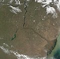
 Terra/MODIS, 2002-05-17.
 -
 Terra/MODIS, 2001-10-10.


Cultural significance
[edit]Literature
[edit]- Without a Dowry, The Storm – dramas by the Russian playwright Aleksandr Ostrovsky
- In the Forests, On the Hills – novels by Pavel Melnikov
- Yegor Bulychov and Others, Dostigayev and Others – plays by Maxim Gorky
- "Distance After Distance" – poem by Aleksandr Tvardovsky
- "On the Volga" – a poem by Nikolay Nekrasov
- "Volga and Vazuza" – a poem by Samuil Marshak
- The Precipice – a novel by Ivan Goncharov
- Volga Se Ganga - a novel by Hindi language writer Rahul Sankrityayan
Cinema
[edit]- Volga-Volga (1938) – a Soviet film comedy directed by Grigori Aleksandrov
- Ekaterina Voronina (1957) – Soviet drama film directed by Isidor Annensky
- The Bridge Is Built (1965) – a Soviet film about the construction of a road bridge across the Volga in Saratov by Oleg Efremov and Gavriil Egiazarov
- A Cruel Romance (1984) – romantic drama directed by Eldar Ryazanov
- Election Day (2007) – Russian comedy film directed by Oleg Fomin
Music
[edit]Video games
[edit]- Metro Exodus – Volga is one of main levels of the game
See also
[edit]References
[edit]- ^ a b c «Река Волга» Archived 5 March 2016 at the Wayback Machine, Russian State Water Registry
- ^ a b c "Rivers Network". 2020. Archived from the original on 9 January 2023. Retrieved 10 April 2022.
- ^ a b c d e f Scheffel, Richard L.; Wernet, Susan J., eds. (1980). Natural Wonders of the World. United States of America: Reader's Digest Association, Inc. p. 406. ISBN 0-89577-087-3.
- ^ Volga at GEOnet Names Server
- ^ "Rivers Network". 2020. Archived from the original on 9 January 2023. Retrieved 10 April 2022.
- ^ "Rivers Network". 2020. Archived from the original on 9 January 2023. Retrieved 10 April 2022.
- ^ a b c d "Rivers Network". 2020. Archived from the original on 9 January 2023. Retrieved 10 April 2022.
- ^ "10 Longest Rivers In Europe".
- ^ a b Gannholm, Tore. "Birka, Varangian Emporium". Archived from the original on 18 April 2022. Retrieved 15 August 2020.
- ^ Luttwak, Edward N. (2011). Grand Strategy of the Byzantine Empire. Belknap Harvard. p. 52. ISBN 978-0674062078. OCLC 733913679.
- ^ Walker, Joel (2007). "Iran and Its Neighbors in Late Antiquity: Art of the Sasanian Empire (224–642 C.E.)". American Journal of Archaeology. 1 11 (4): 797. doi:10.3764/aja.111.4.795. ISSN 0002-9114. S2CID 192943660.
- ^ McNeese, Tim (2005). The Volga river. Philadelphia: Chelsea House Publishers. pp. 14–16. ISBN 0791082474. OCLC 56535045.
- ^ See Max Vasmer's dictionary under "Волга".
- ^ Brunner, C. J. (1986). "ARANG". Encyclopædia Iranica. Archived from the original on 12 August 2022. Retrieved 13 August 2022.
Middle Persian Arang/Arag renders Avestan Raŋhā, which is cognate with the Scythian name Rhâ (*Rahā) transmitted by Ptolemy
- ^ J.P. Mallory & D.Q. Adams, Encyclopedia of Indo-European Culture, s.v. "dew" (London: Fitzroy Dearborn, 1997), 158–9.
- ^ Michiel de Vaan, Etymological Dictionary of Latin and the Other Italian Languages, s.v. "rōs, rōris" (Leiden: Brill, 2008), 526–7.
- ^ Nourai, Ali. 2013. An Etymological Dictionary of Persian, English and Other Indo-European Languages. Index of Words in Different Languages, vol. 1, p. 130.
- ^ Lebedynsky, Iaroslav. Les Sarmates: Amazones et lanciers cuirassés entre Oural et Danube. Paris: Editions Errance, 2002.
- ^ Hartley, Janet M. (2021). The Volga: A History. Yale University Press. p. 2. ISBN 978-0-300-24564-6.
- ^ Herrala, Eva; Feoktistov, Aleksandr (1998). Mokšalais-Suomalainen sanakirja. Turku: University of Turku. p. 54. ISBN 951-29-1244-9.
- ^ a b Harmatta 1999, p. 129.
- ^ a b Olbrycht, Marek Jan (2000). "The Cimmerian Problem Re-Examined: the Evidence of the Classical Sources". In Pstrusińska, Jadwiga [in Polish]; Fear, Andrew (eds.). Collectanea Celto-Asiatica Cracoviensia. Kraków: Księgarnia Akademicka [pl]. ISBN 978-8-371-88337-8. Archived from the original on 13 August 2022. Retrieved 16 August 2022.
- ^ a b Olbrycht, Marek Jan (2000). "Remarks on the Presence of Iranian Peoples in Europe and Their Asiatic Relations". In Pstrusińska, Jadwiga [in Polish]; Fear, Andrew (eds.). Collectanea Celto-Asiatica Cracoviensia. Kraków: Księgarnia Akademicka [pl]. pp. 101–104. ISBN 978-8-371-88337-8. Archived from the original on 25 September 2022. Retrieved 16 August 2022.
- ^ Akhmetyanov R. G. Brief Historical and etymological dictionary of the Tatar language. - Kazan: Tat. publishing house, 2001. p. 76. ISBN 5-298-01004-0 (In tatar: Әхмәтьянов Р. Г. Татар теленең кыскача тарихи-этимологик сүзлеге. — Казан: Тат. кит. нәшр., 2001. б. 76. )
- ^ "Kama River | river, Russia | Britannica". www.britannica.com. Archived from the original on 24 January 2022. Retrieved 24 January 2022.
- ^ "Volga River | Map, Definition, Economy, & Facts | Britannica". www.britannica.com. 12 June 2025. Retrieved 21 June 2025.
- ^ Zhilin, M. (2015). Early Mesolithic bone arrowheads from the Volga-Oka interfluve, central Russia. 32. 35-54.
- ^ "VORGESCHICHE DER URALISCHEN SPRACHFAMILIE, GESCHICHTE DER KLEINEREN URALISCHEN SPRACHEN: CHRONOLOGIE" (PDF). Archived (PDF) from the original on 30 May 2019. Retrieved 30 May 2019.
- ^ Katona, Cseste (2018). Co-operation between the Viking Rus' and the Turkic nomads of the steppe in the ninth-eleventh centuries (PDF) (MA thesis). Central European University. Archived (PDF) from the original on 18 April 2019. Retrieved 4 July 2019.
- ^ "Marija Gimbutas. "A Survey Study of the Ancient Balts - Reviewed by Jonas Puzinas". www.lituanus.org. Archived from the original on 4 August 2019. Retrieved 30 May 2019.
- ^ Zhirohov, Mikhail. (2019). The Khazars: a Judeo-Turkish Empire on the Steppes, 7th-11th Centuries AD. Nicolle, David., Hook, Christa. London: Bloomsbury Publishing Plc. p. 47. ISBN 9781472830104. OCLC 1076253515.
- ^ "Early East Slavic Tribes in Russia". Study.com. Archived from the original on 28 March 2019. Retrieved 16 December 2018.
- ^ "The Volga". www.volgawriter.com. Archived from the original (Microsoft FrontPage 12.0) on 20 June 2010. Retrieved 11 June 2010.
- ^ "In all, Soviet dams flooded 2,600 villages and 165 cities, almost 78,000 sq. km. – the area of Maryland, Delaware, Massachusetts, and New Jersey combined – including nearly 31,000 sq. km. of agricultural land and 31,000 sq. km. of forestland". Quoted from: Paul R. Josephson. Industrialized Nature: Brute Force Technology and the Transformation of the Natural World. Island Press, 2002. ISBN 1-55963-777-3. Page 31.
- ^ Brian Pearce, Introduction Archived 3 February 2008 at the Wayback Machine to Fyodor Raskolnikov s "Tales of Sub-lieutenant Ilyin."
- ^ Brackman, Roman (23 November 2004). The Secret File of Joseph Stalin: A Hidden Life. Routledge. p. 129. ISBN 978-1-135-75840-0. Archived from the original on 3 October 2023. Retrieved 30 October 2023.
- ^ Sebag Montefiore, Simon (2004). Stalin : the court of the red tsar. London: Grown House. p. 34. ISBN 978-0-7538-1766-7.
- ^ "::The Battle of Stalingrad". Historylearningsite.co.uk. Archived from the original on 30 May 2015. Retrieved 11 June 2010.
- ^ "Early East Slavic Tribes in Russia | Study.com". Study.com. Archived from the original on 26 August 2018. Retrieved 13 October 2018.
- ^ Mikhail., Zhirohov (2019). The Khazars: a Judeo-Turkish Empire on the Steppes, 7th-11th Centuries AD. Nicolle, David., Hook, Christa. London: Bloomsbury Publishing Plc. p. 47. ISBN 9781472830104. OCLC 1076253515.
- ^ Bašić, Marko (14 May 2015). "Noble Sarmatian Grave Discovered In Russia". Slavorum. Archived from the original on 28 March 2019. Retrieved 28 March 2019.
- ^ Tim., McNeese (2005). The Volga river. Philadelphia: Chelsea House Publishers. p. 14. ISBN 0791082474. OCLC 56535045.
- ^ "When the Arabs met the Vikings: New discovery suggests ancient links". The National. 6 May 2015. Archived from the original on 25 May 2019. Retrieved 25 May 2019.
- ^ "The Volga Trade Route". www.pbs.org. 7 February 2013. Archived from the original on 23 May 2019. Retrieved 25 May 2019.
- ^ "Unique History of Volga River That You Need to Know - Learn Russian Language". Learn Russian Language. 30 June 2018. Archived from the original on 13 October 2018. Retrieved 13 October 2018.
- ^ "Catherine's Manifesto 1763". NORKA. Archived from the original on 4 March 2021. Retrieved 18 March 2021.
- ^ Egan, Timothy (2006). The Worst Hard Time. Houghton Mifflin Harcourt. p. 63. ISBN 9780618346974.
- ^ Wie leben die Russlanddeutschen heute an den Ufern der Wolga? (7 February 2022)
- ^ Korotenko, K. A.; Mamedov, R. M.; Mooers, C. N. K. (2000). "Prediction of the Dispersal of Oil Transport in the Caspian Sea Resulting from a Continuous Release". Spill Science & Technology Bulletin. 6 (5–6): 323. doi:10.1016/S1353-2561(01)00050-0.
- ^ "NoorderSoft Waterways Database". Noordersoft.com. Archived from the original on 9 November 2005. Retrieved 11 June 2010.
Sources
[edit]- Harmatta, János (1999). "Herodotus, Historian of the Cimmerians and the Scythians". In Reverdin, Olivier [in French]; Nenci, Giuseppe [in Italian] (eds.). Hérodote et les Peuples Non Grecs [Herodotus and the Non-Greek Peoples] (in French). Vandœuvres, Switzerland: Fondation Hardt pour l'étude de l'Antiquité classique [fr]. pp. 115–130. ISBN 978-3-774-92415-4.
Further reading
[edit]- Hartley, J. M. (2021). The Volga: A History. New Haven: Yale University Press.
- Sunderland, Willard (2021). "Reviewed work: The Volga: A History of Russia's Greatest River, Hartley, Janet M". The Slavonic and East European Review. 99 (4): 761–763. doi:10.1353/see.2021.0094. JSTOR 10.5699/slaveasteurorev2.99.4.0761. S2CID 259804772.
External links
[edit]- Kropotkin, Peter Alexeivitch; Bealby, John Thomas (1911). . Encyclopædia Britannica. Vol. 28 (11th ed.). pp. 193–195.
- Volga Delta from Space
- Photos of the Volga coasts
 Geographic data related to Volga at OpenStreetMap
- Video about the source of the Volga
| Tributaries |
| |
|---|---|---|
| Reservoirs | ||
| Hydroelectric stations | ||
| Canals | ||
| Cities | ||
| International | |
|---|---|
| National | |
| Geographic | |
| Other | |
Volga
View on GrokipediaGeography
Physical Characteristics
The Volga River originates in the Valdai Hills of Tver Oblast, Russia, at an elevation of 228 meters above sea level near the village of Volgoverkhov'ye.[7] It extends 3,531 kilometers southward, primarily through Russian territory, before discharging into the Caspian Sea at an elevation of -28 meters below sea level.[7] The river's drainage basin spans 1,360,000 square kilometers, representing Europe's largest river basin by area.[7] As a typical lowland river, the Volga features minimal gradient, with approximately 80% of its basin below 200 meters above sea level and only 5% exceeding 400 meters.[8] Its upper reaches are narrow, resembling streams a few meters wide, while the channel broadens progressively downstream to widths of 1-2 kilometers in middle sections and several kilometers in the lower course.[9] The Volga Delta, Europe's largest, measures about 160 kilometers in length and comprises over 500 channels and distributaries, covering an area exceeding 19,000 square kilometers as of recent expansions linked to Caspian Sea level fluctuations.[10] Average annual discharge increases downstream, reaching 8,380 cubic meters per second near Volgograd and approximately 8,000 cubic meters per second at the mouth, reflecting contributions from major tributaries.[11][4] Depths vary from shallow upper sections to 3-20 meters in navigable lower portions, though regulated by reservoirs in modern conditions.[12]Basin and Tributaries
The drainage basin of the Volga River spans approximately 1,380,000 km², occupying about one-third of the European portion of Russia and extending from the Valdai Hills in the northwest to the Caspian Lowland in the southeast.[13] The basin's terrain is predominantly flat, with over 80% of the area featuring landscapes at elevations of 200 meters or less, while mountainous regions constitute less than 5% of the total.[14] This low-relief topography facilitates broad floodplains and extensive wetland areas, particularly in the upper and middle sections.[15] The Volga receives inflow from more than 200 tributaries, which collectively contribute the majority of its discharge.[13] [15] The largest tributary is the Kama River, entering from the right bank near Kazan; it measures 1,805 km in length with a drainage area of 507,000 km², nearly rivaling the Volga's own basin in scale. The Oka River, the principal left-bank tributary, joins upstream of the Kama confluence, stretching 1,478 km and draining 245,000 km² across central Russia.[16] Other significant tributaries include the Sura (841 km, right bank), Vetluga (889 km, right bank), and Sheksna (northern left bank), which bolster the river's flow through diverse sub-basins dominated by forested and agricultural landscapes.[16] Tributaries from the left bank predominate in the upper Volga, reflecting the steeper gradients of the Central Russian Upland, while right-bank inputs increase downstream, drawing from the more arid eastern steppes.[15] The integrated network supports extensive navigation and irrigation but has been altered by damming, which fragments natural flow regimes across multiple sub-basins.Major Settlements and Infrastructure
The Volga River supports numerous major settlements, serving as a vital axis for urban development in central and southern Russia. Key cities upstream include Tver, with a population of approximately 420,000, and Yaroslavl, home to around 600,000 residents, both functioning as important industrial and transport hubs. Further downstream, Nizhny Novgorod, a major manufacturing center, has a population of 1,204,985 as of early 2024. Kazan, the capital of Tatarstan and a key petrochemical and aviation node, counts 1,318,604 inhabitants. In the middle Volga, Samara, an aerospace and oil refining hub, supports over 1.1 million people, while Volgograd, historically significant for its World War II role and now a steel and machinery producer, has about 1 million residents. Astrakhan at the delta, focused on fishing and oil, accommodates roughly 500,000. These settlements collectively house over 10 million people, leveraging the river for water supply, trade, and industry.[17] Infrastructure along the Volga emphasizes navigation, hydropower, and inter-basin connectivity, largely developed during the Soviet period. A cascade of 11 dams and reservoirs on the Volga and its tributary the Kama, built between 1937 and the 1960s, has regulated flow, enabled year-round shipping for bulk cargoes like grain and oil, and generated about 5% of Russia's electricity through hydroelectric stations such as the Volga Hydroelectric Station near Volgograd.[17] The largest, the Kuybyshev Reservoir, spans 6,450 square kilometers and supports irrigation and flood control.[18] The Volga-Don Canal, opened in 1952 after construction from 1948 to 1952, stretches 101 kilometers with 13 locks, 3 pumping stations, and a minimum depth of 3.5 meters, linking the Volga to the Don River and thereby connecting the Caspian Sea to the Black Sea for vessels up to 5,000 tons.[5][19] The Moscow Canal, completed in 1937, further integrates the river into Russia's Unified Deep Water System, allowing barge traffic from the Baltic to the Volga basin.[6] These facilities handle over 100 million tons of freight annually but face maintenance challenges from aging structures and silting.[20]Hydrology
River Flow Dynamics
The Volga River's natural flow regime is predominantly nival, with the majority of annual discharge occurring during spring snowmelt from April to June, when melting of accumulated winter snow in its extensive basin contributes up to 60-70% of the yearly runoff. Average annual discharge near the mouth averages 8,000-8,364 cubic meters per second (m³/s), with peak monthly discharges reaching 25,805 m³/s in May due to flood waves propagating downstream. Winter flows drop to minima around 3,085 m³/s, reflecting ice cover and minimal precipitation input, resulting in high flow variability characterized by a coefficient of variation exceeding 30% in unregulated upper sections.[4][21][22] The construction of the Volga-Kama reservoir cascade, beginning in the 1950s, has transformed these dynamics by regulating approximately 97% of the total runoff in middle and lower reaches through storage and controlled releases, flattening seasonal peaks and extending high-flow periods into summer for hydropower and irrigation demands. This anthropogenic intervention reduced maximum flood discharges by up to 50% in regulated segments while elevating minimum winter flows, altering intra-annual distribution from a sharply peaked hydrograph to a more even pattern with reduced irregularity post-1946 across much of the basin. Daily and weekly flow pulses from reservoir operations have intensified local bedload transport during release surges, as hydraulic models indicate heightened shear stress and sediment mobility under unsteady conditions.[23][24][25] Climatic shifts, including air temperature rises since the mid-1970s, have superimposed further changes, correlating with decreased spring high flows (projected reductions of 18% in extreme quantiles) and shifts in runoff timing toward earlier peaks, driven by reduced snow accumulation and increased evaporation in the basin. Interannual variability remains tied to precipitation anomalies and large-scale atmospheric patterns, with multi-decadal phases of high and low flow identified over instrumental records spanning 1938-2020, influencing downstream Caspian Sea levels through modulated freshwater influx.[26][22][27]Reservoirs and Water Management
The Volga-Kama cascade comprises 11 major reservoirs and dams constructed between the 1930s and 1980s, transforming the river into a regulated system primarily for hydroelectric power generation, navigation, flood control, and water supply. This infrastructure, the largest such cascade in Europe, has an installed capacity of 10,192 megawatts and produces an average annual output of 37,927 gigawatt-hours, accounting for approximately 5% of Russia's electricity. The reservoirs store spring floodwaters to prevent downstream inundation while enabling consistent flow for shipping and irrigation in the arid lower basin.[17][28] Key reservoirs include the Rybinsk Reservoir, formed by the 1941–1947 Rybinsk Hydroelectric Station with a surface area exceeding 4,500 square kilometers; the Kuibyshev Reservoir behind the 1955–1967 Zhiguli Hydroelectric Station, one of the world's largest artificial lakes; and the Volgograd Reservoir, created by the 1958–1961 Volga Hydroelectric Station, Europe's largest hydropower facility with 2,560 megawatts capacity. These structures incorporate navigation locks to maintain a 3,500-kilometer waterway from Moscow to the Caspian Sea, supporting freight transport of over 100 million tons annually. Flood control operations involve coordinated releases during high-water periods, reducing peak discharges that historically devastated the lower Volga floodplains.[29][30] Water management balances competing demands through centralized algorithms prioritizing energy production in winter, navigation depths year-round, and ecological releases to mimic natural flooding for delta wetlands. Irrigation withdrawals from reservoirs sustain agriculture across the basin's 1.36 million square kilometers, though evaporation from expanded surface areas—totaling over 27,000 square kilometers—results in significant runoff losses estimated at 10-15% of annual discharge. Sedimentation in reservoirs has reduced storage volumes over decades, necessitating dredging, while altered flow regimes have diminished floodplain inundation critical for fish spawning and biodiversity.[31][32][33] Ongoing challenges include climate-driven variability in inflows, with models projecting reduced spring floods under warming scenarios, potentially straining multi-objective operations. Russian authorities, via entities like RusHydro, employ real-time monitoring and optimization to mitigate risks, though critics note insufficient adaptation to ecological degradation from prolonged low-flow periods in the regulated lower river.[34][35]Climate and Seasonal Variations
The Volga River basin features a continental climate that transitions from moderately humid conditions in the north to arid in the south, with average annual air temperatures ranging from 3°C in the northern sections to 9°C in the southern reaches, exhibiting increasing continentality southward.[11] Precipitation falls mainly as snow during winter, accounting for about 60% of the river's water supply through subsequent melt, while rainfall contributes the remaining 40%, concentrated in warmer months.[22] This seasonal distribution drives the river's flow dynamics, with annual runoff totaling approximately 262 km³, of which winter contributes 23%, spring flood 53%, and summer-autumn periods 24%.[26] In winter, subfreezing temperatures lead to ice formation starting in late November along the upper and middle Volga, extending to the lower reaches by December; the ice cover persists for up to four months in upstream areas before breaking up progressively from late March in the delta region to late April upstream.[22] Under this cover, discharge remains low, primarily fed by groundwater seepage, resulting in minimal water levels and restricted navigation. Spring warming triggers rapid snowmelt across the basin, causing peak flows and historical flooding in April–May, though post-1940s reservoir construction has reduced flow irregularity by regulating these surges.[24] Summer and autumn bring warmer conditions with higher evaporation rates, particularly in the arid south, leading to declining water levels and low-flow periods despite some rainfall input; irrigation demands further deplete volumes in downstream sections.[22] These natural seasonal patterns, altered but not eliminated by the Volga-Kama cascade of dams, underscore the river's reliance on winter snow accumulation and spring thaw for volumetric renewal, with southern aridity amplifying low-water risks during extended dry spells.[36]History
Ancient and Medieval Periods
The Volga River, referred to in ancient sources as Rha (from Scythian Rā, meaning wetness or moisture) or Oaros, was first documented by the Greek historian Herodotus in the 5th century BCE during his description of the Scythian campaigns of Darius I of Persia around 513 BCE. Herodotus portrayed it as a major northern tributary emptying into the Caspian Sea (which he called the Hyrcanian Sea), distinguishing it from other rivers like the Araxes, and noted its role in the vast steppe landscapes inhabited by nomadic Iranic peoples.[37][38] The upper and middle Volga regions were primarily occupied by Finno-Ugric forest-dwelling tribes, such as proto-Mari and Mordvins, while the lower Volga and adjacent steppes saw seasonal migrations of Scythians (7th–3rd centuries BCE) and later Sarmatians (3rd century BCE–4th century CE), who engaged in pastoral nomadism, horse breeding, and raids but left limited permanent settlements along the river due to the challenges of the floodplain terrain.[38] By the early medieval period, from the 7th century CE, the lower Volga fell under the sway of the Khazar Khaganate, a semi-nomadic Turkic-Jewish state that dominated the Pontic-Caspian region and extracted tribute from Volga trade routes linking the Baltic to the Caspian and Silk Road networks. The Khazars established fortified outposts and facilitated commerce in furs, slaves, and honey, but their control waned after defeats by the Rus' and Arabs in the late 9th and 10th centuries. Concurrently, the Volga Bulgars—a Turkic group originating from the Pontic steppes—migrated northward in the 7th century and founded a sedentary state in the Middle Volga-Kama confluence area, with key settlements like Bolghar emerging as a political and economic hub by the 10th century, evidenced by archaeological remains of mosques, palaces, and coin mints. The Bulgars adopted Islam en masse in 922 CE after diplomatic exchanges with the Abbasid Caliphate, enhancing their role as intermediaries in east-west trade.[39][40] Norse Varangians, known as the Rus', exploited the Volga as a vital waterway from the 8th to 11th centuries, sailing from the Baltic via rivers and portages to Volga Bulgaria and Khazaria, trading amber, furs, and swords for silks, spices, and silver dirhams, which circulated widely in northern Europe. This route's prosperity drew raids from Pechenegs and Cumans in the 11th–12th centuries, disrupting but not halting commerce. The region's stability ended with the Mongol invasion: in 1223, Volga Bulgarian forces under Khan Mö'min briefly repelled vanguard Mongols at the Battle of Samara Bend, but Batu Khan's full campaign from 1236 to 1237 systematically razed major cities like Bolghar and Bişke, killing or enslaving tens of thousands and reducing the Bulgar state to vassalage under the Golden Horde. The Horde then centered its capital at Sarai on the lower Akhtuba (a Volga distributary) around 1240s, transforming the Volga into a conduit for Mongol tribute extraction and Eurasian overland trade until the Horde's fragmentation in the 15th century.[41][42]Imperial Russian Era
![Barge Haulers on the Volga by Ilya Repin][float-right] During the Imperial Russian era, the Volga River solidified its role as a vital artery for trade and transportation within the expanding Russian Empire, facilitating the movement of raw materials southward and manufactured goods northward. Grain shipments surged in the late 19th century, becoming a dominant commodity, while petroleum transport via the Volga emerged as the principal route for Tsarist Russia's oil industry, linking the Caspian fields to northern markets.[43] [44] Other key exports included timber, salt, and fish from the lower reaches, underscoring the river's economic linkage of disparate regions.[45] Navigation relied heavily on human labor until the advent of steam power, with burlaki—seasonal workers, often impoverished peasants—towing heavily laden barges upstream against the current, a grueling practice emblematic of the era's labor conditions and persisting into the late 19th century.[46] The introduction of steamboats in the 1830s revolutionized downstream travel, reducing reliance on wind and muscle while enabling faster commerce, though upstream hauling remained challenging until further technological advances.[47] State efforts to secure the route against banditry involved military patrols and fortifications, protecting valuable cargoes essential to imperial revenues.[47] The Nizhny Novgorod Fair, formalized in 1817 on the Volga's banks, epitomized the river's commercial pinnacle, earning the city the moniker "Moneybag of Russia" by drawing merchants from across the empire and beyond to trade up to half of Russia's export goods, including textiles, metals, and Siberian furs.[48] This annual event spurred infrastructure like electrification in the 1870s-1880s, amplifying the Volga's integration into the empire's economy and transforming frontier perceptions into a core symbol of Russian identity.[49] Military shipbuilding along the Volga also advanced in the 18th and 19th centuries, supporting Russia's eastern expansion and naval ambitions on the Caspian.[50] By the era's end, the river's logistical demands highlighted both imperial ingenuity and the human costs of pre-industrial transport.[45]Soviet Industrialization and Conflicts
During the Soviet Union's rapid industrialization under Joseph Stalin's Five-Year Plans, initiated in 1928, the Volga River became a focal point for heavy industry development, leveraging its waterway for transport and power generation.[17] The construction of the Moscow-Volga Canal, completed in 1937 using forced labor from the Gulag system, connected the river to Moscow, supplying water and enabling barge traffic for industrial materials.[51] This was followed by the Volga-Don Canal, opened in 1952, which linked the Volga to the Sea of Azov and facilitated the transport of oil, grain, and manufactured goods, boosting Soviet economic integration.[17] A series of hydroelectric dams, known as the Volga Cascade, were built primarily from the 1930s to the 1960s as part of the "Great Construction Projects of Communism," transforming the river into a chain of reservoirs for electricity production to fuel factories and urbanization.[52] Key projects included the Ivankovo Dam (1937), the first in the cascade, and the massive Volgograd Hydroelectric Station, construction of which began in 1958 and was completed in 1961, generating over 2.5 million kilowatts to support post-war industrial expansion in the region.[53] These efforts, often reliant on coerced labor, prioritized output over environmental or human costs, with the Volga-Ural oil fields' development contributing to peak production of around 12 million tons annually by the 1940s, underpinning the Soviet war machine and heavy industry.[54][55] The Volga also played a strategic role in military conflicts, most prominently during World War II in the Battle of Stalingrad (now Volgograd), fought from August 23, 1942, to February 2, 1943. German forces under Operation Blau aimed to seize the city to control Volga shipping routes, sever Soviet supply lines to the Caucasus oil fields, and dominate the river's west bank for logistical advantage.[56][57] Soviet troops, reinforced by ferrying across the Volga under heavy fire, defended tenaciously from the river's eastern shore, using it as a natural barrier and supply corridor despite intense urban combat that reduced much of the city to rubble.[58] The battle, resulting in German surrender and over 800,000 Axis casualties, marked a decisive turning point on the Eastern Front, halting Nazi advances and shifting momentum to the Allies.[57] Earlier, during the Russian Civil War (1917–1922), the Volga served as a contested waterway for Bolshevik-Red Army control against White forces, with key battles like the defense of Kazan in 1918 underscoring its transport value for troops and munitions.[45]Post-Soviet Developments
Following the dissolution of the Soviet Union in 1991, the Volga River experienced significant economic contraction in navigation and shipping, with inland river transport volumes plummeting from 600 million tons in 1989 to approximately 100 million tons by 2010, reflecting broader post-Soviet industrial decline and reduced state subsidies.[59] This downturn affected Volga-Don Canal operations, a key Soviet-era link to the Black Sea, which by 2020 required urgent modernization or replacement due to aging infrastructure built with forced labor, limiting its capacity for bulk cargo like grain exports via Caspian and Black Sea ports.[20] Privatization efforts in the 1990s fragmented state-owned fleets, exacerbating inefficiencies, though the river retained strategic value for transporting agricultural goods, supporting Russia's export corridors despite logistical bottlenecks.[60] Environmental conditions improved temporarily in the 1990s due to sharp reductions in industrial output, which lowered water withdrawal and pollutant discharges into the Volga basin, as political and economic transitions curtailed heavy manufacturing along the river.[61] Municipal sewage remained the primary pollution source, followed by industry and agriculture, but overall anthropogenic pressures eased, contributing to partial hydrological recovery, including a shift toward increased river flow phases from the mid-1990s to early 2000s in much of the basin.[62][63] However, legacy Soviet dams continued to alter ecosystems, with decisions like the 1989 adjustment to Cheboksary Reservoir levels persisting into the post-Soviet era, reducing downstream water availability and exacerbating erosion and sedimentation issues.[17] Fisheries in the Volga and Caspian basin faced collapse, particularly for sturgeon species vital to caviar production, leading Russia to impose a nationwide ban on commercial sturgeon fishing and black caviar exports by the late 1990s as stocks neared extinction from overfishing and habitat degradation.[64] This crisis devastated riverside communities dependent on the industry, with towns like those in the lower Volga experiencing depopulation and economic stagnation as alternative livelihoods failed to materialize.[65] Hydropower generation from Volga stations, including the massive Volga Hydroelectric Station near Volgograd, persisted as a key energy source—producing over 2,000 MW—but faced maintenance challenges amid funding shortfalls, underscoring the river's dual role as an economic asset and environmental liability in Russia's transition economy.[29]Ecology and Environment
Native Biodiversity
The Volga River basin hosts significant native biodiversity, particularly in its delta, which serves as a critical wetland ecosystem supporting diverse aquatic and terrestrial species. The delta alone encompasses 314 vascular plant species, including relic forms such as Nelumbo caspica (Caspian lotus), which covers approximately 5,000 hectares, and Trapa natans (water caltrop).[10] Across the broader basin, flora includes widespread riparian species like Salix alba, Phragmites australis, and Typha angustifolia.[10] Aquatic fauna features around 120-140 native fish species historically present in the Volga-Kama system, with the delta supporting 56-70 species across 12 families.[66] [10] Key native fishes include sturgeons such as beluga (Huso huso), Russian sturgeon (Acipenser gueldenstaedtii), and stellate sturgeon (A. stellatus), alongside cyprinids like common carp (Cyprinus carpio), bream (Abramis brama), and Caspian roach (Rutilus caspicus).[10] Endemic species comprise the Volga gudgeon (Gobio volgensis) and Agrakhan shad (Alosa sphaerocephala).[67] [68] The basin also sustains approximately 850 aquatic invertebrate species.[69] Avifauna numbers over 270 species in the delta, with 99 nesting and many migratory, including dalmatian pelican (Pelecanus crispus), saker falcon (Falco cherrug), and great bustard (Otis tarda).[10] Mammalian diversity reaches 34 species in the delta, featuring European beaver (Castor fiber), Eurasian otter (Lutra lutra), and the relic Russian desman (Desmana moschata).[10] Biosphere reserves in the basin document 59 mammal and 230 bird species, underscoring the river's role in supporting regional wildlife.[70] The delta's productivity historically accounted for 25% of global sturgeon populations, highlighting its ecological significance prior to extensive human modifications.[1]Pollution Sources and Impacts
Industrial activities, particularly oil extraction and processing in the Volga Federal District, discharge petroleum hydrocarbons into surface and groundwater, with concentrations in affected groundwater reaching 0.5–2.5 mg/L, exceeding Russia's maximum permissible concentration (MPC) of 0.1 mg/L by factors of up to 25.[71] In the Astrakhan region, petroleum product levels in river waters surpassed MPCs by up to 4.2 times during 2014–2018 monitoring, while bottom sediments accumulated up to 18,719 mg/kg near oil pits, resulting in near-total loss of diverse zoobenthos communities, leaving only resilient oligochaetes.[72] These inputs stem from well leaks, pipeline failures, and waste disposal at extraction sites, exacerbating contamination in tributaries and the main channel.[72] Agricultural runoff introduces excess nutrients like nitrates and phosphates, alongside pesticide residues such as DDT, fostering eutrophication across reservoirs. In the Ivankovskoye Reservoir, total phosphorus concentrations of 0.025–0.044 mg/L classify the system as eutrophic, triggering phytoplankton blooms and oxygen depletion that mobilize secondary pollutants like manganese from sediments.[73] Municipal wastewater adds untreated sewage, contributing to nutrient loads and organic matter, with the share of polluted discharges into the basin declining modestly from 47.3% in 1990 to 43.4% in 2021, yet persisting as a vector for pathogens and biochemical oxygen demand.[74] Heavy metals from industrial effluents, including iron, copper, manganese, mercury, and cadmium, exceed MPCs in upper reservoirs and the delta; for instance, iron levels upstream of Tver surpass 0.1 mg/L, while mercury and cadmium vary unstably in delta waters, accumulating in sediments and biota.[73] [75] These pollutants bioaccumulate in fish and benthic organisms, impairing reproduction and health, as evidenced by elevated metal concentrations in Volga fisheries, which compromise the river's role as a prime fishery zone and threaten biodiversity in the Caspian-adjacent delta.[76] Eutrophication further reduces dissolved oxygen, promoting hypoxic zones that stress aquatic life and diminish habitat suitability for native species like sturgeon.[73] Overall, these stressors degrade water quality from "balanced" in headwaters—despite official "very polluted" ratings due to natural organics—to critically impaired downstream, with cascading effects on ecosystem services including fisheries and drinking water provision.[73]Dams and Hydrological Alterations
The Volga River's hydrological regime has been extensively modified by the Volga-Kama Cascade, a system of 11 major dams and reservoirs constructed predominantly during the Soviet period from the 1930s to the 1970s. These structures regulate river flow for hydroelectric power generation, flood control, and navigation, converting much of the Volga from a free-flowing river into a series of impounded lakes with controlled discharges. The cascade captures over 90% of the river's length in reservoirs, significantly reducing flow velocity—down to about one-tenth of pre-dam levels in some sections—and altering seasonal discharge patterns by storing spring floodwaters for release during low-flow periods.[17][30] Major dams include the Ivankovo (completed 1937), Uglich (1940), Rybinsk (1941, with reservoir filling completed 1947), Gorky (1955), Kuibyshev (1964), Zhiguli (1978), and Volgograd (1961) hydroelectric stations, each creating expansive reservoirs that collectively hold billions of cubic meters of water. This regulation has minimized extreme floods, stabilizing downstream water levels, but it has also disrupted natural variability, leading to warmer summer water temperatures due to reduced flow and prolonged ice-free periods influenced by reservoir operations. Hydrological data from 1938 to 2020 indicate shifts in annual runoff distribution, with dams enabling managed releases that mitigate drought impacts on the Caspian Sea but exacerbate evaporation losses from enlarged surface areas.[22][17] Sediment dynamics have been profoundly affected, as reservoirs trap approximately 90-95% of incoming suspended and bedload sediments, slashing delivery to the lower Volga and delta by over 80% compared to pre-dam eras (e.g., annual sediment input dropped from levels supporting delta aggradation to near negligible post-1960s). This reduction has caused riverbed incision downstream of dams, floodplain degradation, and halted natural delta expansion, contributing to coastal erosion and diminished habitat formation in the Caspian inlet. While channelization and regulated flows have partially offset some subsidence through controlled sediment redistribution, the overall trend underscores a causal chain from impoundment to sediment starvation, with reservoirs accumulating silt that further impairs their storage capacity over time.[77][78][79]Restoration Efforts and Ongoing Challenges
The Russian national project "Ecology," launched in 2019 as part of broader environmental priorities, incorporates the federal subproject "Recovery of the Volga," proposed by President Vladimir Putin in 2018 and aimed at reducing polluted wastewater discharges into the river by 66.7% by 2024 through the construction and modernization of wastewater treatment facilities across the basin.[80][81] This initiative has allocated significant funding, including 3.6 billion rubles (approximately $40 million at 2020 exchange rates) in the Republic of Tatarstan alone for Volga improvements and water body preservation by 2024.[82] Complementary efforts under the project target the elimination or recultivation of legacy pollution sites and the reduction of inflowing contaminated waters, with extensions planned to other rivers in the Volga basin such as the Oka and Kama.[80] Localized restoration activities have focused on floodplain wetlands, particularly in the Volga-Akhtuba region. For instance, ongoing work under the "Ecology" project plans to restore four water bodies—Lakes Varezhka and Peschanoe, plus the Shulyashka and Kletsky eriks—by the end of 2025 via dredging, hydrological reconnection, and vegetation management to revive natural flooding regimes.[83] Earlier international efforts, such as the 2006 UNDP-GEF project "Conservation of Wetland Biodiversity in the Lower Volga Region," restored sites like Lake Sazanie by removing barriers to natural water inflow, thereby rehabilitating adjacent wetlands and supporting migratory bird habitats across 1.5 million hectares of protected areas.[84][85] Despite these initiatives, ongoing challenges persist due to entrenched pollution sources and hydrological alterations. Industrial effluents, untreated municipal sewage, agricultural fertilizers, and pesticides continue to contaminate the river, with pollutants accumulating in reservoirs up to several meters deep and impairing self-purification capacity, particularly in smaller tributaries.[4] Recent declines in water levels—exacerbated by climate variability, dam operations, and reduced precipitation—have concentrated toxins, accelerated eutrophication, and caused mass fish die-offs, while threatening biodiversity in the Volga delta and Caspian Sea interface, where a projected 5-10 meter drop could disrupt habitats for endemic species like sturgeon and Caspian seals.[81][86] The cascade of 11 major dams fragments the riverine ecosystem, blocking sediment transport and fish migration, which undermines restoration efficacy and contributes to floodplain desiccation.[17] Implementation hurdles, including underperformance in wastewater reduction targets and delays in facility upgrades despite billions in rubles invested, highlight coordination issues between federal and regional authorities.[87][4]Economic Role
Hydropower Generation
The Volga-Kama Cascade constitutes Russia's largest system of hydroelectric power plants, encompassing 12 stations along the Volga River and its major tributary, the Kama, with a combined installed capacity of 10.5 gigawatts (GW).[30] These facilities generate between 35 and 40 billion kilowatt-hours (kWh) of electricity annually, accounting for approximately 5% of the country's total power production.[30][17] The cascade exploits the Volga's total head of about 135 meters from the Ivankovo Reservoir to the Volgograd Reservoir tailwater, enabling efficient conversion of potential energy into electrical power through run-of-river and reservoir operations.[30] Key installations include the Volga Hydroelectric Station (Volzhskaya GES), the largest in Europe with an installed capacity of 2,734 megawatts (MW), located near Volgograd and featuring 20 turbine units that produce around 12 billion kWh per year.[88] The Zhiguli Hydroelectric Station, situated upstream near Tolyatti, contributes 2,488 MW via 20 Kaplan turbines, with an average annual output of 11.7 billion kWh.[89] Other significant plants in the cascade, such as the Cheboksary, Nizhny Novgorod, and Rybinsk stations, add progressively smaller capacities but collectively enhance grid stability by providing flexible peaking and base-load power.[90] Hydropower from the Volga supports Russia's energy security by delivering renewable, low-carbon electricity, though output varies seasonally due to natural river flow fluctuations managed by reservoir storage.[30] The stations' turbines, primarily Kaplan types optimized for low-head conditions, achieve high efficiency, with the overall system integrating flood control and navigation benefits that indirectly sustain generation reliability.[91] In recent years, maintenance and modernization efforts have aimed to sustain these outputs amid aging infrastructure, ensuring continued economic contributions without reliance on fossil fuels for this portion of supply.[17]Navigation and Trade
The Volga River functions as a principal navigable waterway in Russia, integrated into the Unified Deep Water System of European Russia, which facilitates connectivity between the Baltic, White, Black, Azov, and Caspian Seas through canals and reservoirs.[60] Navigation spans approximately 3,530 kilometers from the river's source to its delta, supported by 11 hydroelectric dams with locks that maintain sufficient depth for vessels up to 5,000 deadweight tons via the Volga-Don Canal.[20] The V.I. Lenin Volga-Don Canal, operational since 1952 and measuring 101 kilometers, links the Volga to the Don River, enabling maritime access from Caspian ports to the Black Sea and beyond for bulk cargo transport.[60] Cargo trade along the Volga primarily involves grain, petroleum products, timber, metals, and construction materials, with the river handling a significant portion of Russia's inland waterway freight directed toward export hubs.[60] In 2024, the Volga-Don river system transported 13.5 million tonnes of cargo, reflecting a 29% year-over-year increase driven by heightened demand for grain and energy exports amid geopolitical shifts.[92] Volga Shipping Company, a key operator, managed 8.2 million tonnes during the 2020 navigation season, underscoring the river's role in domestic and regional logistics despite seasonal ice constraints limiting operations from April to November.[93] Passenger navigation emphasizes river cruises, which leverage the Volga's scenic reservoirs and historic ports to support tourism, with routes often extending via interconnected waterways to Moscow and Saint Petersburg.[6] Major ports such as Astrakhan, Volgograd, and Nizhny Novgorod serve as hubs for both freight loading and cruise embarkations, contributing to local economies through ancillary services like warehousing and hospitality, though overall volumes remain subordinate to cargo throughput. Challenges including aging infrastructure and siltation periodically disrupt trade efficiency, yet the system's strategic value persists for Russia's Eurasian connectivity.[20]Agriculture, Fisheries, and Industry
The Volga River basin encompasses roughly 50% of Russia's agricultural production, supporting extensive cultivation of grains such as wheat, barley, and rye, as well as sunflowers and livestock in regions like Saratov Oblast.[28] Irrigation from the river and its reservoirs sustains farming in semi-arid lower reaches, contributing to over 25% of national agricultural output amid periodic droughts that have historically impacted yields, such as severe events in 1946 and 1948.[59] [94] Commercial fisheries in the Volga and its cascade of reservoirs primarily target cyprinids like bream (Abramis brama) and roach (Rutilus rutilus), alongside pike (Esox lucius) and catfish (Silurus glanis), with historical catches peaking mid-20th century before declining due to damming, habitat fragmentation, and overexploitation.[95] Research trawls indicate reduced biomass by the 2010s–2020s across reservoirs like Rybinsk and Kuibyshev, reflecting broader trends of diminished connectivity in floodplains and invasive species impacts.[96] Forecasts predict further contractions in Volga-Caspian yields, constrained by quotas and ecosystem alterations rather than abundant stocks.[95] Industry along the Volga leverages the river for transport, water supply, and energy, with the Volga Federal District dominating in mechanical engineering, petrochemicals, and metallurgy, including refined petroleum exports valued at $11 billion annually as of recent trade data.[97] Key sectors encompass oil refining and synthetic rubber production in areas like Tatarstan, alongside automotive and defense manufacturing in Nizhny Novgorod, where the basin hosts about 40–45% of Russia's industrial capacity.[98] [22] Chemical industries, fueled by potassic fertilizers ($3.24 billion in exports), rely on riverine logistics but contribute to pollution loads affecting downstream uses.[97]Infrastructure
Dams and Canals
The Volga River hosts a cascade of eleven major dams, primarily built during the Soviet period from the 1930s to the 1960s, forming the Volga-Kama hydroelectric system that generates about 5% of Russia's electricity while regulating flow for navigation and irrigation.[17] These structures, including the Ivankovo Dam (completed 1937), Uglich Dam (1940), and Rybinsk Dam (construction started 1935, reservoir filled by 1941), created expansive reservoirs that submerged historical sites and altered the river's natural hydrology.[99] The Gorky Hydroelectric Station (now Nizhny Novgorod) followed in the 1950s, with the Volga Hydroelectric Station near Volgograd constructed between 1950 and 1961, featuring a 725-meter-long, 44-meter-high concrete dam.[29] Lower Volga dams, such as those at Saratov (1967) and Volgograd, provide flood control and support shipping by maintaining navigable depths, though they have reduced sediment flow to the Caspian Sea and disrupted fish migration.[100] The system's reservoirs, including the vast Rybinsk Reservoir (once the world's largest artificial lake at 4,580 km²), store water for peak power generation and agriculture but have led to shoreline erosion and ecosystem changes.[99] Connecting the Volga to broader waterway networks, the Moscow Canal, built from 1932 to 1937 using forced labor, spans 128 km to link the Moskva River with the Volga at Ivankovo, featuring seven locks that raise water levels up to 220 meters above sea level for Moscow's water supply and navigation to northern seas.[101] [59] The Volga-Don Canal, operational since May 31, 1952, measures 101 km with 13 locks—nine on the Volga slope lifting vessels 88 meters and four on the Don slope descending 44 meters—facilitating trade between the Caspian and Black Seas via connections to 47,000 km of Russian waterways.[5] [19] The Volga-Baltic Waterway, totaling about 1,100 km, integrates canals, rivers, and locks—including upgrades to the former Mariinsk system—to connect the Volga with the Baltic Sea at St. Petersburg, supporting heavy freight transit like oil and timber since major reconstructions in the 1960s.[102] [103] These canals, equipped with dams and pumping stations, enable year-round navigation in deepened channels but require ongoing maintenance amid silting and ice challenges.[5]Bridges and Urban Crossings
The Volga River's breadth, frequently surpassing 1 kilometer in the vicinity of major cities, has historically posed engineering challenges for constructing bridges that facilitate urban connectivity and transport across its banks. These crossings, primarily road and rail bridges, emerged prominently in the late 19th and 20th centuries as Russia's industrialization expanded along the river, enabling the integration of left- and right-bank settlements.[104] Early structures often combined rail and road functions due to economic constraints, while modern ones incorporate advanced designs like cable-stayed or truss systems to handle heavy traffic loads exceeding 40,000 vehicles daily in some cases.[105] In Ulyanovsk, the President Bridge, a steel deck truss road bridge spanning 5.825 kilometers, was completed in 2009 after construction began in 1988, serving as a primary arterial linking the city's core to its eastern districts and alleviating congestion on older crossings.[106] This structure, one of Europe's longest fixed bridges over a major waterway, features 25 spans and supports dual carriageways.[107] Complementing it is the adjacent Imperial Bridge, a through truss rail bridge opened on October 18, 1916, with a length of approximately 2.1 kilometers; at the time, it was Europe's longest railway bridge and remains operational for freight and passenger lines.[104][108] Its construction, initiated in 1912, marked a milestone in Tsarist-era engineering over the Volga.[109] The Saratov Bridge, connecting Saratov on the western bank to Engels on the eastern, extends 2,803.7 meters and was inaugurated in 1965 as a multi-lane road crossing, holding the distinction of Europe's longest bridge for much of the late Soviet period until subsequent constructions surpassed it.[110] This structure, comprising steel girders, handles significant intercity traffic and underscores the Volga's role in linking Volga German heritage areas with Russian heartlands.[111] Further downstream in Volgograd, the Volgograd Bridge, a concrete box girder road bridge with adjacent flyovers totaling 2,514 meters, opened in 2009 following phased construction from 1996, providing essential connectivity between the city's western highlands and eastern industrial zones.[112] Early operations revealed vortex-induced vibrations prompting closure in 2010, resolved by installing semi-active tuned mass dampers to mitigate oscillations under wind loads.[113] Other urban crossings, such as the Syzran railway bridge opened in 1880—the first permanent span over the lower Volga—facilitate rail continuity in smaller cities, while ongoing projects like the Tolyatti bypass bridge, exceeding several kilometers, address expanding freight demands.[114] These infrastructures collectively support over 50 million residents in the Volga basin by enabling seamless east-west movement, though maintenance challenges persist due to ice floes and seismic activity in the region.[115]Modern Engineering Projects
In July 2024, the Tolyatti bypass road was inaugurated, incorporating a 3.7-kilometer bridge across the Volga River that ranks among Russia's ten longest engineering structures, designed to alleviate traffic congestion and enhance regional connectivity.[116][115] This project, part of broader federal highway improvements, spans the river near Tolyatti in Samara Oblast and supports increased vehicular and logistical flows along the M5 federal highway.[116] Ongoing modernization efforts at the Volzhskaya Hydroelectric Power Plant, operational since the mid-20th century, include a multi-year program initiated around 2016 to upgrade 22 of its 23 turbine generators, enhancing efficiency and reliability at the 2,639.5 MW facility on the Volga near Volgograd.[117] These upgrades address aging Soviet-era equipment, aiming to sustain hydropower output amid fluctuating river levels and environmental pressures.[117] In 2022, Russian authorities announced a €1 billion initiative to dredge and modernize the Volga-Don Canal, including lock upgrades and other enhancements to enable year-round navigation for larger vessels, thereby improving freight transport between the Caspian Sea basin and the Black Sea.[118] The project targets sedimentation buildup and infrastructure decay in the 101-kilometer canal system, which features 13 locks and connects the Volga to the Don River, facilitating over 10 million tons of annual cargo.[118] Regional water infrastructure developments, such as the New Development Bank-financed project for modernizing supply and sanitation systems in Volga River basin cities, incorporate advanced engineering for treatment facilities and pipelines to combat pollution and support urban growth, though these emphasize utility-scale rather than megastructures.[119] These initiatives reflect a pattern of refurbishment over new dam construction, constrained by environmental regulations and the legacy of the Volga-Kama cascade's 11 existing reservoirs.[119]Demographics and Society
Ethnic Groups and Populations
The Volga River basin supports a population of roughly 40 million people, concentrated in urban centers and agricultural areas along its course, with the Volga Federal District serving as a primary administrative proxy for much of the drainage area and recording 28.6 million residents as of recent estimates derived from census data.[120] Russians form the largest ethnic group throughout the basin, comprising majorities in oblasts like Nizhny Novgorod, Samara, Saratov, and Volgograd, where they exceed 80-90% of local populations based on self-reported identifications in national censuses.[121] This dominance stems from historical Russian expansion and settlement patterns since the 16th century, reinforced by industrialization and Soviet-era migrations that favored Slavic groups in riverine industries and cities. In the middle Volga, ethnic diversity increases due to autonomous republics preserving indigenous languages and cultures. Tatarstan, centered on Kazan along the river's midsection, has a population of about 4 million, with Volga Tatars—the predominant subgroup of Tatars—accounting for 53% and Russians 40% per self-identification in the 2021 census.[122] These proportions reflect Tatarstan's status as a Turkic-Muslim cultural hub, though intermarriage and urbanization have driven gradual Russification. Chuvashia, downstream near Cheboksary, features Chuvash people (a Turkic group with distinct Oghuric linguistic roots) as the titular ethnicity, historically over two-thirds of residents but showing a 25% absolute decline in self-identified numbers from 2010 to 2021 amid low birth rates and out-migration.[123] Russians comprise about 25-30% there, with smaller Tatar and Mordvin communities. Finno-Ugric groups cluster in upstream tributaries and republics like Mordovia and Mari El. In Mordovia, Russians slightly outnumber Mordvins (encompassing Erzya and Moksha subgroups) at around 53% to 40%, a shift from earlier balances due to higher Russian fertility and minority assimilation trends observed in census data.[124] Mari El and Udmurtia similarly host Mari and Udmurt peoples, each around 40-50% in their republics but facing proportional erosion from demographic pressures, with total Finno-Ugric populations in the Volga region numbering under 2 million combined. Lower Volga areas, including Astrakhan Oblast, include Kazakh and Nogai minorities near the delta, alongside a vestigial presence of Volga Germans—historically numbering over 1 million before 1941 deportation but now fewer than 400,000 nationwide and negligible along the river.[121] Overall, non-Russian ethnicities represent 20-30% of the basin's inhabitants, with declines in minority self-identification in the 2021 census attributed partly to undercounting and cultural shifts rather than solely natural decrease.[123]| Republic/Oblast | Population (approx., recent) | Major Ethnic Groups (% shares, indicative from censuses) |
|---|---|---|
| Tatarstan | 4 million | Tatars (53%), Russians (40%)[125] [122] |
| Chuvashia | 1.1 million | Chuvash (67%), Russians (27%)[123] |
| Mordovia | 0.8 million | Russians (53%), Mordvins (40%)[124] |
| Astrakhan Oblast | 1 million | Russians (57%), Kazakhs (16%)[126] |